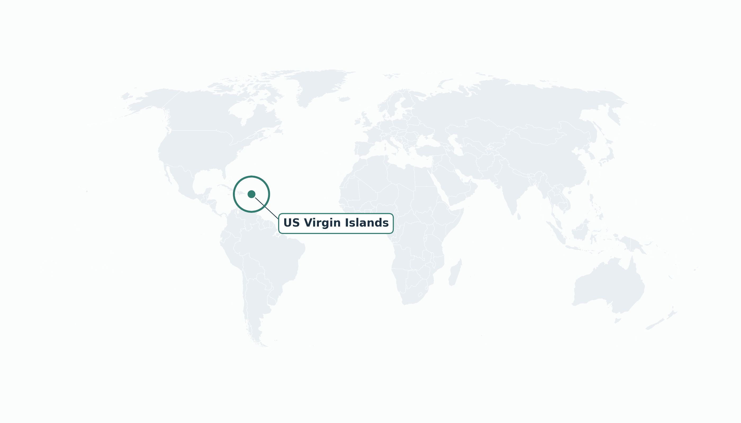
US Virgin Islands is located in the Caribbean region at latitude 18.3358 and longitude -64.8963 and is part of the North American continent.
The DMS coordinates for the center of the country are:
- 18° 20' 9'' N
- 64° 53' 47'' W
You can see the location of US Virgin Islands on the world map below:
Maritime Borders
The U.S. Virgin Islands have no land borders; they lie in the Caribbean Sea immediately east of Puerto Rico.
US Virgin Islands Key Facts
| Country | US Virgin Islands |
| Coordinates | Latitude: 18.3358 Longitude: -64.8963 |
| Country Codes | Alpha 2: VI Alpha 3: VIR |
| Country Flag Emoji | 🇻🇮 |
| Int. Phone Prefix | +1 (340) |
| Capital city | Charlotte Amalie |
| Continent Subcontinent | North America Caribbean |
| Country Area | 347 sq km |
| Population 2025 | 103,792 World Rank: 192 |
| Median Age | 43 |
| Life expectancy | 80.8 |
| Major languages | English |
| UTC/GMT Time | Number of time zones: 1
|
| Internet TLD | .vi |
| Biggest Airport | Cyril E. King Airport (STT) |
| Average temperature | 27 °C 81 °F |
| Administrative Divisions | 3 districts (St. Thomas, St. John, St. Croix) |
| Political system | Unincorporated territory of the United States |
US Virgin Islands Economy Facts
| World Bank Income Group | High income |
| World Bank Region | Latin America & Caribbean |
| Currency | United States dollar (USD) |
| GDP in 2023 | $4.67 (billions of USD) World Rank: 170 |
| GDP per capita in 2023 | $44,321 World Rank: 36 |
| Major Industries / Economic Sectors | Tourism, rum distilling, watch and electronics assembly, financial services |
| Top 5 Import Countries | United States, British Virgin Islands, Puerto Rico, Trinidad and Tobago, Canada |
| Top 5 Export Countries | United States, Puerto Rico, British Virgin Islands |
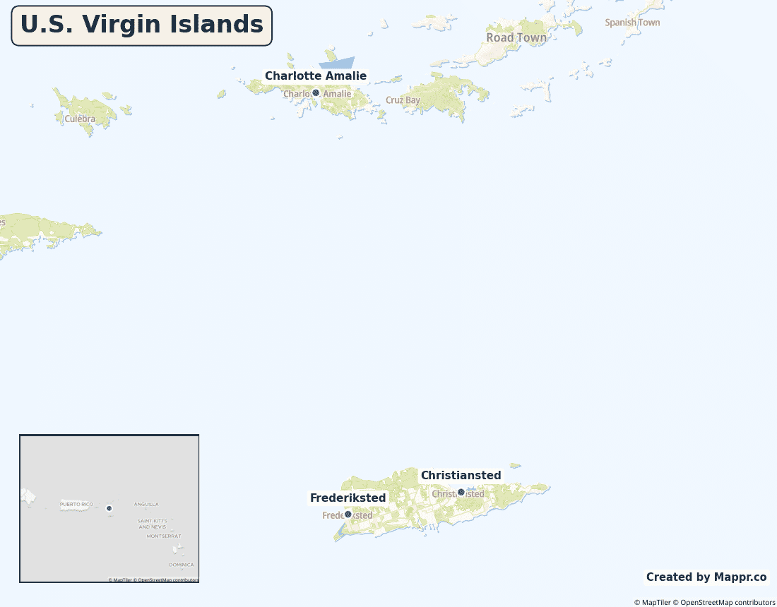
Biggest Cities in US Virgin Islands
Here are the largest cities in US Virgin Islands based on 2024 data:
| City | Population |
|---|
| Saint Croix | 50,601 | Charlotte Amalie | 20,000 |
Map of US Virgin Islands with the Largest Cities
Other Countries in the Caribbean Region
- Where are the Bahamas?
- Where are the British Virgin Islands?
- Where are the Cayman Islands?
- Where are the Turks and Caicos Islands?
- Where is Anguilla?
- Where is Antigua and Barbuda?
- Where is Aruba?
- Where is Barbados?
- Where is Bonaire?
- Where is Cuba?
- Where is Curaçao?
- Where is Dominica?
- Where is Grenada?
- Where is Guadeloupe?
- Where is Haiti?
- Where is Jamaica?
- Where is Martinique?
- Where is Montserrat?
- Where is Puerto Rico?
- Where is Saba?
- Where is Saint Barthélemy?
- Where is Saint Kitts and Nevis?
- Where is Saint Lucia?
- Where is Saint Martin?
- Where is Saint Vincent and the Grenadines?
- Where is Sint Eustatius?
- Where is Sint Maarten?
- Where is the Dominican Republic?
- Where is Trinidad and Tobago?
Geography
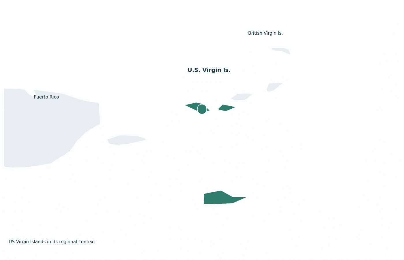
The U.S. Virgin Islands lie in the Caribbean Sea just east of Puerto Rico, at the western end of the Virgin Islands chain. The territory consists of three main islands — St. Thomas, St. John and St. Croix — plus dozens of smaller islets.
St. Thomas holds the capital, Charlotte Amalie, and a major cruise port, while St. Croix is the largest island by area.
Are the US Virgin Islands a country?
The U.S. Virgin Islands are an unincorporated territory of the United States, acquired from Denmark in 1917. Residents are U.S. citizens but cannot vote in presidential elections and have a single non-voting delegate in Congress.
| Status | Unincorporated territory of the United States |
| Sovereign state | United States |
| Capital | Charlotte Amalie |
| Population | 104,377 |
| Area | 347 km² |
| Currency | United States dollar (USD) |
| Official language(s) | English |
| ISO 3166 code | VI / VIR |
| Calling code | +1 (340) |
| Internet TLD | .vi |
US Virgin Islands in its region
The islands sit immediately east of Puerto Rico and share the Virgin Islands archipelago with the neighbouring British Virgin Islands.
Climate
The U.S. Virgin Islands have a tropical climate, warm and breezy at around 27°C (81°F) all year. Hurricane season runs June to November, and the islands were badly hit by Hurricanes Irma and Maria in 2017.
Economy
The U.S. Virgin Islands’ high-income economy is led by tourism — especially cruise visitors — along with rum distilling for export to the U.S. mainland and financial services. The 2012 closure of its giant oil refinery was a major blow.
Administrative divisions
The territory is divided into three districts, one for each main island, administered from Charlotte Amalie on St. Thomas.


