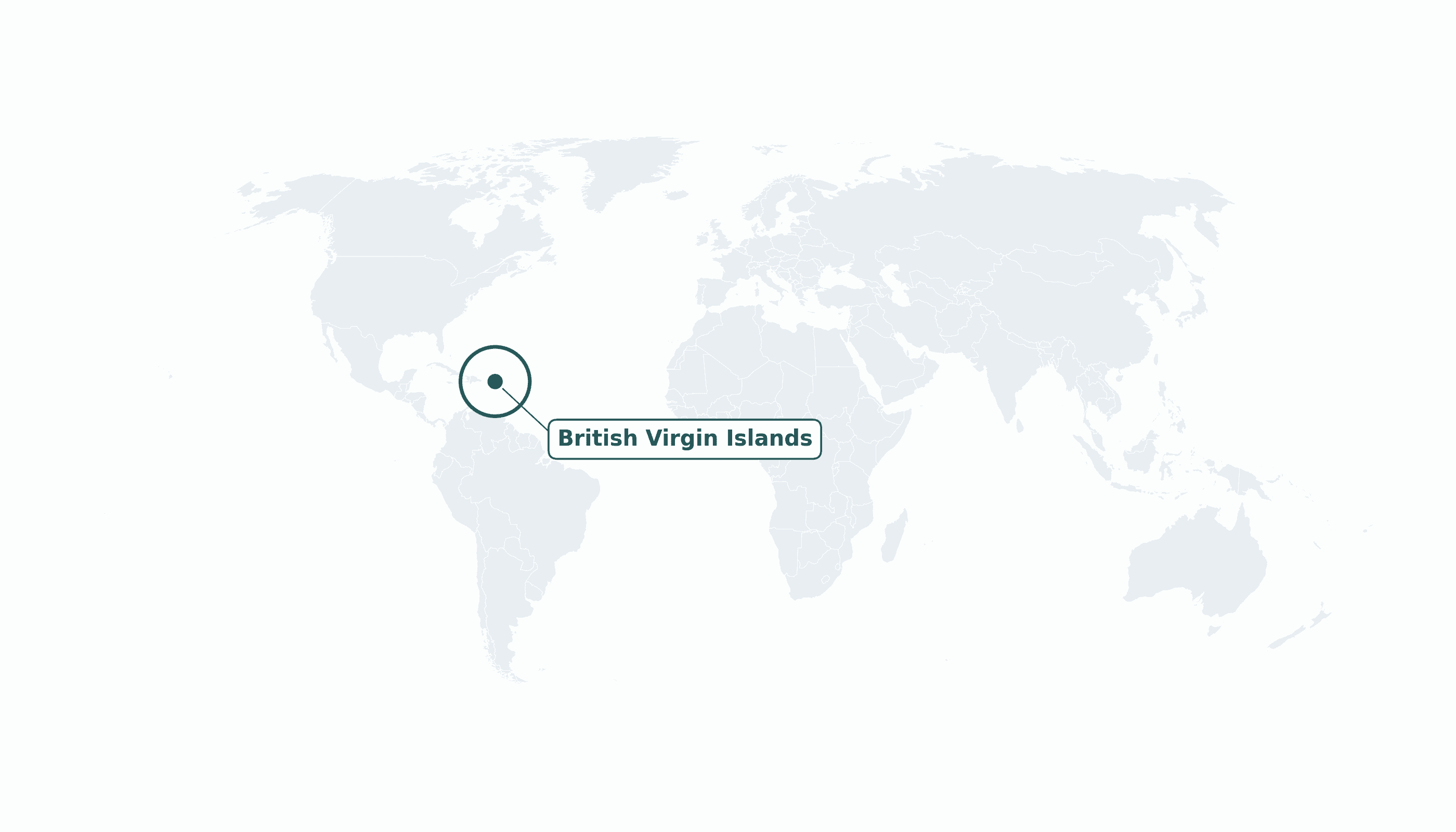
British Virgin Islands is located in the Caribbean region at latitude 18.4207 and longitude -64.64 and is part of the North American continent.
The DMS coordinates for the center of the country are:
- 18° 25' 15'' N
- 64° 38' 24'' W
You can see the location of British Virgin Islands on the world map below:
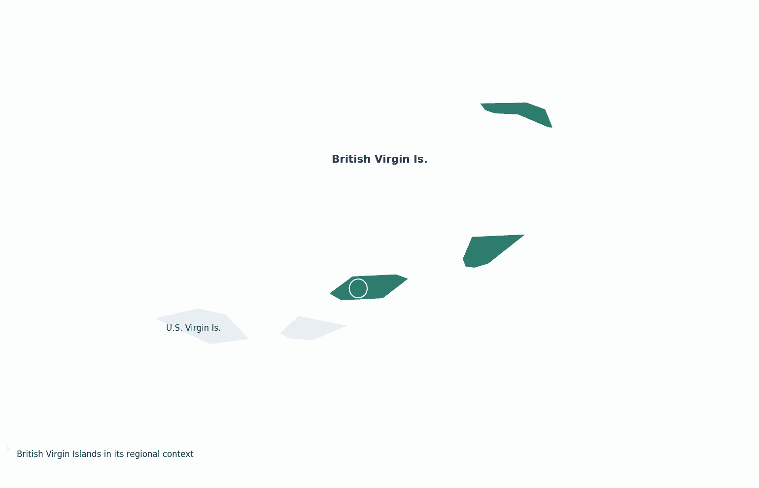
Maritime Borders
The British Virgin Islands have no land borders; they lie in the Caribbean just east of the U.S. Virgin Islands.
British Virgin Islands Key Facts
| Country | British Virgin Islands |
| Coordinates | Latitude: 18.4207 Longitude: -64.64 |
| Country Codes | Alpha 2: VG Alpha 3: VGB |
| Country Flag Emoji | 🇻🇬 |
| Int. Phone Prefix | +1 (284) |
| Capital city | Road Town |
| Continent Subcontinent | North America Caribbean |
| Country Area | 151 sq km |
| Population 2025 | 39,732 World Rank: 210 |
| Median Age | 38 |
| Life expectancy | 77.4 |
| Major languages | English |
| UTC/GMT Time | Number of time zones: 1
|
| Internet TLD | .vg |
| Biggest Airport | Terrance B. Lettsome Int'l Airport (EIS) |
| Average temperature | 27 °C 81 °F |
| Administrative Divisions | 9 electoral districts |
| Political system | British Overseas Territory |
British Virgin Islands Economy Facts
| World Bank Income Group | High income |
| World Bank Region | Latin America & Caribbean |
| Currency | United States dollar (USD) |
| GDP in 2023 | $1.5 (billions of USD) World Rank: 197 |
| GDP per capita in 2023 | $46,358 World Rank: 34 |
| Major Industries / Economic Sectors | Financial services (company incorporation), tourism, yachting |
| Top 5 Import Countries | United States, U.S. Virgin Islands, Puerto Rico |
| Top 5 Export Countries | United States, U.S. Virgin Islands |
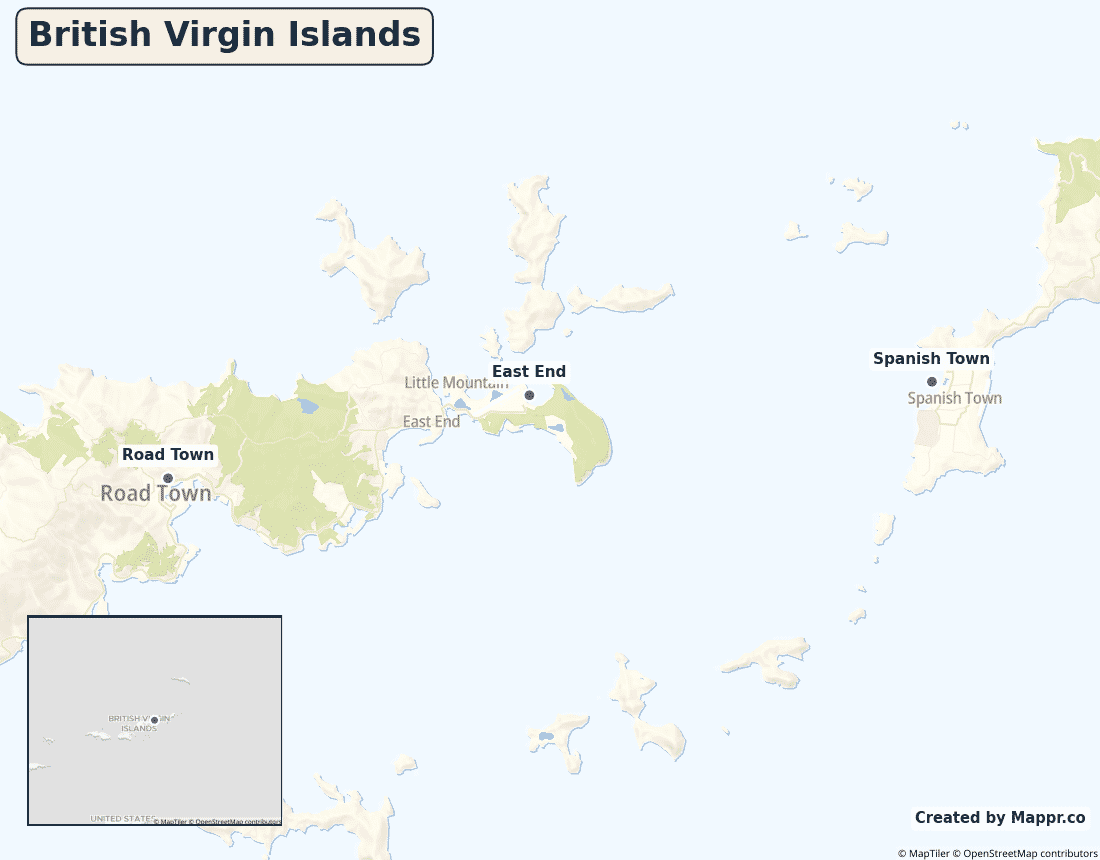
Biggest Cities in British Virgin Islands
Here are the largest cities in British Virgin Islands based on 2024 data:
| City | Population |
|---|
| Road Town | 8,449 |
Map of British Virgin Islands with the Largest Cities
Other Countries in the Caribbean Region
- Where are the Bahamas?
- Where are the Cayman Islands?
- Where are the Turks and Caicos Islands?
- Where are the US Virgin Islands?
- Where is Anguilla?
- Where is Antigua and Barbuda?
- Where is Aruba?
- Where is Barbados?
- Where is Bonaire?
- Where is Cuba?
- Where is Curaçao?
- Where is Dominica?
- Where is Grenada?
- Where is Guadeloupe?
- Where is Haiti?
- Where is Jamaica?
- Where is Martinique?
- Where is Montserrat?
- Where is Puerto Rico?
- Where is Saba?
- Where is Saint Barthélemy?
- Where is Saint Kitts and Nevis?
- Where is Saint Lucia?
- Where is Saint Martin?
- Where is Saint Vincent and the Grenadines?
- Where is Sint Eustatius?
- Where is Sint Maarten?
- Where is the Dominican Republic?
- Where is Trinidad and Tobago?
Geography
The British Virgin Islands are a group of about 60 islands and cays at the eastern end of the Virgin Islands archipelago, in the Caribbean just east of the U.S. Virgin Islands. The main islands are Tortola, Virgin Gorda, Anegada and Jost Van Dyke.
Famous for sailing, they are one of the world’s largest offshore company-registration centres.
Are the British Virgin Islands a country?
The British Virgin Islands are a British Overseas Territory, self-governing internally while the United Kingdom retains defence and external affairs.
| Status | British Overseas Territory |
| Sovereign state | United Kingdom |
| Capital | Road Town |
| Population | 31,000 |
| Area | 151 km² |
| Currency | United States dollar (USD) |
| Official language(s) | English |
| ISO 3166 code | VG / VGB |
| Calling code | +1 (284) |
| Internet TLD | .vg |
Climate
The BVI have a warm tropical climate averaging about 27°C (81°F), tempered by trade winds, with an Atlantic hurricane season from June to November.
Economy
The BVI economy rests on two pillars: financial services — it is one of the world’s top jurisdictions for registering companies — and tourism, especially sailing and yacht charters.
British Virgin Islands in its region
The islands lie immediately east of the U.S. Virgin Islands and Puerto Rico.
Administrative divisions
The territory is divided into nine electoral districts, with Road Town on Tortola the capital.


