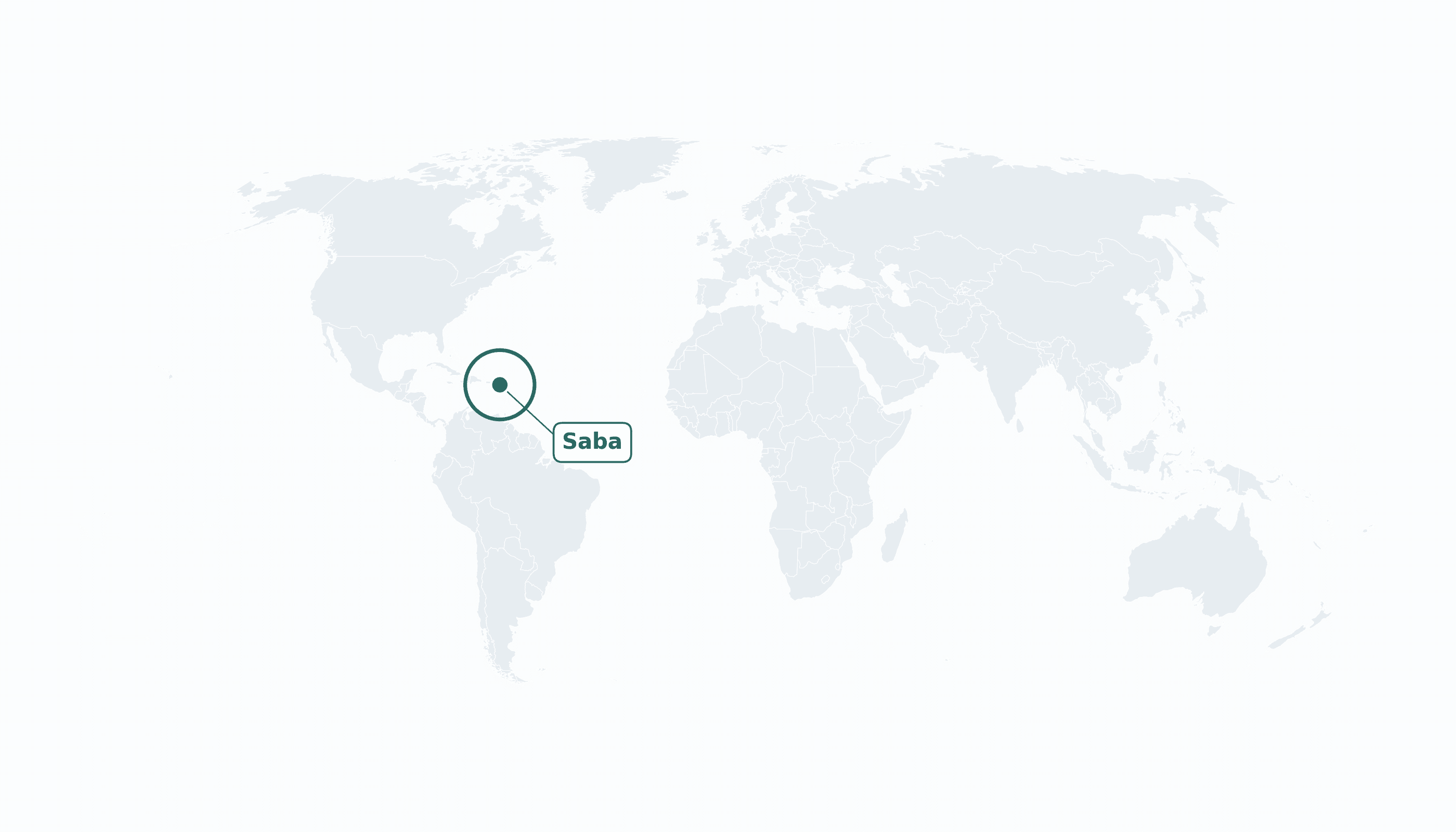
Saba is located in the Caribbean region at latitude 17.6354 and longitude -63.2327 and is part of the North American continent.
The DMS coordinates for the center of the country are:
- 17° 38' 7'' N
- 63° 13' 58'' W
You can see the location of Saba on the world map below:
Maritime Borders
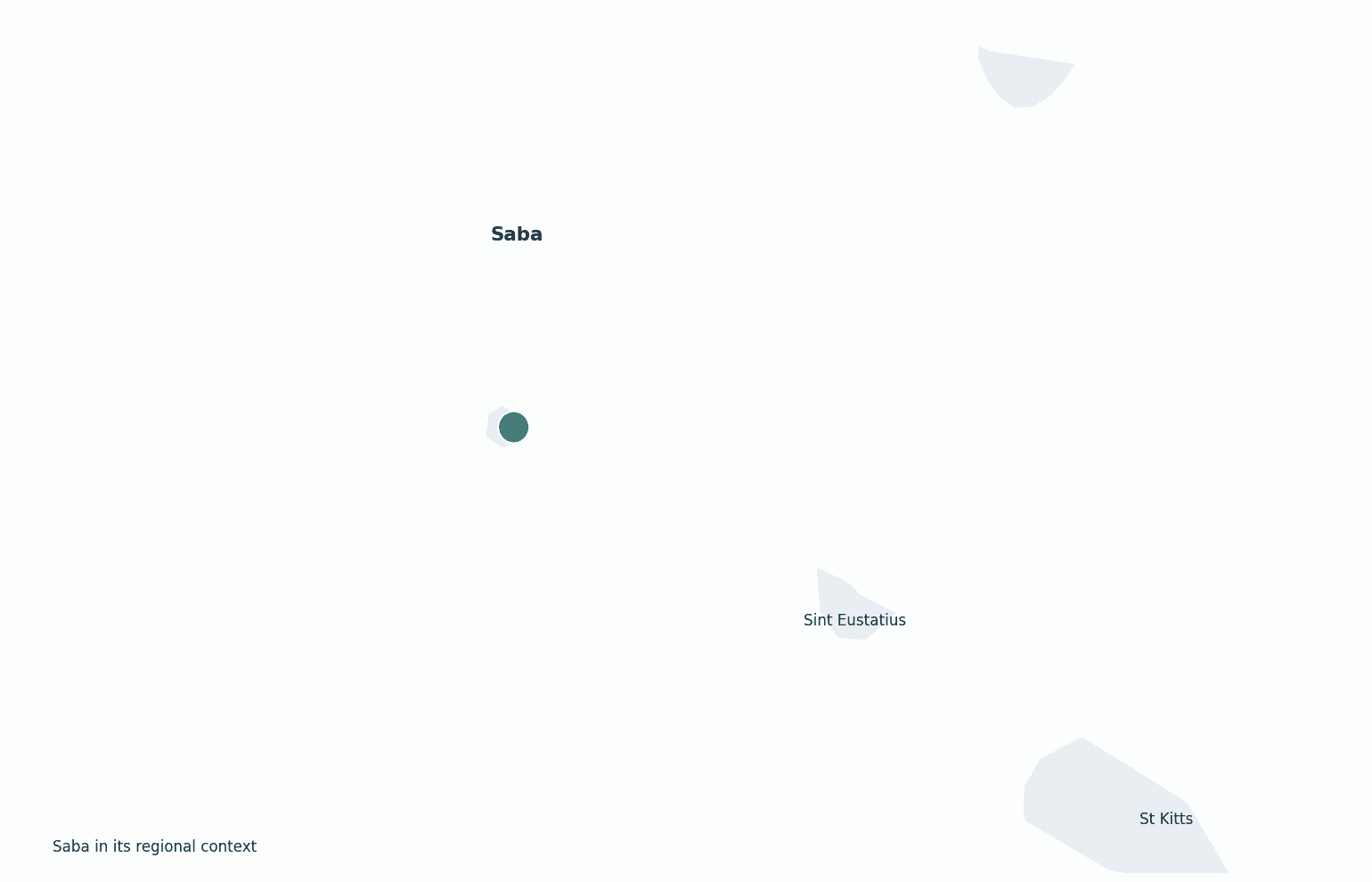
Saba has no land borders; it is a tiny volcanic island in the northeastern Caribbean, southwest of Sint Maarten.
Saba Key Facts
| Country | Saba |
| Coordinates | Latitude: 17.6354 Longitude: -63.2327 |
| Country Codes | Alpha 2: BQ Alpha 3: BES |
| Country Flag Emoji | 🇧🇶 |
| Int. Phone Prefix | +599 |
| Capital city | The Bottom |
| Continent Subcontinent | North America Caribbean |
| Country Area | 13 sq km |
| Population 2023 | 2,158 World Rank: 218 |
| Median Age | 42 |
| Life expectancy | 79.0 |
| Major languages | Dutch (official), English |
| UTC/GMT Time | Number of time zones: 1
|
| Internet TLD | .bq |
| Biggest Airport | Juancho E. Yrausquin Airport (SAB) |
| Average temperature | 27 °C 81 °F |
| Administrative Divisions | Special municipality (no subdivisions) |
| Political system | Special municipality of the Netherlands (Caribbean Netherlands) |
Saba Economy Facts
| World Bank Income Group | High income |
| World Bank Region | Latin America & Caribbean |
| Currency | United States dollar (USD) |
| GDP in 2023 | $0.06 (billions of USD) World Rank: 215 |
| GDP per capita in 2023 | $27,000 World Rank: 59 |
| Major Industries / Economic Sectors | Tourism (diving), the Saba University medical school, fishing |
| Top 5 Import Countries | Sint Maarten, United States, Netherlands |
| Top 5 Export Countries | Sint Maarten, United States |
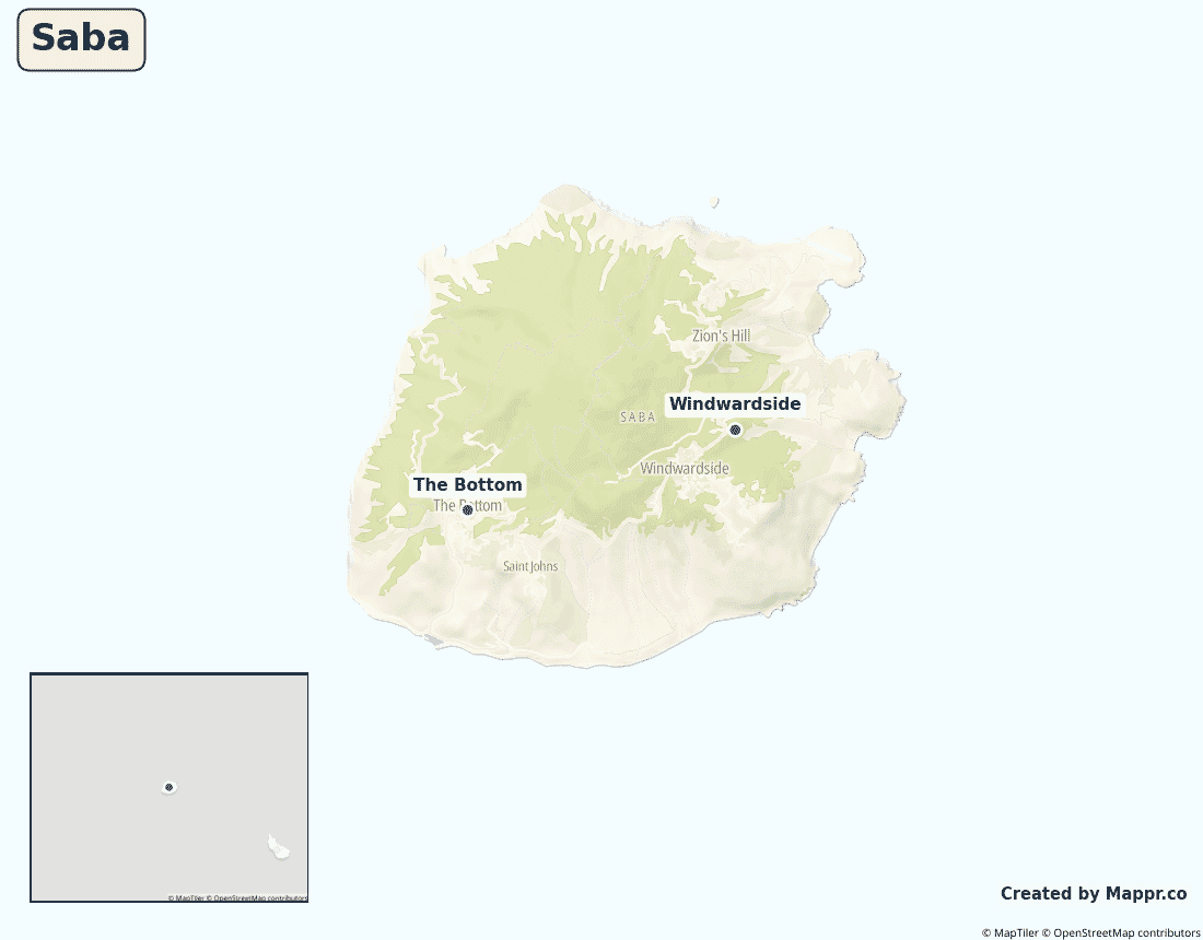
Biggest Cities in Saba
Here are the largest cities in Saba based on data:
| City | Population |
|---|
| The Bottom | 460 | Windwardside | 200 |
Map of Saba with the Largest Cities
Other Countries in the Caribbean Region
- Where are the Bahamas?
- Where are the British Virgin Islands?
- Where are the Cayman Islands?
- Where are the Turks and Caicos Islands?
- Where are the US Virgin Islands?
- Where is Anguilla?
- Where is Antigua and Barbuda?
- Where is Aruba?
- Where is Barbados?
- Where is Bonaire?
- Where is Cuba?
- Where is Curaçao?
- Where is Dominica?
- Where is Grenada?
- Where is Guadeloupe?
- Where is Haiti?
- Where is Jamaica?
- Where is Martinique?
- Where is Montserrat?
- Where is Puerto Rico?
- Where is Saint Barthélemy?
- Where is Saint Kitts and Nevis?
- Where is Saint Lucia?
- Where is Saint Martin?
- Where is Saint Vincent and the Grenadines?
- Where is Sint Eustatius?
- Where is Sint Maarten?
- Where is the Dominican Republic?
- Where is Trinidad and Tobago?
Geography
Saba is the smallest of the Caribbean Netherlands — a single, steep volcanic cone rising straight out of the sea in the northeastern Caribbean, southwest of Sint Maarten. Its summit, Mount Scenery, is the highest point in the whole Kingdom of the Netherlands.
With about 2,000 residents and no beaches to speak of, it draws divers and hikers rather than mass tourism.
Is Saba a country?
Saba is a special municipality of the Netherlands, part of the Caribbean Netherlands. Its residents are Dutch citizens and use the U.S. dollar; the Netherlands provides most public services.
| Status | Special municipality of the Netherlands (Caribbean Netherlands) |
| Sovereign state | Netherlands |
| Capital | The Bottom |
| Population | 2,158 |
| Area | 13 km² |
| Currency | United States dollar (USD) |
| Official language(s) | Dutch (official), English |
| ISO 3166 code | BQ / BES |
| Calling code | +599 |
| Internet TLD | .bq |
Climate
Saba has a warm tropical climate averaging about 27°C (81°F), wetter and cooler on its forested upper slopes, with a hurricane risk in late summer.
Economy
Saba’s tiny economy runs on dive tourism and, importantly, the Saba University School of Medicine, whose students underpin much of the local economy.
Saba in its region
Saba lies just northwest of Sint Eustatius and southwest of Sint Maarten, with St Kitts to the south.
Administrative divisions
As a special municipality of the Netherlands, Saba has no subdivisions; its main villages are The Bottom (the capital) and Windwardside.


