Solomon Islands is located in the Australia and Oceania region at latitude -9.64571 and longitude 160.156194 and is part of the Oceania continent continent.
The DMS coordinates for the center of the country are:
9° 38' 44.56'' S
160° 9' 22.30'' E
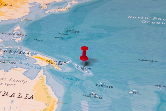
You can see the location of Solomon Islands on the world map below:
Solomon Islands on the World Map
Solomon Islands Neighboring Countries
The country has no neighboring countries/land borders.
Maritime Borders
Solomon Islands borders with the Pacific Ocean.
Solomon Islands Key Facts
| Country | Solomon Islands |
|---|---|
| Coordinates |
Latitude: -9.64571 Longitude: 160.156194 |
| Country Codes |
Alpha 2: SB Alpha 3: SLB |
| Country Flag Emoji | 🇸🇧 |
| Int. Phone Prefix | +677 |
| Capital city | Honiara |
| Continent / Subcontinent |
Oceania Australia and Oceania |
| Country Area | 28,896 sq km |
| Population 2025 |
838,645 World Rank: 163 |
| Median Age | 19.3 |
| Life expectancy | 70.7 |
| Major languages | Melanesian pidgin (in much of the country is lingua franca), English (official but spoken by only 1%-2% of the population), 120 indigenous languages |
| UTC/GMT Time |
Number of time zones: 1
|
| Internet TLD | .sb |
| Biggest Airport | Honiara International Airport (HIR) |
| Average temperature |
25.65 °C 78.17 °F |
| Administrative Divisions | 1 capital territory 9 provinces |
| Political system | Parliamentary democracy |
Solomon Islands Economy Facts
| World Bank Income Group | Lower middle income |
|---|---|
| World Bank Region | East Asia & Pacific |
| Currency | Solomon Dollar (SBD) |
| GDP in 2024 |
$1.58 (billions of USD) World Rank: 193 |
| GDP per capita in 2024 |
$2,086 World Rank: 175 |
| Major Industries / Economic Sectors | Agriculture, manufacturing, energy, services |
| Top 5 Import Countries | Australia, China, United States, Japan, New Zealand |
| Top 5 Export Countries | Australia, China, United States, New Zealand, Japan |
Biggest Cities in Solomon Islands
Here are the largest cities in Solomon Islands based on 2024 data:
| City | Population |
|---|---|
| Honiara | 56,298 |
| Panatina | 32,712 |
| Tandai | 24,592 |
| Malango | 15,560 |


