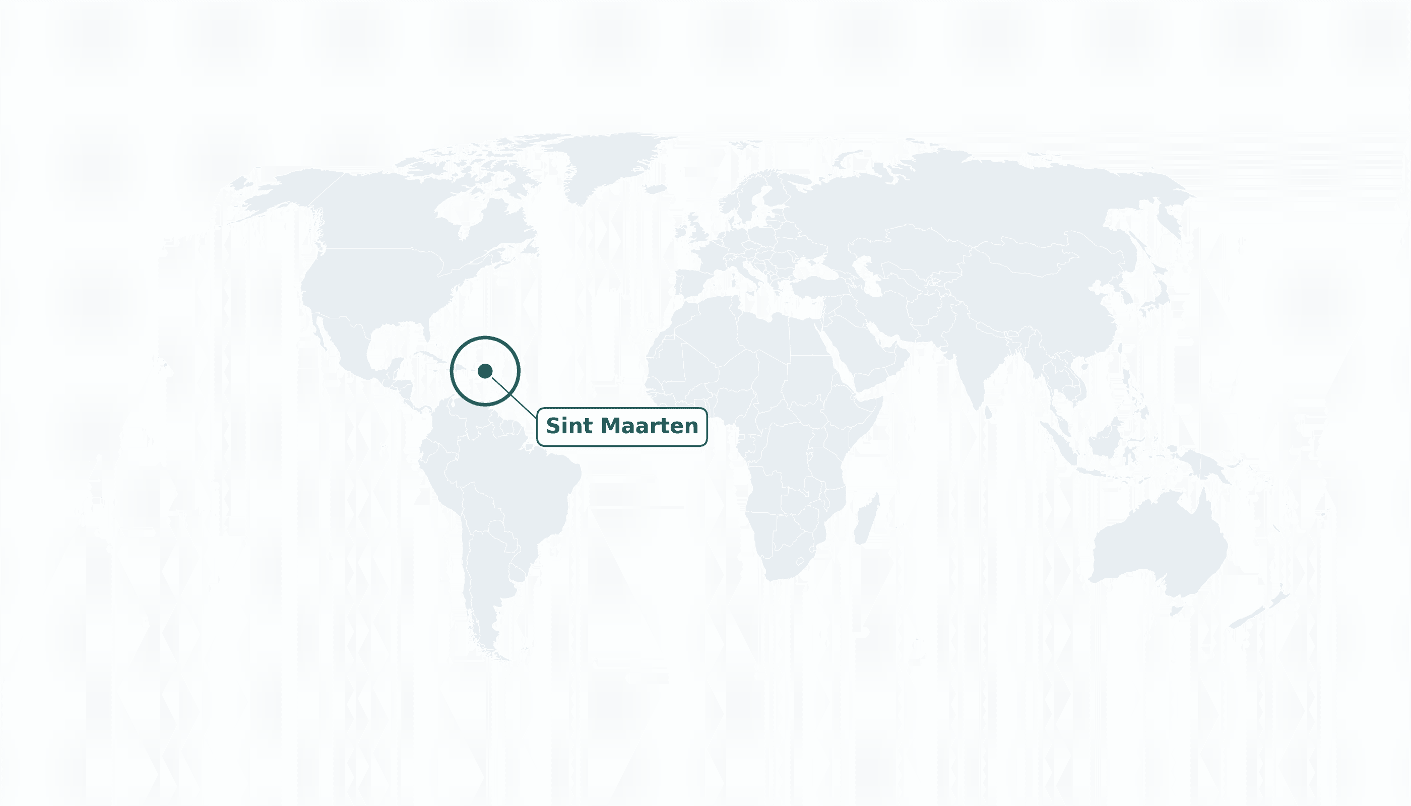
Sint Maarten is located in the Caribbean region at latitude 18.0425 and longitude -63.0548 and is part of the North American continent.
The DMS coordinates for the center of the country are:
- 18° 2' 33'' N
- 63° 3' 17'' W
You can see the location of Sint Maarten on the world map below:
Maritime Borders
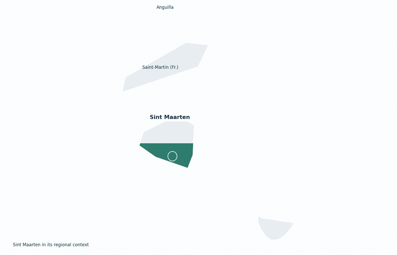
Sint Maarten shares a land border with French Saint-Martin to the north; the two halves divide one small island in the northeastern Caribbean.
Sint Maarten Key Facts
| Country | Sint Maarten |
| Coordinates | Latitude: 18.0425 Longitude: -63.0548 |
| Country Codes | Alpha 2: SX Alpha 3: SXM |
| Country Flag Emoji | 🇸🇽 |
| Int. Phone Prefix | +1 (721) |
| Capital city | Philipsburg |
| Continent Subcontinent | North America Caribbean |
| Country Area | 34 sq km |
| Population 2025 | 43,923 World Rank: 206 |
| Median Age | 40 |
| Life expectancy | 76.5 |
| Major languages | Dutch, English (both official) |
| UTC/GMT Time | Number of time zones: 1
|
| Internet TLD | .sx |
| Biggest Airport | Princess Juliana Int'l Airport (SXM) |
| Average temperature | 27 °C 81 °F |
| Administrative Divisions | No first-order divisions (districts) |
| Political system | Constituent country of the Kingdom of the Netherlands |
Sint Maarten Economy Facts
| World Bank Income Group | High income |
| World Bank Region | Latin America & Caribbean |
| Currency | Netherlands Antillean guilder (ANG) |
| GDP in 2023 | $1.74 (billions of USD) World Rank: 191 |
| GDP per capita in 2023 | $42,978 World Rank: 38 |
| Major Industries / Economic Sectors | Tourism (cruise and stopover), retail, financial services |
| Top 5 Import Countries | United States, Netherlands, China |
| Top 5 Export Countries | United States, France |
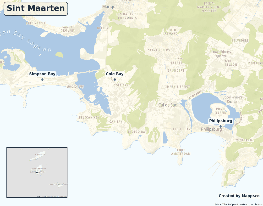
Biggest Cities in Sint Maarten
Here are the largest cities in Sint Maarten based on 2024 data:
| City | Population |
|---|
| Philipsburg | 1,400 |
Map of Sint Maarten with the Largest Cities
Other Countries in the Caribbean Region
- Where are the Bahamas?
- Where are the British Virgin Islands?
- Where are the Cayman Islands?
- Where are the Turks and Caicos Islands?
- Where are the US Virgin Islands?
- Where is Anguilla?
- Where is Antigua and Barbuda?
- Where is Aruba?
- Where is Barbados?
- Where is Bonaire?
- Where is Cuba?
- Where is Curaçao?
- Where is Dominica?
- Where is Grenada?
- Where is Guadeloupe?
- Where is Haiti?
- Where is Jamaica?
- Where is Martinique?
- Where is Montserrat?
- Where is Puerto Rico?
- Where is Saba?
- Where is Saint Barthélemy?
- Where is Saint Kitts and Nevis?
- Where is Saint Lucia?
- Where is Saint Martin?
- Where is Saint Vincent and the Grenadines?
- Where is Sint Eustatius?
- Where is the Dominican Republic?
- Where is Trinidad and Tobago?
Geography
Sint Maarten is the Dutch southern half of a small island in the northeastern Caribbean — the smallest landmass in the world shared by two nations. The northern half is the French territory of Saint-Martin.
Its Princess Juliana airport, with planes skimming over Maho Beach, is one of the most famous in the world.
Is Sint Maarten a country?
Sint Maarten is a constituent country of the Kingdom of the Netherlands, self-governing since 2010, while the Netherlands handles defence and foreign policy. Its people are Dutch citizens.
| Status | Constituent country of the Kingdom of the Netherlands |
| Sovereign state | Netherlands |
| Capital | Philipsburg |
| Population | 44,000 |
| Area | 34 km² |
| Currency | Netherlands Antillean guilder (ANG) |
| Official language(s) | Dutch, English (both official) |
| ISO 3166 code | SX / SXM |
| Calling code | +1 (721) |
| Internet TLD | .sx |
Climate
Sint Maarten has a warm tropical climate averaging about 27°C (81°F), cooled by trade winds; it sits in the Atlantic hurricane belt and was hit hard by Hurricane Irma in 2017.
Economy
Sint Maarten’s economy is overwhelmingly tourism-driven — a major cruise port and duty-free shopping hub — supported by financial services.
Sint Maarten in its region
Sint Maarten shares its island with French Saint-Martin to the north, with Anguilla just beyond and St Barthélemy to the southeast.
Administrative divisions
Sint Maarten has no formal first-order subdivisions; it is organised into districts around the capital, Philipsburg.


