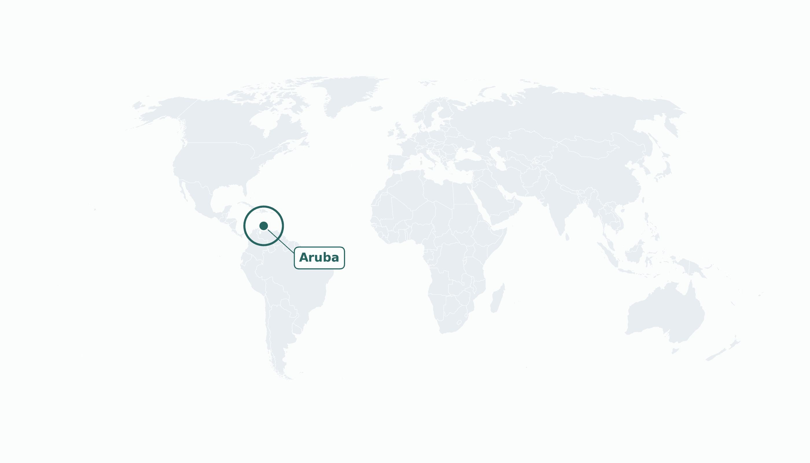
Aruba is located in the Caribbean region at latitude 12.5211 and longitude -69.9683 and is part of the North American continent.
The DMS coordinates for the center of the country are:
- 12° 31' 16'' N
- 69° 58' 6'' W
You can see the location of Aruba on the world map below:
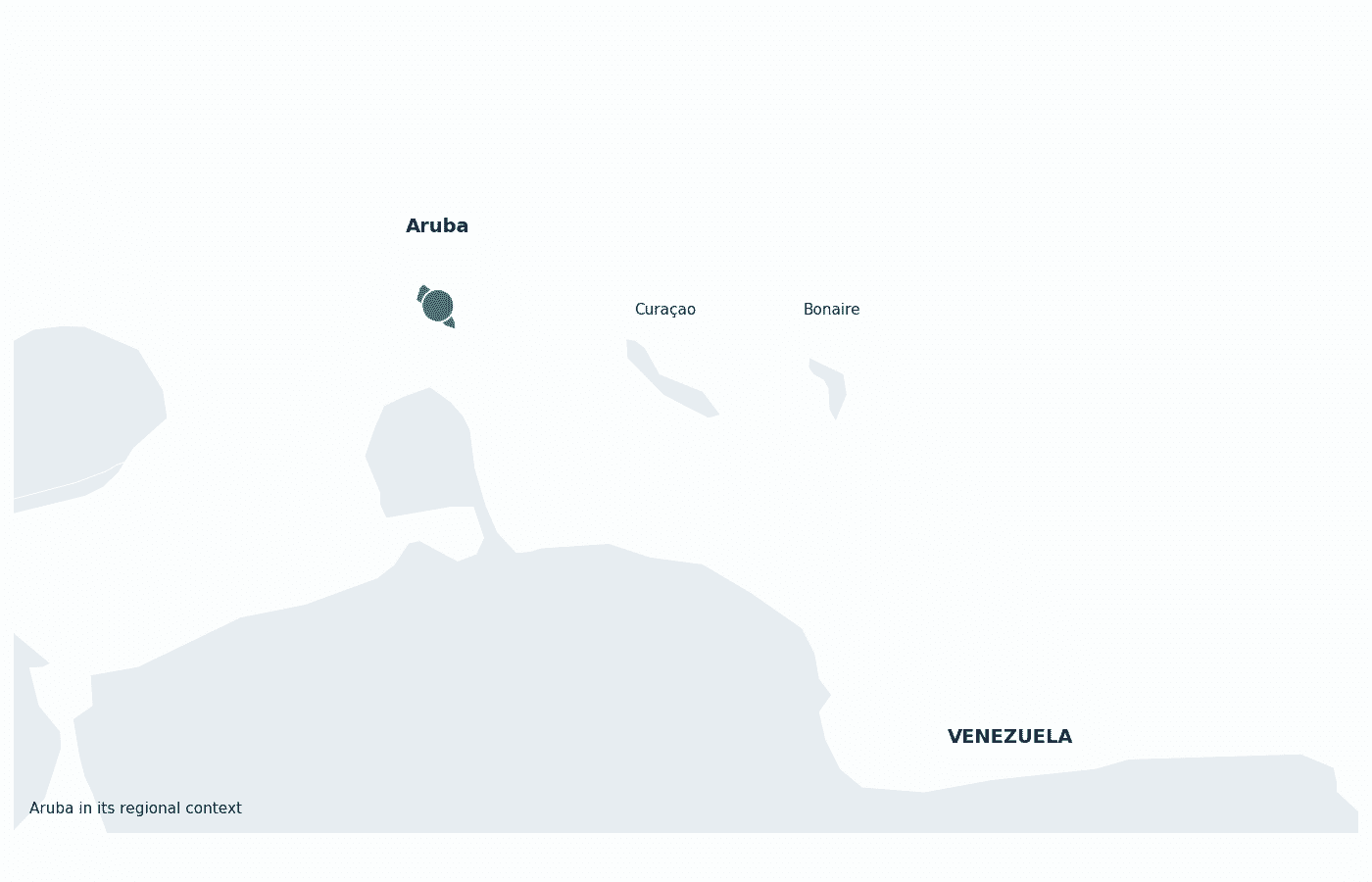
Maritime Borders
Aruba has no land borders; it is an island in the southern Caribbean Sea, about 30 km off the Venezuelan coast.
Aruba Key Facts
| Country | Aruba |
| Coordinates | Latitude: 12.5211 Longitude: -69.9683 |
| Country Codes | Alpha 2: AW Alpha 3: ABW |
| Country Flag Emoji | 🇦🇼 |
| Int. Phone Prefix | +297 |
| Capital city | Oranjestad |
| Continent Subcontinent | North America Caribbean |
| Country Area | 180 sq km |
| Population 2025 | 108,785 World Rank: 191 |
| Median Age | 40 |
| Life expectancy | 76.5 |
| Major languages | Dutch, Papiamento (both official) |
| UTC/GMT Time | Number of time zones: 1
|
| Internet TLD | .aw |
| Biggest Airport | Queen Beatrix International Airport (AUA) |
| Average temperature | 28 °C 82 °F |
| Administrative Divisions | No first-order administrative divisions |
| Political system | Constituent country of the Kingdom of the Netherlands |
Aruba Economy Facts
| World Bank Income Group | High income |
| World Bank Region | Latin America & Caribbean |
| Currency | Aruban florin (AWG) |
| GDP in 2023 | $4.27 (billions of USD) World Rank: 174 |
| GDP per capita in 2023 | $38,591 World Rank: 44 |
| Major Industries / Economic Sectors | Tourism, banking and finance, petroleum transshipment |
| Top 5 Import Countries | United States, Netherlands, China, Brazil, Italy |
| Top 5 Export Countries | United States, Netherlands, Colombia, Panama, Venezuela |
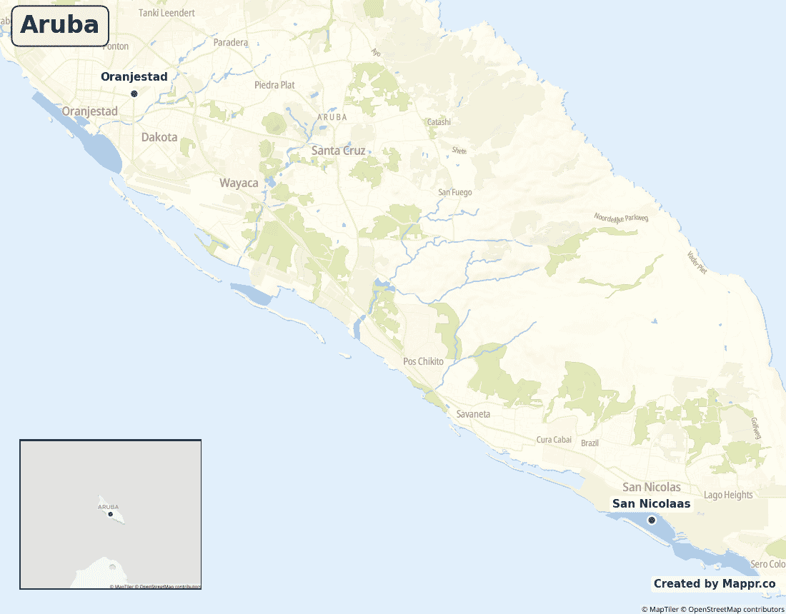
Biggest Cities in Aruba
Here are the largest cities in Aruba based on 2024 data:
| City | Population |
|---|
| Oranjestad | 29,998 | Noord | 24,193 | Tanki Leendert | 21,500 | Santa Cruz | 15,236 |
Map of Aruba with the Largest Cities
Other Countries in the Caribbean Region
- Where are the Bahamas?
- Where are the British Virgin Islands?
- Where are the Cayman Islands?
- Where are the Turks and Caicos Islands?
- Where are the US Virgin Islands?
- Where is Anguilla?
- Where is Antigua and Barbuda?
- Where is Barbados?
- Where is Bonaire?
- Where is Cuba?
- Where is Curaçao?
- Where is Dominica?
- Where is Grenada?
- Where is Guadeloupe?
- Where is Haiti?
- Where is Jamaica?
- Where is Martinique?
- Where is Montserrat?
- Where is Puerto Rico?
- Where is Saba?
- Where is Saint Barthélemy?
- Where is Saint Kitts and Nevis?
- Where is Saint Lucia?
- Where is Saint Martin?
- Where is Saint Vincent and the Grenadines?
- Where is Sint Eustatius?
- Where is Sint Maarten?
- Where is the Dominican Republic?
- Where is Trinidad and Tobago?
Geography
Aruba is a small island in the southern Caribbean Sea, lying about 30 kilometres off the northern coast of Venezuela. It is the westernmost of the three ABC islands — Aruba, Bonaire and Curaçao.
Flat, dry and largely outside the Atlantic hurricane belt, Aruba’s reliable sunshine and white-sand beaches have made tourism the backbone of its economy.
Is Aruba a country?
Aruba is a constituent country of the Kingdom of the Netherlands, self-governing in its internal affairs since separating from the Netherlands Antilles in 1986. The Netherlands handles defence and foreign policy, and Arubans are Dutch citizens.
| Status | Constituent country of the Kingdom of the Netherlands |
| Sovereign state | Netherlands |
| Capital | Oranjestad |
| Population | 107,995 |
| Area | 180 km² |
| Currency | Aruban florin (AWG) |
| Official language(s) | Dutch, Papiamento (both official) |
| ISO 3166 code | AW / ABW |
| Calling code | +297 |
| Internet TLD | .aw |
Aruba in its region
Aruba’s closest neighbours are its fellow ABC islands — Curaçao and Bonaire to the east — and the South American mainland of Venezuela just to the south.
Climate
Aruba has a hot, dry climate cooled by constant trade winds, averaging about 28°C (82°F). Like its ABC neighbours it sits outside the main hurricane belt, giving it some of the most reliable beach weather in the Caribbean.
Economy
Aruba’s high-income economy is one of the most tourism-dependent in the world, with visitors — many of them American — driving the bulk of activity, supported by banking and a legacy oil-transshipment sector.
Administrative divisions
Aruba has no first-order administrative subdivisions; for statistical purposes it is split into eight regions, with most people living in or around the capital, Oranjestad.


