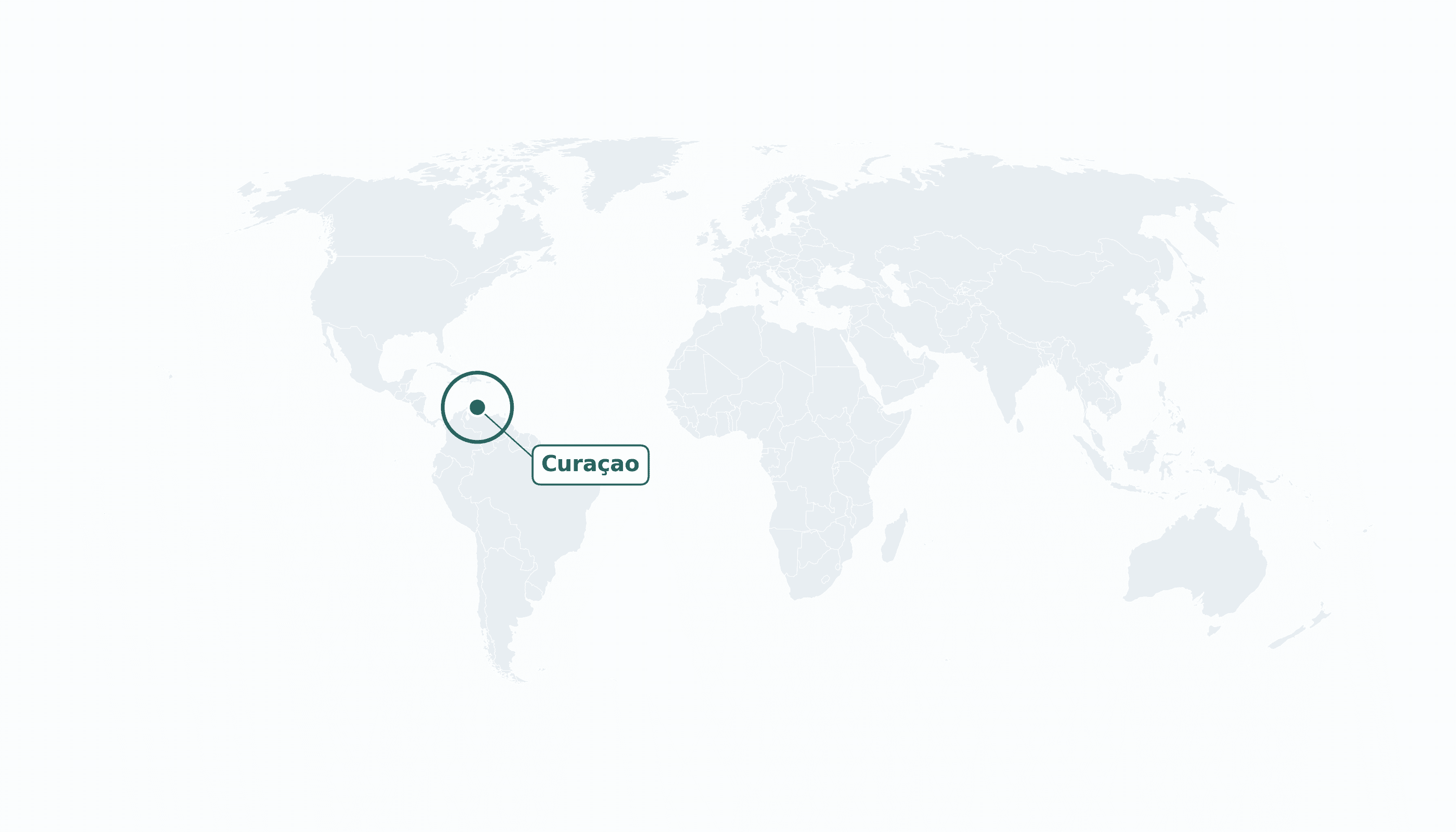
Curaçao is located in the Caribbean region at latitude 12.1696 and longitude -68.99 and is part of the North American continent.
The DMS coordinates for the center of the country are:
- 12° 10' 11'' N
- 68° 59' 24'' W
You can see the location of Curaçao on the world map below:
Maritime Borders
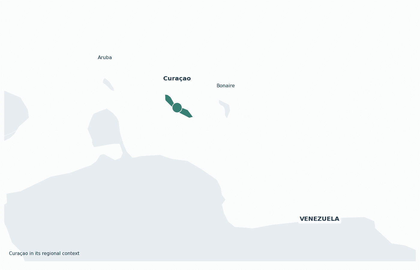
Curaçao has no land borders; it is an island in the southern Caribbean Sea, about 65 km north of Venezuela.
Curaçao Key Facts
| Country | Curaçao |
| Coordinates | Latitude: 12.1696 Longitude: -68.99 |
| Country Codes | Alpha 2: CW Alpha 3: CUW |
| Country Flag Emoji | 🇨🇼 |
| Int. Phone Prefix | +599 |
| Capital city | Willemstad |
| Continent Subcontinent | North America Caribbean |
| Country Area | 444 sq km |
| Population 2025 | 156,263 World Rank: 186 |
| Median Age | 39 |
| Life expectancy | 77.0 |
| Major languages | Dutch, Papiamento, English (all official) |
| UTC/GMT Time | Number of time zones: 1
|
| Internet TLD | .cw |
| Biggest Airport | Curaçao International Airport (CUR) |
| Average temperature | 28 °C 82 °F |
| Administrative Divisions | No first-order administrative divisions |
| Political system | Parliamentary democracy (constituent country of the Kingdom of the Netherlands) |
Curaçao Economy Facts
| World Bank Income Group | High income |
| World Bank Region | Latin America & Caribbean |
| Currency | Netherlands Antillean guilder (ANG) |
| GDP in 2024 | $3.56 (billions of USD) World Rank: 177 |
| GDP per capita in 2024 | $22,833 World Rank: 70 |
| Major Industries / Economic Sectors | Tourism, petroleum refining and transshipment, financial services, shipping, light manufacturing |
| Top 5 Import Countries | United States, Netherlands, China, Brazil, Colombia |
| Top 5 Export Countries | United States, Netherlands, Panama, Dominican Republic, Haiti |
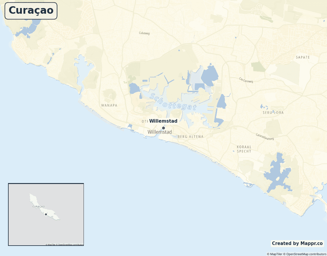
Biggest Cities in Curaçao
Here are the largest cities in Curaçao based on 2024 data:
| City | Population |
|---|
| Willemstad | 125,000 | Bandariba | 20,838 |
Map of Curaçao with the Largest Cities
Other Countries in the Caribbean Region
- Where are the Bahamas?
- Where are the British Virgin Islands?
- Where are the Cayman Islands?
- Where are the Turks and Caicos Islands?
- Where are the US Virgin Islands?
- Where is Anguilla?
- Where is Antigua and Barbuda?
- Where is Aruba?
- Where is Barbados?
- Where is Bonaire?
- Where is Cuba?
- Where is Dominica?
- Where is Grenada?
- Where is Guadeloupe?
- Where is Haiti?
- Where is Jamaica?
- Where is Martinique?
- Where is Montserrat?
- Where is Puerto Rico?
- Where is Saba?
- Where is Saint Barthélemy?
- Where is Saint Kitts and Nevis?
- Where is Saint Lucia?
- Where is Saint Martin?
- Where is Saint Vincent and the Grenadines?
- Where is Sint Eustatius?
- Where is Sint Maarten?
- Where is the Dominican Republic?
- Where is Trinidad and Tobago?
Geography
Curaçao is an island in the southern Caribbean Sea, lying just off the northern coast of Venezuela, roughly 65 kilometres (40 miles) to the south. It is the largest of the three ABC islands — Aruba, Bonaire and Curaçao — that make up the Leeward Antilles.
Although it sits geographically in the Americas, Curaçao is constitutionally part of the Kingdom of the Netherlands, an arrangement that gives the island a distinctly European administrative character layered over its Caribbean setting. Its capital and largest city is Willemstad, whose historic centre is a UNESCO World Heritage Site.
Curaçao lies outside the main Atlantic hurricane belt, which — together with its arid climate and protected harbour — has long made it a hub for shipping, oil refining and tourism in the region.
Is Curaçao a country?
Curaçao is a constituent country of the Kingdom of the Netherlands — not a fully independent state, but far more than a colony. Since the dissolution of the Netherlands Antilles in 2010, Curaçao has governed its own internal affairs, with its own parliament, prime minister and currency, while the Kingdom (effectively the Netherlands) retains responsibility for defence and foreign policy. Curaçaoans are Dutch citizens, and the island is an associated overseas territory of the European Union rather than a full member.
| Status | Constituent country of the Kingdom of the Netherlands |
| Sovereign state | Netherlands 🇳🇱 |
| Capital | Willemstad |
| Population | ≈ 152,000 (2023) |
| Area | 444 km² (171 sq mi) |
| Currency | Netherlands Antillean guilder (ANG) |
| Official languages | Dutch, Papiamento, English |
| ISO 3166 code | CW / CUW |
| Calling code | +599 |
| Internet TLD | .cw |
Curaçao in the Caribbean
Curaçao’s closest neighbours are its fellow ABC islands — Venezuela to the south, Aruba to the west and Bonaire to the east. Together the ABC islands form the western end of the Lesser Antilles, sitting well south of the hurricane-prone islands of the eastern Caribbean.
Climate
Curaçao has a hot, semi-arid climate, averaging around 28°C (82°F) year-round with little rainfall. Crucially it sits south of the main Atlantic hurricane belt, so direct hits are rare — a major draw for tourism and shipping.
Economy
Curaçao’s high-income economy rests on tourism, a historic oil-refining and transshipment industry, and a sizeable financial-services sector, with GDP of about $3.6 billion.
Administrative divisions
Unlike most countries, Curaçao has no first-order administrative subdivisions such as provinces or states. The island is instead organised into local districts and neighbourhoods (banda), with Willemstad and its surrounding area home to the large majority of the population.


