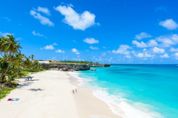
Known for its idyllic beaches and friendly population, this independent republic within the British commonwealth isn’t one that everyone can point to on a map.
Where is Barbados? We’ll give you a hint: its nickname is the “Jewel of the Caribbean.”
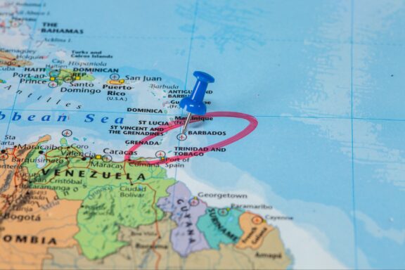
Barbados is located in the Caribbean region and is part of the Americas.
Barbados Interesting Facts
- World-famous singer Rihanna is from Barbados.
- Barbados is home to the world’s oldest rum distillery.
- Grapefruit originally came from Barbados.
- Flying fish are common around Barbados, earning the island the name “Land of the Flying Fish.”
Precise Location Coordinates of Barbados
The DMS (Degrees, Minutes, Seconds) coordinates for the center of Barbados are:
- 13° 11′ 37.99” N
- 59° 32′ 35.51” W
The latitude and longitude of Barbados are:
- Latitude: 13.193887
- Longitude: -59.543198
You can see the location of Barbados on the world map below:
Neighboring Countries of Barbados
Because Barbados is an island, it doesn’t share any land borders with foreign countries. The nearest countries to Barbados are more than 150 kilometers away.
The closest countries to Barbados (BB) are:
- Saint Lucia (LC) 168 km (104 mi) away
- Saint Vincent and the Grenadines (VC) 168 km (104 mi) away
- Martinique (MQ) 180 km (110 mi) away
Maritime Borders
Barbados is located in the Lesser Antilles island chain, which places it at the far eastern edge of the Caribbean Sea. In fact, some descriptions of the island place it outside of the Caribbean Sea, though it is still considered to be in the Caribbean region.
Whether the island borders the Caribbean Sea or not, it is certainly located in the Western Atlantic Ocean.

Administrative Divisions of Barbados
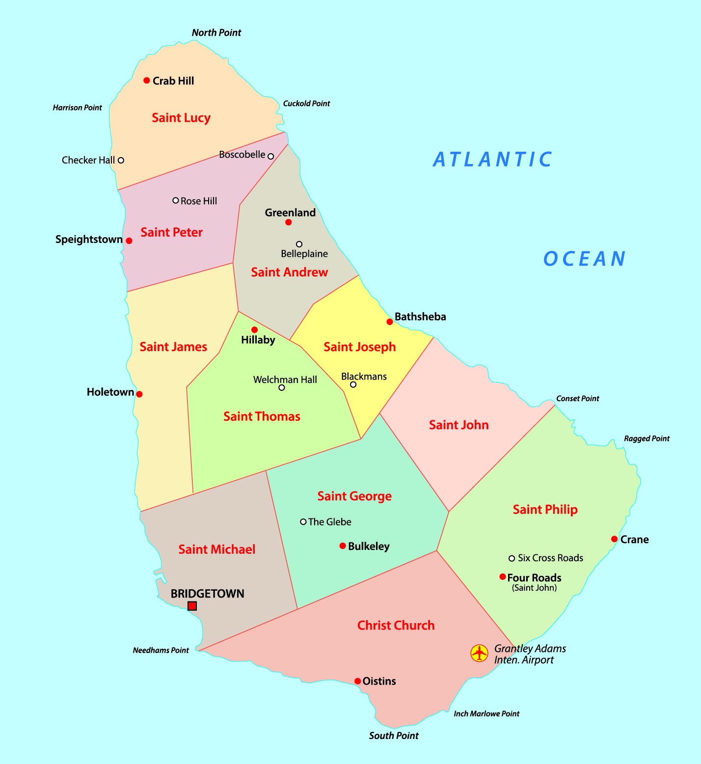
The sub-regions of Barbados are called parishes, a naming convention that comes from the island’s history with the Church of England during colonial years. In 1629, six original parishes were established by English settlers.
In 1645, the number of parishes was increased to the eleven that are still present today, each with its own parish church. The capital of Barbados, Bridgetown, is located in the parish of Saint Michael, which is also the country’s most populous parish. By total area, the largest parish in Barbados is St. Philip.
Geography of Barbados
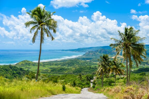
In contrast to the nearby mountainous Windward Islands, the topography of Barbados is mostly flat. The elevation of the island does rise gently in the central highlands region, known as the Scotland District. The highest point in Barbados is on top of Mount Hillaby, which reaches 340 m (1,120 ft) above sea level.
Geologically, Barbados is covered in a layer of coral that measures up to 90 m (300 ft) thick in places; this layer has eroded in the Scotland District region. The waters around Barbados are also home to coral reefs, for which conservation efforts are underway.
Barbados covers an area of 432 km2 (167 mi2), which makes it the 26th largest island in the Caribbean.
History of Barbados
First Inhabitants
From archaeological evidence, it is suspected that humans first visited and settled in Barbados around 1600 BCE, arriving from the northern parts of South America.
Little is known about the island’s presence or lack of inhabitants in the years that followed, though more permanent settlements of Amerindian people were established between the 4th and 7th centuries CE. The next groups to inhabit and visit the island were the Arawaks and Caribs.
European Arrival
Detailed information on the first arrival of Europeans to the island isn’t available, though it’s thought that either the Spanish or Portuguese were the first to visit around the 16th century.
Portuguese explorers named the island Barbados, which translates to “bearded” in English, either after the bearded fig trees on the island or after the bearded people living there. Spain conducted a number of slave raids on the island, reducing the local population, and those who were not enslaved are thought to have migrated elsewhere.
English Colonialism
The first English ship arrived at the island in 1625, and the first English settlement began in 1627 near present-day Holetown. The colonists in Barbados eventually began sugar production in what is referred to as the Sugar Revolution. The industry was extremely profitable but came at the expense of slave labor.
Indentured and enslaved labor were integral parts of the success of the sugar production industry in Barbados, and a racist class system was a central part of society.
Conditions for slaves in Barbados were extremely harsh and led to several planned rebellions, the most notable of which is known as Bussa’s Rebellion in 1816. Slavery was eventually abolished in the British Empire in 1833, but plantation owners retained political and economic power on the island.
Independence
Growing dissatisfaction with the ruling class in Barbados led to several reforms in the 20th century. Universal suffrage was adopted in 1950, and full internal self-government was achieved in 1961. Barbados would gain full independence in 1966.
Barbados initially remained within the Commonwealth of Nations but became a republic and left the Commonwealth in 2021.
Culture and People of Barbados
Ethnicity
Almost 90% of Barbados’ population of around 300,000 are of Afro-Caribbean and mixed ancestry. Barbadians are colloquially referred to as Bajans, and the Anglo-Bajan or European-Bajan populations have ancestry primarily from the United Kingdom, Ireland, Germany, and Italy.
Other ethnic groups in Barbados are the Indo-Guyanese, Chinese-Barbadians, and several others.
Religion
Barbados is a secular state that guarantees freedom of religion for its citizens. Christianity is the most widely practiced religion in the country, and Anglican is the predominant denomination. The Church of England was the official state religion until Barbados gained independence.
In 2019, around 20% of Barbadians do not identify with a particular religion, which makes non-religious the largest group after Anglican. Making up less than 3% of the population, other religious groups include Muslims, Jews, Rastafarians, Hindus, Buddhists, and Baha’is.
Language
Due to its history as an English colony, the official language of Barbados is English, which is used for official communications across the island and is closest to British English.
The most commonly spoken language in Barbados, however, is the Bajan Dialect, which is an English-based creole language with African and British influences. The Bajan Dialect is primarily spoken, and most written communications happen in English.
Cuisine
The multicultural history of Barbados is reflected in its cuisine. Barbadian or Bajan cuisine fuses elements of African, Portuguese, Indian, Irish, Creole, Indigenous and British cooking styles to create its own unique blend.
The national dish of Barbados is flying fish and cou-cou, which is traditionally eaten on Fridays. Other seafood dishes such as fish cakes are also fairly common in Barbados, and beverages include rum, juices, coconut water, sorrel drink, and mauby.
Arts
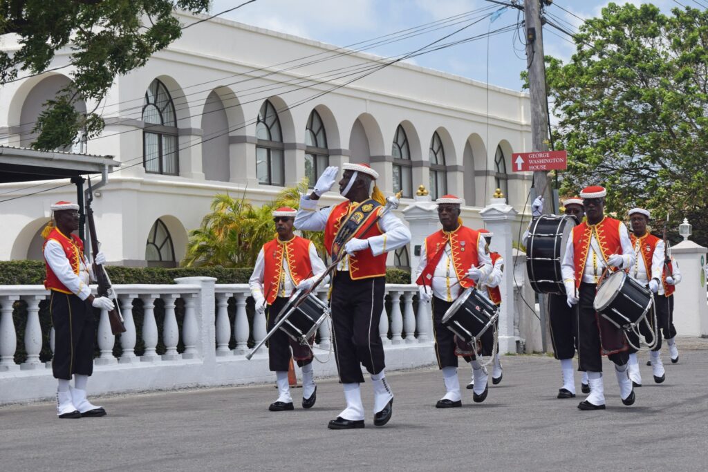
As with the country’s cuisine, the arts in Barbados draw on a number of different influences from around the world: African, Indian, Irish, Creole, British, and more. Many traditional Barbadian forms of music and art are based on parodies of British culture.
Anglican church hymns and British military drills, and other practices of white authorities in Barbados were parodied, and this has created traditions such as the Landship tradition and many folk songs.
Some popular genres of music in Barbados are spouge, reggae, and calypso. Barbadian singer Rihanna is one of the most famous musicians in the world.
The biggest festival in Barbados is the Crop Over Festival, which is a traditional end-of-harvest festival that involves music, dancing, masquerade, and processions. Another important festival in the country is the National Independence Festival of Creative Arts, which takes place on Barbados’ independence day.
Biggest Cities in Barbados
Here are the largest cities in Barbados based on 2024 data:
| City | Population |
|---|
| Bridgetown | 98,511 |
Map of Barbados with the Largest Cities
Barbados Economy Facts
| World Bank Income Group | High income |
| World Bank Region | Latin America & Caribbean |
| Currency | Barbados Dollar (BBD) |
| GDP in 2024 | $7.5 (billions of USD) World Rank: 160 |
| GDP per capita in 2024 | $28,365 World Rank: 61 |
| Major Industries / Economic Sectors | Tourism, manufacturing, agriculture, energy |
| Top 5 Import Countries | United States, China, Trinidad and Tobago, Brazil, United Kingdom |
| Top 5 Export Countries | United States, United Kingdom, Canada, China, Venezuela |
Government and Politics in Barbados
Having gained independence in 1966, Barbados is a parliamentary republic. The head of state is the President of Barbados, and Sandra Mason became the first president of the country since it became a republic in 2021. The Constitution of Barbados provides the supreme law of the country.
Barbados has a two-party system dominated by the Democratic Labour Party and the Barbados Labour Party.
Tourist Attractions of Barbados
Many islands in the Caribbean are known for being tourist hotspots, and indeed there are many reasons to visit Barbados as well. Navigating the country with English is an easy task, and there are plenty of natural sights to soak up under the Barbadian sun.
Harrison’s Cave
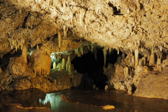
The beaches may get all the glamor, but one of the most stunning natural sites in Barbados is actually beneath the Earth: Harrison’s Cave.
Exploring the cave’s myriad stalagmites and stalactites brings a crocodile’s jaw to mind and is possible with walk-in tours and the ever-popular tram option.
Bathsheba Beach
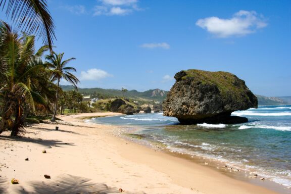
This is certainly one of the best beaches in Barbados, especially for those looking for one with a wild, untouched feeling. Bathsheba Beach is lined with cliffs and large rock formations that give it a unique flair.
Swimming isn’t encouraged at this beach due to strong currents, but it’s a popular spot for expert surfers and anyone interested in admiring nature.
Mount Gay Distillery
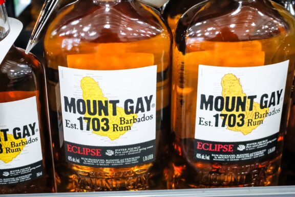
If you need a break from the great outdoors, Mount Gay Distillery is an iconic Barbadian locale that offers rum tastings and an info-packed tour of the rum-making process. The distillery’s visitor center includes exhibitions that detail some of the island’s 300-year history with rum production.
Transportation and Infrastructure of Barbados
Getting to Barbados is done almost exclusively by air travel. There are no ferry services currently available to bring passengers to the island, but there are many direct flights that connect Barbados to other Caribbean islands.
For visitors arriving from farther afield, British Airways, American Airlines, and Air Canada are the major international airlines servicing the country. The largest international airport and only port of entry by air is Grantley Adams International Airport, located about 13km (8 mi) from Bridgetown.
Once in the country, it’s possible to get around the island by taxi, minibus, bus, or car rental. If renting a car, it’s necessary to obtain a driver’s permit once on the island. It’s also important to remember that Barbados is one of the countries that have left-hand traffic!
Climate and Weather of Barbados
The climate in Barbados consists of two distinct seasons: the wet season and the dry season. The wet season lasts from June until December and is when most of the country’s annual precipitation occurs. The dry season lasts from December to May, and temperatures remain fairly consistent throughout the year between 21 to 31 °C (70 to 88 °F).
Although hurricanes affect much of the Caribbean, the location of Barbados outside of the main hurricane strike zone makes them a rare occurrence on the island, which averages one hurricane every 26 years.
Barbados Related Content
- The World’s Smallest Countries
- Caribbean Islands Map with Countries, Sovereignty, and Capitals
- Most Expensive Countries in the World
- The Greater Antilles and Lesser Antilles Map
Barbados Key Facts
| Country | Barbados |
| Coordinates | Latitude: 13.193887 Longitude: -59.543198 |
| Country Codes | Alpha 2: BB Alpha 3: BRB |
| Country Flag Emoji | 🇧🇧 |
| Int. Phone Prefix | +1-246 |
| Capital city | Bridgetown |
| Continent Subcontinent | North America Caribbean |
| Country Area | 430 sq km |
| Population 2025 | 282,623 World Rank: 179 |
| Median Age | 38.9 |
| Life expectancy | 76.3 |
| Major languages | English (official), Bajan (English-based creole language, widely spoken in informal settings) |
| UTC/GMT Time | Number of time zones: 1
|
| Internet TLD | .bb |
| Biggest Airport | Grantley Adams International Airport (BGI) |
| Average temperature | 26.00 °C 78.80 °F |
| Administrative Divisions | 11 parishes |
| Political system | Parliamentary democracy |


