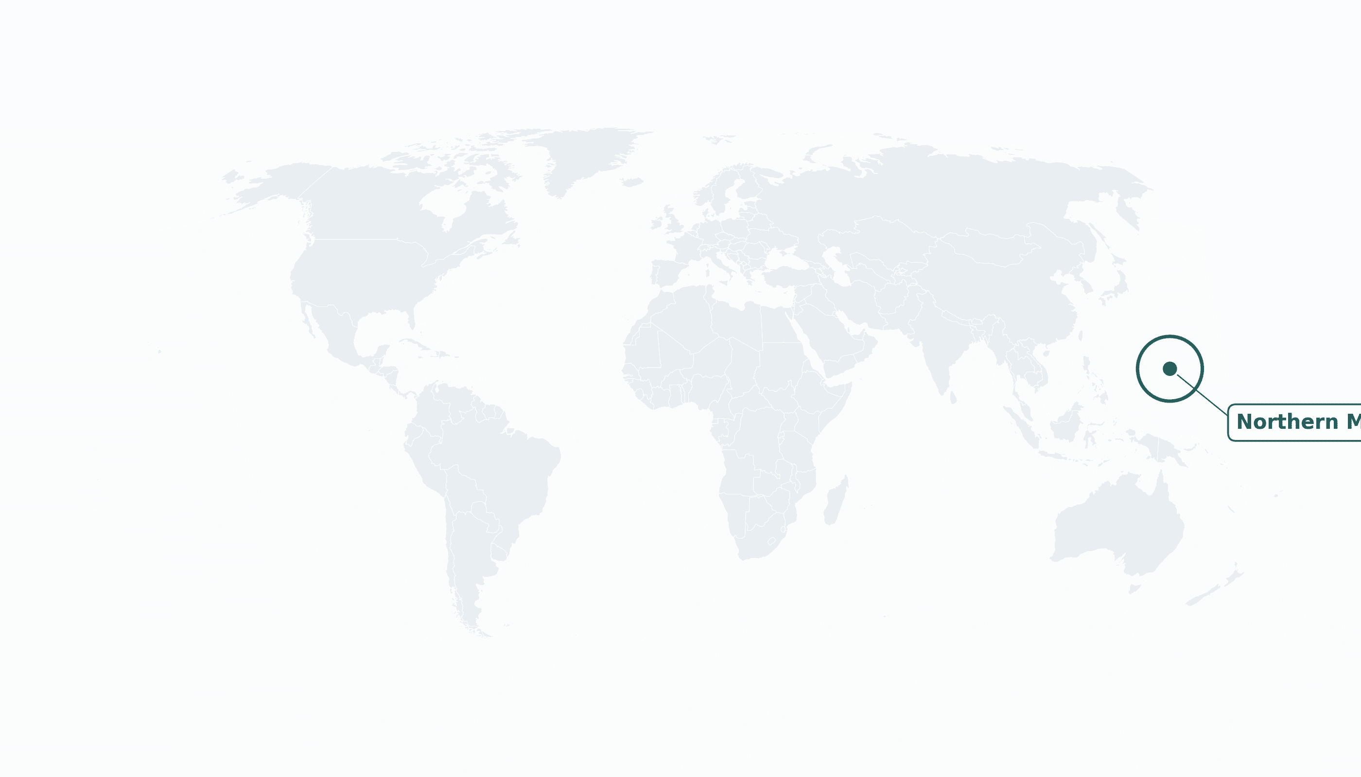
Northern Mariana Islands is located in the Australia and Oceania region at latitude 15.19 and longitude 145.74 and is part of the Oceania region.
The DMS coordinates for the center of the country are:
- 15° 11' 24'' N
- 145° 44' 24'' E
You can see the location of Northern Mariana Islands on the world map below:
Maritime Borders
The Northern Mariana Islands have no land borders; the chain stretches across the western Pacific just north of Guam.
Northern Mariana Islands Key Facts
| Country | Northern Mariana Islands |
| Coordinates | Latitude: 15.19 Longitude: 145.74 |
| Country Codes | Alpha 2: MP Alpha 3: MNP |
| Country Flag Emoji | 🇲🇵 |
| Int. Phone Prefix | +1 (670) |
| Capital city | Capitol Hill (Saipan) |
| Continent Subcontinent | Oceania Australia and Oceania |
| Country Area | 464 sq km |
| Population 2025 | 43,541 World Rank: 207 |
| Median Age | 33 |
| Life expectancy | 78.9 |
| Major languages | English, Chamorro, Carolinian (all official) |
| UTC/GMT Time | Number of time zones: 1
|
| Internet TLD | .mp |
| Biggest Airport | Saipan Int'l Airport (SPN) |
| Average temperature | 27 °C 81 °F |
| Administrative Divisions | 4 municipalities |
| Political system | Commonwealth of the United States |
Northern Mariana Islands Economy Facts
| World Bank Income Group | High income |
| World Bank Region | East Asia & Pacific |
| Currency | United States dollar (USD) |
| GDP in 2023 | $1.1 (billions of USD) World Rank: 200 |
| GDP per capita in 2023 | $23,786 World Rank: 69 |
| Major Industries / Economic Sectors | Tourism, garment legacy, public sector |
| Top 5 Import Countries | South Korea, Japan, United States, China |
| Top 5 Export Countries | United States |
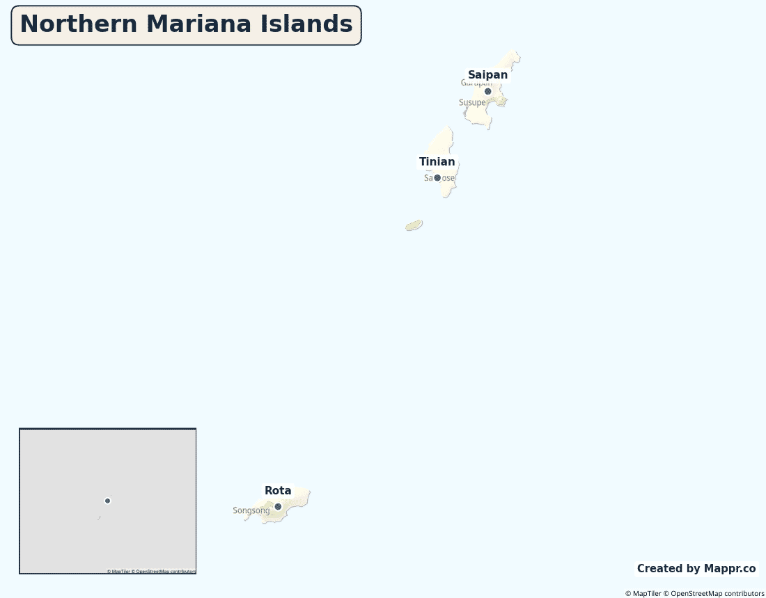
Biggest Cities in Northern Mariana Islands
Here are the largest cities in Northern Mariana Islands based on 2024 data:
| City | Population |
|---|
| Saipan | 48,220 |
Map of Northern Mariana Islands with the Largest Cities
Other Countries in the Australia and Oceania Region
- Where are the Cook Islands?
- Where are the Marshall Islands?
- Where are the Pitcairn Islands?
- Where are the Solomon Islands?
- Where is American Samoa?
- Where is Australia?
- Where is Fiji?
- Where is French Polynesia?
- Where is Guam?
- Where is Kiribati?
- Where is Micronesia?
- Where is Nauru?
- Where is New Caledonia?
- Where is New Zealand?
- Where is Niue?
- Where is Norfolk Island?
- Where is Palau?
- Where is Papua New Guinea?
- Where is Samoa?
- Where is Tokelau?
- Where is Tonga?
- Where is Tuvalu?
- Where is Vanuatu?
- Where is Wallis and Futuna?
Geography
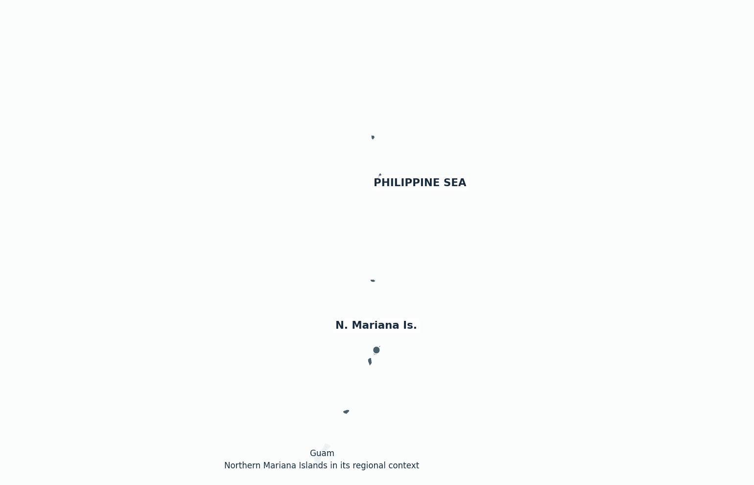
The Northern Mariana Islands are a chain of 14 islands in the western Pacific Ocean, in the region of Micronesia, stretching north from Guam. Most people live on the three southern islands of Saipan, Tinian and Rota.
The chain sits beside the Mariana Trench, the deepest part of the world’s oceans.
Are the Northern Mariana Islands a country?
The Northern Mariana Islands are a Commonwealth of the United States. Islanders are U.S. citizens but, like other territories, cannot vote in presidential elections and send a non-voting delegate to Congress.
| Status | Commonwealth of the United States |
| Sovereign state | United States |
| Capital | Capitol Hill (Saipan) |
| Population | 44,278 |
| Area | 464 km² |
| Currency | United States dollar (USD) |
| Official language(s) | English, Chamorro, Carolinian (all official) |
| ISO 3166 code | MP / MNP |
| Calling code | +1 (670) |
| Internet TLD | .mp |
Climate
The Northern Marianas have a warm, humid tropical climate averaging about 27°C (81°F) year-round, lying within the western Pacific’s typhoon belt.
Economy
The economy depends heavily on tourism — chiefly from East Asia — together with U.S. federal spending; a once-large garment industry has largely closed.
Northern Mariana Islands in its region
The islands lie just north of Guam in the western Pacific, west of the open ocean and east of the Philippines.
Administrative divisions
The territory is divided into four municipalities, with the seat of government at Capitol Hill on Saipan, the main island.


