Tanzania is located in the region at latitude -6.369028 and longitude 34.888822 and is part of the African continent.
The DMS coordinates for the center of the country are:
- 6° 22' 8.50'' S
- 34° 53' 19.76'' E
You can see the location of Tanzania on the world map below:
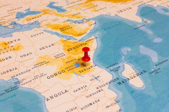
Tanzania Neighboring Countries
The neighboring countries of Tanzania (TZ) are:
- Burundi (BI)
- Congo (the Democratic Republic of the) (CD)
- Kenya (KE)
- Malawi (MW)
- Mozambique (MZ)
- Rwanda (RW)
- Uganda (UG)
- Zambia (ZM)
Maritime Borders
Tanzania borders with the Indian Ocean.
Tanzania, United Republic of Related Content
Tanzania Key Facts
| Country | Tanzania, United Republic of |
| Coordinates | Latitude: -6.369028 Longitude: 34.888822 |
| Country Codes | Alpha 2: TZ Alpha 3: TZA |
| Country Flag Emoji | 🇹🇿 |
| Int. Phone Prefix | +255 |
| Capital city | Dodoma |
| Continent Subcontinent | Africa |
| Country Area | 947,300 sq km |
| Population 2021 | 61,498,438 World Rank: 23 |
| Median Age | 16.8 |
| Life expectancy | 66.2 |
| Major languages | Swahili, English |
| UTC/GMT Time | Number of time zones: 1
|
| Internet TLD | .tz |
| Biggest Airport | Julius Nyerere International Airport (Dar es Salaam) |
| Average temperature | 27.00 °C 80.60 °F |
| Administrative Divisions | 31 regions |
| Political system | Presidential representative democratic republic |
Tanzania Economy Facts
| World Bank Income Group | Lower middle income |
| World Bank Region | Sub-Saharan Africa |
| Currency | Tanzanian Shilling (TZS) |
| GDP in 2020 | $62.4 (billions of USD) World Rank: 73 |
| GDP per capita in 2020 | $1,076 World Rank: 168 |
| Major Industries / Economic Sectors | Agriculture, manufacturing, energy, services |
| Top 5 Import Countries | China, India, United Arab Emirates, Saudi Arabia, Kenya |
| Top 5 Export Countries | China, India, United Arab Emirates, Mozambique, Belgium |
Biggest Cities in Tanzania
Here are the largest cities in Tanzania based on 2021 data:
| City | Population |
|---|
| Dar es Salaam | 7,461,000 | Arusha | 416,442 | Dodoma | 410,956 | Mwanza | 385,810 | Mbeya | 291,649 | Tanga | 243,580 | Morogoro | 207,000 | Zanzibar | 205,870 | Sumbawanga | 147,483 | Moshi | 144,739 |
Map of Tanzania with the Largest Cities
Other Countries in the Region
- Where are the Seychelles?
- Where are the Bahamas?
- Where are the Maldives?
- Where are the Marshall Islands?
- Where are the Netherlands?
- Where are the Philippines?
- Where are the Solomon Islands?
- Where are the United Arab Emirates?
- Where are the United States of America?
- Where is Afghanistan?
- Where is Albania?
- Where is Algeria?
- Where is Andorra?
- Where is Angola?
- Where is Antigua and Barbuda?
- Where is Argentina?
- Where is Armenia?
- Where is Australia?
- Where is Austria?
- Where is Azerbaijan?
- Where is Bahrain?
- Where is Bangladesh?
- Where is Barbados?
- Where is Belarus?
- Where is Belgium?
- Where is Belize?
- Where is Benin?
- Where is Bhutan?
- Where is Bolivia?
- Where is Bosnia and Herzegovina?
- Where is Botswana?
- Where is Brazil?
- Where is Brunei?
- Where is Bulgaria?
- Where is Burkina Faso?
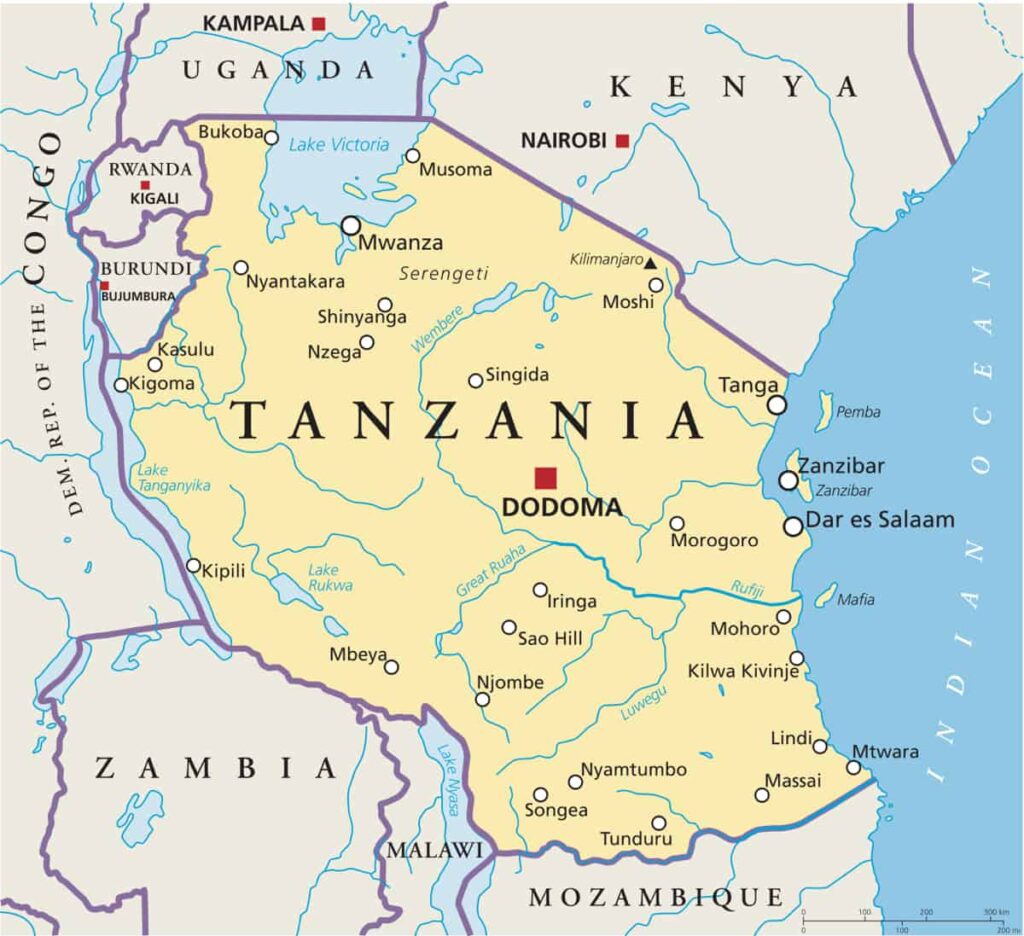
Tanzania Political Map
Important Sites
Tanzania has 7 important sites currently registered with UNESCO including a mix of natural and cultural:
- Kondoa Rock-Art Sites (2006)
- Ruins of Kilwa Kisiwani & Ruins of Songo Mnara (1981)
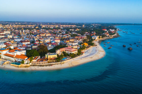
- Stone Town of Zanzibar (2000)
- Kilimanjaro National Park (1987)
- Selous Game Reserve (1982)
- Serengeti National Park (1981)
- Ngorongoro Conservation Area (1979)
There is also 5 important sites currently under consideration including Gombe National Park, and The Central Slave and Ivory Trade Route.
Transport Systems
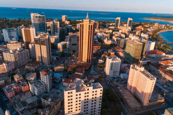
Tanzania has a varied transport system that caters for tourists and those wishing to explore the national parks. The predominant transport method is the road, followed by the Tanzanian rail network. Trunk roads connect the main cities in this country such as Dodoma, Dar es Salaam, and Tanga. These roads, and regional roads, are managed by the Ministry of Works, Transport, and Communication.
Railways are mainly commercial and used for freight transport. These are maintained by two companies – TRC, and TAZARA.
For travelers, the international airport is located in Da es Salaam and accommodates 2.3 million passengers per year. The Julius Nyerere International Airport facilitates international flights from airlines including KLM, Qatar Airways, and Emirates.
Famous Tourist Attractions
As you can see from the Tanzania map with regions, this country has diverse geography – this means there is an abundance of natural tourist attractions. Tourists usually visit Tanzania to travel through the Serengeti and spot big game wildlife. Alternatively, the other popular spot is the island of Zanzibar which has some amazing beaches and cultural history.
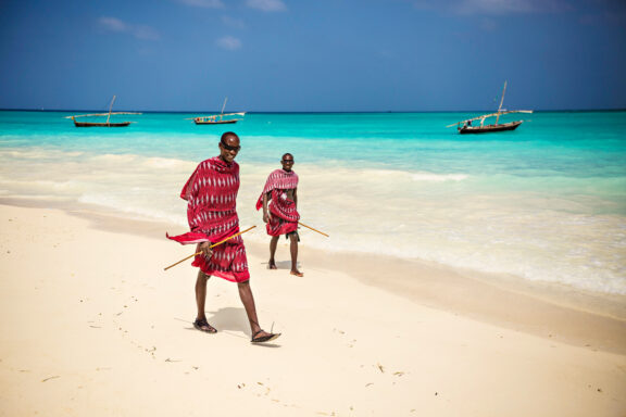
Two Masai walk along a beach in Zanzibar
If you love nature, and the great outdoors, popular natural attractions include [6]:
- Lake Manyara National Park
- Tarangire National Park
- Selous Game Reserve
- Gombe Stream National Park
- Mount Kilimanjaro
- Serengeti National Park
- Ngorongoro Conservation Area
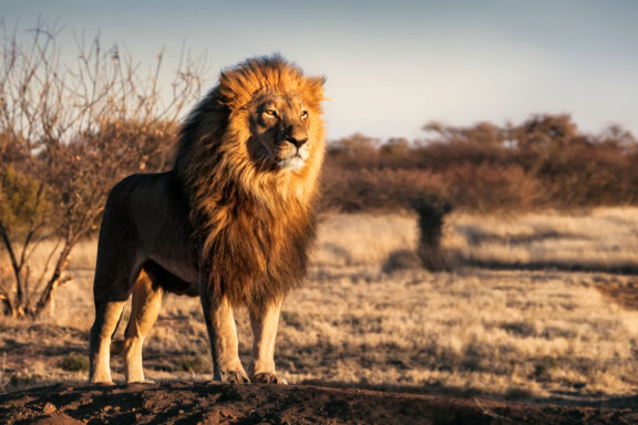
Each of these locations offers an abundance of wildlife – from elephants and giraffes to thousands of flamingos and zebras. Guided safaris through the national parks offer breathtaking scenery and an unfiltered look at mother nature.
Currency
The official currency of Tanzania is the Tanzanian Shilling. The main unit is one Shilling, and the minor unit is one hundred cents. Tanzanian Shillings have banknote denotations of 500, 1000, 2000, 5000, and 10000. Aside from the Shilling, US Dollars are widely accepted as a secondary currency.
Circulation of the Tanzanian Shilling is controlled by the Central Bank of Tanzania – it was first used as the national currency in 1966 and replaced the East African Shilling.
Political System & Economy
Tanzania is officially recognized as the United Republic of Tanzania. The country’s current constitution was adopted in 1977 – it specifies the single-party government structure and the idea of a strong president.
In terms of leadership, Tanzania has a Chief of State who is also Head of the Government. The functional government is split into three main branches – executive, judicial, and legislative. A president is elected by the public; they then appoint judicial staff. Tanzania also has a National Assembly with 239 voted members from different constituencies.
This country is split into different administrative divisions – regions, districts, divisions, and finally local wards. Tanzania has the following:
- 31 Regions
- 169 Districts
There are multiple divisions and wards and their administrative size can vary depending on the region. The original regions of Tanzania were formed under British rule, but have since been changed.
In terms of economy, Tanzania has a developing system that is mainly dependent on agriculture. The agricultural industry accounts for approximately 50% of the nation’s employed population. In the world stage, Tanzania has a GDP rank of 74/196. Moreover, it has a positive GDP growth of +7.2%. Aside from agriculture, other main industries include salt production and mining. The mining industry is hugely important and Tanzania is one of the main exporters of gold in Africa.
Geography
As shown in the detailed political map of Tanzania above, it borders 8 African countries – Mozambique, Malawi, and Zambia in the south. The Democratic Republic of Congo, Burundi, and Rwanda in the west, and Uganda and Kenya in the north.
Its east coast is located on the Indian Ocean and is north of Madagascar. Along the east coast, Tanzania has many small to medium-sized islands – the largest of which is Zanzibar. Zanzibar is a popular tourist location and a main economic hub. Other notable islands include Mafia Island and Pemba Island.
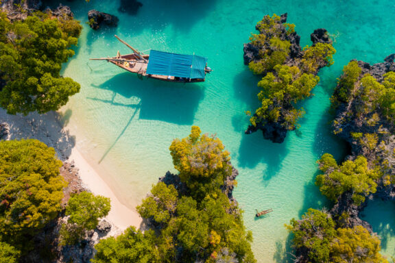
In terms of physical geography, Tanzania has several distinct regions:
- Indian coastline and islands sheltered by coral reefs
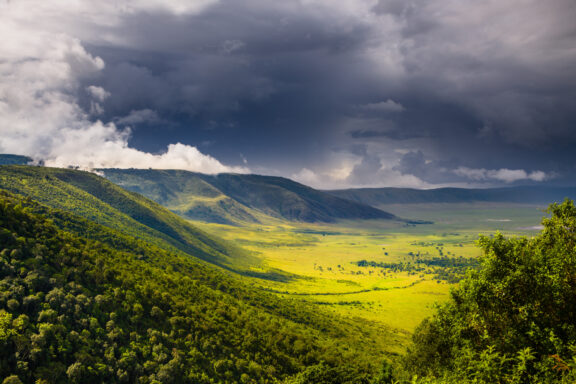
- Mainland central plateau (grassland, rolling hills, and plains)
- Serengeti plain
- Mountain region (Including Mount Kilimanjaro)
You can also see from the Tanzania map, that it has several borders on some of the largest lakes in Africa including Lake Victoria, and Lake Malawi. Moreover, the Ngorongoro Crater is classed as the world’s biggest caldera, spanning an area of 265 square km.
Tanzania FAQs
What Tanzania is famous for?
The first thing that most people think of when considering Tanzania is Mount Kilimanjaro – it is an impressive sight and one of the most noteworthy mountains in the world.
Is Tanzania a safe country?
Tanzania is relatively safe compared to some other African countries [5]. As with traveling anywhere, exercise common sense and keep your belongings out of sight when walking through big cities. It is also advisable to avoid isolated beaches at night and to take taxis for public transportation at night.
Where is Tanzania located?
East Africa – bordering 8 other African countries and the Indian Ocean.
What are the current issues in Tanzania?
The main issues the population of Tanzania currently faces is inequality and poverty – there is a divide in quality of life where some live in poverty, and others have a great quality of life.