Micronesia (Federated States of) is located in the Australia and Oceania region at latitude 7.425554 and longitude 150.550812 and is part of the Oceania continent continent.
The DMS coordinates for the center of the country are:
7° 25' 31.99'' N
150° 33' 2.92'' E
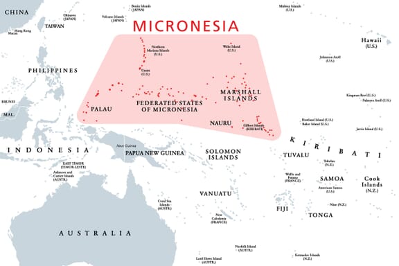
You can see the location of Micronesia on the world map below:
Micronesia on the World Map
Micronesia Neighboring Countries
The country has no neighboring countries/land borders.
Maritime Borders
Federated States of Micronesia border with the Pacific Ocean.
Micronesia (Federated States of) Key Facts
| Country | Micronesia (Federated States of) |
|---|---|
| Coordinates |
Latitude: 7.425554 Longitude: 150.550812 |
| Country Codes |
Alpha 2: FM Alpha 3: FSM |
| Country Flag Emoji | 🇫🇲 |
| Int. Phone Prefix | +691 |
| Capital city | Palikir |
| Continent / Subcontinent |
Oceania Australia and Oceania |
| Country Area | 702 sq km |
| Population 2024 |
113,160 World Rank: 190 |
| Median Age | 23.4 |
| Life expectancy | 67.2 |
| Major languages | English, Chuukese, Pohnpeian |
| UTC/GMT Time |
Number of time zones: 2
|
| Internet TLD | .fm |
| Biggest Airport | Kosrae International Airport (KSA) |
| Average temperature |
27.00 °C 80.60 °F |
| Administrative Divisions | 4 states |
| Political system | Presidential representative democratic republic |
Micronesia Economy Facts
| World Bank Income Group | Lower middle income |
|---|---|
| World Bank Region | East Asia & Pacific |
| Currency | US Dollar (USD) |
| GDP in 2020 |
$0.4 (billions of USD) World Rank: 206 |
| GDP per capita in 2020 |
$4,166 World Rank: 146 |
| Major Industries / Economic Sectors | Agriculture, manufacturing, energy, services |
| Top 5 Import Countries | United States, China, Japan, Australia, South Korea |
| Top 5 Export Countries | United States, Japan, China, Australia, South Korea |
Biggest Cities in Micronesia
Here are the largest cities in Micronesia based on 2024 data:
| City | Population |
|---|---|
| Palikir | 6,942 |


