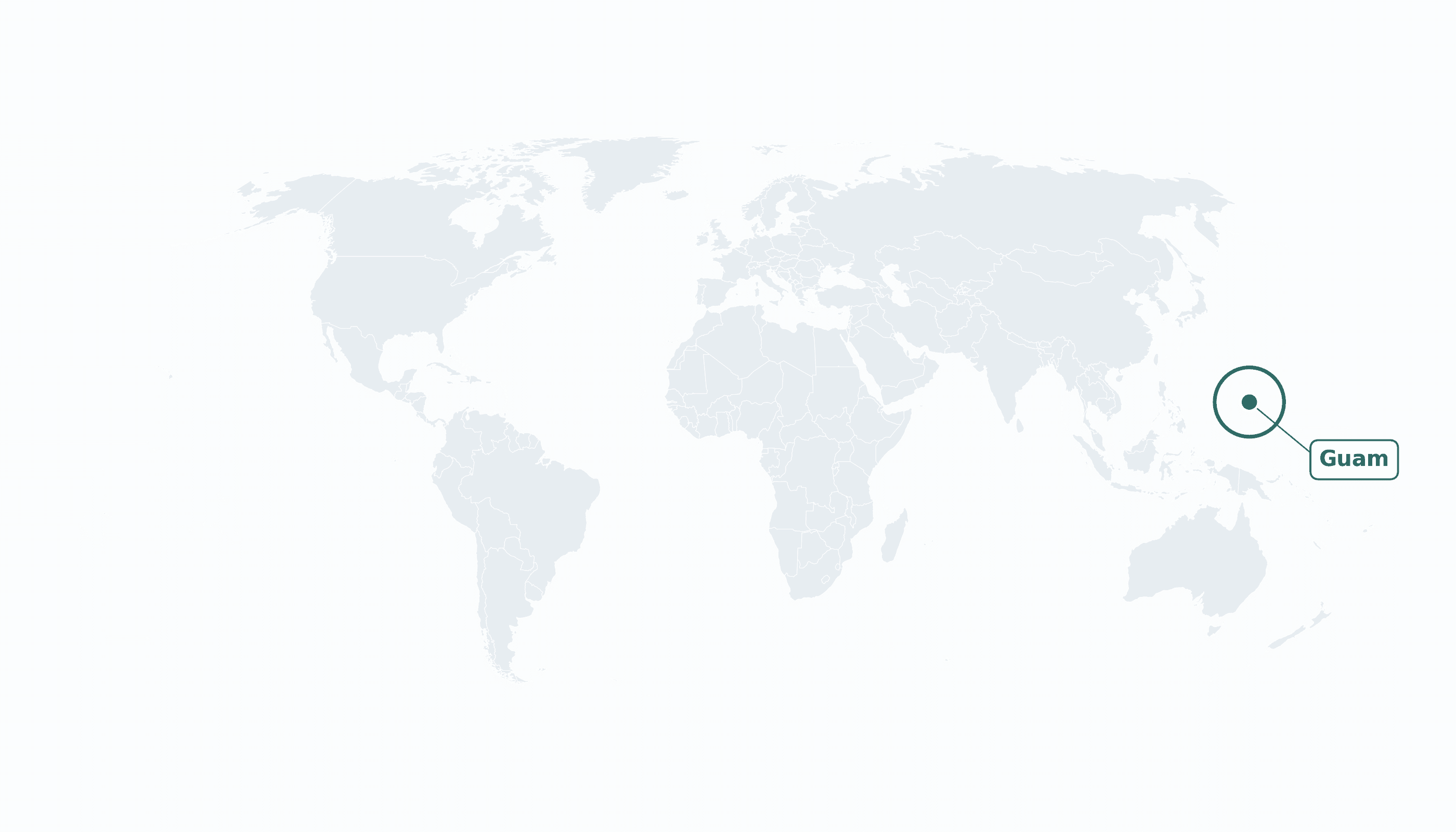
Guam is located in the Australia and Oceania region at latitude 13.4443 and longitude 144.7937 and is part of the Oceania region.
The DMS coordinates for the center of the country are:
- 13° 26' 39'' N
- 144° 47' 37'' E
You can see the location of Guam on the world map below:
Maritime Borders
Guam has no land borders; it is an island surrounded by the Pacific Ocean, with the Philippine Sea to its west.
Guam Key Facts
| Country | Guam |
| Coordinates | Latitude: 13.4443 Longitude: 144.7937 |
| Country Codes | Alpha 2: GU Alpha 3: GUM |
| Country Flag Emoji | 🇬🇺 |
| Int. Phone Prefix | +1 (671) |
| Capital city | Hagåtña |
| Continent Subcontinent | Oceania Australia and Oceania |
| Country Area | 544 sq km |
| Population 2025 | 168,999 World Rank: 184 |
| Median Age | 31 |
| Life expectancy | 77.4 |
| Major languages | English, Chamorro (both official) |
| UTC/GMT Time | Number of time zones: 1
|
| Internet TLD | .gu |
| Biggest Airport | Antonio B. Won Pat International Airport (GUM) |
| Average temperature | 27 °C 81 °F |
| Administrative Divisions | 19 villages |
| Political system | Unincorporated organized territory of the United States |
Guam Economy Facts
| World Bank Income Group | High income |
| World Bank Region | East Asia & Pacific |
| Currency | United States dollar (USD) |
| GDP in 2023 | $6.91 (billions of USD) World Rank: 165 |
| GDP per capita in 2023 | $41,833 World Rank: 39 |
| Major Industries / Economic Sectors | U.S. military, tourism, construction, services |
| Top 5 Import Countries | Singapore, South Korea, Japan, United States, Hong Kong |
| Top 5 Export Countries | United States, Japan, South Korea, Philippines, Palau |
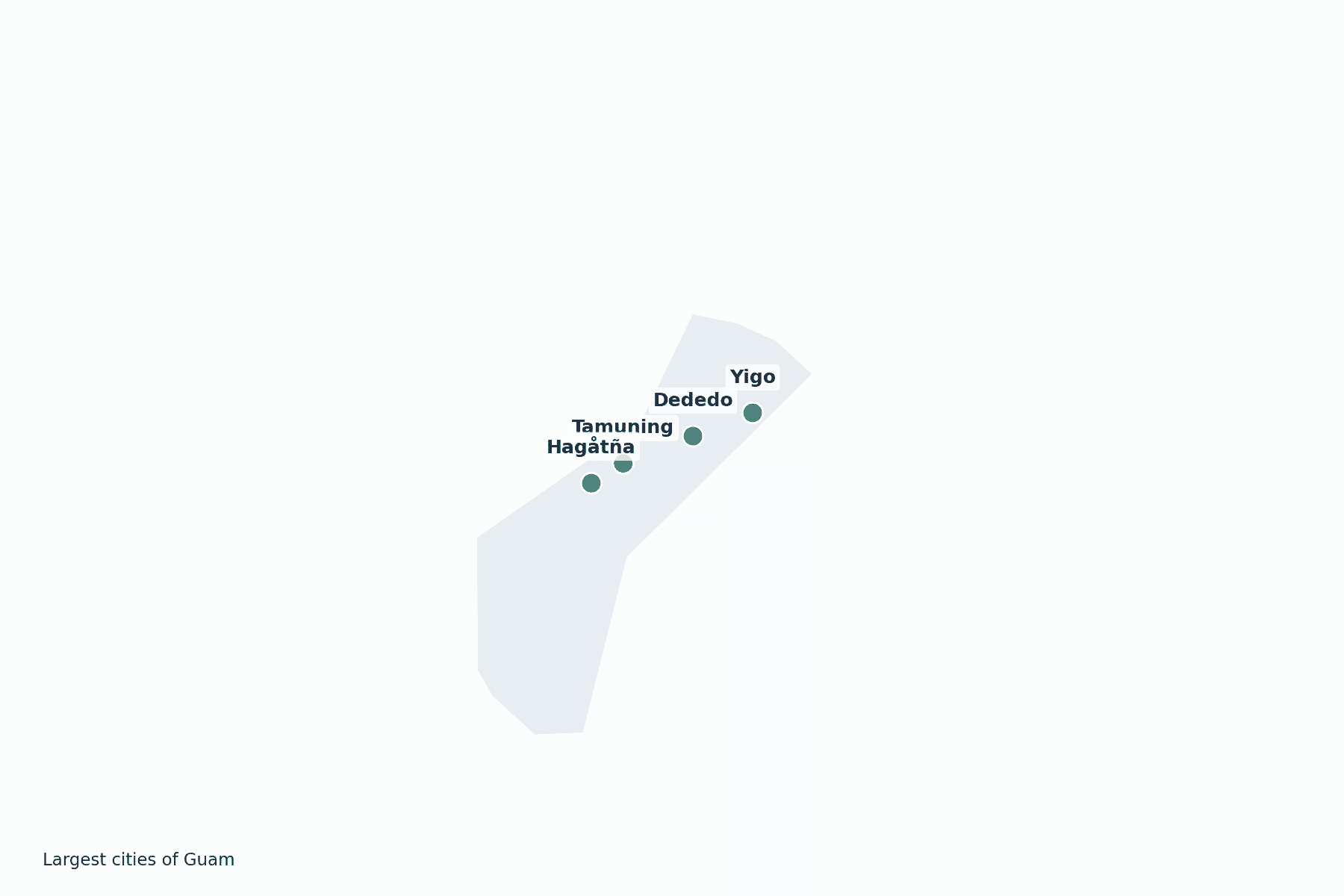
Biggest Cities in Guam
Here are the largest cities in Guam based on 2024 data:
| City | Population |
|---|
| Dededo | 44,943 | Yigo | 20,539 | Tamuning | 19,685 | Mangilao Village | 15,191 | Hagåtña | 1,051 |
Map of Guam with the Largest Cities
Other Countries in the Australia and Oceania Region
- Where are the Cook Islands?
- Where are the Marshall Islands?
- Where are the Northern Mariana Islands?
- Where are the Pitcairn Islands?
- Where are the Solomon Islands?
- Where is American Samoa?
- Where is Australia?
- Where is Fiji?
- Where is French Polynesia?
- Where is Kiribati?
- Where is Micronesia?
- Where is Nauru?
- Where is New Caledonia?
- Where is New Zealand?
- Where is Niue?
- Where is Norfolk Island?
- Where is Palau?
- Where is Papua New Guinea?
- Where is Samoa?
- Where is Tokelau?
- Where is Tonga?
- Where is Tuvalu?
- Where is Vanuatu?
- Where is Wallis and Futuna?
Geography
Guam is the largest and southernmost island of the Mariana Islands in the western Pacific Ocean, in the region of Micronesia. It lies roughly midway between Japan and Papua New Guinea and is the westernmost point of the United States.
Volcanic in origin and fringed by coral reefs, Guam covers about 544 square kilometres and is a strategically vital U.S. military outpost in the Pacific.
Is Guam a country?
Guam is an unincorporated territory of the United States. People born in Guam are U.S. citizens, but the island has no vote in presidential elections and sends only a non-voting delegate to Congress.
| Status | Unincorporated organized territory of the United States |
| Sovereign state | United States |
| Capital | Hagåtña |
| Population | 167,777 |
| Area | 544 km² |
| Currency | United States dollar (USD) |
| Official language(s) | English, Chamorro (both official) |
| ISO 3166 code | GU / GUM |
| Calling code | +1 (671) |
| Internet TLD | .gu |
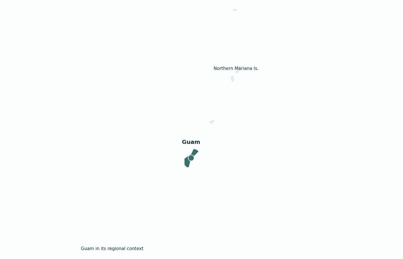
Guam in its region
Guam’s nearest neighbours are the other islands of the Mariana chain, with the U.S. Commonwealth of the Northern Mariana Islands immediately to the north and the Philippine Sea to the west.
Climate
Guam has a tropical marine climate, warm and humid year-round at about 27°C (81°F). Its rainy season runs roughly July to November, and it lies in the western Pacific’s typhoon belt.
Economy
Guam’s high-income economy rests on two pillars: the U.S. military, which occupies about a third of the island, and tourism, drawing large numbers of visitors from Japan and South Korea. Most goods are imported and federal spending is central.
Administrative divisions
Guam is divided into 19 villages (municipalities), the most populous being Dededo and Yigo in the north of the island.


