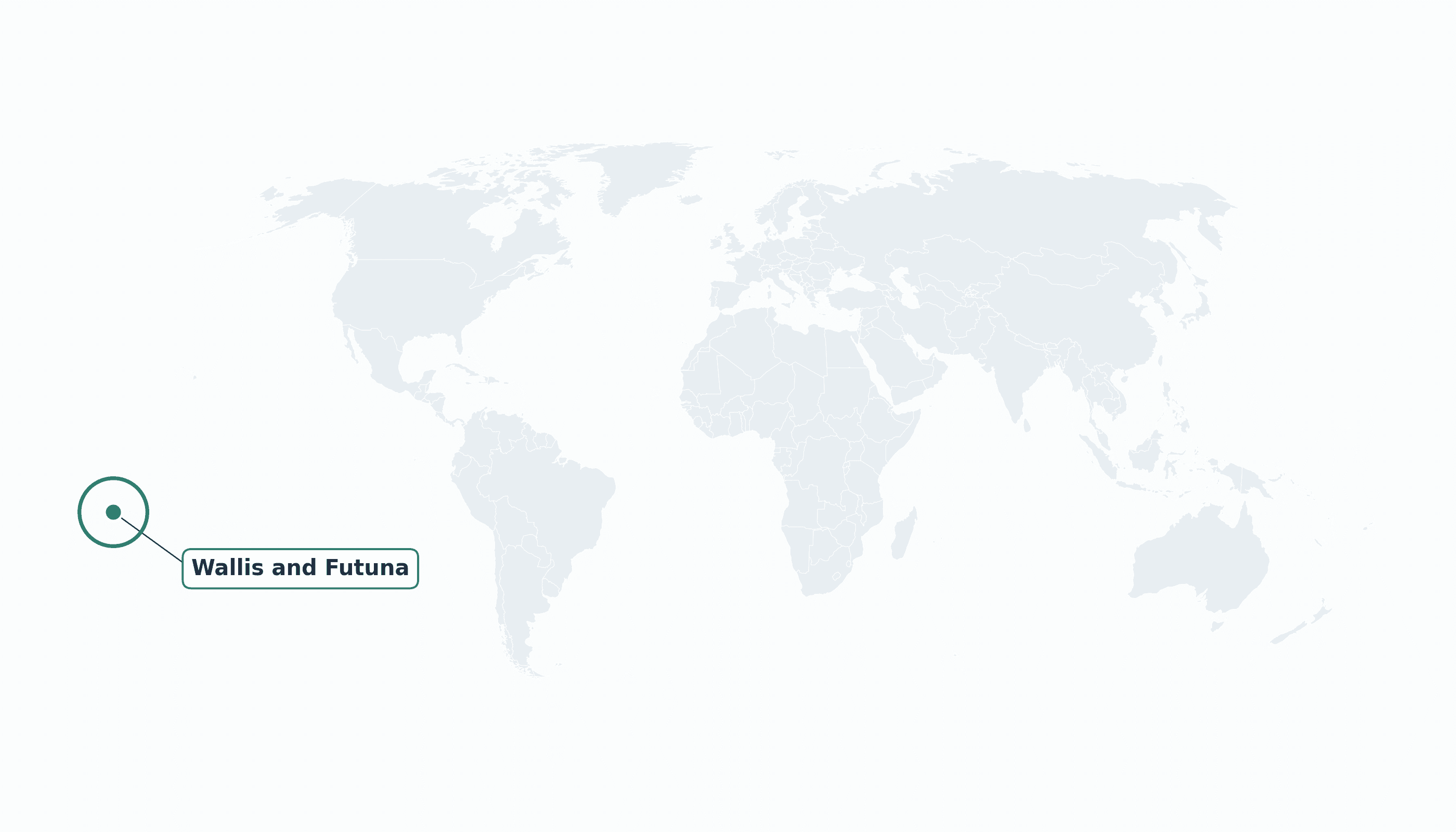
Wallis and Futuna is located in the Australia and Oceania region at latitude -13.7687 and longitude -177.1561 and is part of the Oceania region.
The DMS coordinates for the center of the country are:
- 13° 46' 7'' S
- 177° 9' 22'' W
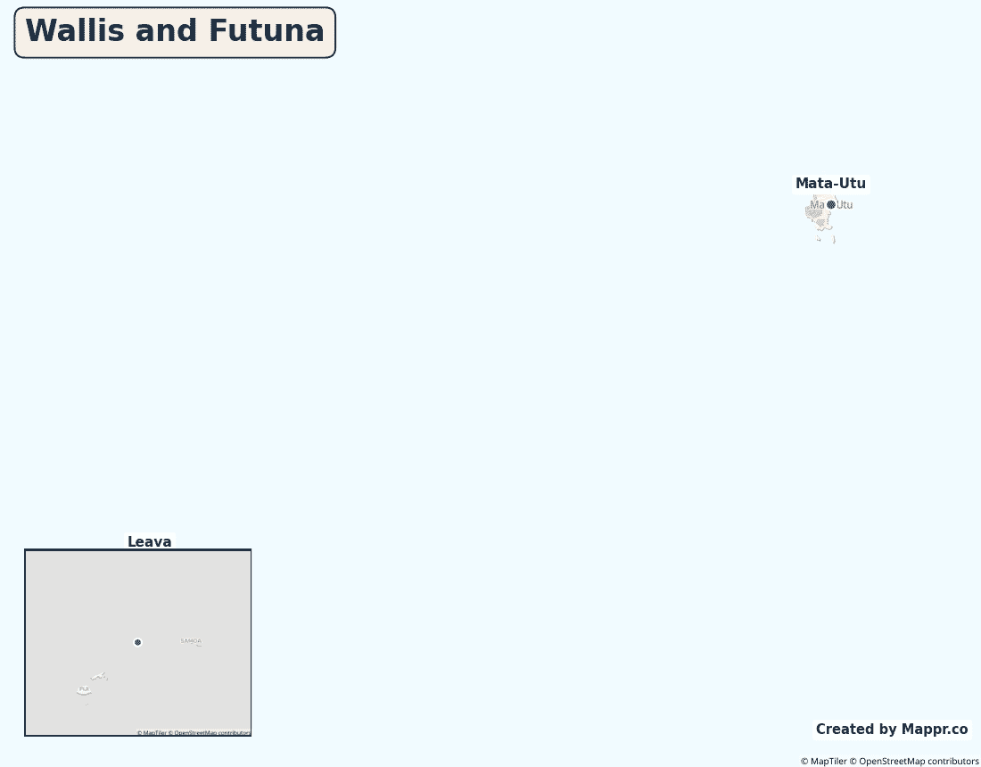
You can see the location of Wallis and Futuna on the world map below:
Maritime Borders
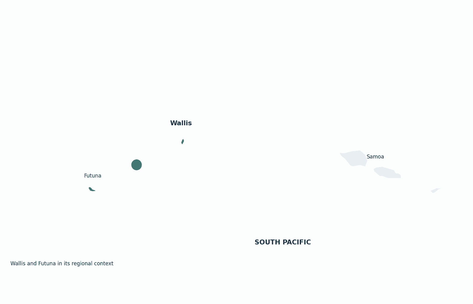
Wallis and Futuna has no land borders; the islands lie in the South Pacific Ocean between Fiji and Samoa.
Wallis and Futuna Key Facts
| Country | Wallis and Futuna |
| Coordinates | Latitude: -13.7687 Longitude: -177.1561 |
| Country Codes | Alpha 2: WF Alpha 3: WLF |
| Country Flag Emoji | 🇼🇫 |
| Int. Phone Prefix | +681 |
| Capital city | Mata-Utu |
| Continent Subcontinent | Oceania Australia and Oceania |
| Country Area | 142 sq km |
| Population 2023 | 11,000 World Rank: 217 |
| Median Age | 36 |
| Life expectancy | 80.0 |
| Major languages | French (official), Wallisian, Futunan |
| UTC/GMT Time | Number of time zones: 1
|
| Internet TLD | .wf |
| Biggest Airport | Hihifo Airport (WLS) |
| Average temperature | 27 °C 81 °F |
| Administrative Divisions | 3 traditional kingdoms |
| Political system | Overseas collectivity of France |
Wallis and Futuna Economy Facts
| World Bank Income Group | Upper middle income |
| World Bank Region | East Asia & Pacific |
| Currency | CFP franc (XPF) |
| GDP in 2023 | $0.06 (billions of USD) World Rank: 215 |
| GDP per capita in 2023 | $5,500 World Rank: 134 |
| Major Industries / Economic Sectors | Subsistence agriculture, fishing, copra, public sector |
| Top 5 Import Countries | France, New Zealand, Australia, Fiji |
| Top 5 Export Countries | Copra, handicrafts |
Biggest Cities in Wallis and Futuna
Here are the largest cities in Wallis and Futuna based on 2024 data:
| City | Population |
|---|
| Mata-Utu | 1,200 |
Map of Wallis and Futuna with the Largest Cities
Other Countries in the Australia and Oceania Region
- Where are the Cook Islands?
- Where are the Marshall Islands?
- Where are the Northern Mariana Islands?
- Where are the Pitcairn Islands?
- Where are the Solomon Islands?
- Where is American Samoa?
- Where is Australia?
- Where is Fiji?
- Where is French Polynesia?
- Where is Guam?
- Where is Kiribati?
- Where is Micronesia?
- Where is Nauru?
- Where is New Caledonia?
- Where is New Zealand?
- Where is Niue?
- Where is Norfolk Island?
- Where is Palau?
- Where is Papua New Guinea?
- Where is Samoa?
- Where is Tokelau?
- Where is Tonga?
- Where is Tuvalu?
- Where is Vanuatu?
Geography
Wallis and Futuna is a French territory of three main volcanic islands in the South Pacific, roughly between Fiji to the west and Samoa to the east. Wallis (Uvea) and the Futuna group lie about 230 kilometres apart.
One of the most traditional places in the Pacific, it is still governed in part through three customary kingdoms.
Is Wallis and Futuna a country?
Wallis and Futuna is an overseas collectivity of France. Its people are French citizens, yet day-to-day life is also shaped by three traditional kingdoms recognised within the French system.
| Status | Overseas collectivity of France |
| Sovereign state | France |
| Capital | Mata-Utu |
| Population | 11,000 |
| Area | 142 km² |
| Currency | CFP franc (XPF) |
| Official language(s) | French (official), Wallisian, Futunan |
| ISO 3166 code | WF / WLF |
| Calling code | +681 |
| Internet TLD | .wf |
Climate
Wallis and Futuna has a hot, humid tropical climate averaging about 27°C (81°F), with a wet, cyclone-prone season from November to April.
Economy
The economy is largely subsistence — agriculture, fishing and copra — supported by French public funding and remittances from the large Wallisian community in New Caledonia.
Wallis and Futuna in its region
The islands sit in the heart of the South Pacific, between Fiji to the west and Samoa to the east, north of New Caledonia.
Administrative divisions
Wallis and Futuna is organised into three traditional kingdoms (Uvea, Sigave and Alo), with Mata-Utu on Wallis the administrative capital.


