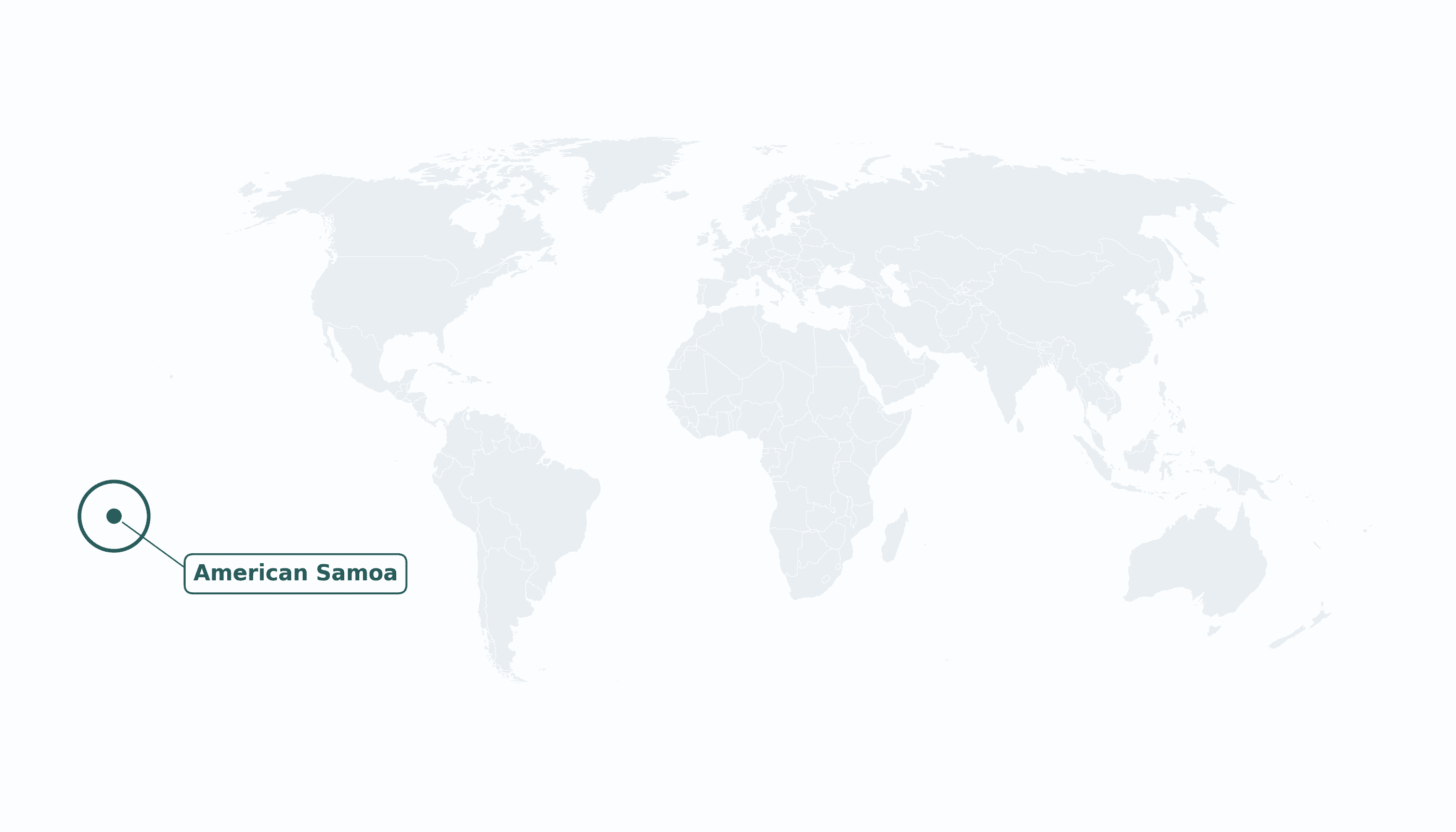
American Samoa is located in the Australia and Oceania region at latitude -14.271 and longitude -170.1322 and is part of the Oceania region.
The DMS coordinates for the center of the country are:
- 14° 16' 16'' S
- 170° 7' 56'' W
You can see the location of American Samoa on the world map below:
Maritime Borders
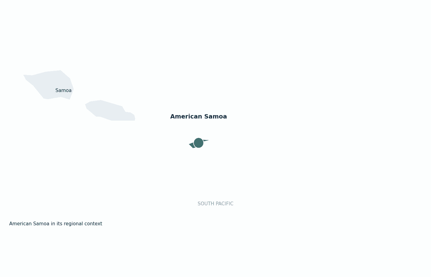
American Samoa has no land borders; it is a group of islands in the South Pacific, just east of independent Samoa.
American Samoa Key Facts
| Country | American Samoa |
| Coordinates | Latitude: -14.271 Longitude: -170.1322 |
| Country Codes | Alpha 2: AS Alpha 3: ASM |
| Country Flag Emoji | 🇦🇸 |
| Int. Phone Prefix | +1 (684) |
| Capital city | Pago Pago |
| Continent Subcontinent | Oceania Australia and Oceania |
| Country Area | 199 sq km |
| Population 2025 | 46,029 World Rank: 205 |
| Median Age | 27 |
| Life expectancy | 73.0 |
| Major languages | Samoan, English (both official) |
| UTC/GMT Time | Number of time zones: 1
|
| Internet TLD | .as |
| Biggest Airport | Pago Pago International Airport (PPG) |
| Average temperature | 27 °C 81 °F |
| Administrative Divisions | 3 districts |
| Political system | Unincorporated, unorganized territory of the United States |
American Samoa Economy Facts
| World Bank Income Group | High income |
| World Bank Region | East Asia & Pacific |
| Currency | United States dollar (USD) |
| GDP in 2023 | $0.87 (billions of USD) World Rank: 202 |
| GDP per capita in 2023 | $18,017 World Rank: 82 |
| Major Industries / Economic Sectors | Tuna canning and fishing, public sector, tourism |
| Top 5 Import Countries | Fiji, New Zealand, Samoa, United States, Australia |
| Top 5 Export Countries | United States, Australia, Ghana, Samoa, Indonesia |
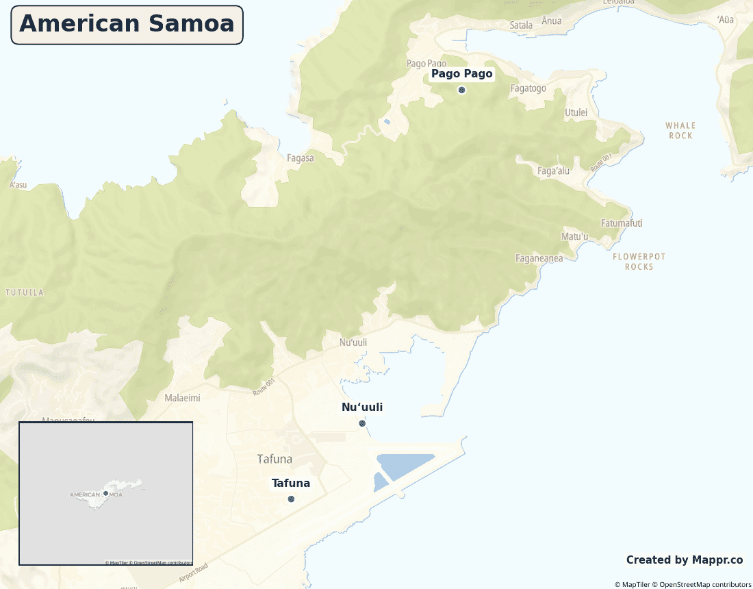
Biggest Cities in American Samoa
Here are the largest cities in American Samoa based on 2024 data:
| City | Population |
|---|
| Pago Pago | 11,500 |
Map of American Samoa with the Largest Cities
Other Countries in the Australia and Oceania Region
- Where are the Cook Islands?
- Where are the Marshall Islands?
- Where are the Northern Mariana Islands?
- Where are the Pitcairn Islands?
- Where are the Solomon Islands?
- Where is Australia?
- Where is Fiji?
- Where is French Polynesia?
- Where is Guam?
- Where is Kiribati?
- Where is Micronesia?
- Where is Nauru?
- Where is New Caledonia?
- Where is New Zealand?
- Where is Niue?
- Where is Norfolk Island?
- Where is Palau?
- Where is Papua New Guinea?
- Where is Samoa?
- Where is Tokelau?
- Where is Tonga?
- Where is Tuvalu?
- Where is Vanuatu?
- Where is Wallis and Futuna?
Geography
American Samoa is a group of five volcanic islands and two coral atolls in the South Pacific, about halfway between Hawaii and New Zealand. It is the only U.S. territory south of the equator.
Most people live on the main island of Tutuila, around the deep natural harbour of Pago Pago.
Is American Samoa a country?
American Samoa is an unincorporated, unorganized territory of the United States. Uniquely, people born there are U.S. nationals rather than automatic U.S. citizens — a distinction that sets it apart from other U.S. territories.
| Status | Unincorporated, unorganized territory of the United States |
| Sovereign state | United States |
| Capital | Pago Pago |
| Population | 46,765 |
| Area | 199 km² |
| Currency | United States dollar (USD) |
| Official language(s) | Samoan, English (both official) |
| ISO 3166 code | AS / ASM |
| Calling code | +1 (684) |
| Internet TLD | .as |
American Samoa in its region
American Samoa lies just east of the independent state of Samoa, with Fiji and Tonga to the west and southwest.
Climate
American Samoa has a hot, humid tropical climate averaging about 27°C (81°F), with heavy rainfall and a wetter season from November to April that brings occasional cyclones.
Economy
American Samoa’s economy is dominated by tuna canning — for years its canneries were among the largest in the world and the territory’s main private employer — supported by the public sector and U.S. federal funding.
Administrative divisions
The territory is divided into three districts — Eastern, Western and the Manuʻa Islands — plus two outlying islands.


