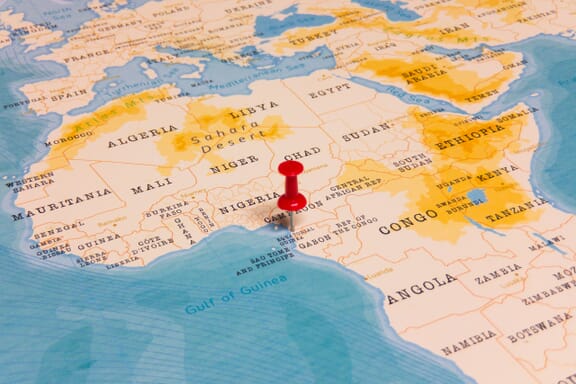
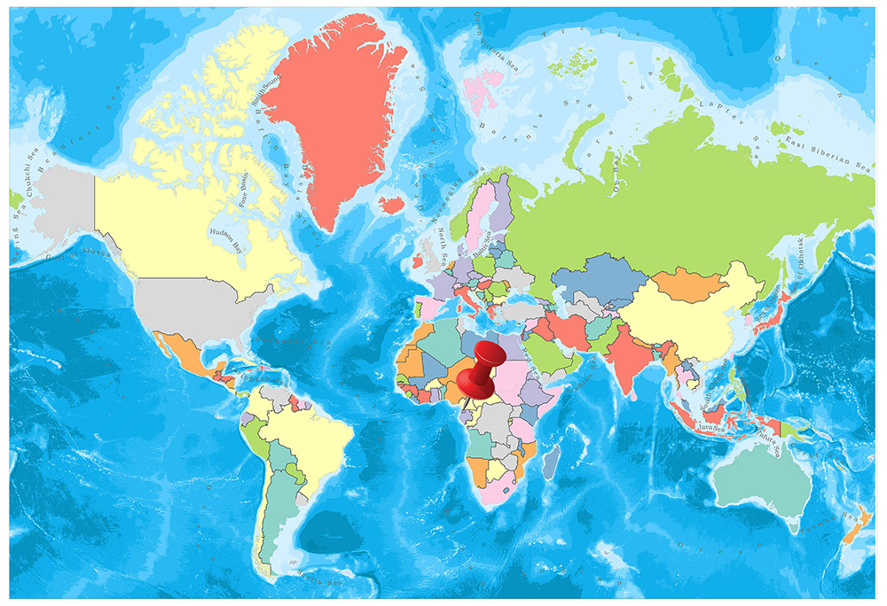
Equatorial Guinea is located in the Northern Africa region at latitude 1.650801 and longitude 10.267895 and is part of the African continent.
The DMS coordinates for the center of the country are:
- 1° 39' 2.88'' N
- 10° 16' 4.42'' E
You can see the location of Equatorial Guinea on the world map below:
Equatorial Guinea Neighboring Countries
The neighboring countries of Equatorial Guinea (GQ) are:
- Cameroon (CM)
- Gabon (GA)
Maritime Borders
Equatorial Guinea bordres with the Gulf of Guinea.
Equatorial Guinea Related Content
- Equatorial Guinea Flag Map and Meaning
- What is the Capital of Equatorial Guinea?
- Equator Map/Countries on the Equator
Equatorial Guinea Key Facts
| Country | Equatorial Guinea |
| Coordinates | Latitude: 1.650801 Longitude: 10.267895 |
| Country Codes | Alpha 2: GQ Alpha 3: GNQ |
| Country Flag Emoji | 🇬🇶 |
| Int. Phone Prefix | +240 |
| Capital city | Malabo |
| Continent Subcontinent | Africa Northern Africa |
| Country Area | 28,051 sq km |
| Population 2021 | 1,449,891 World Rank: 150 |
| Median Age | 20.9 |
| Life expectancy | 60.6 |
| Major languages | Spanish (official) 67.6%, other (includes Fang, Bubi, Portuguese (official), French (official)) 32.4% (1994 census) |
| UTC/GMT Time | Number of time zones: 1
|
| Internet TLD | .gq |
| Biggest Airport | Malabo International Airport Aeropuerto Internacional de Malabo (SSG) |
| Average temperature | 24.55 °C 76.19 °F |
| Administrative Divisions | 2 regions 8 provinces |
| Political system | Presidential representative democratic republic |
Equatorial Guinea Economy Facts
| World Bank Income Group | Upper middle income |
| World Bank Region | Sub-Saharan Africa |
| Currency | CFA Franc (XAF) |
| GDP in 2020 | $10.1 (billions of USD) World Rank: 145 |
| GDP per capita in 2020 | $7,198 World Rank: 81 |
| Major Industries / Economic Sectors | Oil and gas, agriculture, manufacturing, energy |
| Top 5 Import Countries | China, United States, France, Spain, Portugal |
| Top 5 Export Countries | United States, China, Spain, France, Netherlands |
Biggest Cities in Equatorial Guinea
Here are the largest cities in Equatorial Guinea based on 2021 data:
| City | Population |
|---|
| Bata | 250,770 | Malabo | 187,302 | Ebebiyin | 36,565 | Anisoc | 16,626 | Bengonbeyene | 15,644 | Aconibe | 13,382 | Rebola | 10,000 | Evinayong | 9,155 | Luba | 7,739 | Mongomo | 7,251 |
Map of Equatorial Guinea with the Largest Cities
Other Countries in the Northern Africa Region
- Where is Algeria?
- Where is Benin?
- Where is Burkina Faso?
- Where is Cabo Verde?
- Where is Cameroon?
- Where is Chad?
- Where is Comoros?
- Where is Djibouti?
- Where is Egypt?
- Where is Eritrea?
- Where is Ethiopia?
- Where is Gabon?
- Where is Gambia?
- Where is Ghana?
- Where is Guinea-Bissau?
- Where is Guinea?
- Where is Ivory Coast (Côte d’Ivoire)?
- Where is Liberia?
- Where is Libya?
- Where is Mali?
- Where is Mauritania?
- Where is Morocco?
- Where is Niger?
- Where is Nigeria?
- Where is Sao Tome and Principe?
- Where is Senegal?
- Where is Sierra Leone?
- Where is Somalia?
- Where is Sudan?
- Where is the Central African Republic?
- Where is Togo?
- Where is Tunisia?
Map of Equatorial Guinea, Regions, Geography, and Facts
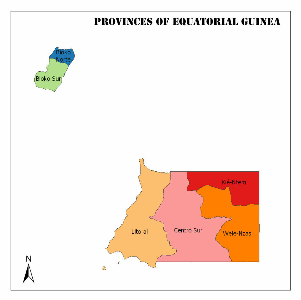
Equatorial Guinea has 8 provinces. These are San Antonio de Palé, Bioko Norte, Bioko Sur, Centro Sur, Kié-Ntem, Litoral, Wele-Nzas, and Djibloho.
In this article, we will give some general information about the provinces of Equatorial Guinea such as population and area.
You can see the Provinces of Equatorial Guinea on the map below.
Provinces of Equatorial Guinea Map
Provinces of Equatorial Guinea
Annobón
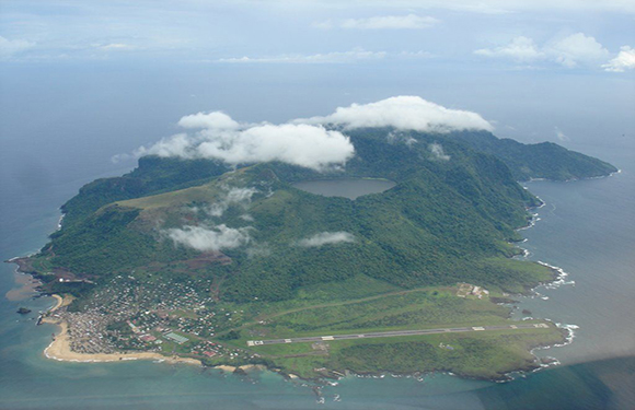
The capital of the province is San Antonio de Palé. The population of 2015 is 5,232. It also has an area of 17 square kilometers.
Bioko Norte
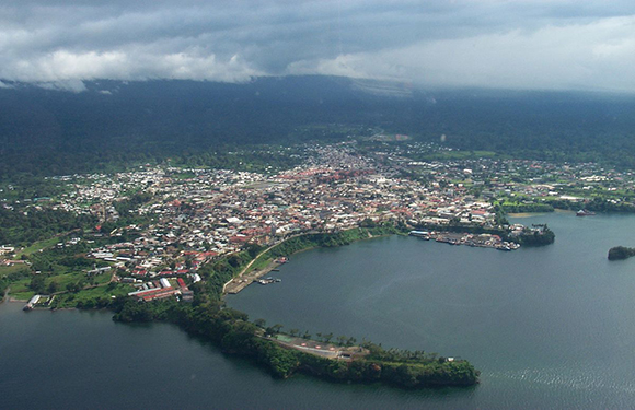
The capital of the province is Rebola. The population of 2015 is 299,836. It also has a surface area of 776 square kilometers.
Bioko Sur
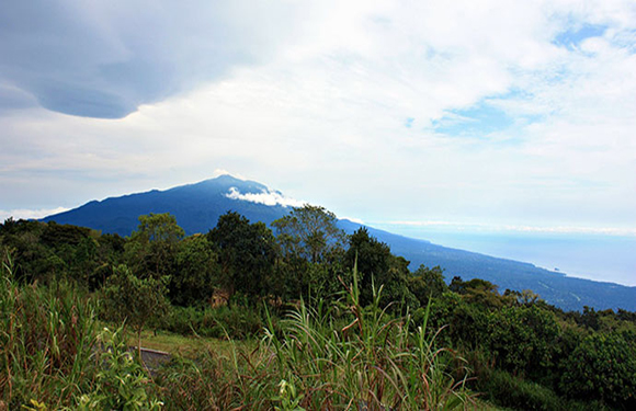
The capital of the province is Luba. The population of 2015 is 34,627. It also has an area of 1,241 square kilometers.
Centro Sur
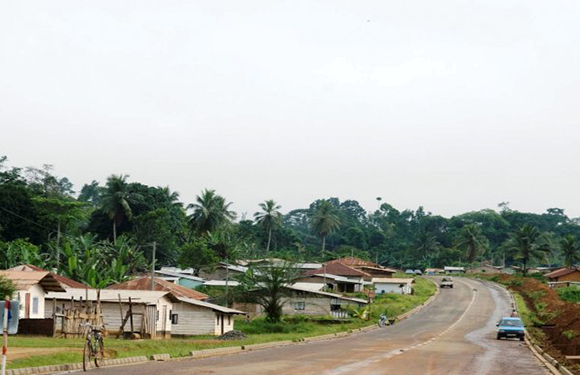
The capital of the province is Evinayong. The population of 2015 is 141,903. It also has an area of 9,931 square kilometers.
Kié-Ntem
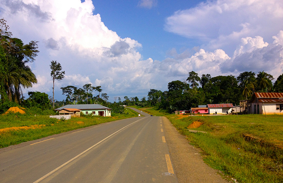
The capital of the Province is Ebebiyín. The population of 2015 is 183,331. It also has an area of 3,943 square kilometers.
Litoral
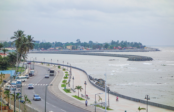
The capital of the province is Bata. The population of 2015 is 366,130. It also has an area of 6,665 square kilometers.
Wele-Nzas
The capital of the province is Mongomo. The population of 2015 is 191,383. It also has an area of 5,478 square kilometers.
Country Facts
- Population: 1,343,011
- Population Density: 48 per Km2
- Land Area: 28,050 Km2
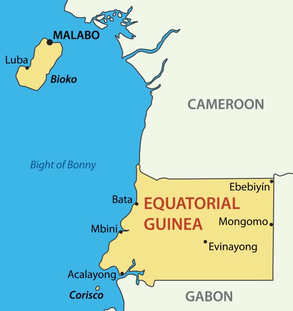
Equatorial Guinea is one of the smallest countries in Africa, located in West Africa, on the coast of the Atlantic Ocean.
It is bounded by Cameroon in the north, Gabon in the south and east, the Gulf of Guinea in the west and São Tomé and Príncipe in the southwest.
Geography
As one of the smallest countries in the African continent, the country is spread over an area of 28.051 km². Of these, 26,000 km² is composed of the mainland, while the remaining area covers the islands. In the islands, Bioko is the biggest island of 2017 km². Starting from the mainland shore Mbini reaches up to 1,200 m inland.
Governance
The country is governed by a dictatorial regime, despite the country’s form of government as a parliamentary democracy. President Mbasogo is one of the top decision makers in the country.
Analysts say the country is governed by a Kleptocracy system and states that the country has one of the most corrupt systems in the world. With the constitutional amendment made in 1991, the president was elected for a period of seven years.
The head of state has the power to appoint the prime minister, members of the judiciary, and is also at the top of the armed forces.
Climate
It has a tropical climate. The average temperature is around 26 ° C. The average rainfall per year in the country with abundant rainfall varies between 2400-4600 mm. Between June and August, the Rio Muni region has a dry season, while Bioko has a rainy season. December – February is the opposite situation. Temperatures in the island of Bioko vary around 16 to 33 degrees Celsius, while temperatures in the Rio Muni region are around 27 degrees.
Religion
One of the characteristics that Spain left after the colonial period was religious. 87% of the people of Equatorial Guinea belong to the Catholic Christian faith. While 5% of the population is Protestant Christian, there are a group of about 1,000 Jehovah’s Witnesses in the country. The proportion of those who believe in local religions is almost negligible.
Industry and Tourism
The majority of people are engaged in agriculture. After the discovery and processing of oil resources in 1996, the economic development of the country has been affected in recent years. As of 2004, Equatorial Guinea has become the 3rd largest oil producer in Sub-Saharan Africa. Forestry, farming, and fishing are also important factors that meet gross national product.
Before the country gained independence from the cocoa production, the rural economy, which went bad under the relentless regime, reduced the potential for agricultural development. Owners of commercial establishments are mostly civil servants. Unprocessed natural resources are titanium, iron, manganese, uranium, and gold. Cocoa is the most important of export products. 75 percent of foreign trade in Spain. Spain is paying twice the price paid to Equatorial Guinea’s cocoa in the world market and applying fewer tariffs.