Guinea-Bissau is located in the Northern Africa region at latitude 11.803749 and longitude -15.180413 and is part of the African continent.
The DMS coordinates for the center of the country are:
- 11° 48' 13.50'' N
- 15° 10' 49.49'' W
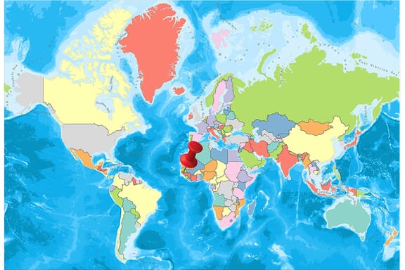
You can see the location of Guinea-Bissau on the world map below:
Guinea-Bissau Neighboring Countries
The neighboring countries of Guinea-Bissau (GW) are:
- Guinea (GN)
- Senegal (SN)
Maritime Borders
Guinea-Bissau borders the Atlantic Ocean.
Guinea-Bissau Related Content
Guinea-Bissau Key Facts
| Country | Guinea-Bissau |
| Coordinates | Latitude: 11.803749 Longitude: -15.180413 |
| Country Codes | Alpha 2: GW Alpha 3: GNB |
| Country Flag Emoji | 🇬🇼 |
| Int. Phone Prefix | +245 |
| Capital city | Bissau |
| Continent Subcontinent | Africa Northern Africa |
| Country Area | 36,125 sq km |
| Population 2024 | 2,201,352 World Rank: 147 |
| Median Age | 18.3 |
| Life expectancy | 64.1 |
| Major languages | Crioulo (lingua franca), Portuguese (official; largely used as a second or third language), Pular (a Fula language), Mandingo |
| UTC/GMT Time | Number of time zones: 1
|
| Internet TLD | .gw |
| Biggest Airport | Osvaldo Vieira International Airport (Bissau) |
| Average temperature | 26.75 °C 80.15 °F |
| Administrative Divisions | 3 provinces 1 autonomous sector 8 regions |
| Political system | Presidential representative democratic republic |
Guinea-Bissau Economy Facts
| World Bank Income Group | Low income |
| World Bank Region | Sub-Saharan Africa |
| Currency | CFA Franc (XAF) |
| GDP in 2024 | $2.2 (billions of USD) World Rank: 186 |
| GDP per capita in 2024 | $1,008 World Rank: 194 |
| Major Industries / Economic Sectors | Agriculture, manufacturing, energy, services |
| Top 5 Import Countries | China, India, Senegal, United Arab Emirates, United States |
| Top 5 Export Countries | Senegal, China, India, United Arab Emirates, Brazil |
Biggest Cities in Guinea-Bissau
Here are the largest cities in Guinea-Bissau based on 2024 data:
| City | Population |
|---|
| Bissau | 439,704 | Gabu | 49,371 | Bafata | 33,502 | Xitole | 19,424 |
Map of Guinea-Bissau with the Largest Cities
Other Countries in the Northern Africa Region
- Where is Algeria?
- Where is Benin?
- Where is Burkina Faso?
- Where is Cabo Verde?
- Where is Cameroon?
- Where is Chad?
- Where is Comoros?
- Where is Djibouti?
- Where is Egypt?
- Where is Equatorial Guinea?
- Where is Eritrea?
- Where is Ethiopia?
- Where is Gabon?
- Where is Gambia?
- Where is Ghana?
- Where is Guinea?
- Where is Ivory Coast (Côte d’Ivoire)?
- Where is Liberia?
- Where is Libya?
- Where is Mali?
- Where is Mauritania?
- Where is Morocco?
- Where is Niger?
- Where is Nigeria?
- Where is Sao Tome and Principe?
- Where is Senegal?
- Where is Sierra Leone?
- Where is Somalia?
- Where is Sudan?
- Where is the Central African Republic?
- Where is Togo?
- Where is Tunisia?
- Where is Western Sahara?
The African country of Guinea-Bissau is divided into nine regions, one of which is an autonomous city sector. Although the capital of the country is called the Bissau sector, it is equal to the other eight regions. The other eight regions are divided into 37 sectors.
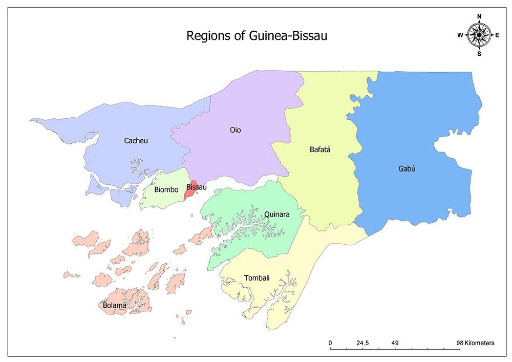
These regions, which exist throughout the country, are unofficially divided into three provinces, although they do not have any political or administrative effect.
These provinces are:
- Leste (East: Bafatá, Gabú)
- Norte (North: Biombo, Cacheu, Oio)
- Sul (South: Bolama, Quinara, Tombali)
Nine Regions of Guinea-Bissau
Guinea-Bissau is divided into nine regions, the highest administrative division. These regions are:
- Bafatá
- Biombo
- Bissau
- Bolama
- Cacheu
- Gabu
- Oio
- Quinara and Tombali
Bafatá
Bafatá is one of nine regions of Guinea-Bissau. The region is located in the northern and central part of the country. Its capital city is Bafatá which is the same name as the region. According to 2009 data of the country with a surface area of 5,981 square kilometers, the population is 225,516. The region forms the border with Senegal country in the north, with the Gabu region in the east, with the Tombali and Quinara region to the north, and to the Oio region to the west.
Biombo
Biombo is one of nine regions of Guinea-Bissau. The region is located in the western part of the country. Its capital city is Quinhámel. According to 2009 data of the country with a surface area of 838 square kilometers, the population is 97,120. The region forms the border with the Cacheu region in the west, the Bissau region in the east and the Oio region in the northeast.
Bissau
Bissau is the country’s largest city, main port, administration and military center. The main commercial ingredients are peanuts, wood materials, palm oil, and rubber. The city was founded in 1687 by the colonists of the Portuguese Empire to be a commercial center and support port. In 1942, it became the capital of the country’s then-named Portuguese Guinea. In 1973 it was replaced by Madina do Boe, but a year later it became the capital again. While the surface area of the Bissau region is 77.5 square kilometers, it has a population of 492,004 according to 2015 data.
Bolama
Bolama is one of nine regions of Guinea-Bissau. The region is located in the southwestern part of the country. Its capital city is Bolama. According to 2009 data of the country with an area of 2,624 square kilometers, the population is 34,563. It is a region consisting of the islands of Guinea-Bissau. These islands are divided into three sectors.
Cacheu
Cacheu is one of nine regions of Guinea-Bissau. The region is located in the most western part of the country. Its capital city is Cacheu. According to 2009 data of the country with a surface area of 5,174 square kilometers, the population is 192,508. The region forms the border with Senegal country in the north, Oio region in the east and Biombo region in the northeast.
Gabu
Gabu is one of the nine regions of Guinea-Bissau. The region is located in the most eastern part of the country. Gabu is the capital city of the same name as the region. According to 2009 data of the country with a surface area of 9,150 square kilometers, the population is 215,530. The region forms a border with the country of Senegal to the north, Guinea to the east and south.
Oio
Oio is one of the nine regions of Guinea-Bissau. The region is located in the central and northern part of the country. Its capital city is Farim. According to 2009 data of the country with a surface area of 5,403 square kilometers, the population is 224,644. The region forms the border with Senegal country to the north, Bafatá region to the east, Cacheu region to the west and Biombo and Bissau to the southwest.
Quinara
Quinara is one of the nine regions of Guinea-Bissau. The region is located in the central part of the country. Its capital city is Buba. According to 2009 data of the country with an area of 3,138 square kilometers, the population is 63,610. The region forms the border with the Oio region in the north, the Bafatá region to the east, the Bolama region to the west, and the Tombali region to the south.
Tombali
Tombali is one of nine regions of Guinea-Bissau. The region is located in the southernmost part of the country. Its capital city is Catió. According to 2009 data of the country with an area of 3,736 square kilometers, the population is 94,939. The region forms a border with the Quinara region to the north, North Atlantic Ocean to the east, and Guinea to the west and south.
Guinea-Bissau Maps and Facts
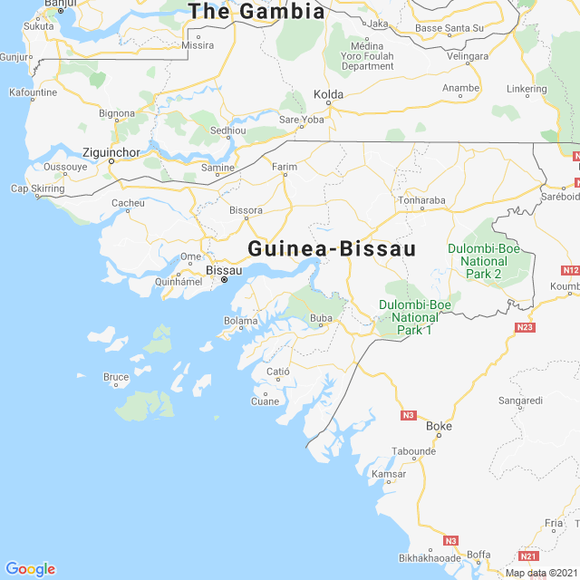
Guinea-Bissau or the Republic of Guinea-Bissau is a country in the western part of the African continent. Senegal and Guinea are the border neighbors of the country and the Atlantic Ocean is located in the west of the country. The country’s capital is Bissau.
Geography
The country has an area of 36,155 square kilometers including 28,120 km² of green area and 8,005 km² of water area. In terms of Africa, Guinea-Bissau is one of the smallest countries of the continent. While the plains are seen in the inner parts of the country, these areas are combined with the swamp areas due to the erosion towards the coastal areas.
The highest mountain in the country is Madina do Boé mountain with an altitude of 262 m. The most important rivers in the country are the Río Gêba, the Río Cacheu, and the Río Corubal rivers. The Bissagos Archipelago, which the country owns outside the mainland continent, consists of 88 islands in total.
Governance
The country is governed by a presidential system with a constitutional amendment in 1984. In the country where the single-party system worked until 1991, the transition to the multi-party system was carried out from this year.
Climate
There is a tropical climate throughout the country. The country has humid and hot weather throughout the year and the average temperature is 24 ° C. Especially between December and April, there is a dry period with the effect of the desert winds and it rains from May to the end of October. During these months, especially in July and August, it increases the intensity and amount of rain.
Religion
50% of the country’s population adopts the Islamic faith. 40% of believers in local religions and 10% of people living according to Christian faith.
Industry and Tourism
Guinea-Bissau is one of the poorest countries in the world. Although the country has been growing economically in recent years, according to 2009 data, the country’s GDP is at $ 512. The country’s foreign trade deficit is at very high levels.
The export of country resources abroad constitutes a source for the state. All the requirements of industrial products are imported from other countries, mainly Europe. For this reason, the products sold are sold at a higher cost than the neighboring countries. In the country where income distribution is not equal, family members may have difficulty in meeting their daily needs.


