Mali is located in the Northern Africa region at latitude 17.570692 and longitude -3.996166 and is part of the African continent continent.
The DMS coordinates for the center of the country are:
17° 34' 14.49'' N
3° 59' 46.20'' W
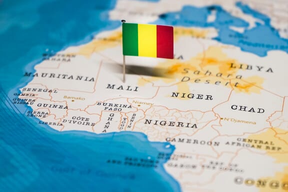
You can see the location of Mali on the world map below:
Mali on the World Map
Mali Neighboring Countries
The neighboring countries of Mali (ML) are:
- Algeria (DZ)
- Burkina Faso (BF)
- Cote d’Ivoire (CI)
- Guinea (GN)
- Mauritania (MR)
- Niger (NE)
- Senegal (SN)
Mali is a landlocked country, which means it does not have direct access to the open ocean.
Mali Key Facts
| Country | Mali |
|---|---|
| Coordinates |
Latitude: 17.570692 Longitude: -3.996166 |
| Country Codes |
Alpha 2: ML Alpha 3: MLI |
| Country Flag Emoji | 🇲🇱 |
| Int. Phone Prefix | +223 |
| Capital city | Bamako |
| Continent / Subcontinent |
Africa Northern Africa |
| Country Area | 1,240,192 sq km |
| Population 2024 |
24,478,595 World Rank: 58 |
| Median Age | 15.1 |
| Life expectancy | 60.4 |
| Major languages | French (official), Bambara 46.3%, Peuhl/Foulfoulbe 9.4%, Dogon 7.2%, Maraka/Soninke 6.4%, Malinke 5.6%, Sonrhai/Djerma 5.6%, Minianka 4.3%, Tamacheq 3.5%, Senoufo 2.6%, Bobo 2.1%, unspecified 0.7%, other 6.3% (2009 est.) |
| UTC/GMT Time |
Number of time zones: 1
|
| Internet TLD | .ml |
| Biggest Airport | Modibo Keita International Airport (BKO) |
| Average temperature |
28.25 °C 82.85 °F |
| Administrative Divisions | 1 district 10 regions |
| Political system | Presidential representative democratic republic |
Mali Economy Facts
| World Bank Income Group | Low income |
|---|---|
| World Bank Region | Sub-Saharan Africa |
| Currency | CFA Franc (XOF) |
| GDP in 2024 |
$26.8 (billions of USD) World Rank: 114 |
| GDP per capita in 2024 |
$1,095 World Rank: 190 |
| Major Industries / Economic Sectors | Agriculture, manufacturing, energy, services |
| Top 5 Import Countries | China, France, United States, Senegal, Germany |
| Top 5 Export Countries | China, Ivory Coast, United Arab Emirates, India, Thailand |
Biggest Cities in Mali
Here are the largest cities in Mali based on 2024 data:
| City | Population |
|---|---|
| Bamako | 4,227,569 |
| Sikasso | 349,324 |
| Koutiala | 218,031 |
| Segou | 205,787 |
| Kayes | 194,716 |
| Mopti | 186,187 |
| Kalaban Koro | 148,247 |
| Gao | 133,110 |
| Kati | 130,254 |
| San | 103,227 |


