Gambia (the) is located in the Northern Africa region at latitude 13.443182 and longitude -15.310139 and is part of the African continent continent.
The DMS coordinates for the center of the country are:
13° 26' 35.46'' N
15° 18' 36.50'' W
You can see the location of Gambia on the world map below:
Gambia on the World Map
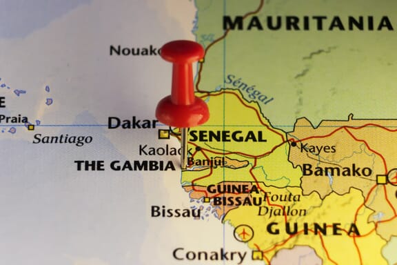
Gambia Neighboring Countries
The neighboring countries of Gambia (GM) are:
- Senegal (SN)
Maritime Borders
The Gambia borders the Atlantic Ocean.
Gambia (the) Key Facts
| Country | Gambia (the) |
|---|---|
| Coordinates |
Latitude: 13.443182 Longitude: -15.310139 |
| Country Codes |
Alpha 2: GM Alpha 3: GMB |
| Country Flag Emoji | 🇬🇲 |
| Int. Phone Prefix | +220 |
| Capital city | Banjul |
| Continent / Subcontinent |
Africa Northern Africa |
| Country Area | 11,300 sq km |
| Population 2024 |
2,759,988 World Rank: 141 |
| Median Age | 16.8 |
| Life expectancy | 65.9 |
| Major languages | English |
| UTC/GMT Time |
Number of time zones: 1
|
| Internet TLD | .gm |
| Biggest Airport | Banjul International Airport (Banjul) |
| Average temperature |
27.00 °C 80.60 °F |
| Administrative Divisions | 1 city 5 divisions |
| Political system | Presidential representative democratic republic |
Gambia Economy Facts
| World Bank Income Group | Low income |
|---|---|
| World Bank Region | Sub-Saharan Africa |
| Currency | Gambian Dalasi (GMD) |
| GDP in 2024 |
$2.4 (billions of USD) World Rank: 184 |
| GDP per capita in 2024 |
$871 World Rank: 200 |
| Major Industries / Economic Sectors | Agriculture, manufacturing, tourism, energy |
| Top 5 Import Countries | China, Senegal, India, United Arab Emirates, France |
| Top 5 Export Countries | Senegal, China, India, United Arab Emirates, Netherlands |
Biggest Cities in Gambia
Here are the largest cities in Gambia based on 2024 data:
| City | Population |
|---|---|
| Serekunda | 340,000 |
| Brikama | 97,233 |
| Sukuta | 56,472 |
| Talinding | 48,687 |
| Faji Kunda | 45,757 |
| Bakau | 43,098 |
| Banjul | 37,274 |
| Nema Kunku | 34,390 |
| Farafenni | 32,883 |
| Busumbala | 28,829 |