Malta is located in the Southern Europe region at latitude 35.937496 and longitude 14.375416 and is part of the European continent continent.
The DMS coordinates for the center of the country are:
35° 56' 14.99'' N
14° 22' 31.50'' E
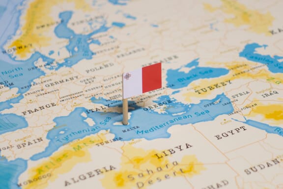
You can see the location of Malta on the world map below:
Malta on the World Map
Malta Neighboring Countries
The country has no neighboring countries/land borders.
Maritime Borders
Malta borders with the Mediterranean Sea.
Malta Key Facts
| Country | Malta |
|---|---|
| Coordinates |
Latitude: 35.937496 Longitude: 14.375416 |
| Country Codes |
Alpha 2: MT Alpha 3: MLT |
| Country Flag Emoji | 🇲🇹 |
| Int. Phone Prefix | +356 |
| Capital city | Valletta |
| Continent / Subcontinent |
Europe Southern Europe |
| Country Area | 316 sq km |
| Population 2025 |
579,704 World Rank: 170 |
| Median Age | 39 |
| Life expectancy | 83.0 |
| Major languages | Maltese (official) 90.1%, English (official) 6%, multilingual 3%, other 0.9% (2005 est.) |
| UTC/GMT Time |
Number of time zones: 1
|
| Internet TLD | .mt |
| Biggest Airport | Malta International Airport Valletta (MLA) |
| Average temperature |
19.20 °C 66.56 °F |
| Administrative Divisions | 68 local councils |
| Political system | Parliamentary democracy |
Malta Economy Facts
| World Bank Income Group | High income |
|---|---|
| World Bank Region | Middle East & North Africa |
| Currency | Euro (EUR) |
| GDP in 2025 |
$27.8 (billions of USD) World Rank: 119 |
| GDP per capita in 2025 |
$47,907 World Rank: 35 |
| Major Industries / Economic Sectors | Manufacturing, services, agriculture, energy |
| Top 5 Import Countries | Italy, Germany, China, France, United States |
| Top 5 Export Countries | Italy, Germany, France, United Kingdom, United States |
Biggest Cities in Malta
Here are the largest cities in Malta based on 2024 data:
| City | Population |
|---|---|
| Saint Paul's Bay | 32,042 |
| Birkirkara | 24,356 |
| Mosta | 23,482 |
| Sliema | 22,591 |
| Qormi | 16,801 |
| Zabbar | 15,648 |
| Valletta | 6,794 |


