Ireland is located in the Northern Europe region at latitude 53.41291 and longitude -8.24389 and is part of the European continent.
The DMS coordinates for the center of the country are:
- 53° 24' 46.48'' N
- 8° 14' 38.00'' W
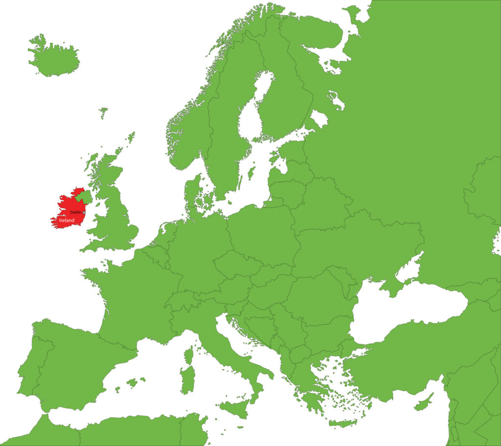
You can see the location of Ireland on the world map below:
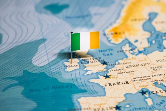
Ireland Neighboring Countries
The neighboring countries of Ireland (IE) are:
- United Kingdom of Great Britain and Northern Ireland (GB)
Maritime Borders
Ireland borders with the Atlantic Ocean.
Ireland Related Content
- Geographical Regions of Ireland
- Counties of Ireland
- Ireland Flag Map and Meaning
- What is the Capital of Ireland?
Ireland Key Facts
| Country | Ireland |
| Coordinates | Latitude: 53.41291 Longitude: -8.24389 |
| Country Codes | Alpha 2: IE Alpha 3: IRL |
| Country Flag Emoji | 🇮🇪 |
| Int. Phone Prefix | +353 |
| Capital city | Dublin |
| Continent Subcontinent | Europe Northern Europe |
| Country Area | 70273 sq km |
| Population 2021 | 5,028,230 World Rank: 123 |
| Median Age | 37.6 |
| Life expectancy | 82 |
| Major languages | English (official, the language generally used), Irish (Gaelic or Gaeilge) (official, spoken by approximately 39.8% of the population as of 2016; mainly spoken in areas along Ireland's western coast known as gaeltachtai, which are officially recognized regions where Irish is the predominant language) |
| UTC/GMT Time | Number of time zones: 1
|
| Internet TLD | .ie |
| Biggest Airport | Dublin Airport (DUB) |
| Average temperature | 9.30 °C 48.74 °F |
| Administrative Divisions | 4 provinces 26 counties |
| Political system | Parliamentary democracy |
Ireland Economy Facts
| World Bank Income Group | High income |
| World Bank Region | Europe & Central Asia |
| Currency | Euro (EUR) |
| GDP in 2020 | $388.3 (billions of USD) World Rank: 30 |
| GDP per capita in 2020 | $85,423 World Rank: 5 |
| Major Industries / Economic Sectors | Manufacturing, services, agriculture, energy |
| Top 5 Import Countries | United States, China, Germany, Netherlands, Belgium |
| Top 5 Export Countries | United States, United Kingdom, Belgium, Germany, Netherlands |
Biggest Cities in Ireland
Here are the largest cities in Ireland based on 2021 data:
| City | Population |
|---|
| Dublin | 553,165 | Cork | 208,669 | Galway | 79,504 | Limerick | 58,319 | Waterford | 48,369 | Drogheda | 40,956 | Dun Dealgan | 39,004 | Swords | 36,924 | Blackrock | 28,557 | Tralee | 26,384 |
Map of Ireland with the Largest Cities
Other Countries in the Northern Europe Region
The borders of Ireland, located in northwestern Europe, were drawn with the Atlantic Ocean in the west, the Irish Sea in the east, the St. George Canal in the southeast, and the Celtic Sea in the south.
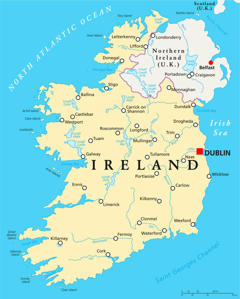
The Irish Sea separates the country from Great Britain. One of the six on the island belongs to England.
The capital city Dublin is the largest city in the country.
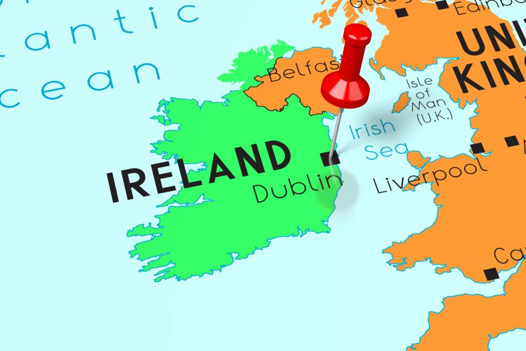
In 2013, Dublin was the happiest city in the world and the best city to live in!
Geography
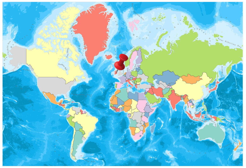
Ireland on the Europe Map
In the inner part of the country, where the surface forms vary, there are large plains surrounded by mountain ranges used as grassland, except for the 1000 square kilometers of the Alien Swamp.
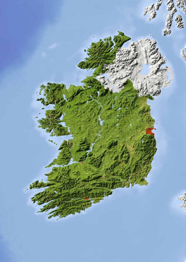
The extensions of the Scottish Mountains descend steeply to the west coast covered with fjords. The Leinster Range, typical Navy, and Wicklow are typical examples of this phenomenon.
There are many islands on the west coast. In the southwest, the height of the Magilly Mountains is 1014 meters, while the other elevations do not reach 452-762 meters.
Map of Ireland Administrative Divisions
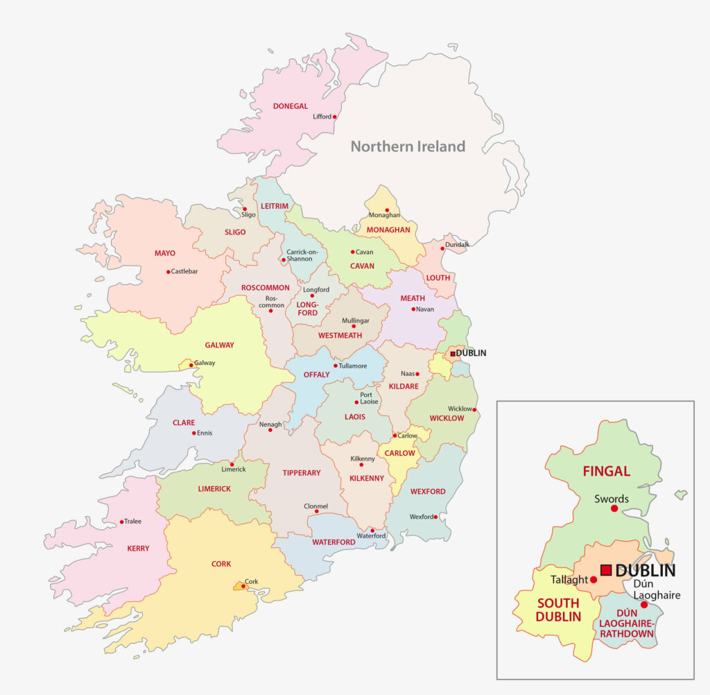
Related: Counties of Ireland and Northern Ireland
The Irish lands have passed through two stages of the glacial age: In the first phase all the country, in the second stage, from the Leinster Mountains to the mouth of the Shannon River was glacier-covered.
As a result of severe eruptions, clusters of granite-covered areas, moraines, san, and pebbles emerged as in Connaught Region in the west, Galway in the east.
Governance
In Ireland, governed by parliamentary democracy, the president of the state, who is directly elected by the people, has been sitting in his chair for seven years and has come up for two terms.
Climate
A cool and warm ocean climate prevails. Winter is soft and damp, summer is cool and cloudy. The average temperature is 15 in summer and 5 in winter.
Religion
95% of the population is Catholic, 5% is Protestant.
Industry and Tourism
They use the euro as their currency.
There are two official languages in Ireland: Irish and English. Most of the population prefer English as spoken language.
Agriculture: 70% of Ireland’s land consists of pastures, meadows, 15%, and cultivated fields. Barley, sugar beet, potato, wheat, oat are the main agricultural products.
Livestock: Cattle, sheep, pigs, horses, poultry are basic animal assets. Annual red and white meat production is 650 thousand tons, milk production is 5.3 million, butter is 60 thousand tons, milk powder production is 200 thousand tons. 1,700 tons of fish and shellfish production exceeding 190 thousand tons per year are provided from inland water.
Natural Resources: The production of lead, zinc, and silver sold out in the past is in decline recently. Coal, copper, barite, gypsum, green and black marble are other natural sources.
Art
Irish Literature: Ireland has given to the world, Ulysses, Dracula and Gulliver’s Travels. Dublin is among the UNESCO Literary Cities where four cities are located. George Bernard Shaw, Samuel Becket, Butler Yeats, and Seamus Heaney have earned Ireland a Nobel Prize in literature.
Music in Ireland: Dance, music, and storytelling are at the core of the Irish. Traditional Irish music has influenced bluegrass, folk, jazz and rock music in North America, Europe, Australia, and other countries. Go wherever you go you feel yourself in Ireland with Irish tunes.
Irish music is incredibly powerful and varied. Enya, Altan Group, Celtic Woman Group, and six Grammy Awards Chieftains, who is one of the best female voices in the world, U2 defined as Rock’s hot ticket, has given Irish music to the world.
Visual Arts and Performing Arts: Riverdance, a traditional Irish dance, has created a storm in the world. Louis Le Brocquy’s highly acclaimed President Portraits and Francis Bacon, born in Ireland, are in the galleries of Dublin Hugh Lane.
Film Industry in Ireland: Irish Jim Sheridan and Neil Jordan, silver screen specialists, are eyeing the Irish film industry with a new generation of Irish filmmakers following the film classics of Once and Garage, and nominations for the Oscar with short animations and awards.
From the important players of Hollywood; Actresses Gabriel Byrne (Irish Cultural Ambassador), Pierce Brosnan, Colin Farrell, Liam Neeson, Jonathan Rhys-Meyers, Patrick Bergin, Daniel-Day Lewis, Brendan Gleeson, and Cillian Murphy actors and Sorcha Ronan, Brenda Flicker, Dearbhla Walsh, and Joan Bergin are Irish.
Sports
Gal Football is one of the most popular sports in the country. It’s Ireland’s national sport. Hurling is Ireland’s other national sport along with Gal Football. Apart from Gal Football, football is also being followed very well. Almost everyone in the country has a team in the England Premier League.
Image Sources and Copyright Information
- Ireland Flag Pin on World Map: © hyotographics/Shutterstock