Northern Ireland had administrative areas called counties from 1921 to 1972. These administrative divisions that do not exist today were as in the map below.
In this article, we will take a look at the counties of Northern Ireland a little more closely. Let’s have a look at the map below:

As we saw in the map above, there were 6 counties in total.
Related: Where is Ireland on the World Map?
Now, let’s have some more detailed information about Northern Ireland’s regions:
Antrim
Although the first date of the County’s formation is not clearly known, the history dates back to the 14th century. The total area is 3,046 square kilometres. Furthermore, its population is 618,000 and it is also the most populous county in Northern Ireland. The name comes from Antrim Town.
Antrim County has two cities. The cities in the county are Belfast and Lisburn. Moreover, Belfast is the capital city of the country at the same time, which is a great historic heritage for Northern Ireland.
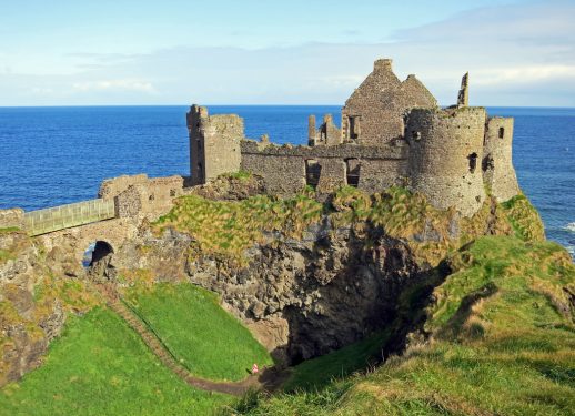
Visitors to this area are advised to visit Dunluce Castle and Carrickfergus Castle.
In addition, Giant’s Causeway’s natural rock formations along the Antarctic coast have been identified as a UNESCO World Heritage Site. This is one of the places to visit.
Armagh
The total area is 1,326 square kilometres. The population is 174,792. There are two large towns in the county. Moreover, the population of these large towns is higher than 18,000, less than 75,000.
Furthermore, the large towns in County are Newry (Craigavon) and Craigavon.
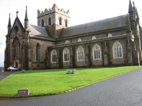
Visitors to the area are advised to visit St. Patrick’s Cathedral, Gosford Castle and Slieve Gullion.
Down
The total area is 2,448 square kilometres. The population is 531,665. In the county, there are three provinces. However, a large part of these cities are located in other counties. These cities are Belfast, Lisburn and Newry.
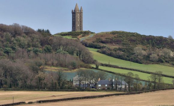
Visitors to Down County are advised to visit Castlewellan Forest Park, Tollymore Forest Park and Scrabo Tower.
Fermanagh
The total area is 1,691 km. The population is 61,170. There is no city-based residence in the county. Furthermore, Enniskillen is located in the district, medium town. Moreover, county’s largest source of income is agriculture and tourism.
You should visit Belleek Pottery, Castle Archdale, Crom Estate, Devenish Island, Florence Court and Marble Arch Caves in Fermanagh.
Londonderry
The total area is 2,074 square kilometers. The population is 247,132. We advise those who visit the region to see the walls of the city successfully preserved from the 17th century to the present day.
Also, at the National Trust-owned Plantation estate at Springhill, Mussenden Temple on the Atlantic coast, the dikes, the artificial coastlines and the bird sanctuaries on the eastern shore of Lough Foyle, and the visitor center at Bellaghy Bawn, close to the childhood home of Nobel laureate Seamus is among the other places to visit in Heaney.
Tyrone
The total area is 3,155 kilometers. The population is 177.986. There is no settlement in the county within the county. But Omagh is in the Large Town status.
Related: Counties of Ireland