Croatia is located in the Southern Europe region at latitude 45.1 and longitude 15.2 and is part of the European continent continent.
The DMS coordinates for the center of the country are:
45° 6' 0.00'' N
15° 12' 0.00'' E
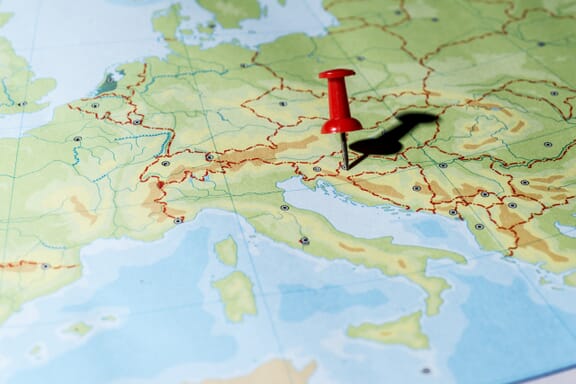
You can see the location of Croatia on the world map below:
Croatia on the World Map
Croatia Neighboring Countries
The neighboring countries of Croatia (HR) are:
- Bosnia and Herzegovina (BA)
- Hungary (HU)
- Montenegro (ME)
- Serbia (RS)
- Slovenia (SI)
Maritime Borders
Croatia borders the Adriatic Sea.
Croatia Key Facts
| Country | Croatia |
|---|---|
| Coordinates |
Latitude: 45.1 Longitude: 15.2 |
| Country Codes |
Alpha 2: HR Alpha 3: HRV |
| Country Flag Emoji | 🇭🇷 |
| Int. Phone Prefix | +385 |
| Capital city | Zagreb |
| Continent / Subcontinent |
Europe Southern Europe |
| Country Area | 56,594 sq km |
| Population 2024 |
3,866,200 World Rank: 129 |
| Median Age | 43.7 |
| Life expectancy | 78.5 |
| Major languages | Croatian (official) 95.6%, Serbian 1.2%, other 3% (including Hungarian, Czech, Slovak, and Albanian), unspecified 0.2% (2011 est.) |
| UTC/GMT Time |
Number of time zones: 1
|
| Internet TLD | .hr |
| Biggest Airport | Zagreb Airport (ZAG) |
| Average temperature |
10.90 °C 51.62 °F |
| Administrative Divisions | 1 city 20 counties |
| Political system | Parliamentary republic |
Croatia Economy Facts
| World Bank Income Group | High income |
|---|---|
| World Bank Region | Europe & Central Asia |
| Currency | Kuna (HRK) |
| GDP in 2024 |
$93 (billions of USD) World Rank: 76 |
| GDP per capita in 2024 |
$24,050 World Rank: 63 |
| Major Industries / Economic Sectors | Manufacturing, tourism, agriculture, energy |
| Top 5 Import Countries | Germany, Italy, Slovenia, Austria, China |
| Top 5 Export Countries | Italy, Germany, Slovenia, Austria, Bosnia and Herzegovina |
Biggest Cities in Croatia
Here are the largest cities in Croatia based on 2024 data:
| City | Population |
|---|---|
| Zagreb | 663,592 |
| Split | 149,830 |
| Rijeka | 107,964 |
| Osijek | 75,535 |
| Zadar | 67,309 |
| Sesvete | 55,313 |
| Pula | 52,220 |
| Slavonski Brod | 45,005 |
| Karlovac | 41,869 |
| Varazdin | 36,187 |