Uganda is located in the Southern Africa region at latitude 1.373333 and longitude 32.290275 and is part of the African continent.
The DMS coordinates for the center of the country are:
- 1° 22' 24.00'' N
- 32° 17' 24.99'' E
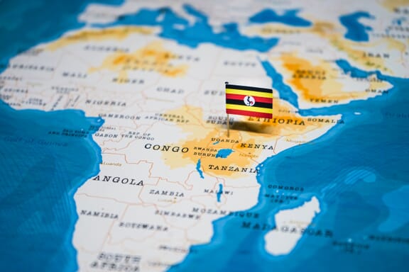
You can see the location of Uganda on the world map below:
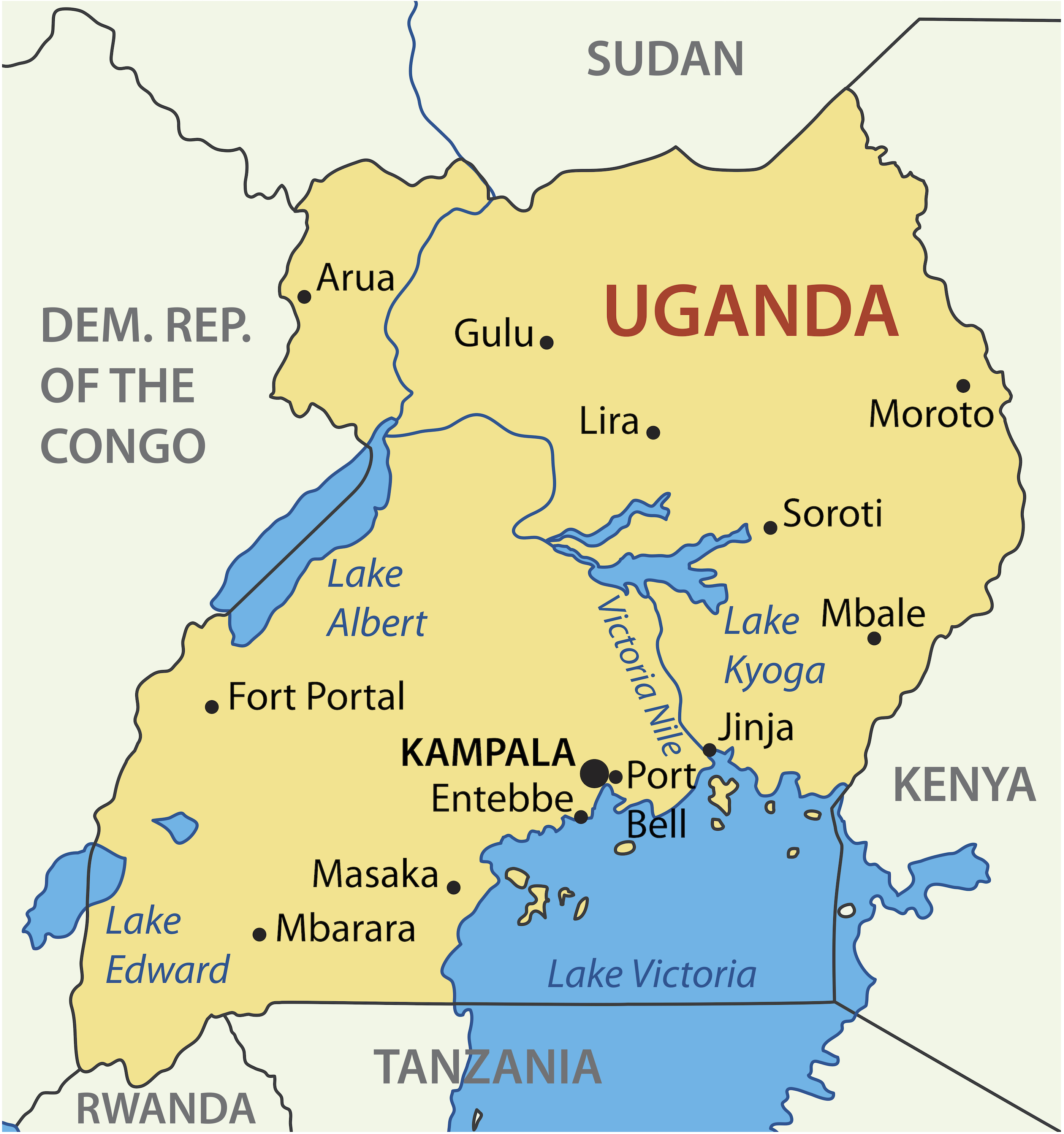
Uganda Neighboring Countries
The neighboring countries of Uganda (UG) are:
- Congo (the Democratic Republic of the) (CD)
- Kenya (KE)
- Rwanda (RW)
- South Sudan (SS)
- Tanzania (the United Republic of) (TZ)
Uganda is a landlocked country, which means it does not have direct access to the open ocean.
Uganda Related Content
Uganda Key Facts
| Country | Uganda |
| Coordinates | Latitude: 1.373333 Longitude: 32.290275 |
| Country Codes | Alpha 2: UG Alpha 3: UGA |
| Country Flag Emoji | 🇺🇬 |
| Int. Phone Prefix | +256 |
| Capital city | Kampala |
| Continent Subcontinent | Africa Southern Africa |
| Country Area | 241,038 sq km |
| Population 2024 | 50,015,092 World Rank: 31 |
| Median Age | 15.9 |
| Life expectancy | 68.3 |
| Major languages | English (official language, taught in schools, used in courts of law and by most newspapers and some radio broadcasts), Ganda or Luganda (most widely used of the Niger-Congo languages and the language used most often in the capital), other Niger-Congo languages, Nilo-Saharan languages, Swahili (official), Arabic |
| UTC/GMT Time | Number of time zones: 1
|
| Internet TLD | .ug |
| Biggest Airport | Entebbe International Airport (EBB) |
| Average temperature | 22.80 °C 73.04 °F |
| Administrative Divisions | 4 geographical regions 134 districts 1 city |
| Political system | Presidential representative democratic republic |
Uganda Economy Facts
| World Bank Income Group | Low income |
| World Bank Region | Sub-Saharan Africa |
| Currency | Ugandan shilling (UGS) |
| GDP in 2024 | $53.9 (billions of USD) World Rank: 90 |
| GDP per capita in 2024 | $1,078 World Rank: 192 |
| Major Industries / Economic Sectors | Agriculture, manufacturing, energy, services |
| Top 5 Import Countries | Kenya, China, United Arab Emirates, India, South Africa |
| Top 5 Export Countries | Kenya, China, United Arab Emirates, India, Democratic Republic of the Congo |
Biggest Cities in Uganda
Here are the largest cities in Uganda based on 2024 data:
| City | Population |
|---|
| Kampala | 1,680,600 | Nansana | 532,800 | Kira | 462,900 | Bunamwaya | 413,400 | Kyengera | 285,400 | Mbarara | 221,300 | Kasangati | 207,800 | Mukono | 191,300 | Njeru | 178,800 | Gulu | 177,400 |
Map of Uganda with the Largest Cities
Other Countries in the Southern Africa Region
- Where are the Seychelles?
- Where are the French Southern and Antarctic Lands?
- Where is Angola?
- Where is Botswana?
- Where is Burundi?
- Where is Eswatini (formerly named Swaziland)?
- Where is Kenya?
- Where is Lesotho?
- Where is Madagascar?
- Where is Malawi?
- Where is Mauritius?
- Where is Mayotte?
- Where is Mozambique?
- Where is Namibia?
- Where is Réunion?
- Where is Rwanda?
- Where is Saint Helena?
- Where is South Africa?
- Where is South Sudan?
- Where is the British Indian Ocean Territory?
- Where is the Congo?
- Where is Zambia?
- Where is Zimbabwe?
Map of Uganda
Administrative Division of Uganda
Uganda is divided into 4 regions and 112 districts, including the capital Kampala. These regions do not constitute any administrative structure within the country and only represent an additional administrative structure.
Four Regions of Uganda
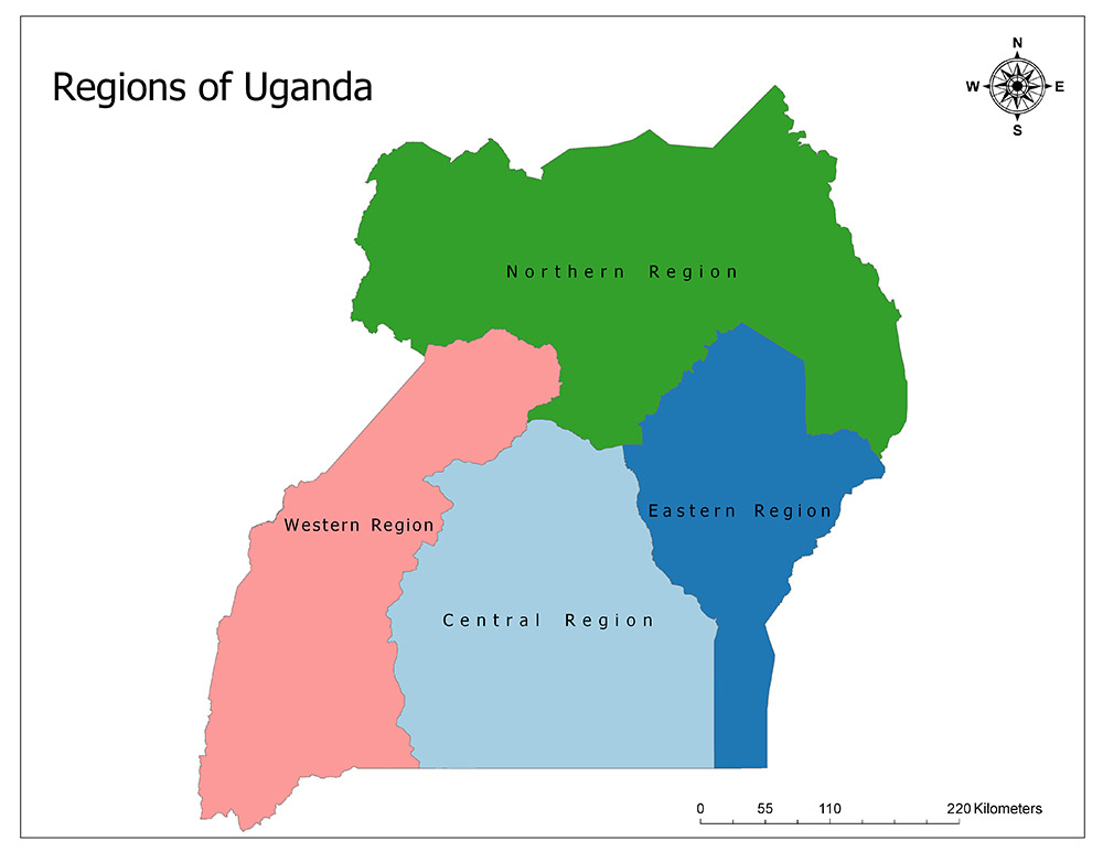
Uganda is divided into four regions under the name of geographical division. These four regions do not have any administrative status.
The geographical regions of Uganda are as follows:
- Central Region,
- Western Region,
- Eastern Region, and
- Northern Region.
The highest official administrative division of Uganda is the districts. Uganda is divided into 112 districts under four geographical regions.
Central Region
Central Region is one of four regions in the African country of Uganda. While the central region is the second largest region in terms of area, it is the region with the highest population in terms of population.
The region is adjacent to the West Region in the west and northwest, the East Region in the east, the North Region in the north, and Tanzania in the south.
According to the 2014 census data, 9,529,227 people live in the region and this is the region with the most populous population. The area is 61,403 square kilometers. The region is divided into 24 districts.
Western Region
The West is one of four regions in the African country of Uganda. While the western region is the third largest in terms of area, it is the third most populated region in terms of population.
The region is adjacent to the North Region in the northeast, the Central Region in the east, Tanzania in the south, Rwanda in the southwest, and the Democratic Republic of Congo in the west.
According to the 2014 census data, there are 8,874,862 people living in the region and with this data, it is the third most populous region of the country. The area of the region is 55,276 square kilometers. The region is divided into 26 districts.
Eastern Region
The East is one of four regions in the African country of Uganda. While the central region is the smallest region of the country in terms of surface area, it is the second most populated region of the country in terms of population.
The region is adjacent to Central Region in the west, Northern Region in the north and Kenya in the east. To the south of the area is Lake Victoria.
According to the 2014 census data, 9,042,422 people live in the region and this is the second most populous region of the country. The area of the region is 39,478 square kilometers. The region is divided into 32 districts.
Northern Region
The North is one of four regions in the African country of Uganda. While the northern region is the largest in the country in terms of area, it is the region with the lowest population in terms of population.
The region is adjacent to the West Region in the southwest, the East Region and the Central Region in the south, South Sudan in the north, Kenya in the east and the Democratic Republic of Congo in the west.
According to the 2014 census data, 7,188,139 people live in the region and with this data, it is the region with the lowest population. The area of the region is 85,391 square kilometers. The region is divided into 30 districts.


- Uganda Flag Pin on Map — © hyotographics/Shutterstock