Central America is one of the most unique places on Earth. It’s a winding stretch of pristine beaches, dense jungles, and active volcanoes nestled between two great oceans, forming a land bridge between North and South America.
Humans have lived in this geographically diverse and beautiful part of the world for thousands of years, and it’s now shared by seven different countries.
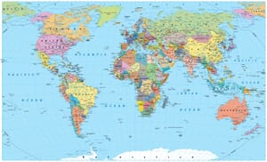
In this post, we’ll take a look at a detailed political map of Central America before learning about human history in the region and finally getting to know more about each of its seven countries.

Human History in Central America
Humans have been present in the area of Central America for thousands of years. Evidence of incredible ancient cultures can still be seen in the form of ruins throughout the region as well as in various Indigenous groups that maintain traditions and languages that predate the arrival of Europeans in the 16th century.
The colonization of the region by the Spanish is responsible for the widespread use of the Spanish language and Catholicism in Central American countries.
Countries in Central America
Belize

Belize is the second-smallest country in Central America and contains the northernmost point in the region. It is bordered by the Caribbean Sea to the east, and its territory includes several islands.
On the mainland, Belize is bordered by Mexico and Guatemala, though the Belize-Guatemala border has been disputed for more than a century. The most recent attempt to resolve the dispute has involved the International Court of Justice, with which proceedings are still underway.
With an estimated 2023 population of 419,137, Belize has the smallest population of any Central American country and is the least densely populated. Around 25% of the country’s population lives in Belize City, the former capital. In 1965, Belmopan became the new capital city of Belize.
The dense, tropical jungles and ancient Mayan ruins are some of the biggest draws for tourists visiting Belize. Those more interested in marine life will also be impressed by the Belize Barrier Reef System, the second-largest reef system in the world and a UNESCO World Heritage Site since 1996.
Costa Rica

Costa Rica is located between Panama to the south and Nicaragua to the north, with the Caribbean Sea to the east and the Pacific Ocean to the west. Known for its incredible jungles and wildlife, Costa Rica is one of the most biodiverse countries on the planet. It accounts for nearly 6% of the world’s biodiversity while occupying only 0.3% of its land.
In addition to stunning natural beauty, and perhaps because of it, Costa Rica regularly ranks among the happiest countries in the world. One of the reasons cited for this is the country’s lack of an army and the high percentage of GDP allocated toward education.
The oldest evidence of humans in present-day Costa Rica dates back to 10,000 to 7,000 years BCE in the form of stone tools. The indigenous people still living in Costa Rica from before the arrival of Europeans are the Bribri and Boruca tribes located near the border with Panama.
Costa Rica is also known for its commitment to environmental protection. The country announced intentions to become completely carbon neutral in 2007 and has made significant progress toward that goal.
El Salvador

Covering a total area of just 21,041 square kilometers (8,124 square miles), El Salvador is the smallest country in Central America. It’s located in the central-western part of the region, bordering Honduras, Guatemala, and the Pacific Ocean. The capital of El Salvador is San Salvador, which is also the country’s largest city.
Before the Spanish Empire conquered Central America, the area of present-day El Salvador was inhabited by various Mesoamerican nations such as the Lenca, Mayans, and Cuzcatlecs. El Salvador became a sovereign state after being controlled by the Spanish and then forming part of the Federal Republic of Central America until its dissolution in 1841.
Despite ongoing struggles with gang violence, El Salvador is appreciated by many tourists for its beaches, landscape, cultural heritage, and ancient ruins. Archeological sites like San Andrés, Tazumal, and Joya de Cerén rank highly among the many reasons to visit El Salvador.
El Salvador’s economy was historically based mostly on agricultural activities, but the country has been making efforts to diversify its economy by increasing manufacturing and opening up trade opportunities. The country became the first in the world to accept Bitcoin as legal tender in 2021.
Guatemala

Guatemala borders more countries than any other in Central America: Mexico to the north and west, Belize to the northeast, Honduras to the east, and El Salvador to the southeast. It’s also the largest country in Central America both by total area and population, with an estimated 17,980,803 residents in 2023.
Two of Guatemala’s most distinguishing features are its rich cultural heritage and its awe-inspiring landscapes. The center of the Mayan civilization was located in what is now Guatemala, and this heritage is evident in some of the most impressive archaeological sites in the world, such as Tikal and Yaxha.
The diverse geography of Guatemala includes dense jungles, striking volcanos, remote beaches, and serene lakes. Lake Atitlan, surrounded by volcanoes and several small villages connected by boat, is a tourist favorite.
A trek up Acatenango Volcano, considered Guatemala’s most beautiful, is another incredible way to witness the country’s natural beauty.
Exploring the cultural and natural wonders of Guatemala is possible through a wide variety of guided tours and experiences starting in many different cities across the country.
Although Guatemala has the largest economy of any Central American country, there is a high level of inequality in the country and more than half of its population is living below the national poverty line.
Honduras

Honduras is located near the center of Central America, bordering Guatemala, El Salvador, and Nicaragua. It also has a long coastline on the Caribbean Sea and borders the Gulf of Fonseca in the Pacific Ocean. Honduras is the second-largest country in Central America, covering an area of 112,492 square kilometers (43,433 square miles).
The capital and largest city of Honduras is Tegucigalpa, located in the south-central region of the country. Separated from sister-city Comayagua by the Choluteca River, Tegucigalpa is located in a valley surrounded by mountains and forms the country’s Central District.
The capital is home to important state-owned organizations as well as the National Autonomous University of Honduras and two international airports.
As with neighboring Guatemala and El Salvador, the territory of Honduras was occupied by the Maya before the onset of Spanish colonization in the 16th century. The Maya Ch’ortí people living in Honduras are descendants of the civilization that lived at Copán, now an important archaeological site.
Xiomara Castro, the first female President of Honduras, was elected in 2022. She had previously served as the first lady during the presidency of her husband, Manuel Zelaya, from 2006 to 2009.
Nicaragua

Breathtaking coastlines on the Caribbean Sea and the Pacific Ocean, magnificent volcanic landscapes, and great lakes are some of the things this Central American country is famous for. Nicaragua is located between Honduras to the north and Costa Rica to the south. The capital and largest city in Nicaragua is Managua.
Spanish is the most common language in Nicaragua, owing its prevalence to the Spanish colonization that began in the region during the 16th century. There are a number of indigenous cultures in Nicaragua that were present before the arrival of the Spanish, and some of the languages of these cultures are still spoken today, particularly on the country’s Atlantic Coast.
Lake Nicaragua, the largest freshwater lake in Central America, is one of the most noteworthy natural wonders of Nicaragua. It is home to volcanic islands and a great variety of marine life, such as bull sharks and at least 16 cichlids that are endemic to the region. Ometepe Island is the largest island in Lake Nicaragua and is home to impressive biodiversity.
Unfortunately, in addition to its natural and cultural beauty, Nicaragua is also one of the most corrupt countries in the world. Widespread dissatisfaction with the presidency of Daniel Ortega has led to protests, which have led to deaths and repression tactics by the government in recent years.
Panama

Panama is the southernmost country in Central America and plays an important role as the link between the North and South American continents as well as between the Pacific and Atlantic Oceans via the Panama Canal. The country is bordered by Costa Rica to the west and Colombia to the southeast.
One of the largest engineering projects ever attempted, The Panama Canal is an artificial waterway that connects the Pacific and Atlantic Oceans and separates North America from South America.
The construction of the canal dramatically reduced the time it takes ships to travel between the Pacific and Atlantic, and revenue from canal tolls still makes up a significant portion of Panama’s GDP.
The capital city of Panama is Panama City, which is home to nearly half of the country’s population. It’s the political and administrative hub of Panama and is located at the entrance to the Panama Canal. Founded in 1519 by Spanish conquistador Pedro Arias Dávila, the city was a strategic location in expeditions that conquered the Inca Empire in Peru.
Humans had inhabited the Isthmus of Panama for thousands of years prior to the arrival of Europeans. The seven Indigenous peoples living in Panama today are the Ngäbe, the Buglé, the Guna, the Emberá, the Wounaan, the Bri Bri, and the Naso Tjërdi.


- Colorful Political Map of Central America — © Rainer Lesniewski/Shutterstock
- Serene View of the Ancient Xunantunich Mayan Ruins in Belize — © milosk50/Shutterstock
- Aerial View of Playa Flamingo, Guanacaste, Costa Rica — © Stefan Neumann/Shutterstock
- Panoramic View of Coatepeque Lake with Surrounding Hills and Lush Vegetation — © Guayo Fuentes/Shutterstock
- Sunrise Over the Colorful Main Street of Antigua, Guatemala with Volcano in the Background — © SL-Photography/Shutterstock
- Aerial View of a Serene Tropical Beach in Honduras at Early Morning — © Guayo Fuentes/Shutterstock
- Rural Road Leading to the Concepción Volcano on Ometepe Island, Nicaragua — © Simon Dannhauer/Shutterstock
- Dusk Descends on Avenida Balboa in Panama City — © Rodrigo Cuel/Shutterstock