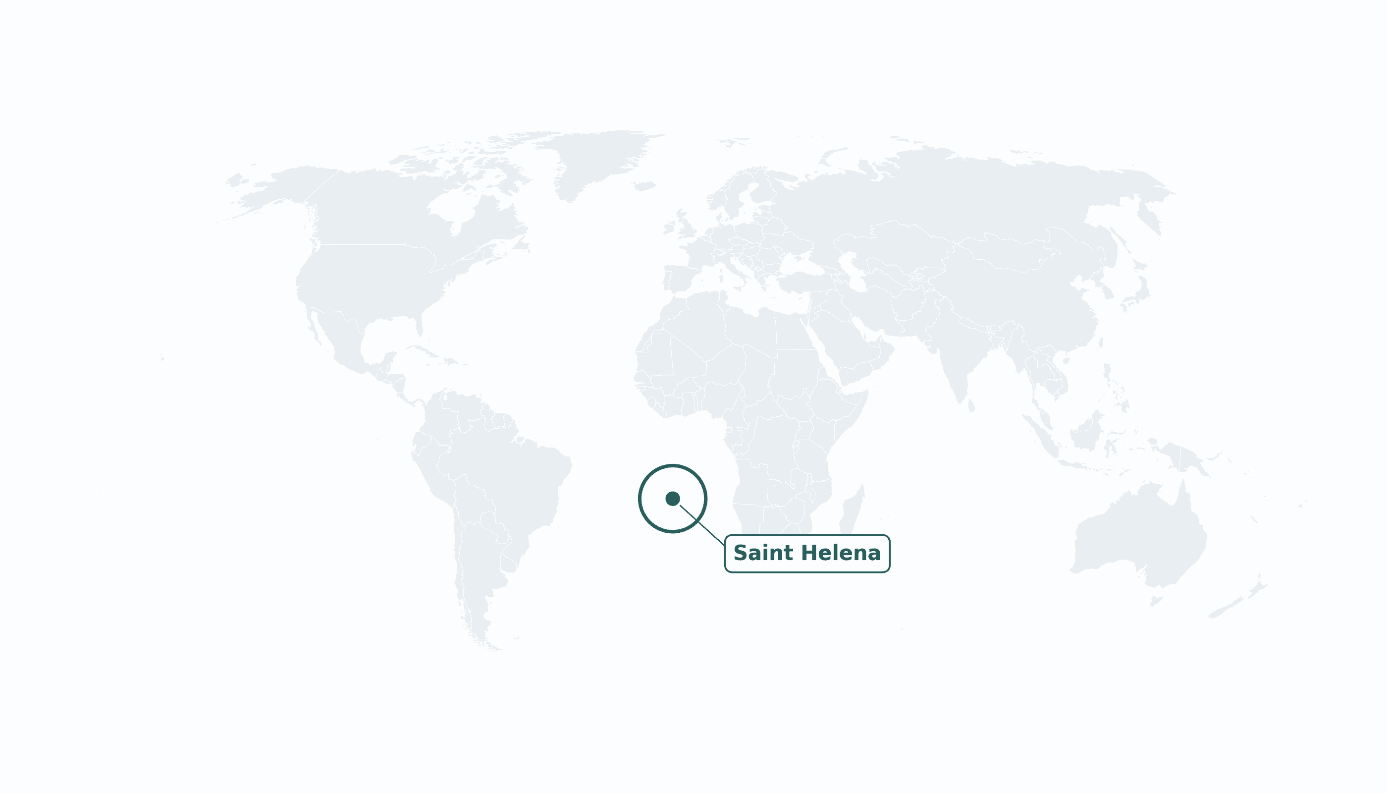
Saint Helena is located in the Southern Africa region at latitude -15.965 and longitude -5.7089 and is part of the African continent.
The DMS coordinates for the center of the country are:
- 15° 57' 54'' S
- 5° 42' 32'' W
You can see the location of Saint Helena on the world map below:
Maritime Borders
Saint Helena has no land borders; it is one of the most remote inhabited islands on Earth, in the middle of the South Atlantic Ocean.
Saint Helena Key Facts
| Country | Saint Helena |
| Coordinates | Latitude: -15.965 Longitude: -5.7089 |
| Country Codes | Alpha 2: SH Alpha 3: SHN |
| Country Flag Emoji | 🇸🇭 |
| Int. Phone Prefix | +290 |
| Capital city | Jamestown |
| Continent Subcontinent | Africa Southern Africa |
| Country Area | 122 sq km |
| Population 2023 | 5,147 World Rank: 218 |
| Median Age | 51 |
| Life expectancy | 79.0 |
| Major languages | English |
| UTC/GMT Time | Number of time zones: 1
|
| Internet TLD | .sh |
| Biggest Airport | Saint Helena Airport (HLE) |
| Average temperature | 21 °C 70 °F |
| Administrative Divisions | 8 districts |
| Political system | British Overseas Territory |
Saint Helena Economy Facts
| World Bank Income Group | High income |
| World Bank Region | Sub-Saharan Africa |
| Currency | Saint Helena pound (SHP) |
| GDP in 2023 | $0.047 (billions of USD) World Rank: 215 |
| GDP per capita in 2023 | $9,100 World Rank: 106 |
| Major Industries / Economic Sectors | Public sector, fishing, tourism, coffee |
| Top 5 Import Countries | United Kingdom, South Africa |
| Top 5 Export Countries | Fish, coffee (to United Kingdom) |
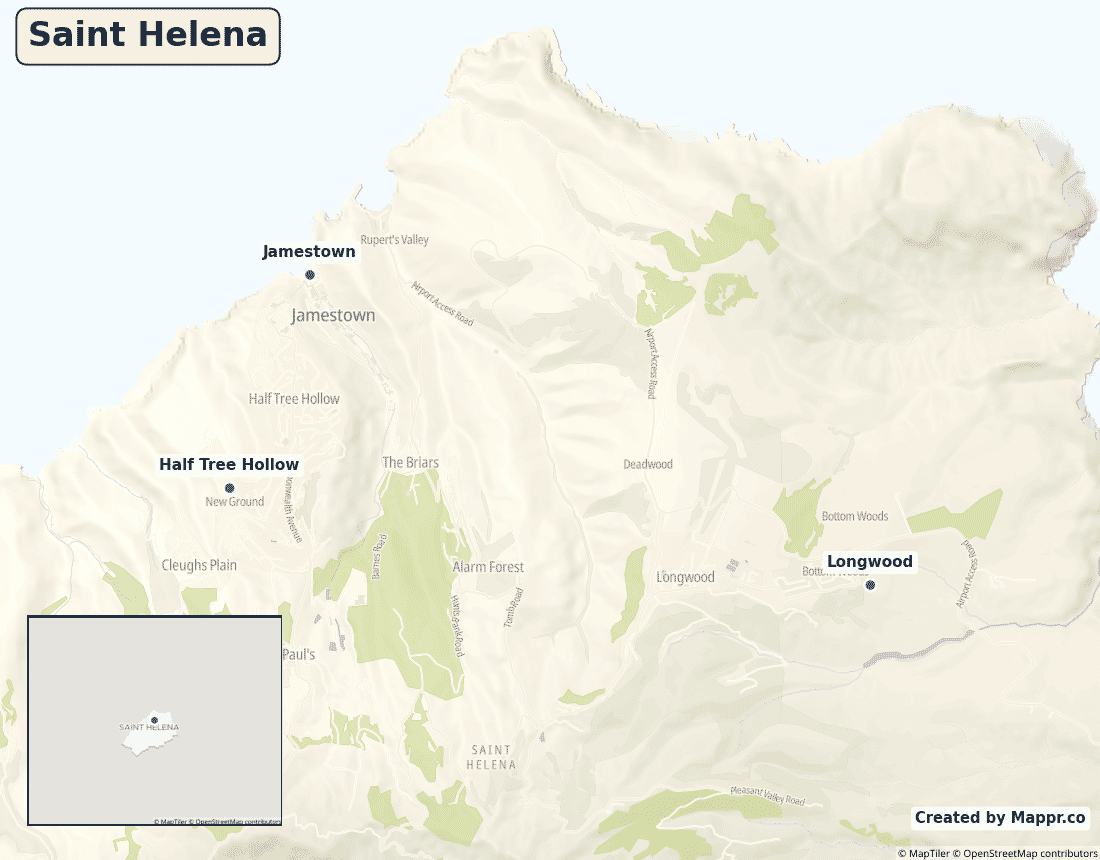
Biggest Cities in Saint Helena
Here are the largest cities in Saint Helena based on data:
| City | Population |
|---|
| Jamestown | 629 | Half Tree Hollow | 901 | Longwood | 960 |
Map of Saint Helena with the Largest Cities
Other Countries in the Southern Africa Region
- Where are the Seychelles?
- Where are the French Southern and Antarctic Lands?
- Where is Angola?
- Where is Botswana?
- Where is Burundi?
- Where is Eswatini (formerly named Swaziland)?
- Where is Kenya?
- Where is Lesotho?
- Where is Madagascar?
- Where is Malawi?
- Where is Mauritius?
- Where is Mayotte?
- Where is Mozambique?
- Where is Namibia?
- Where is Réunion?
- Where is Rwanda?
- Where is South Africa?
- Where is South Sudan?
- Where is the British Indian Ocean Territory?
- Where is the Congo?
- Where is Uganda?
- Where is Zambia?
- Where is Zimbabwe?
Geography
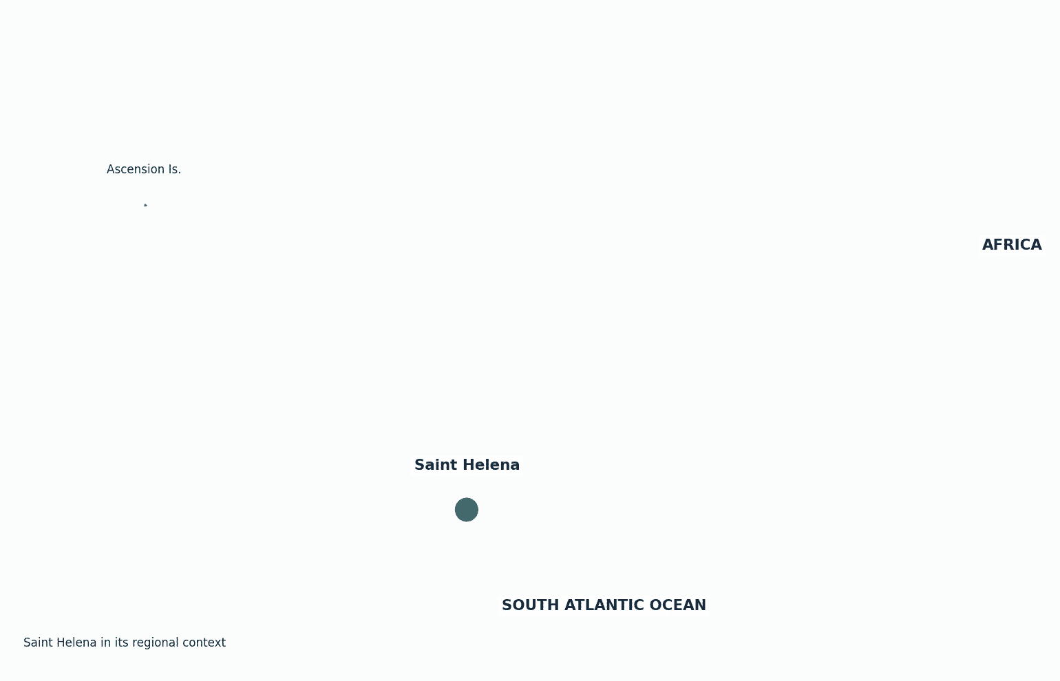
Saint Helena is a small volcanic island marooned in the middle of the South Atlantic Ocean, roughly 1,900 kilometres west of Africa and 4,000 kilometres east of South America. With Ascension and Tristan da Cunha it forms a single British territory.
Famous as the place of Napoleon’s final exile, it was one of the world’s most isolated communities until an airport finally opened in 2017.
Is Saint Helena a country?
Saint Helena is a British Overseas Territory (together with Ascension Island and Tristan da Cunha), self-governing internally while the United Kingdom handles defence and foreign affairs.
| Status | British Overseas Territory |
| Sovereign state | United Kingdom |
| Capital | Jamestown |
| Population | 5,147 |
| Area | 122 km² |
| Currency | Saint Helena pound (SHP) |
| Official language(s) | English |
| ISO 3166 code | SH / SHN |
| Calling code | +290 |
| Internet TLD | .sh |
Climate
Saint Helena has a mild subtropical oceanic climate averaging about 21°C (70°F), kept temperate year-round by the surrounding ocean and the South Atlantic trade winds.
Economy
Saint Helena’s small economy relies on the public sector and UK support, plus fishing, a growing tourism trade since the airport opened, and its prized coffee.
Saint Helena in its region
Saint Helena sits alone in the South Atlantic, with Ascension Island to the northwest and the nearest mainland — southern Africa — some 1,900 km to the east.
Administrative divisions
Saint Helena is divided into eight districts, with the tiny port town of Jamestown the capital.


