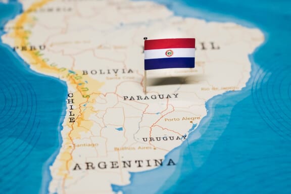
Paraguay is located in the South America region at latitude -23.442503 and longitude -58.443832 and is part of the South American continent.
The DMS coordinates for the center of the country are:
- 23° 26' 33.01'' S
- 58° 26' 37.80'' W
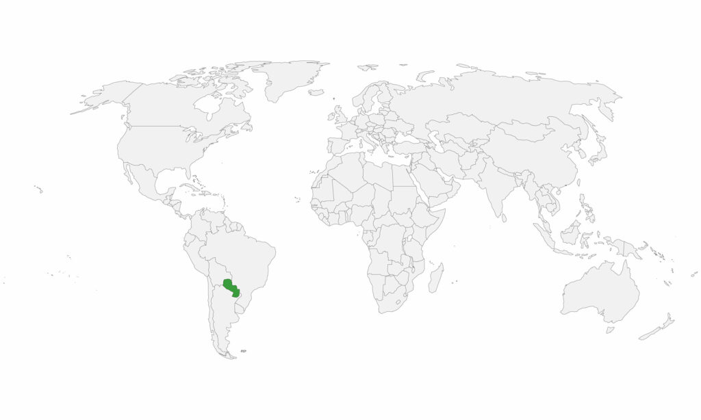
You can see the location of Paraguay on the world map below:
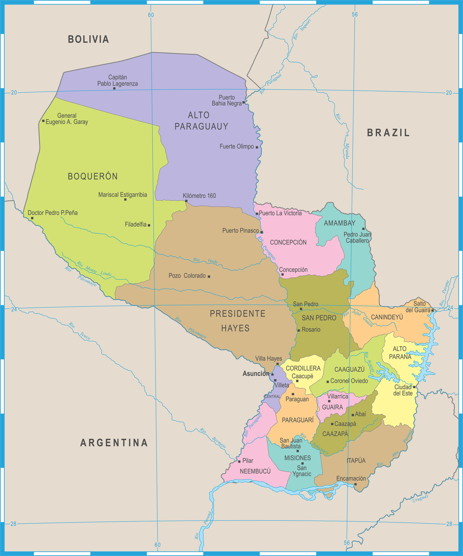
Paraguay Neighboring Countries
The neighboring countries of Paraguay (PY) are:
- Argentina (AR)
- Bolivia (Plurinational State Of) (BO)
- Brazil (BR)
Paraguay is a landlocked country, which means it does not have direct access to the open ocean.
Paraguay Related Content
Paraguay Key Facts
| Country | Paraguay |
| Coordinates | Latitude: -23.442503 Longitude: -58.443832 |
| Country Codes | Alpha 2: PY Alpha 3: PRY |
| Country Flag Emoji | 🇵🇾 |
| Int. Phone Prefix | +595 |
| Capital city | Asunción |
| Continent Subcontinent | South America South America |
| Country Area | 406,752 sq km |
| Population 2021 | 7,219,641 World Rank: 103 |
| Median Age | 25.6 |
| Life expectancy | 70.3 |
| Major languages | Spanish (official) and Guarani (official) 46.3%, only Guarani 34%, only Spanish 15.2%, other (includes Portuguese, German, other indigenous languages) 4.1% , no response .4% (2012 est.) |
| UTC/GMT Time | Number of time zones: 1
|
| Internet TLD | .py |
| Biggest Airport | Silvio Pettirossi International Airport (ASU) |
| Average temperature | 23.55 °C 74.39 °F |
| Administrative Divisions | 1 capital 17 departments |
| Political system | Presidential representative democratic republic |
Paraguay Economy Facts
| World Bank Income Group | Upper middle income |
| World Bank Region | Latin America & Caribbean |
| Currency | Guarani (PYG) |
| GDP in 2020 | $35.4 (billions of USD) World Rank: 93 |
| GDP per capita in 2020 | $4,968 World Rank: 100 |
| Major Industries / Economic Sectors | Agriculture, manufacturing, energy, services |
| Top 5 Import Countries | Brazil, Argentina, China, United States, Uruguay |
| Top 5 Export Countries | Brazil, Argentina, China, United States, Chile |
Biggest Cities in Paraguay
Here are the largest cities in Paraguay based on 2021 data:
| City | Population |
|---|
| Asuncion | 524,190 | Ciudad del Este | 320,782 | San Lorenzo | 287,977 | Pedro Juan Caballero | 115,583 | Coronel Oviedo | 88,101 | Ita | 81,084 | San Antonio | 69,976 | Encarnacion | 69,868 | Aregua | 67,487 | San Ignacio | 50,468 |
Map of Paraguay with the Largest Cities
Other Countries in the South America Region
Paraguay Maps and Regions
The country of Paraguay is located in central South America and divides into three main regions: the eastern Chaco lowlands, the central highlands, and the western Gran Chaco. The eastern Chaco lowlands are a semi-arid region home to the Guaraní people and feature rolling hills and dry forests.
The central highlands are a temperate region, home to the capital city of Asunción and many other large cities. The western Gran Chaco is a sparsely populated, dry region that is home to many indigenous tribes.
Paraguay on the World Map
Paraguay is a small country, with a total area of about 406,750 sq km. Paraguayans often refer to the size of their nation by saying it is “as big as a handkerchief” or an “umbrella.”
Paraguay borders both Brazil and Argentina. Its neighbors have been in many border disputes with the nation throughout history.
GDP is USD 37.7 billion. The country ranks 77th out of 175 countries in GDP per capita. Paraguay’s currency is the Guarani.
Paraguay on the Map of South America

South America consists of 12 countries including, Argentina, Bolivia, Brazil, Chile, Colombia, Venezuela, Ecuador, Guyana, Paraguay, Peru, Suriname, and Uruguay.
The language of Paraguay is Spanish, but other languages are spoken. Indigenous Guaraní is the language of the majority of the people. About 90% of Paraguayans speak both Spanish and Guarani.
Related: Spanish Speaking Countries on the World Map
Paraguay Political Map
Paraguay is one of the poorest countries in South America.
The population is about 7,259,565 people.
Since 1811, Paraguay has had more than 150 coups and counter-coups. The first president was José Gaspar Rodríguez de Francia, who ruled for life from 1814 to 1840 and did not allow citizens to leave the country or foreigners to enter it without his permission. The government today is a representative democracy.
Paraguay gained independence from Spain in 1811. After independence, a series of dictators ruled and were often corrupt and cruel.
During the late 1800s, Paraguay fought a bloody and disastrous war against Brazil, Argentina, and Uruguay. This war is known as the War of the Triple Alliance.
Paraguay is a land-locked country in South America, and most of its people live in the eastern region.
Asunción is the capital of Paraguay. The city sits at an elevation of 175 feet above sea level.
The city got its name in honor of the stockade that was erected on the Feast of the Assumption in 1537. It is one of the oldest cities on the continent.
Paraguay Regions
There are 17 regions in the country of Paraguay. They are: Alto Paraná, Amambay, Apa, Boquerón, Caaguazú, Caazapá, Canindeyú, Central, Concepción, Cordillera, Guairá, Itapúa, Misiones, Paraguarí, Presidente Hayes, San Pedro, and Santaní.
1. Departamento de Concepción
The department of Concepción occupies the southern part of Eastern Paraguay. It extends to the Paraguay River. The capital is the city of Concepción.
2. Departamento de San Pedro
This department is in the southeastern region of Paraguay. It is bordered on the east by Brazil, on the south and west by Argentina, and the north by the departments of Concepción and Itapúa.
The main economic activities are agriculture and cattle raising.
3. Departamento de Cordillera
This department is in the central region of Paraguay. It is bordered on the north by the departments of Central and Presidente Hayes, on the east by Argentina, on the south by Brazil, and on the west by the department of Itapúa.
4. Departamento de Guairá
This department is in the eastern region of Paraguay. Economics activities are agriculture, cattle raising, and the production of timber.
Villarrica is the capital city.
5. Departamento de Caaguazú
This department is in the south-central region of Paraguay. The capital is the city of Coronel Oviedo.
6. Departamento de Caazapá
This department is in the eastern central region of Paraguay. The capital is the city of Caazapá. Orange and mandarin trees, as well as forest hills, are all well-known features of the region.
7. Departamento de Itapúa
This department is in the lower eastern region of Paraguay. It is made up of 30 districts – more than any other district in Paraguay. The city of Encarnación is the department’s capital.
8. Departamento de Misiones
This department is in the southern region of Paraguay. The capital is the city of San Ignacio de Misiones. The capital is San Juan Bautista. It was created in 1906.
9. Departamento de Paraguarí
This department is in the south-central region of Paraguay. The capital is the city of Paraguarí. You will find the Mbatovi and Ybycuí hills here.
10. Departamento de Alto Paraná
This department is in the southern region of Paraguay. It was created in 1943. The capital is Ciudad del Este.
11. Departamento Central
This department is in the central region of Paraguay. The capital is Areguá. Central is the smallest department.
12. Departamento de Ñeembucú
This department is in the southern region of Paraguay. Visit the oldest and most well-preserved Jesuit sites here.
13. Departamento de Amambay
This department is in the northern region of Paraguay. Food, dairy, mills, and yerba industries are the most important sectors. The capital is Pedro Juan Caballero.
14. Departamento de Canindeyú
This department is in the northern region of Paraguay. You can visit the beautiful Salto del Guairá, which has electricity and big embankments. There are 10 districts in the region.
15. Departamento de Presidente Hayes
This department is in the north-central region of Paraguay. The capital is Villa Hayes in honor of American President Rutherford B. Hayes.
16. Departamento de Alto Paraguay
Cerro León hill is the highest point in the northern region of Paraguay. Alto Paraguay also has several national parks.
17. Departamento de Boquerón
This is the largest department and is in the western region of Paraguay. Over 160 educational institutions can be found here.
Image Sources and Copyright Information
- Paraguay Flag Pin on Map: © hyotographics/Shutterstock