Saint Kitts and Nevis is located in the Caribbean region at latitude 17.357822 and longitude -62.782998 and is part of the North American continent continent.
The DMS coordinates for the center of the country are:
17° 21' 28.16'' N
62° 46' 58.79'' W
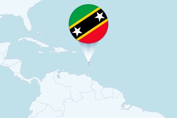
You can see the location of Saint Kitts and Nevis on the world map below:
Saint Kitts and Nevis on the World Map
Saint Kitts and Nevis Neighboring Countries
The country has no neighboring countries/land borders.
Maritime Borders
Saint Kitts and Nevis borders with the Caribbean Sea.
Saint Kitts and Nevis Key Facts
| Country | Saint Kitts and Nevis |
|---|---|
| Coordinates |
Latitude: 17.357822 Longitude: -62.782998 |
| Country Codes |
Alpha 2: KN Alpha 3: KNA |
| Country Flag Emoji | 🇰🇳 |
| Int. Phone Prefix | +1-869 |
| Capital city | Basseterre |
| Continent / Subcontinent |
North America Caribbean |
| Country Area | 261 sq km |
| Population 2024 |
46,843 World Rank: 203 |
| Median Age | 34 |
| Life expectancy | 72.1 |
| Major languages | English |
| UTC/GMT Time |
Number of time zones: 1
|
| Internet TLD | .kn |
| Biggest Airport | Robert L. Bradshaw International Airport (SKB) |
| Average temperature |
24.50 °C 76.10 °F |
| Administrative Divisions | 2 states 14 parishes |
| Political system | Parliamentary democracy |
Saint Kitts and Nevis Economy Facts
| World Bank Income Group | High income |
|---|---|
| World Bank Region | Latin America & Caribbean |
| Currency | Eastern Caribbean Dollar (XCD) |
| GDP in 2024 |
$1.1 (billions of USD) World Rank: 198 |
| GDP per capita in 2024 |
$23,961 World Rank: 64 |
| Major Industries / Economic Sectors | Tourism, manufacturing, agriculture, energy |
| Top 5 Import Countries | United States, China, Trinidad and Tobago, South Korea, Japan |
| Top 5 Export Countries | United States, China, Trinidad and Tobago, India, United Kingdom |
Biggest Cities in Saint Kitts and Nevis
Here are the largest cities in Saint Kitts and Nevis based on 2021 data:
| City | Population |
|---|---|
| Basseterre | 13,220 |