Palau is located in the Australia and Oceania region at latitude 7.51498 and longitude 134.58252 and is part of the Oceania continent continent.
The DMS coordinates for the center of the country are:
7° 30' 53.93'' N
134° 34' 57.07'' E
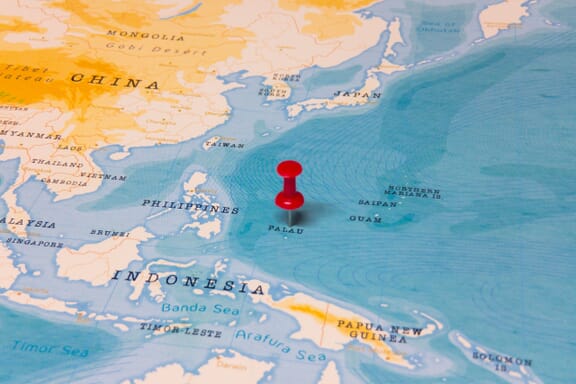
You can see the location of Palau on the world map below:
Palau on the World Map
Palau Neighboring Countries
The country has no neighboring countries/land borders.
Maritime Borders
Palau borders with the Pacific Ocean.
Palau Key Facts
| Country | Palau |
|---|---|
| Coordinates |
Latitude: 7.51498 Longitude: 134.58252 |
| Country Codes |
Alpha 2: PW Alpha 3: PLW |
| Country Flag Emoji | 🇵🇼 |
| Int. Phone Prefix | +680 |
| Capital city | Melekeok |
| Continent / Subcontinent |
Oceania Australia and Oceania |
| Country Area | 459 sq km |
| Population 2021 |
18,174 World Rank: 192 |
| Median Age | 35.7 |
| Life expectancy | 66 |
| Major languages | Palauan (official on most islands) 65.2%, other Micronesian 1.9%, English (official) 19.1%, Filipino 9.9%, Chinese 1.2%, other 2.8% (2015 est.) |
| UTC/GMT Time |
Number of time zones: 1
|
| Internet TLD | .pw |
| Biggest Airport | Roman Tmetuchl International Airport (ROR) |
| Average temperature |
27.60 °C 81.68 °F |
| Administrative Divisions | 16 states |
| Political system | Presidential representative democratic republic |
Palau Economy Facts
| World Bank Income Group | Upper middle income |
|---|---|
| World Bank Region | East Asia & Pacific |
| Currency | US Dollar (USD) |
| GDP in 2020 |
$0.2 (billions of USD) World Rank: 193 |
| GDP per capita in 2020 |
$14,244 World Rank: 54 |
| Major Industries / Economic Sectors | Agriculture, manufacturing, energy, services |
| Top 5 Import Countries | United States, China, Japan, South Korea, Australia |
| Top 5 Export Countries | United States, Japan, China, South Korea, Australia |
Biggest Cities in Palau
Here are the largest cities in Palau based on 2021 data:
| City | Population |
|---|---|
| Koror | 8,744 |
| Melekeok | 7,026 |
| Ngerulmud | 271 |