Mongolia is located in the Northeastern Asia region at latitude 46.862496 and longitude 103.846656 and is part of the Asian continent.
The DMS coordinates for the center of the country are:
- 46° 51' 44.99'' N
- 103° 50' 47.96'' E
You can see the location of Mongolia on the world map below:
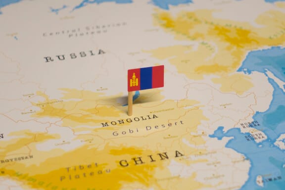
Mongolia Neighboring Countries
The neighboring countries of Mongolia (MN) are:
- China (CN)
- Russian Federation (RU)
Mongolia is a landlocked country, which means it does not have direct access to the open ocean.
Mongolia Related Content
Mongolia Key Facts
| Country | Mongolia |
| Coordinates | Latitude: 46.862496 Longitude: 103.846656 |
| Country Codes | Alpha 2: MN Alpha 3: MNG |
| Country Flag Emoji | 🇲🇳 |
| Int. Phone Prefix | +976 |
| Capital city | Ulaanbaatar |
| Continent Subcontinent | Asia Northeastern Asia |
| Country Area | 1,564,116 sq km |
| Population 2021 | 3,329,282 World Rank: 131 |
| Median Age | 26.8 |
| Life expectancy | 71 |
| Major languages | Mongolian 90% (official) (Khalkha dialect is predominant), Turkic, Russian (1999) |
| UTC/GMT Time | Number of time zones: 2
|
| Internet TLD | .mn |
| Biggest Airport | Buyant-Ukhaa International Airport (ULN) |
| Average temperature | 15.00 °C 59.00 °F |
| Administrative Divisions | 1 capital city 21 provinces |
| Political system | Parliamentary democracy |
Mongolia Economy Facts
| World Bank Income Group | Lower middle income |
| World Bank Region | East Asia & Pacific |
| Currency | Tugrik (MNT) |
| GDP in 2020 | $13.3 (billions of USD) World Rank: 133 |
| GDP per capita in 2020 | $4,061 World Rank: 115 |
| Major Industries / Economic Sectors | Agriculture, manufacturing, energy, services |
| Top 5 Import Countries | China, Russia, Japan, South Korea, Germany |
| Top 5 Export Countries | China, Russia, United States, Japan, Australia |
Biggest Cities in Mongolia
Here are the largest cities in Mongolia based on 2021 data:
| City | Population |
|---|
| Ulaanbaatar | 1,396,288 | Moron | 134,530 | Erdenet | 101,260 | Darhan | 74,738 | Darhan | 74,738 | Choybalsan | 38,150 | Olgiy | 28,496 | Ulaangom | 26,319 | Bayanhongor | 26,252 | Hovd | 26,023 |
Map of Mongolia with the Largest Cities
Other Countries in the Northeastern Asia Region
Mongolia Maps and Provinces
Mongolia is a large, landlocked country located in Central Asia and East Asia. It has a total area of 1,564,116 square kilometers and a population of 3,248,853 people. The country is divided into 21 provinces and one autonomous prefecture.
The capital and largest city of Mongolia is Ulaanbaatar. Other major cities include Darkhan, Erdenet, and Olgiy.
The provinces of Mongolia are divided into aimags (provinces) and soums (districts). The aimags are further divided into sums (townships), baghs (subdistricts), and finally dumig (villages). The soums are further divided into khoroos (rural districts) and baghs (subdistricts).
Mongolia has a mostly continental climate with cold, dry winters and hot summers. In fact, Mongolia is one of the coldest countries in the world.
Most of the country is covered in mountains where the average elevation is over 1000 meters.
The lowest point is the Hoh Nuur at 154 meters below sea level, and the highest point is Nayramadlin Orgil, at 4,374 meters above sea level. Mongolia also has extensive steppe grasslands in the southwest and northern mountains with forests in the northeast.
Mongolia Political Map
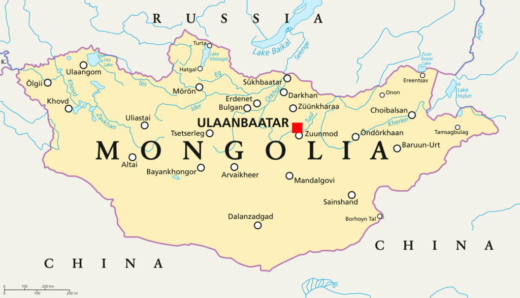
The general Mongolia map outline consists of a landmass with China on the north, Russia on the east, and the Pacific Ocean on the south. The northern border is divided, with Russia to the north and China to the northeast.
Mongolia was once an important part of the Mongolian Empire which spanned most of Eurasia.
It became independent in 1911 when the Qing Dynasty was overthrown. The country lasted until 1924, when it entered into a treaty with China, creating the Chinese Eastern Railway within its borders.
During World War II, Mongolia fought alongside the Soviet Union to regain its independence. It became a socialist state and part of the Soviet Union in 1949.
In 1990, following the fall of the Soviet Union, Mongolia held its first democratic election. It transitioned from a communist state to a democratic one.
A politically dissolved autonomous Mongolian republic now exists as Inner Mongolia in China. Outer Mongolia, which is independent of China, is recognized as the legitimate successor state to the Mongol Empire by most nations.
The capital and largest city of Mongolia is Ulaanbaatar, located in the country’s north-central part.
Mongolia on the Map of Asia
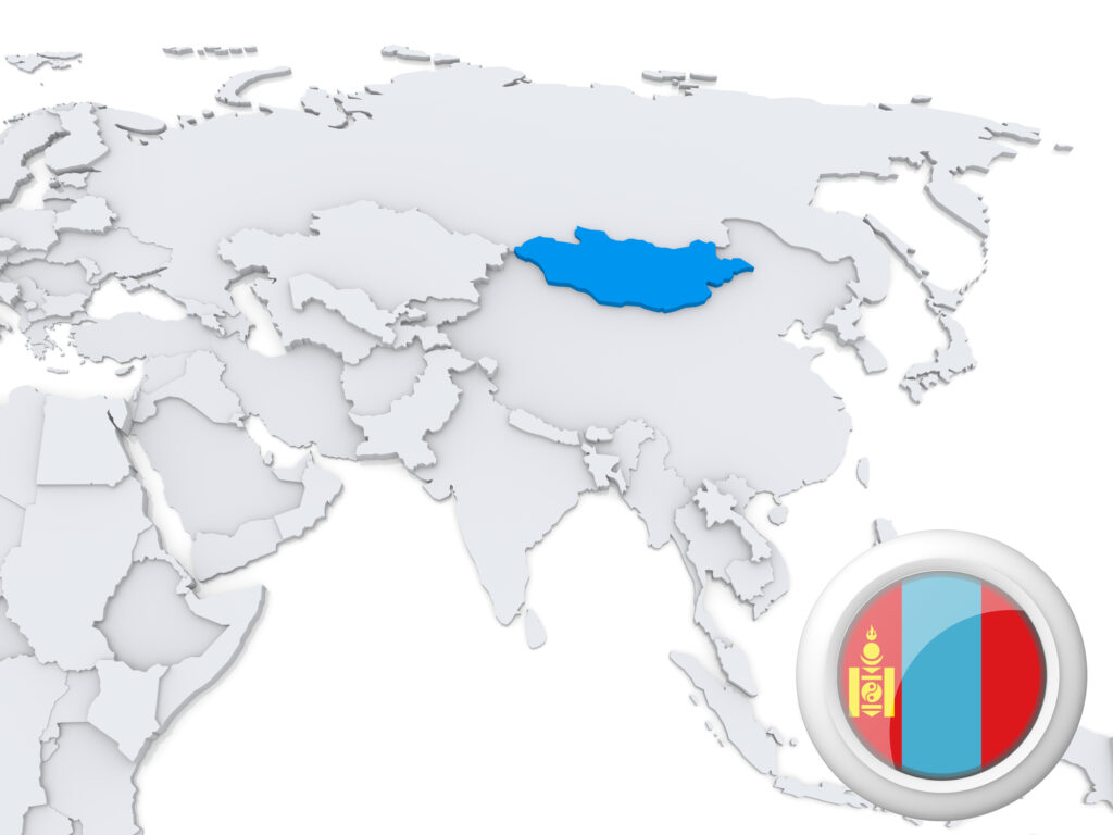
Mongolia is in both Central Asia and East Asia. It shares borders with Russia to the north and east, China to the northeast and southeast, and Kazakhstan to the west.
Mongolia can be divided into three distinct regions.
The Gobi Desert is in Mongolia’s south, which runs into northern China and southern Russia. The steppe is located in central Mongolia and is bound by the Altai Mountains on the west and the Greater Khingan Range on the northeast.
Mongolia on the World Map
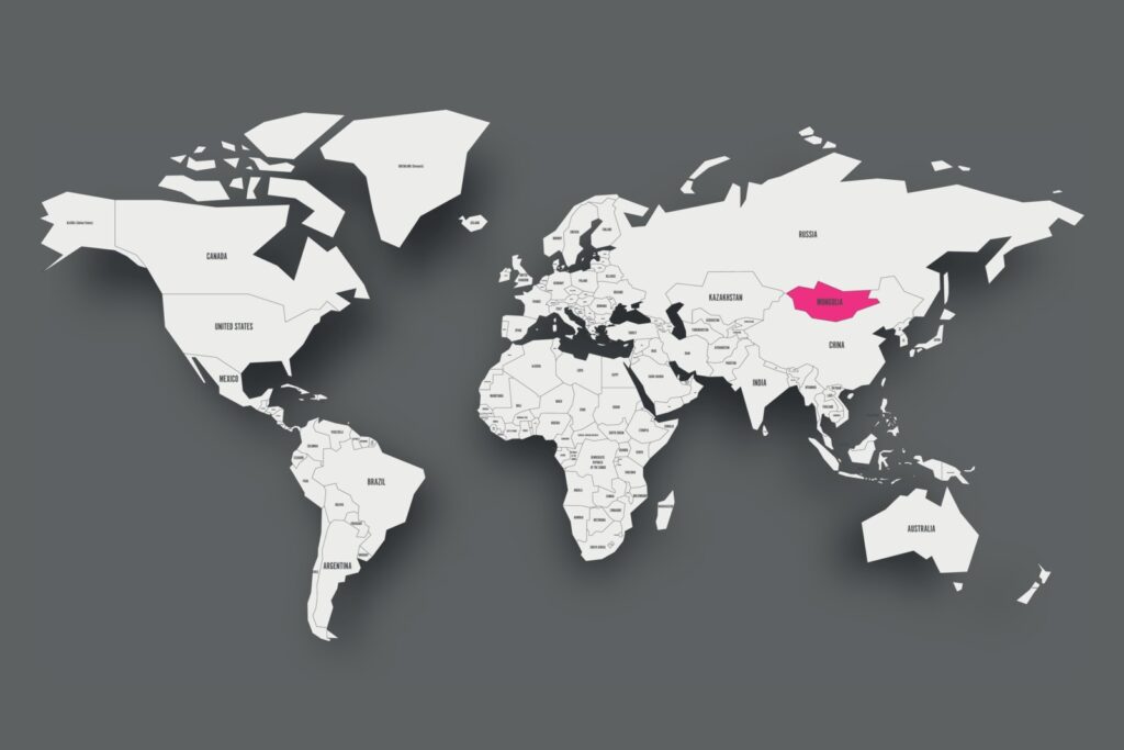
Mongolia’s relations with the world as a whole lie in the context of its ties with China and Russia, as those countries exert considerable influence on Mongolia.
Mongolia is a member of several organizations, including the United Nations, the World Bank, and the International Monetary Fund. It is also a participant in the Shanghai Cooperation Organization, the East Asia Summit, the Conference on Interaction and Confidence-Building Measures in Asia, and the ASEAN Regional Forum.
Mongolia’s GDP (PPP) stands at 13.14 billion, with a per capita GDP of $4000. Its main exports are copper, raw materials, and agricultural products.
Mongolia Provinces Map
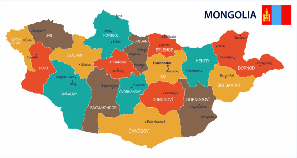
Mongolia divides into 21 provinces and one autonomous prefecture.
Mongolia Provinces
Mongolia Provinces
1. Arkhangai
The Arkhangai aimag is in the country’s interior and borders to the north, south, east, west, and north-west with five other provinces. Agriculture is the primary economic sector here, with animal husbandry coming behind.
2. Bayan-Ölgii
It formed in August 1940 as the nation’s only Muslim and Kazakh-majority aimag. Ölgii is the capital of this province.
3. Bayankhongor
The province received the Outstanding Red Award for meat, wool, and livestock production. It was formed in 1941. The area is diverse and has two mountain ranges. Orog Nuur and Böön Tsagaan Nuur are the biggest lakes in the area.
4. Bulgan
Bulgan is in northern Mongolia and shares a border with Russia. The province has Alpine Forest as well as rivers. You can directly reach this province by way of Bulgan airport.
5. Darkhan-Uul
Darkhan-Uul Is in the northern area of the country. It is also the second-largest industrial section of the country. For farming, there are over 30,000 hectares of soil. Many people keep livestock. This province was settled in 1994.
6. Dornod
Choibalsan Is the capital. This province is the easternmost one in Mongolia. If you fly into this area, you will use the Choibalsan International Airport. Ethnic groups such as the Halh and Buryat are the dominant groups in the region.
7. Dornogovi
This province borders inner Mongolia and is in the Southeast area of the country. It is in the Gobi Desert. As a result, both snow and sand storms are frequent occurrences here.
8. Dundgovi
Mandalgovi Is the capital. This province is in the southern area of Mongolia. Dundgovi Has the second smallest population in the country. It does not have commercial air transportation. Animal husbandry and livestock production form the industry of the local people.
9. Govi-Altai
The Salkhin Sandag NGO is located here and protects the Zavkhan River. The Altai Airport is available for local flights to three cities, such as the capital. This province is in Western Mongolia.
10. Govisümber
Govisümber is in central Mongolia, and the capital is Choir. This province has the smallest population of all of the 21 of them. This province has gone through several name changes since 1911. It received its latest name in 1994.
11. Khentii
This province got its name from the Khentii Mountains. It is also the birthplace of Genghis Khan. It is in the eastern section of the country and borders Russia to the north. The Kherlen and the Onon rivers go through this area.
12. Khovd
The capital city has the same name as the province. Khovd is in the western section of Mongolia, and the Khovd river is here. The culture is very diverse and has more than 17 different ethnicities and nationalities. This area of the country also has very harsh weather.
13. Khövsgöl
The province got its name from Lake Khövsgöl, which happens to be a big tourist attraction. This region also has some of the most extensive forests in the country. In addition to forests, there are also many hills in the area. This province was formed in 1931.
14. Ömnögovi
Ömnögovi is in the southern part of Mongolia and is in the Gobi Desert. It is also the country’s largest province. Copper and gold are abundant here, while agriculture is only a minor part of the economy. The Dalanzadgad Airport has regular flights from the country’s capital.
15. Orkhon
Erdenet is the capital and is in the northern section of the country. Erdenet is a relatively new province formed in 1994 from the Bulgan province.
16. Övörkhangai
The capital is the city of Arvaikheer and is in the southern part of Mongolia. One of the oldest monasteries, the Shankh Monastery, is here. In 2015, the province held its first Special Olympic Games.
17. Selenge
Sükhbaatar is the capital city in the province. Established in 1934, Selenge is in the northern part of Mongolia and has another province within it. Darkhan-Uul is a separate province but is inside of Selenge as an enclave.
18. Sükhbaatar
Baruun-Urt is the capital city of this eastern province. The Baruun-Urt Airport provides flights to the national capital. 1942 was the year the settlement began.
19. Töv
Ulaanbaatar is the capital of Mongolia and is in the center of this province. However, Ulaanbaatar is an independent area. Zuunmod is the capital city of Töv. This province has mountains and rivers. Khalkha Mongols are the dominant ethnic group in Töv .
20. Uvs
Uvs is in the western section of Mongolia and has Ulaangom as its capital. It took its name after the biggest lake in the country. The province shares a border with Russia to the north. Different ethnic groups live here, but the Dörbet are the dominant group.
21. Zavkhan
This province in Western Mongolia gets its name from a river. It connects the Gobi desert with the Khangai mountains. This region is not only one of the coldest parts of Mongolia, but it even has snow in summer. A range of wildlife lives here, such as spotted deer, wolves, wild boars, and more.
22. Ulaanbaatar (Provincial Municipality)
Ulaanbaatar (provincial municipality) is the capital of Mongolia and is located in the north-central part of the country. The city sits at an elevation of 1,300 meters in a valley on the Tuul River.
It is the largest city in Mongolia, with a population of over one million. Ulaanbaatar is divided into 17 districts.
Image Sources and Copyright Information
- Mongolia Location on Map with Flag Pin: © hyotographics/Shutterstock