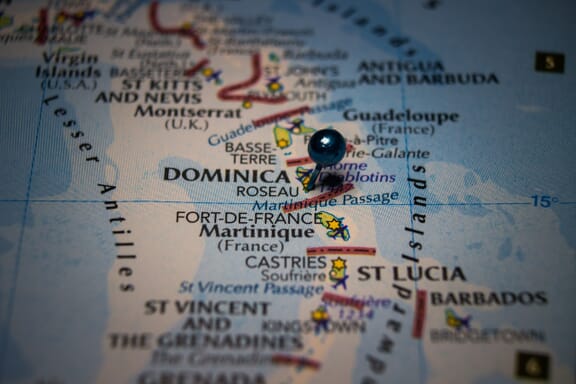
Dominica is located in the Caribbean region at latitude 15.414999 and longitude -61.370976 and is part of the North American continent continent.
The DMS coordinates for the center of the country are:
15° 24' 54.00'' N
61° 22' 15.51'' W
You can see the location of Dominica on the world map below:
Dominica on the World Map
Dominica Neighboring Countries
The country has no neighboring countries/land borders.
Maritime Borders
Dominica borders with the Caribbean Sea.
Dominica Key Facts
| Country | Dominica |
|---|---|
| Coordinates |
Latitude: 15.414999 Longitude: -61.370976 |
| Country Codes |
Alpha 2: DM Alpha 3: DMA |
| Country Flag Emoji | 🇩🇲 |
| Int. Phone Prefix | +1-767 |
| Capital city | Roseau |
| Continent / Subcontinent |
North America Caribbean |
| Country Area | 751 sq km |
| Population 2024 |
66,205 World Rank: 199 |
| Median Age | 31.6 |
| Life expectancy | 71.1 |
| Major languages | English (official), French patois |
| UTC/GMT Time |
Number of time zones: 1
|
| Internet TLD | .dm |
| Biggest Airport | Douglas–Charles Airport (DOM) |
| Average temperature |
22.35 °C 72.23 °F |
| Administrative Divisions | 10 parishes |
| Political system | Parliamentary democracy |
Dominica Economy Facts
| World Bank Income Group | Upper middle income |
|---|---|
| World Bank Region | Latin America & Caribbean |
| Currency | Eastern Caribbean Dollar (XCD) |
| GDP in 2020 |
$0.5 (billions of USD) World Rank: 203 |
| GDP per capita in 2020 |
$10,405 World Rank: 100 |
| Major Industries / Economic Sectors | Agriculture, tourism, manufacturing, energy |
| Top 5 Import Countries | United States, China, Canada, Mexico, Brazil |
| Top 5 Export Countries | United States, China, Canada, United Kingdom, Venezuela |
Biggest Cities in Dominica
Here are the largest cities in Dominica based on 2021 data:
| City | Population |
|---|---|
| Roseau | 16,582 |