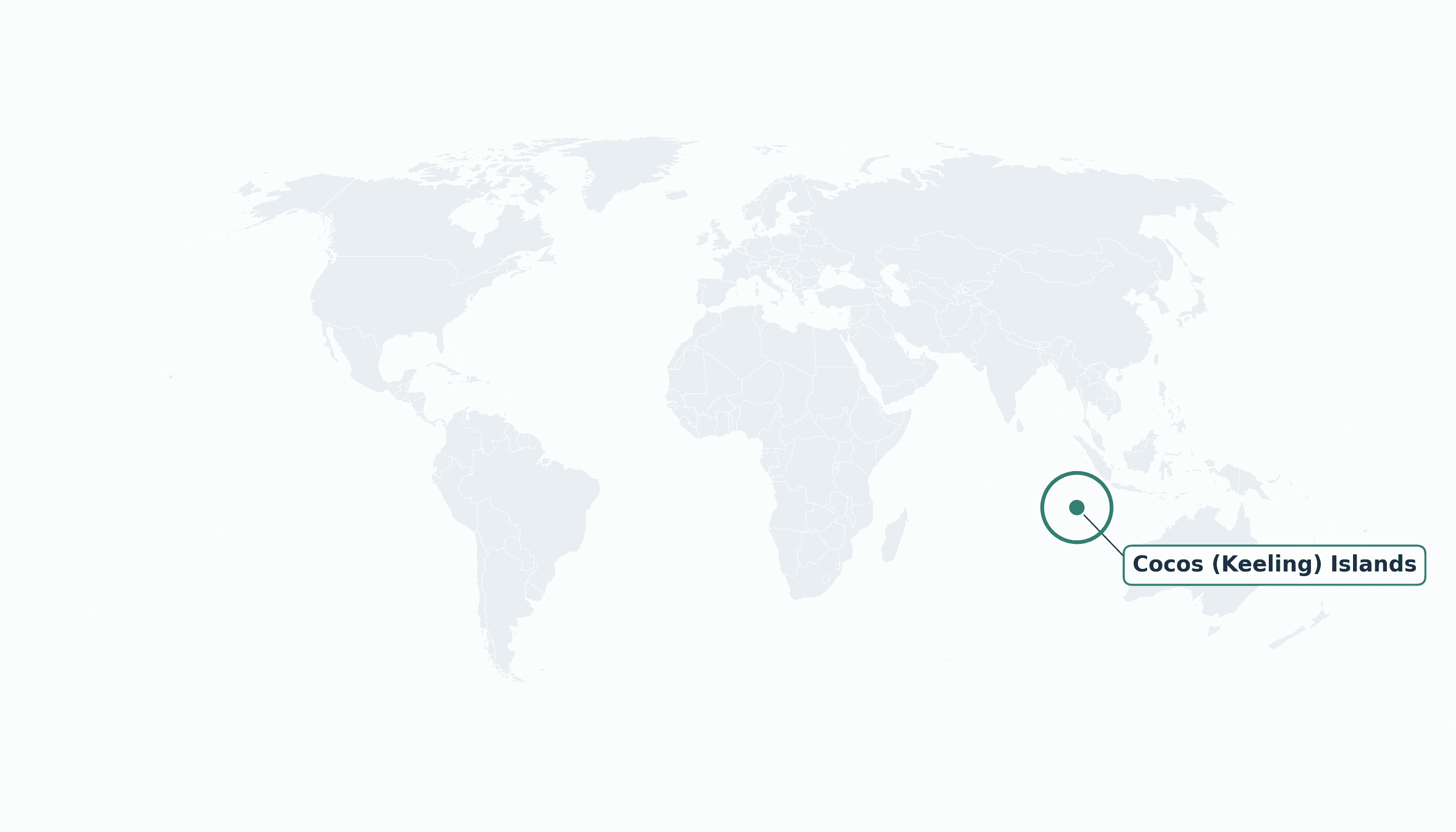
Cocos (Keeling) Islands is located in the South-Eastern Asia region at latitude -12.1642 and longitude 96.871 and is part of the Asian continent.
The DMS coordinates for the center of the country are:
- 12° 9' 51'' S
- 96° 52' 16'' E
You can see the location of Cocos (Keeling) Islands on the world map below:
Maritime Borders
The Cocos (Keeling) Islands have no land borders; they are a remote pair of coral atolls in the Indian Ocean southwest of Christmas Island.
Cocos (Keeling) Islands Key Facts
| Country | Cocos (Keeling) Islands |
| Coordinates | Latitude: -12.1642 Longitude: 96.871 |
| Country Codes | Alpha 2: CC Alpha 3: CCK |
| Country Flag Emoji | 🇨🇨 |
| Int. Phone Prefix | +61 |
| Capital city | West Island |
| Continent Subcontinent | Asia South-Eastern Asia |
| Country Area | 14 sq km |
| Population 2023 | 600 World Rank: 218 |
| Median Age | 40 |
| Life expectancy | 80.0 |
| Major languages | Malay (Cocos), English |
| UTC/GMT Time | Number of time zones: 1
|
| Internet TLD | .cc |
| Biggest Airport | Cocos (Keeling) Islands Airport (CCK) |
| Average temperature | 27 °C 81 °F |
| Administrative Divisions | No first-order divisions (2 inhabited islands) |
| Political system | External territory of Australia |
Cocos (Keeling) Islands Economy Facts
| World Bank Income Group | High income |
| World Bank Region | East Asia & Pacific |
| Currency | Australian dollar (AUD) |
| GDP in 2023 | $0.01 (billions of USD) World Rank: 215 |
| GDP per capita in 2023 | $18,000 World Rank: 79 |
| Major Industries / Economic Sectors | Tourism, copra, coconut products |
| Top 5 Import Countries | Australia |
| Top 5 Export Countries | Copra |
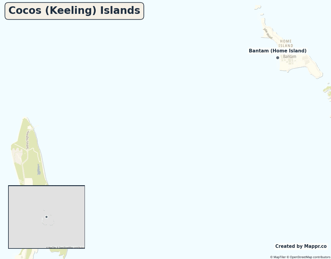
Biggest Cities in Cocos (Keeling) Islands
Here are the largest cities in Cocos (Keeling) Islands based on data:
| City | Population |
|---|
| West Island | 130 | Bantam (Home Island) | 450 |
Map of Cocos (Keeling) Islands with the Largest Cities
Other Countries in the South-Eastern Asia Region
Geography
The Cocos (Keeling) Islands are two flat coral atolls — 27 tiny islands in all — in the remote eastern Indian Ocean, about 900 kilometres southwest of Christmas Island. Only two islands are inhabited: West Island and Home Island.
Home Island’s community descends from Malay workers brought in the 19th century, while West Island holds the airstrip and most services.
Are the Cocos (Keeling) Islands a country?
The Cocos (Keeling) Islands are an external territory of Australia, governed under Australian law in the middle of the Indian Ocean.
| Status | External territory of Australia |
| Sovereign state | Australia |
| Capital | West Island |
| Population | 600 |
| Area | 14 km² |
| Currency | Australian dollar (AUD) |
| Official language(s) | Malay (Cocos), English |
| ISO 3166 code | CC / CCK |
| Calling code | +61 |
| Internet TLD | .cc |
Climate
The Cocos Islands have a warm, pleasant tropical climate averaging about 27°C (81°F), with steady trade winds and a wetter season early in the year.
Economy
With barely 600 residents, the economy is tiny — tourism, copra and coconut products — and depends heavily on Australian government services and supply flights.
Cocos (Keeling) Islands in its region
The atolls lie in the eastern Indian Ocean, southwest of their sister Australian territory, Christmas Island, and south of Indonesia.

Administrative divisions
The Cocos (Keeling) Islands have no first-order subdivisions; the population lives on West Island (the administrative centre) and Home Island.


