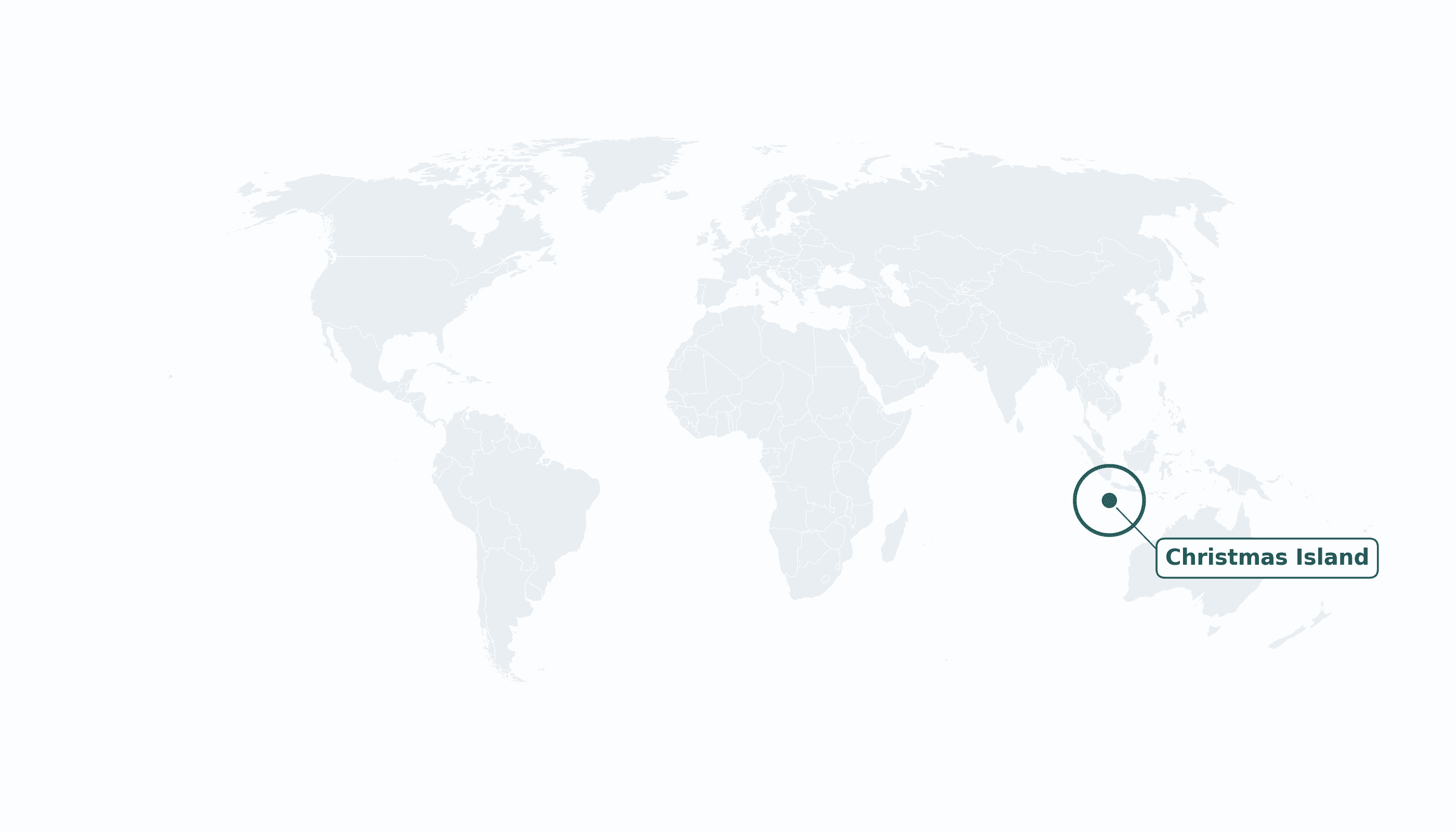
Christmas Island is located in the South-Eastern Asia region at latitude -10.4475 and longitude 105.6904 and is part of the Asian continent.
The DMS coordinates for the center of the country are:
- 10° 26' 51'' S
- 105° 41' 25'' E
You can see the location of Christmas Island on the world map below:
Maritime Borders
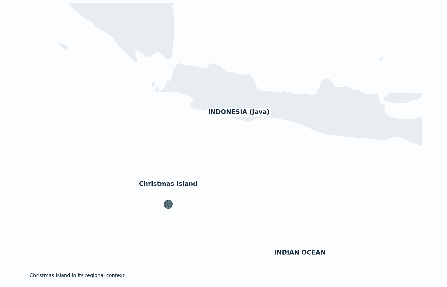
Christmas Island has no land borders; it lies in the Indian Ocean about 350 km south of the Indonesian island of Java.
Christmas Island Key Facts
| Country | Christmas Island |
| Coordinates | Latitude: -10.4475 Longitude: 105.6904 |
| Country Codes | Alpha 2: CX Alpha 3: CXR |
| Country Flag Emoji | 🇨🇽 |
| Int. Phone Prefix | +61 |
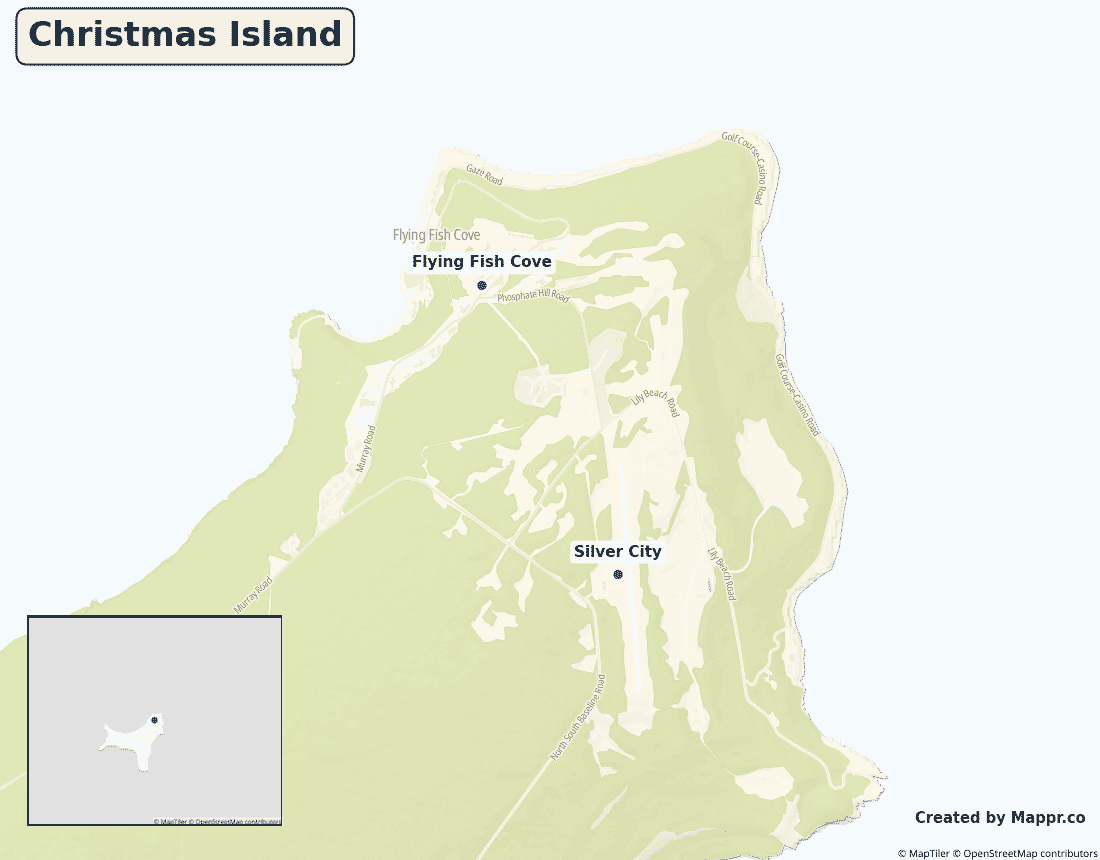
| Capital city | Flying Fish Cove (The Settlement) |
| Continent Subcontinent | Asia South-Eastern Asia |
| Country Area | 135 sq km |
| Population 2023 | 1,692 World Rank: 218 |
| Median Age | 43 |
| Life expectancy | 82.0 |
| Major languages | English, Chinese, Malay |
| UTC/GMT Time | Number of time zones: 1
|
| Internet TLD | .cx |
| Biggest Airport | Christmas Island Airport (XCH) |
| Average temperature | 27 °C 81 °F |
| Administrative Divisions | No first-order divisions |
| Political system | External territory of Australia |
Christmas Island Economy Facts
| World Bank Income Group | High income |
| World Bank Region | East Asia & Pacific |
| Currency | Australian dollar (AUD) |
| GDP in 2023 | $0.05 (billions of USD) World Rank: 215 |
| GDP per capita in 2023 | $30,000 World Rank: 54 |
| Major Industries / Economic Sectors | Phosphate mining, tourism, immigration detention centre |
| Top 5 Import Countries | Australia, Singapore |
| Top 5 Export Countries | Phosphate (to Asia, Australia) |
Biggest Cities in Christmas Island
Here are the largest cities in Christmas Island based on data:
| City | Population |
|---|
| Flying Fish Cove | 600 | Silver City | 400 |
Map of Christmas Island with the Largest Cities
Other Countries in the South-Eastern Asia Region
Geography
Christmas Island is a small Australian territory in the Indian Ocean, lying about 350 kilometres south of Java in Indonesia — far closer to Asia than to Australia, some 1,500 kilometres away. Most of the rugged, jungle-clad island is a national park.
It is world-famous for its annual mass migration of tens of millions of red crabs.
Is Christmas Island a country?
Christmas Island is an external territory of Australia, administered under Australian law despite sitting just off the coast of Indonesia.
| Status | External territory of Australia |
| Sovereign state | Australia |
| Capital | Flying Fish Cove (The Settlement) |
| Population | 1,692 |
| Area | 135 km² |
| Currency | Australian dollar (AUD) |
| Official language(s) | English, Chinese, Malay |
| ISO 3166 code | CX / CXR |
| Calling code | +61 |
| Internet TLD | .cx |
Climate
Christmas Island has a hot, humid tropical climate averaging about 27°C (81°F), with a wet monsoon season from roughly November to April.
Economy
The island’s economy rests on phosphate mining — its historic mainstay — plus tourism drawn by its wildlife and, for years, a large immigration detention centre funded by Australia.
Christmas Island in its region
Christmas Island lies in the eastern Indian Ocean, south of Indonesia‘s Java, with the Cocos (Keeling) Islands its nearest fellow Australian territory to the west.
Administrative divisions
Christmas Island has no first-order subdivisions; most people live around Flying Fish Cove (The Settlement) on the northeast coast.


