The surface area of the world is 510,072,000 square kilometers (196,939,900 square miles), and about 71% of this area is water. The remaining 150 million square kilometers of surface area on the Earth consists of land, and the ten largest countries in the world are so big that they cover almost 50% of it.
In this post, we’ll look at the 30 biggest countries in the world and learn some basic facts about each of them. The table below lists these 30 giant countries by their total areas.
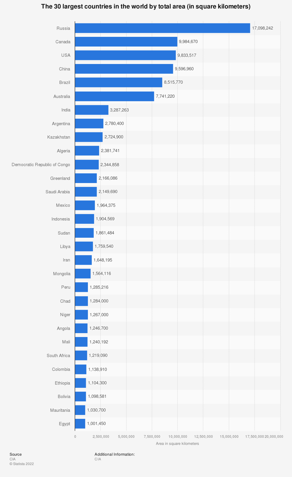
1. Russia
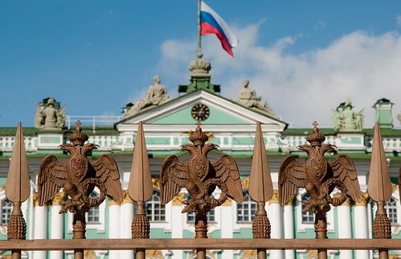
Total Area: 17,098,246 km2 (6,601,670 mi2)
Population: 143,400,000
Capital: Moscow
Russia is the biggest country in the world by a long shot. With a total area of over 17 million square kilometers, it’s almost twice as big as the second-largest country in the world. Given its size, it might not be surprising that Russia’s land spreads across two continents: Europe and Asia. Of Russia’s total area, 4.21% is water, and the rest is land.
In addition to existing on two continents, Russia’s territory spans eleven time zones, shares land borders with fourteen foreign countries, and covers an eighth of all inhabitable land on the planet.
2. Canada
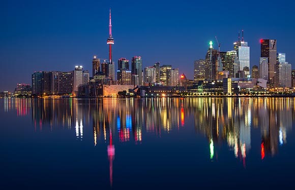
Total Area: 9,984,670 km2 (3,855,100 mi2)
Population: 38,200,000
Capital: Ottowa
Canada is the second largest country in the world and the largest in the Americas. The total surface area of Canada is 9,984,670 km2. The terrestrial area is 9.093.507 km2 and the water area is 891.163 km2. Canada’s water area is 8,93% of the total area of the country.
Canada is the second largest country in the world and the largest in the Americas, with a total area of just under 10 million square kilometers. Of this area, almost 9% is water. This country also has the longest coastline of any country in the world.
3. The United States of America
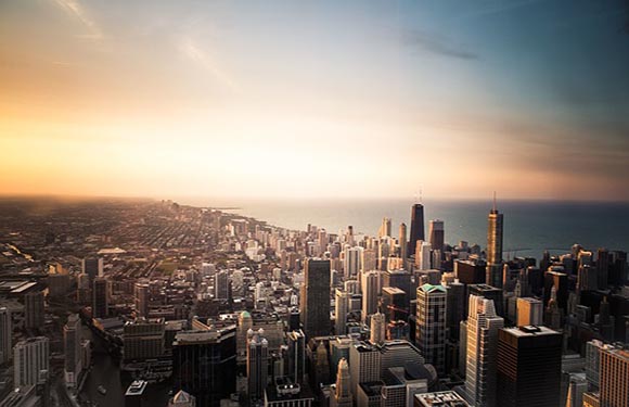
Total Area: 9,833,517 km2 (3,796,742 mi2)
Population: 331,900,000
Capital: Washington D.C.
The USA is third on this list of largest countries in the world with an area of about 9.6 million square kilometers. The country’s territory is spread between the contiguous 48 states as well as Alaska, located on the northwesternmost corner of North America and separated from the rest of the USA by Canada, and Hawaii, an island in the middle of the Pacific Ocean.
It’s generally agreed that North America has been inhabited for around 12,000 years, long before the arrival of European explorers and colonists. The USA gained independence from Britain in the year 1776.
4. China
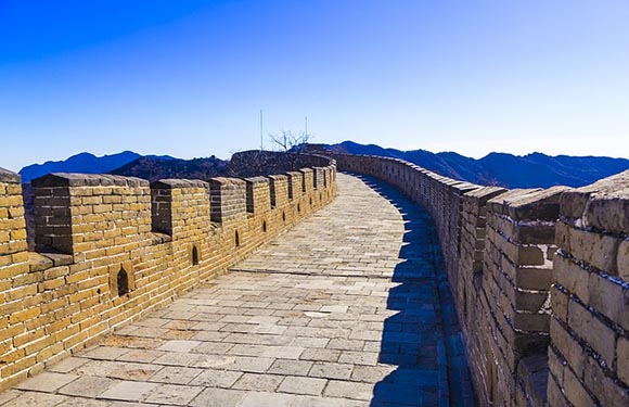
Total Area: 9,596,961 km2 (3,705,407 mi2)
Population: 1,412,400,000
Capital: Beijing
The fourth largest country in the world is China. It is the largest country in Asia, and less than 1.5% of its territory area is made up of water. China is famous for its ancient culture, being the country with the biggest population in the world, and being a major economic power. Bordering 14 other nations, it ties Russia for sharing the most land borders with other countries.
Tracing origins back to a cradle of civilization, China has been inhabited for thousands of years; its legacy of dynasties has influenced and contributed greatly to the region’s countries and cultures.
5. Brazil
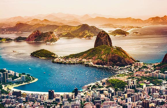
Total Area: 8,515,767 km2 (3,287,956 mi2)
Population: 214,000,000
Capital: Brasília
Brazil is the largest country in South America and the fifth largest in the world. As the largest country in South America, it occupies more than 47% of the continent’s total land area and borders every country on the continent except for Ecuador and Chile.
Due to high levels of immigration for over a century, Brazil has one of the most diverse populations in the world. It’s also the largest country to use Portuguese as an official language. Brazil is made up of 26 Brazilian states and one federal district; the most populous city in the country is São Paulo.
6. Australia
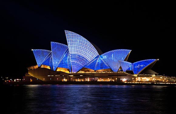
Total Area: 7,692,024 km2 (2,969,907 mi2)
Population: 25,700,000
Capital: Canberra
The largest country in Oceania and the largest that exists entirely in the Southern Hemisphere, Australia is also the largest country to not share land borders with any other country and the only one that is coterminous with a continent. Australia is the sixth largest country in the world.
The first people to inhabit Australia are thought to have migrated from Southeast Asia some 65,000 years ago. They colonized the country and developed hundreds of distinct languages before European settlers first arrived in the early 17th century. Australia has been independent from Britain since 1901.
7. India
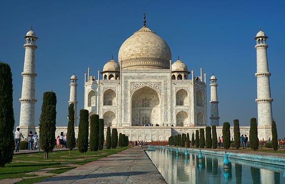
Total Area: 3,287,263 km2 (1,269,219 mi2)
Population: 1,393,400,000
Capital: New Delhi
On the Asian continent, India is the second largest country. On a global scale, it’s the seventh largest by total area. In terms of people, India is the second most populous country in the world, trailing only China, though it is expected to surpass China’s population soon.
About 10% of India’s territory is water, and the country’s topography is diverse. The Himalayan Mountain Range occupies sections of the northern part of the country, and monsoons and hot weather are common throughout. The capital of India is New Delhi, a municipality inside the country’s National Capital Territory.
8. Argentina

Total Area: 2,780,400 km2 (1,073,500 mi2)
Population: 45,800,000
Capital: Buenos Aires
The eighth largest country in the world is Argentina, which is the second biggest country in South America. The country is very long from north to south and shares the majority of the continent’s Southern Cone with Chile. It extends into Patagonia in the south and is traversed by the Andes Mountain Range.
in addition to its land on the South American continent, Argentina claims territory in part of Antarctica, the Falkland Islands, and South Georgia, and the South Sandwich Islands. Over 60% of the country’s population has full or partial Italian ancestry.
9. Kazakhstan
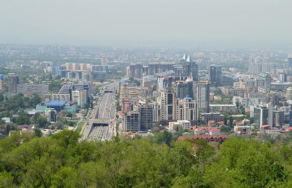
Total Area: 2,724,900 km2 (1,052,100 mi2)
Population: 19,000,000
Capital: Astana
Kazakhstan is the largest country in the world without an ocean coast and the ninth largest overall. It is located in Central Asia and a small section of Eastern Europe, bordering Russia, China, Kyrgyzstan, Uzbekistan, Turkmenistan, and the Caspian Sea.
The largest and most populous city in Kazakhstan is Almaty, which was the capital of the country until 1997. Kazakhstan is the largest and most economically and politically powerful nation in Central Asia. It was a part of the Soviet Union and was the last nation to declare independence from the union. The country has one of the lowest population densities of any nation at just 6 people per square kilometer.
10. Algeria
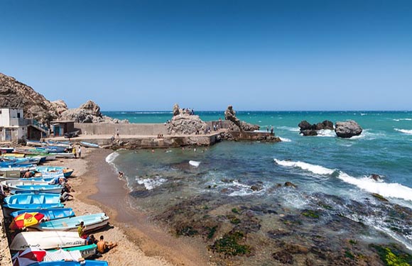
Total Area: 2,381,741 km2 (919,595 mi2)
Population: 44,600,000
Capital: Algiers
Located in the north of Africa and occupying Mediterranean coastline as well as a large portion of the Saharan desert is Algeria, the largest country in Africa. Algeria is the tenth largest country in the world. The fertile northern portion of the country is where the vast majority of the population lives, as the south is dominated by the Sahara Desert.
most of Algeria’s population is Arab-Berber and practices Islam. The official languages of the country are Arabic and Berber, and Algerian Arabic is the most spoken language. The French language is also used in some administrative and educational contexts.
11. The Democratic Republic of the Congo

Total Area: 2,344,858 km2 (905,355 mi2)
Population: 92,400,000
Capital: Kinshasa
Formerly known as Zaire, the Democratic Republic of the Congo (DRC) is the second largest country in Africa. It’s located in the middle of the continent and has a small length of coastline on the Atlantic Ocean. The country’s official language is French, which makes it the most populous officially French-speaking country in the world.
The DRC is located on the equator and experiences large amounts of rainfall each year, which supports the massive Congo Rainforest. The country also has the highest frequency of thunderstorms of anywhere in the world.
12. Greenland

Total Area: 2,166,086 km2 (836,330 mi2)
Population: 56,000
Capital: Nuuk
Technically a part of the Kingdom of Denmark, Greenland is the world’s largest island country, and it’s located between the Arctic and Atlantic oceans. Greenland is number 12 on this list of largest countries in the world, and it’s got the lowest population density of any territory in the world. The bulk of the population lives on the southwest coast of the country, as three-quarters of the island is covered by a permanent ice sheet.
13. Saudi Arabia

Total Area: 2,149,690 km2 (830,000 mi2)
Population: 35,300,000
Capital: Riyadh
Saudi Arabia is the fifth-largest country in Asia and the largest in West Asia. It is located on the Arabian Peninsula and is the second-largest country in the Arab world. The country is bordered by Israel, Jordan, Iraq, Kuwait, Qatar, the United Arab Emirates, Oman, and Yemen, as well as the Persian Gulf and the Red Sea.
The capital city of Saudi Arabia is Riyadh, and the country is also home to two of the holiest cities in Islam: Mecca and Medina.
14. Mexico

Total Area: 1,964,375 km2 (758,449 mi2)
Population: 130,300,000
Capital: Mexico City
Mexico is a country located in the southern region of North America, just south of the United States. There are 32 states that make up Mexico, and it is the country with the largest Spanish-speaking population in the world. Mexico has more UNESCO World Heritage Sites than any other country in the Americas.
The capital of Mexico is Mexico City, which is the most populous city in North America and the oldest capital city in the Americas. The population of its greater metro area is over 20 million, which makes it the sixth-largest metropolitan area in the world.
15. Indonesia

Total Area: 1,904,569 km2 (735,358 mi2)
Population: 276,400,000
Capital: Jakarta
Indonesia is a country made up of more than 17,000 islands in Southeast Asia and Oceania. It lies between the Indian Ocean and the Pacific Ocean. The capital of Indonesia is Jakarta, which is located on the northwest coast of Java, the most populous island in the world. This island is also home to more than half of Indonesia’s population.
Tourism in the country is a major contributor to the economy, as there are many reasons to visit Indonesia. The main attractions for tourists are related to the nature and culture found in the country.
16. Sudan

Total Area: 1,861,484 km2 (718,723 mi2)
Population: 44,900,000
Capital: Khartoum
Sudan is a large country in Northeast Africa that shares land borders with Egypt, Libya, Chad, the Central African Republic, South Sudan, Ethiopia, and Eritrea. It also borders the Red Sea along its northeastern border. Now the third-largest country in Africa by area, Sudan was once Africa’s largest country until the secession of South Sudan in 2011.
Some of the most striking sights in Sudan are the Nubian Pyramids, which were constructed during the period from 800 BCE to 100 BC.
17. Libya

Total Area: 1,759,540 km2 (679,360 mi2)
Population: 7,000,000
Capital: Tripoli
Libya is the fourth African country on this list, as it is the fourth largest on the continent. It is located in the Maghreb Region of Northern Africa and borders the Mediterranean Sea as well as six other countries. The capital city of Libya is Tripoli, which was founded in the 7th century BCE and is home to many important archeological sites.
The coastal plains of present-day Libya have been inhabited since as early as 8000 BCE. The area was colonized by Italy in the early 20th century, and Libya gained independence from Italy in 1947, after World War II.
18. Iran

Total Area: 1,648,195 km2 (636,372 mi2)
Population: 85,000,000
Capital: Tehran
Iran is a country in Western Asia that borders the Caspian Sea to its north and the Persian Gulf and the Gulf of Oman to the south. It also borders seven foreign countries. Iran is the second largest country in Western Asia after Saudi Arabia, and its capital and largest city is Tehran.
The history of Iran is rich, as the land has been inhabited for thousands of years. There are 26 UNESCO World Heritage Sites in this country, and there are many reasons to visit Iran when the country is politically stable.
19. Mongolia

Total Area: 1,564,110 km2 (603,910 mi2)
Population: 3,300,000
Capital: Ulaanbaatar
At just over 1.5 million square kilometers, this is the 19th largest country in the world. Mongolia is located in East Asia and has no sea borders. The only two countries it borders are Russia to the north and China to the south, both countries in the top five biggest in the world. Mongolia is sparsely populated, with just around 3.3 million people living in the country, about half of which live in the capital, Ulaanbaatar.
The Mongol Empire was founded by Genghis Khan in 1206, and modern Mongolia achieved independence from China in 1921.
20. Peru

Total Area: 1,285,216 km2 (496,225 mi2)
Population: 33,400,000
Capital: Lima
Peru is a South American country located on the continent’s west coast. It borders Ecuador, Colombia, Brazil, Bolivia, and Chile. This is the third largest country in South America, and it is considered a megadiverse country — its habitats include the vast Andes mountain range, the Amazon Rainforest, and arid plains along its Pacific coast.
There are many reasons to visit Peru, and tourism is a major contributor to the country’s economy. A construction of the Incas, Machu Picchu, is one of the most famous cultural and touristic sites in the world.
21. Chad

Total Area: 1,284,000 km2 (496,000 mi2)
Population: 16,900,000
Capital: N’Djamena
Chad is a landlocked country between North and Central Africa. The country is named after Africa’s second-largest wetland, Lake Chad. Diverse both geographically and demographically, Chad is home to a variety of regions as well as ethnic and linguistic groups.
Some of the regions that make up Chad are its Saharan Desert zone in the north, the arid Sahelian Belt that runs through the center of the country, and the fertile Sudanian savannah further to the south. There are more than 200 ethnic and linguistic groups in the country, though the official languages are French and English.
22. Niger
https://www.shutterstock.com/es/image-photo/scenic-landscape-view-zuma-rock-niger-1880167714
Total Area: 1,267,000 km2 (489,000 mi2)
Population: 25,100,000
Capital: Niamey
Niger is a country in Western Africa, just to the west of Chad. It’s bordered by seven other countries and has no coastline. The majority of Niger’s territory is Saharan Desert and uninhabited. The majority of the population is Muslim and lives in the south and western regions of the country.
The economy of Niger is largely centered on subsistence agriculture, and it faces economic challenges due to its landlocked position, desert terrain, and overpopulation.
23. Angola
, Angola")
Total Area: 1,246,700 km2 (481,400 mi2)
Population: 33,900,000
Capital: Luanda
Angola is the seventh biggest country in Africa and the second largest Portuguese-speaking country in the world behind only Brazil. It’s located on the west coast of Southern Africa and borders four other countries. There is an Angolan enclave province that borders both the Democratic Republic of the Congo and the Republic of the Congo.
Angola gained independence from Portugal in 1975 after a long anti-colonial struggle. The largest ethnic group in the country is the Ovimbundu, who make up about 37% of the population.
24. Mali

Total Area: 1,240,192 km2 (478,841 mi2)
Population: 20,900,000
Capital: Bamako
Mali is a landlocked country in Western Africa whose territory is mostly covered by the Saharan Desert. The country has a very young population — around 67% of its population is estimated to be under the age of 25 by the CIA World Factbook.
The capital of Mali is Bamako, which is in the southern region of the country in the Sudanian savannah. This region is where the bulk of Mali’s population lives.
25. South Africa

Total Area: 1,221,037 km2 (471,445 mi2)
Population: 60,000,000
Capitals: Cape Town, Pretoria, and Bloemfontein
South Africa is located in the southernmost region of Africa and extends into the South Atlantic and Indian Oceans. It completely enclaves the nation of Lesotho and borders five other countries along its northern border. The country is made up of nine provinces, and it is unique in that it has three capital cities: Pretoria, Bloemfontein, and Cape Town.
26. Colombia

Total Area: 1,141,748 km2 (440,831 mi2)
Population: 51,300,000
Capital: Bogotá
Colombia is located in the northern region of South America and is connected to Central America by its northwestern border with Panama. Inhabited by indigenous peoples since at least 12,000 BCE, the country now has a diverse cultural heritage that reflects its history of indigenous Amerindians, European settlers, and enslaved Africans, among other immigrants.
27. Ethiopia

Total Area: 1,104,300 km2 (426,400 mi2)
Population: 117,900,000
Capital: Addis Ababa
Located in the Horn of Africa and without any ocean coastline, Ethiopia is the 27th largest country in the world and the second most populous in Africa. There are over 80 ethnic groups living in Ethiopia, making it a multi-ethnic state, and Christianity is the most widely practiced faith in the country.
Tourism in Ethiopia is one of its leading economic industries. The biodiversity, national parks, and UNESCO World Heritage Sites are the main tourist attractions.
28. Bolivia

Total Area: 1,098,581 km2 (424,164 mi2)
Population: 11,800,000
Capital: La Paz
Bolivia is a landlocked country in South America that borders Peru, Brazil, Paraguay, Argentina, and Chile. It is the seventh-largest landlocked country and the 28th-largest overall in the world. The geography of Bolivia varies greatly, from the tall peaks of the Andes mountain range that covers one-third of the country to the Eastern Lowlands in the Amazon Basin.
29. Mauritania

Total Area: 1,030,700 km2 (398,000 mi2)
Population: 4,800,000
Capital: Nouakchott
Located in Northwest Africa, Mauritania is a sovereign state situated between the Atlantic Ocean and the Sahara Desert. 90% of the country is located within the Sahara, and most of the country’s population lives in the temperate southern region of the country. The capital of Mauritania is Nouakchott, located on the Atlantic coast.
30. Egypt

Total Area: 1,002,450 km2 (387,050 mi2)
Population: 104,300,000
Capital: Cairo
Egypt is number 30 on this list of the biggest countries in the world. It’s an African country located in Northeastern Africa with a coastline on both the Mediterranean and Red Seas. Egypt has an exceptionally long history of civilizations that have called the region of the Nile Delta home. The capital and largest city in Egypt is Cairo, which was founded in 641 CE.
And at the other end of the scale, see our map of the world’s smallest countries.