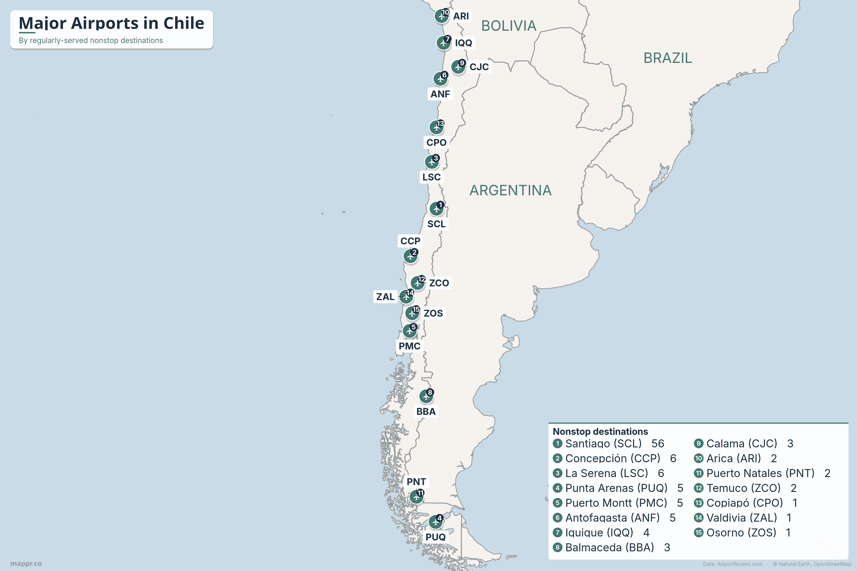
Key Takeaways
- Santiago towers over everything. Comodoro Arturo Merino Benítez International (SCL) reaches around 56 regularly-served nonstop destinations — more than every other Chilean airport combined. It is the home hub of LATAM, Latin America's largest airline group, and Chile's only long-haul and US gateway.
- A 4,300 km ribbon of airports. Chile is one of the world's longest, thinnest countries, and its airports are strung down the Pacific coast — from the Atacama Desert mining cities in the north, through the central core, to the Lakes District and Patagonian fjords in the deep south. Almost all of it is domestic flying fanning out from Santiago.
- Easter Island has the world's most remote airport. Mataveri Airport (IPC) sits about 3,500 km out in the Pacific, the most isolated commercial airport on Earth. LATAM is the only airline, flying the lifeline route from Santiago plus the lone international hop to Tahiti — on a runway NASA once lengthened as a Space Shuttle emergency landing site.
- The far south is a Patagonia and Antarctic gateway. Punta Arenas (PUQ) is the launch point for Chilean Antarctic logistics and even hosts a once-weekly link to the Falkland Islands, while Puerto Natales (PNT) is the closest airport to the Torres del Paine wilderness.
- We rank by regularly-served routes. Outside Santiago, Chile's airports are close in size and almost entirely domestic. Ranking by regularly-served destinations — routes flown often enough to count as scheduled service — gives a truer picture than raw nonstop totals, which can overstate fields with occasional seasonal flights.
Chile is one of the most geographically extreme countries on Earth — a ribbon of land more than 4,300 km long but, on average, barely 180 km wide, pinned between the Andes and the Pacific. Its airport network mirrors that shape: a long north–south chain of fields running from the Atacama Desert down to the fjords and glaciers of Patagonia, almost all of them connected to a single dominant hub in Santiago.
Santiago’s Comodoro Arturo Merino Benítez International Airport (SCL) overshadows everything else, handling almost all of Chile’s international traffic and serving as the global headquarters and main base of LATAM, the largest airline group in Latin America. Domestically, LATAM competes with two Santiago-based low-cost carriers, Sky Airline and JetSMART, which between them fly most of the spokes to the country’s regional cities.
Below we map and rank Chile’s airports by the number of nonstop destinations each one serves, drawn from live route data on AirportRoutes. We rank by regularly-served destinations — routes flown often enough to count as scheduled service — rather than raw nonstop totals, which can overstate airports with occasional seasonal flying. The figures come from observed flight data (a sample rather than a complete published timetable), so treat them as a guide to relative connectivity, not official totals.
Which Chilean airports have direct flights to the US?
In Chile, the answer is simple: only Santiago. Comodoro Arturo Merino Benítez (SCL) is the country’s sole nonstop gateway to the United States, with service to Miami, New York, Los Angeles, Atlanta, Dallas-Fort Worth and Houston on LATAM, American, Delta and United. Chile is also the only South American country in the US Visa Waiver Program, which helps sustain a busy travel market between the two countries.
No other Chilean airport flies nonstop to the US. From the regional cities, travellers reach North America with a connection in Santiago, or via hubs such as Lima, Bogotá, Panama City (Copa) or São Paulo. The handful of other international routes from Chile’s regions are short cross-border hops — Antofagasta and Iquique to Peru and Bolivia, and Easter Island onward to Tahiti.
Ranked
Major Airports in Chile by Nonstop Destinations
Ranked by regularly-served nonstop destinations, busiest first.
| Airport | IATA | Nonstop | Region |
|---|---|---|---|
| 1. Santiago | SCL | 56 | Capital (central Chile) |
| 2. Concepción | CCP | 6 | Biobío (south-central) |
| 3. La Serena | LSC | 6 | Coquimbo (Norte Chico) |
| 4. Punta Arenas | PUQ | 5 | Magallanes (Patagonia) |
| 5. Puerto Montt | PMC | 5 | Los Lagos (Lakes District) |
| 6. Antofagasta | ANF | 5 | Antofagasta (mining north) |
| 7. Iquique | IQQ | 4 | Tarapacá (far north) |
| 8. Balmaceda | BBA | 3 | Aysén (Coyhaique) |
| 9. Calama | CJC | 3 | Atacama (mining/desert) |
| 10. Arica | ARI | 2 | Arica (Peru border) |
| 11. Puerto Natales | PNT | 2 | Magallanes (Torres del Paine) |
| 12. Temuco | ZCO | 2 | La Araucanía |
| 13. Copiapó | CPO | 1 | Atacama (Norte Chico) |
| 14. Valdivia | ZAL | 1 | Los Ríos |
| 15. Osorno | ZOS | 1 | Los Lagos |
| ★ Easter Island | IPC | 1* | Pacific (3,500 km out) |
A closer look at Chile’s main airports
🛫 Santiago (SCL)
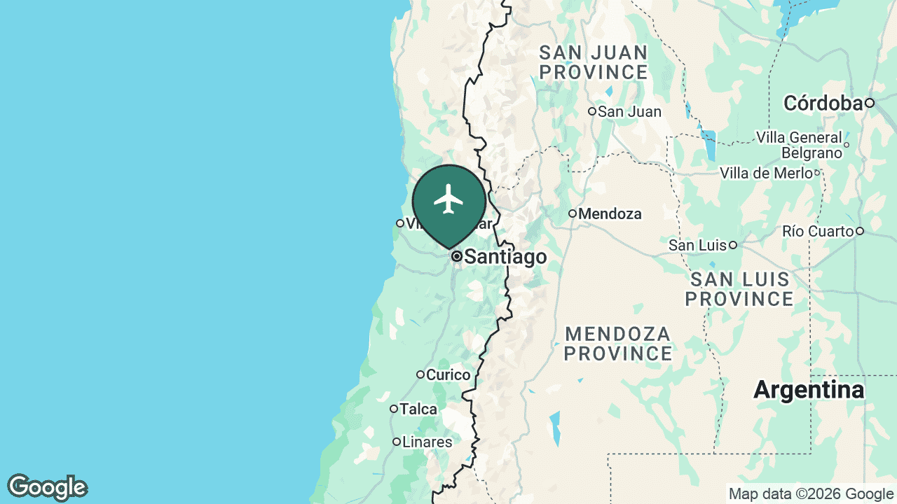
Comodoro Arturo Merino Benítez International Airport — universally known as Santiago or Pudahuel — sits about 15 km northwest of the capital and is, by a wide margin, the busiest airport in Chile. It is the global headquarters and main hub of LATAM Airlines Group, the largest carrier in Latin America, and the country’s only intercontinental gateway.
Santiago reaches around 56 regularly-served nonstop destinations, blending a dense domestic network down the length of Chile with routes across South America and long-haul links to North America, Europe and Oceania (including the gateway flight to Easter Island and onward to Tahiti). A major new international terminal, opened in 2022, roughly doubled the airport’s capacity.
Main airlines: LATAM, Sky Airline, JetSMART. See the full route map for SCL on AirportRoutes →
✈️ Concepción (CCP)
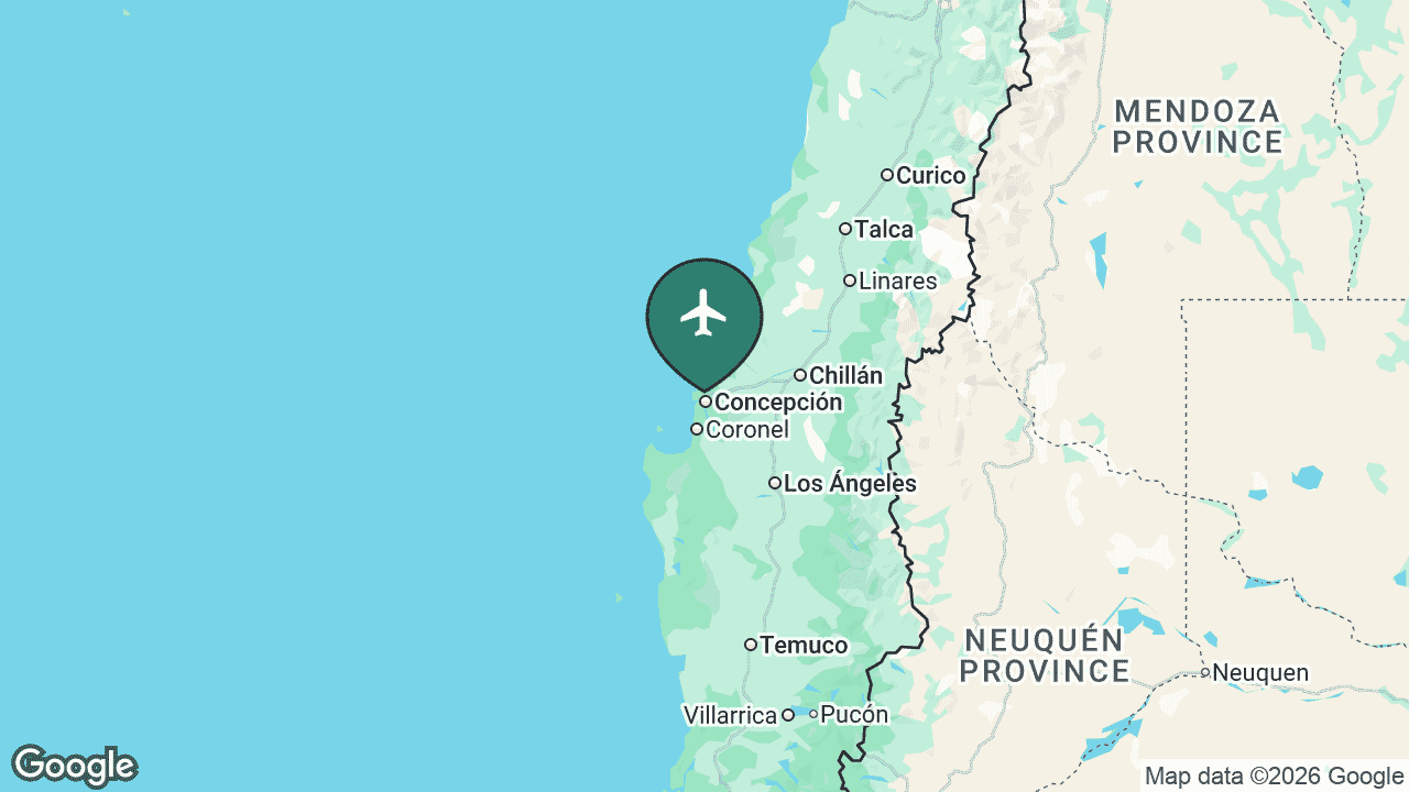
Carriel Sur Airport serves Concepción and the Biobío region, Chile’s second-largest metropolitan area, from Talcahuano on the coast. It is the principal airport of the south-central heartland and an important domestic node.
Concepción reaches about 6 regularly-served nonstop destinations, all domestic, linking the city to Santiago and directly to northern cities such as Antofagasta, Calama and Iquique without backtracking through the capital. It is one of the busiest regional airports in the country.
Main airlines: JetSMART, LATAM, Sky Airline. See the full route map for CCP on AirportRoutes →
🌅 La Serena (LSC)
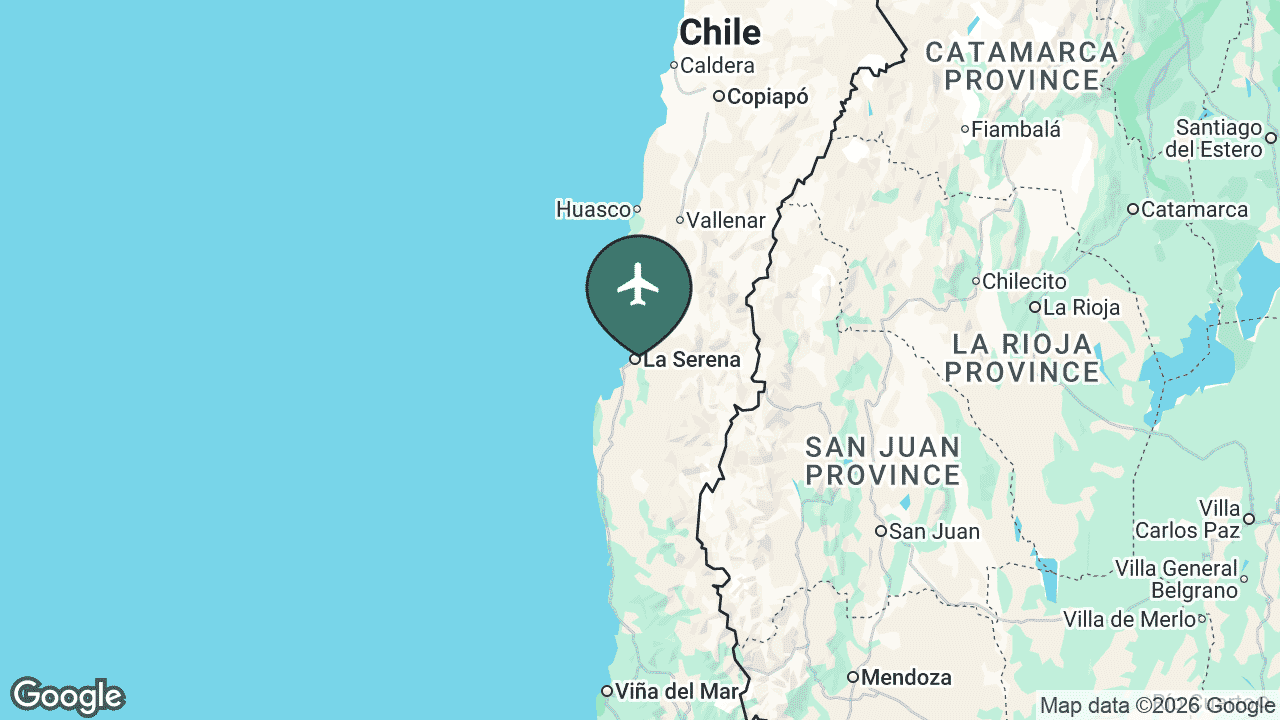
La Florida Airport serves the twin cities of La Serena and Coquimbo in the Norte Chico, a popular beach-holiday destination and the gateway to the Elqui Valley — Chile’s pisco country and one of the world’s premier stargazing regions, home to several major observatories.
La Serena reaches around 6 regularly-served nonstop destinations, entirely domestic, with frequent links to Santiago and connections up and down the northern coast. Tourism and the surrounding mining and agriculture drive much of its traffic.
Main airlines: JetSMART, Sky Airline, LATAM. See the full route map for LSC on AirportRoutes →
🧊 Punta Arenas (PUQ)
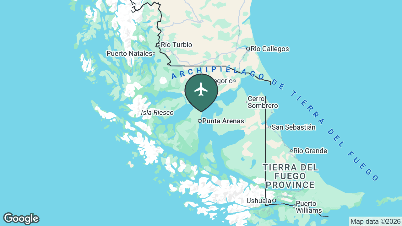
President Carlos Ibáñez del Campo International Airport serves Punta Arenas, the capital of the Magallanes region on the Strait of Magellan — one of the southernmost cities on Earth. It is the air hub of Chilean Patagonia and the main logistics base for Chile’s Antarctic operations, with flights onward to the Chilean Antarctic base on King George Island.
Punta Arenas reaches about 5 regularly-served destinations, mostly domestic links to Santiago and Puerto Montt plus regional Patagonian hops on Aerovías DAP to Porvenir and Puerto Williams (the world’s southernmost town). It also hosts the famous once-weekly LATAM service to the Falkland Islands (Mount Pleasant), the islands’ only scheduled air link, which stops monthly at Río Gallegos in Argentina.
Main airlines: LATAM, Sky Airline, Aerovías DAP. See the full route map for PUQ on AirportRoutes →
🌲 Puerto Montt (PMC)
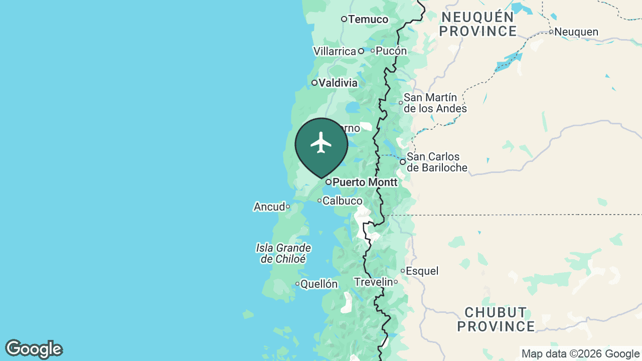
El Tepual Airport serves Puerto Montt in the Los Lagos region, the gateway to Chile’s scenic Lakes District, the island of Chiloé and the start of the Carretera Austral into northern Patagonia. It is one of the busiest regional airports in the south.
Puerto Montt reaches around 5 regularly-served nonstop destinations, all domestic, anchored by the trunk route to Santiago and feeding deeper-south fields such as Balmaceda, Punta Arenas and Puerto Natales. Tourism, salmon farming and Patagonian travel keep it busy year-round.
Main airlines: LATAM, Sky Airline, JetSMART. See the full route map for PMC on AirportRoutes →
⛏️ Antofagasta (ANF)
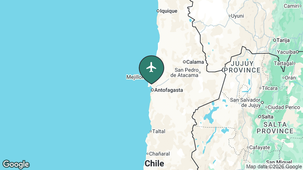
Andrés Sabella Gálvez International Airport serves Antofagasta, the economic capital of Chile’s mining north, in the heart of the Atacama Desert. Copper drives the region, and the airport carries heavy business and commuter traffic alongside leisure flyers.
Antofagasta reaches about 5 regularly-served nonstop destinations — overwhelmingly domestic, led by Santiago, with a couple of short international links to Peru and Colombia. It is the busiest airport in northern Chile after the desert mining fields are taken together.
Main airlines: JetSMART, LATAM, Sky Airline. See the full route map for ANF on AirportRoutes →
🏖️ Iquique (IQQ)
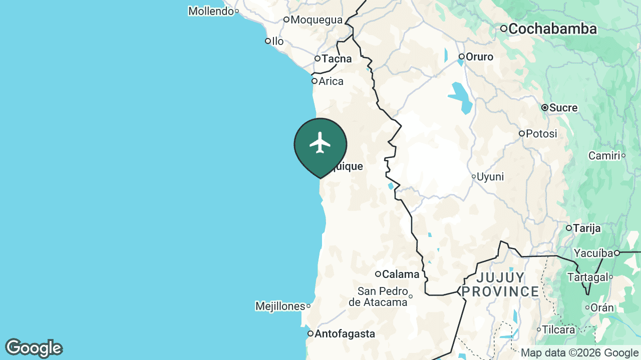
Diego Aracena Airport serves Iquique in the Tarapacá region, a desert port city famous for its enormous duty-free trade zone (ZOFRI), its beaches and its giant coastal sand dune. It sits close to the borders with Peru and Bolivia.
Iquique reaches around 4 regularly-served nonstop destinations, mostly domestic flights to Santiago and other northern cities, plus a cross-border link to Santa Cruz in Bolivia on Boliviana de Aviación. Shopping tourism and mining underpin much of its traffic.
Main airlines: JetSMART, Sky Airline, LATAM, Boliviana de Aviación. See the full route map for IQQ on AirportRoutes →
🏜️ Calama (CJC)
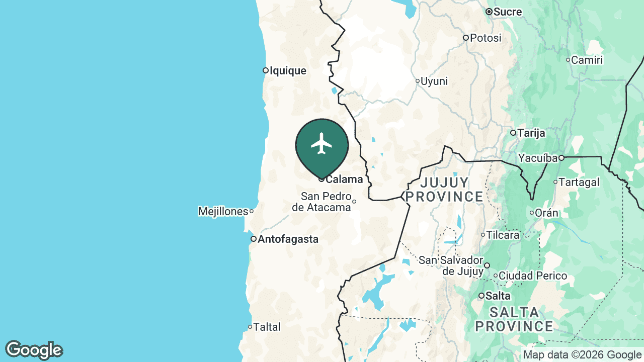
El Loa Airport serves Calama, the base for Chuquicamata — one of the largest open-pit copper mines in the world — and, crucially for travellers, the main air gateway to San Pedro de Atacama, the desert oasis town at the centre of the Atacama’s lunar landscapes, salt flats and high-altitude stargazing.
Calama reaches about 3 regularly-served nonstop destinations, all domestic, dominated by the Santiago route with heavy mining-commuter demand alongside the steady flow of desert tourists heading on to San Pedro.
Main airlines: LATAM, JetSMART, Sky Airline. See the full route map for CJC on AirportRoutes →
🏔️ Puerto Natales (PNT)
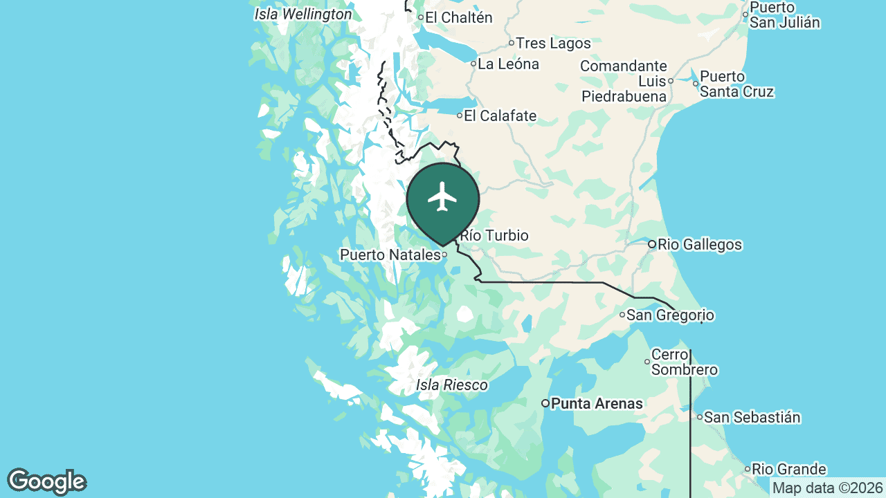
Teniente Julio Gallardo Airport serves Puerto Natales in southern Patagonia — the closest airport to Torres del Paine National Park, one of South America’s most spectacular wilderness destinations. Service is highly seasonal, peaking during the southern summer trekking season.
Puerto Natales reaches about 2 regularly-served destinations, with seasonal nonstop flights from Santiago and Puerto Montt that let trekkers skip the long road transfer from Punta Arenas. Outside peak season, most visitors still fly into Punta Arenas instead.
Main airlines: LATAM, Sky Airline. See the full route map for PNT on AirportRoutes →
🗿 Easter Island (IPC)
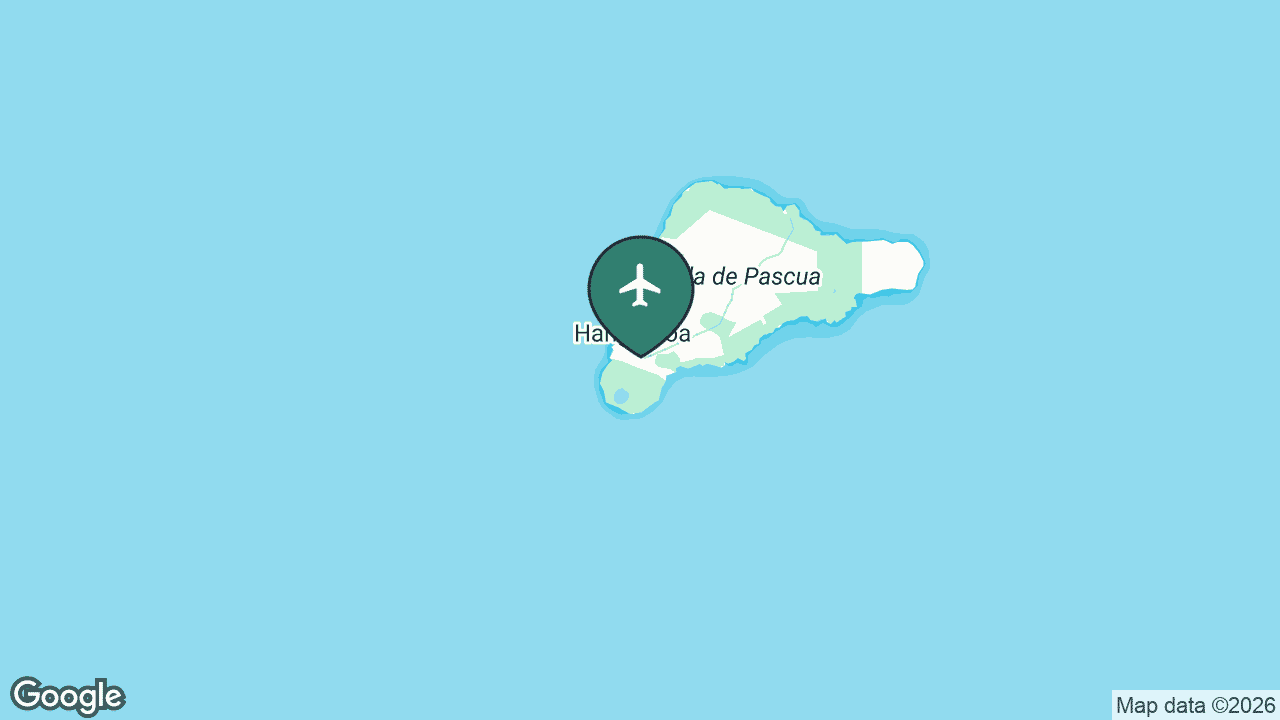
Mataveri International Airport on Easter Island (Rapa Nui) is the most remote commercial airport in the world — roughly 3,500 km from the Chilean mainland and more than 1,900 km from the nearest alternate airport. Its single runway runs almost the full width of the island and was lengthened in the 1980s by NASA as an emergency abort-landing site for the Space Shuttle.
LATAM is the only airline, flying the lifeline route from Santiago (a roughly five-hour hop) plus the lone international service onward to Papeete in Tahiti — making Easter Island a rare stepping stone across the South Pacific. Every flight is a near-event on an island whose visitors come for the moai statues and the Rapa Nui National Park.
Main airlines: LATAM. See the full route map for IPC on AirportRoutes →
Chile’s other regional airports
Beyond the busiest few, a string of regional airports keeps Chile’s far-flung towns connected — most of them served by LATAM, Sky Airline and JetSMART on spokes from Santiago. Note that by regularly-served routes Balmaceda (BBA) actually ranks eighth nationally; we group it here with the other regional fields because the southern and northern airports are all close in size.
In the south, Balmaceda (BBA) is the gateway to the Aysén region and the wild Carretera Austral, serving the city of Coyhaique. Temuco (ZCO), at La Araucanía Airport, anchors the Mapuche heartland and the northern lakes, while Valdivia (ZAL) and Osorno (ZOS) serve the rivers, breweries and German-heritage towns of the Los Ríos and Los Lagos regions.
In the north and centre, Arica (ARI) sits right on the Peruvian border at Chile’s northern tip, and Copiapó (CPO), at Desierto de Atacama Airport, serves the Atacama mining belt and the occasional spectacular “flowering desert”. Together with the bigger hubs, these fields stitch one of the world’s longest countries into a single domestic network.
Airport rankings, nonstop-destination counts, served regions, airline lists and US connections are drawn from live AirportRoutes route data (observed AeroAPI flight data — a sample, not a complete published schedule; we use the regularly-served figure, which filters one-off observations). Airport history and notable facts are cross-checked against the cited references. The ranked map is a Mappr original.
Primary Data Source:
- AirportRoutes — Major airports & routes, Chile – Live route data: per-airport nonstop destinations, served cities, airlines and US connections.
Reference:
- Wikipedia — Chilean airports (Arturo Merino Benítez, Mataveri & others) – Airport history, location and notable facts referenced in the per-airport sections.
- DGAC Chile (Dirección General de Aeronáutica Civil) – Chile's civil aviation authority — background on the national airport network.
- Locator maps — Google Maps / Google Static Maps – Per-airport location maps with airplane markers, generated via Google Static Maps.
Image Sources:
- Map by Mappr – Map of major airports in Chile — a Mappr original built from AirportRoutes data and Natural Earth boundaries.
🌍 More maps & data for Chile
Browse more: All airports by country


