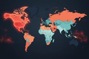
Filter posts by category

Get the world, mapped — in your inbox

New data maps, geography deep-dives, and the stories behind the borders, sent each week. Free, one-click unsubscribe.

By signing up you agree to receive the Mappr newsletter and accept our Privacy Policy. Unsubscribe anytime.

Map showing closed airspace zones over Iraq, Iran, Syria, Israel, and Bahrain with rerouted flight corridors in March 2026

Middle East Airspace Closures, April 10 Update: EASA Extends Warning to April 24 as Crisis Enters Week 6

Six weeks into the Middle East aviation crisis, EASA has extended its Conflict Zone Information Bulletin for 11 FIRs through April 24, 2026. Here’s the April 10 status: closures across Iran, Iraq, Syria, Bahrain, and Kuwait, plus Emirates and flydubai’s gradual Dubai recovery.

Middle East Airspace Closures, April 10 Update: EASA Extends Warning to April 24 as Crisis Enters Week 6 Read More »

Map showing Thailand-Cambodia border clash zones, disputed temples, and displacement areas

Mapped: Thailand-Cambodia Border Clashes — Clash Zones, Disputed Temples, and 500,000+ Displaced

Fighting along the 817 km Thailand-Cambodia border has killed over 100 people and displaced 500,000+ since July 2025. Clashes erupted across Surin, Buri Ram, Sa Kaeo (Thailand) and Preah Vihear, Banteay Meanchey (Cambodia), with the UNESCO-listed Preah Vihear temple suffering severe damage. A ceasefire holds but ~80,000 remain displaced.

Mapped: Thailand-Cambodia Border Clashes — Clash Zones, Disputed Temples, and 500,000+ Displaced Read More »