Sri Lanka has a total of 25 districts, each of which has a capital of the same name and is part of a greater province. There are nine provinces in the country, and they were initially established by the British rulers of Ceylon (present-day Sri Lanka) in 1833.
Districts of Sri Lanka Map
Below, you can see the district map of Sri Lanka:
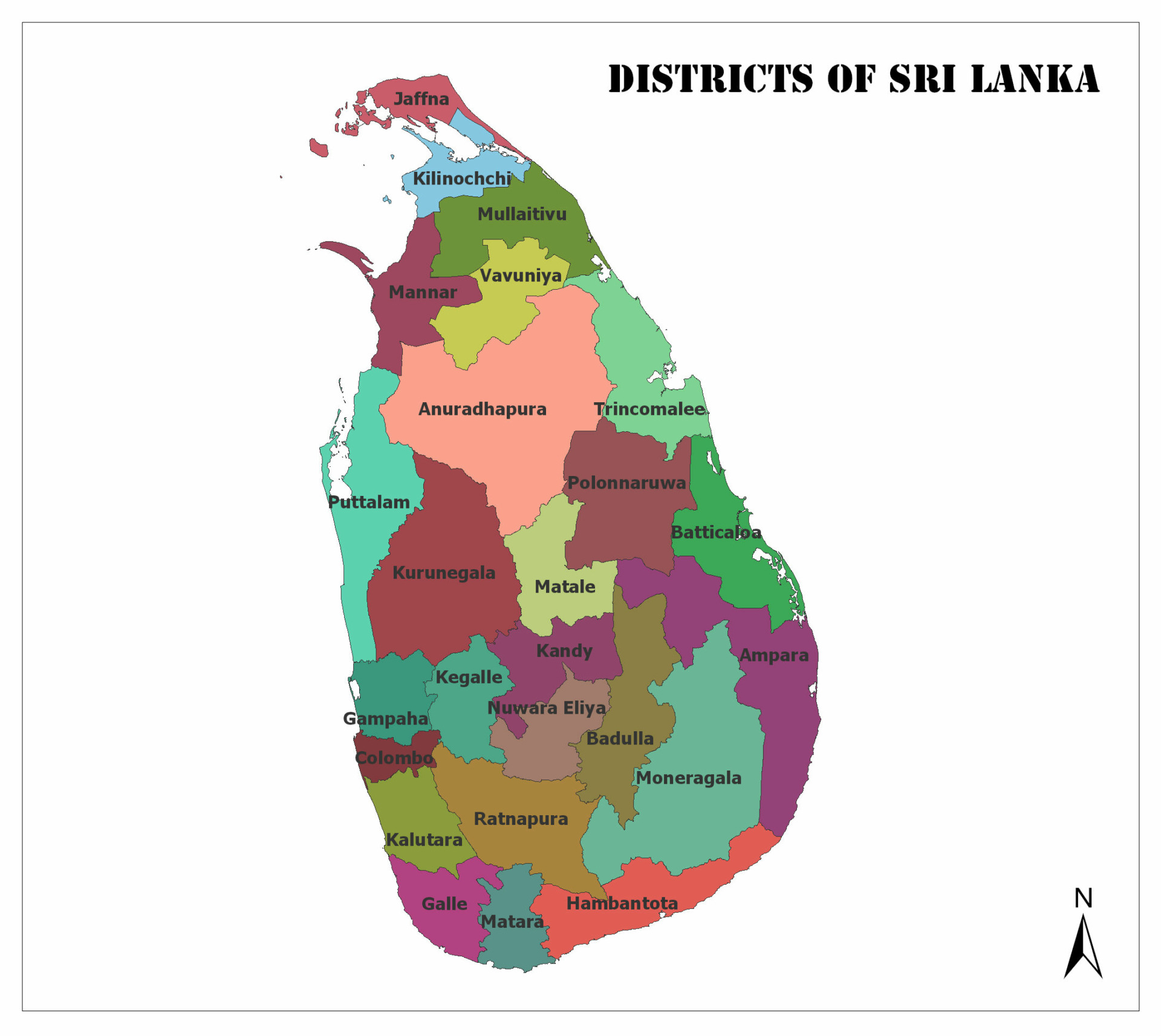
Below, we cover basic information about each district of Sri Lanka such as population, land area, what province they’re a part of, and other interesting facts:
1. Ampara
- 2021 Population Estimate: 752,000
- Total Land Area: 4,222 km2 (1,630 mi2)
- Province: Eastern
The Ampara District is located along the southeastern coast of Sri Lanka, bordering six other districts and the Indian Ocean. It is one of the most diverse districts in the country, and it was formed in 1961 from land that had previously been a part of the Batticaloa District.
During the British colonial period, the capital of Ampara was used as a resting ground for hunters. It was later turned into a town and functioned as a place of residence for workers on the Inginiyagala Dam (Gal Oya Dam).
2. Anuradhapura
- 2021 Population Estimate: 954,000
- Total Land Area: 6,664 km2 (2,573 mi2)
- Province: North Central
Anuradhapura is a district with a capital of the same name located in central northern Sri Lanka. It is the largest district by total land area and borders seven other districts. Anuradhapura has no coastline.
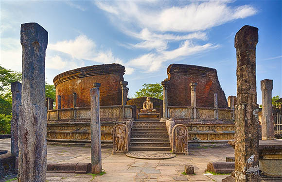
The capital of this district is ancient, and it’s home to well preserved ruins from an ancient Sinhala civilization. The city is also a UNESCO World Heritage Site and is one of the oldest inhabited cities on the planet.
3. Badulla
- 2021 Population Estimate: 895,000
- Total Land Area: 2,827 km2 (1,092 mi2)
- Province: Uva
Badulla is a landlocked district in central southern Sri Lanka in the province of Uva. It’s known for being a primarily agricultural district, and it is divided into an upper and lower region. Tea and vegetables are the main agricultural products to come out of Badulla, and the regions each have their own geographic and climatic differences which make them better suited to growing different kinds of crops.
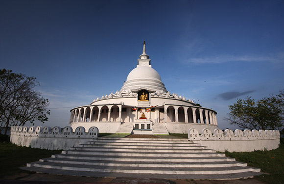
The capital of Badulla is also the capital of the Uva Province, and it is the largest city of both. There are several tourist attractions in the city such as the ancient Buddhist Muthiyangana Temple and the Old Welekade Market.
4. Batticaloa
- 2021 Population Estimate: 590,000
- Total Land Area: 2,610 km2 (1,010 mi2)
- Province: Eastern
Batticaloa is a district that stretches across the middle of Sri Lanka’s east coast. It was once a much larger district before part of its territory became the Ampara District in 1961. The district is bordered by three others and is home to the capital city of the same name, which is one of the largest cities in the Eastern Province.
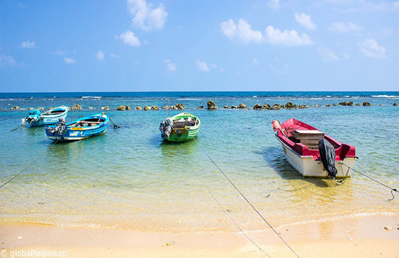
The city of Batticaloa was once the capital of the Eastern Province and is located on an island just off the coast. Today there is a popular tourist destination, Pasikuda, just northwest of the city which features nice beaches and warm waters.
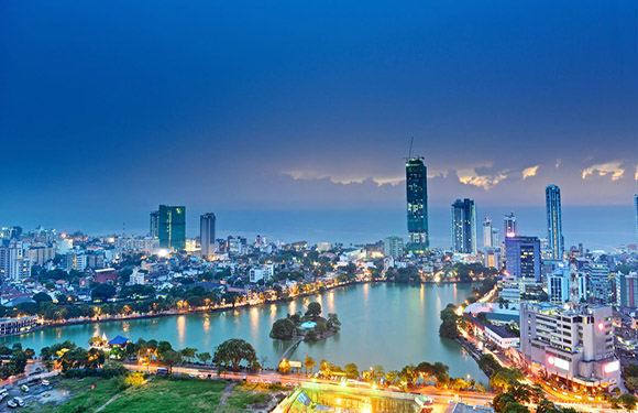
5. Colombo
- 2021 Population Estimate: 2,480,000
- Total Land Area: 676 km2 (261 mi2)
- Province: Western
Colombo is the most populated and most densely populated district in Sri Lanka, and its capital city is also the capital of Sri Lanka. Most of this district’s population is Sinhalese, but there are also Sri Lankan Moor and Sri Lankan Tamil that live here.
This city is on an important trade route and was made the capital of Sri Lanka when it was under British control in 1815; it retained its status as the capital when Sri Lanka gained independence in 1948.
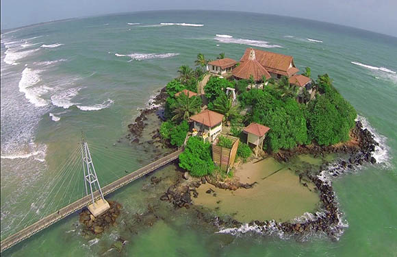
6. Galle
- 2021 Population Estimate: 1,147,000
- Total Land Area: 1,617 km2 (624 mi2)
- Province: Southern
The Galle District is located in the southeast corner of Sri Lanka and borders the Indian Ocean as well as three other districts. It is the site of the Sinharaja Forest Reserve, a UNESCO World Heritage Site.
Galle is the capital city of its district and the Southern Province. Some main sights in the city are the National Maritime Museum, a Shiva Temple, and the city’s natural harbor.
7. Gampaha
- 2021 Population Estimate: 2,443,000
- Total Land Area: 1,341 km2 (518 mi2)
- Province: Western
Gampaha has the second highest population of any district in Sri Lanka after Colombo. It’s located just north of the district of Colombo and borders four other districts and the Indian Ocean. The capital of the Gampaha District goes by the same name, but Negombo is the largest city and economic center of the district.
The name Gampaha means “five villages” in Sinhala and refers to Ihalagama, Pahalagama, Medagama, Pattiyagama and Aluthgama.
8. Hambantota
- 2021 Population Estimate: 676,000
- Total Land Area: 2,496 km2 (964 mi2)
- Province: Southern
The Hambantota District stretches along Sri Lanka’s southeastern coast, bordering four other districts. The district has a very dry climate, and salt production is an economic activity that happens mostly in the district’s capital of the same name.
The capital of Hambantota was severely damaged by the Indian Ocean Tsunami in 2004, and major reconstruction efforts have been underway ever since.
9. Jaffna
- 2021 Population Estimate: 626,000
- Total Land Area: 929 km2 (359 mi2)
- Province: Northern
Occupying most of the Jaffna Peninsula, Sri Lanka’s Jaffna District is in the very far north of the country. The four geographic regions of this district are Thenmarachchi, Vadamarachchi, Valikamam, and the Jaffna Islands.
The capital of this district, Jaffna, is also the capital of the Northern Province and is the 12th most populous city in Sri Lanka. It was previously the second most populous city in the country, but it was affected heavily by the Sri Lankan Civil War.
10. Kalutara
- 2021 Population Estimate: 1,296,000
- Total Land Area: 1,576 km2 (608 mi2)
- Province: Western
The Kalutara District is located in southeastern Sri Lanka, has a capital city of the same name, and is located in the country’s Western Province.
The capital of the district is located where the Kalu Ganga River meets the ocean. It’s known for the production of goods made from coconut palm fiber such as ropes and baskets.
11. Kandy
- 2021 Population Estimate: 1,501,000
- Total Land Area: 1,917 km2 (740 mi2)
- Province: Central
Kandy is a Sri Lankan District located in the center of the country just under the district of Matale. It borders five other districts in total and has no coastline.
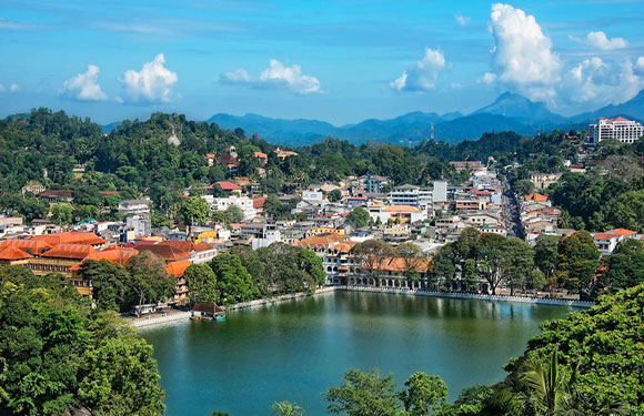
The capital of Kandy is a major city in the Central Province of Sri Lanka and lies among the hills on the Kandy plateau. There are plantations in this region, many of which produce tea.
12. Kegalle
- 2021 Population Estimate: 898,000
- Total Land Area: 1,685 km2 (651 mi2)
- Province: Sabaragamuwa
The Kegalle District is landlocked and located in central southern Sri Lanka. Some of the economic activities that take place in Kegalle are rubber cultivation, the export of coffee, cocoa, and clove, and graphite mining.
The history around this district’s capital dates back to the Stone Age. There’s archeological evidence of a prospering society living as much as 28,000 years ago in this location.
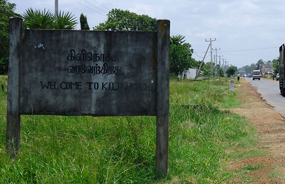
13. Kilinochchi
- 2021 Population Estimate: 133,000
- Total Land Area: 1,205 km2 (465 mi2)
- Province: Northern
The Kilinochchi District is the second northernmost district in Sri Lanka, just under the district of Jaffna. It was part of the region of Rajarata until the 13th Century AD, then became part of the Kingdom of Jaffna before coming under British, Portuguese, and British control. The current borders of this district were established in 1984.
The capital of Kilinochchi was the capital of the Tamil Tigers during the Sri Lankan Civil War. The city was created in 1936 as part of an effort to ease overpopulation in nearby Jaffna. Most of the population in this area is involved in agricultural work.
14. Kurunegala
- 2021 Population Estimate: 1,743,000
- Total Land Area: 4,624 km2 (1,785 mi2)
- Province: North Western
The Kurunegala District is located in Sri Lanka’s North Western Province and is bordered by six other districts; it has no coastline. The languages spoken within this district are Sinhalese, Tamil, and English.
Kurunegala the city and capital of this district is a major city in the North Western Province and is surrounded by coconut plantations and rubber estates. There are several sites with archeological significance around the city, such as the Royal Complex, and Kurunegala Lake.
15. Mannar
- 2021 Population Estimate: 114,000
- Total Land Area: 1,880 km2 (730 mi2)
- Province: Northern
The Mannar District takes up a stretch of coastline on Sri Lanka’s northeastern shore and includes Mannar Island. The animal and plant life in this district are unique from that found in other parts of the country. For example, baobab trees grow on Mannar Island and few other places in the country. The dugong (marine mammal) can also be found in Mannar bay.
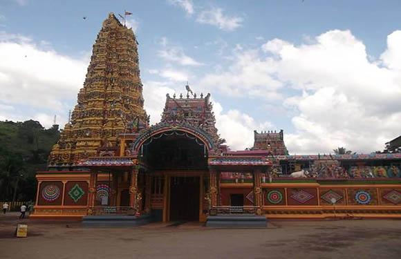
16. Matale
- 2021 Population Estimate: 530,000
- Total Land Area: 1,952 km2 (754 mi2)
- Province: Central
Matale is a district located in the center of Sri Lanka. The largest religious group in the district is Buddhism, followed by Islam, Hinduism, and Christianity. The capital of this district is also called Matale, and it’s located in Sri Lanka’s Central Hills.
The capital of this district has an economy fueled by agriculture, tourism, and trade. The city is famous for its spice gardens and surrounding plantations. One beautiful attraction in the city is the colorful Muthumariamman Hindu Temple.
17. Matara
- 2021 Population Estimate: 873,000
- Total Land Area: 1,270 km2 (490 mi2)
- Province: Southern
The district of Matara is located in the extreme south of Sri Lanka and contains the country’s southernmost point, Dondra Head, Dondra. Sri Lanka’s tallest lighthouse is located here, and it’s one of the tallest in South East Asia.
The capital of the same name is the second largest city in the Southern Province and is a major commercial hub. The city contains a great deal of Dutch architecture and the Star Fort. Tourism is not a major industry in the city.
18. Monaragala
- 2021 Population Estimate: 505,000
- Total Land Area: 5,508 km2 (2,127 mi2)
- Province: Uva
Monaragala is the second-largest district in Sri Lanka. It lies in the southeast corner of the country, bordering four other districts, and has no coastline. The capital of the district is also its largest city, and it’s located just southeast of Badulla, the capital of the Uva Province.
The district’s economy is largely based on agriculture, and the capital lies approximately 170 kilometers east of Colombo.
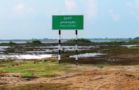
19. Mullaitivu
- 2021 Population Estimate: 92,238
- Total Land Area: 2,617 km2 (1,010 mi2)
- Province: Northern
The Mullaitivu District in Sri Lanka is located at the northeastern tip of the country. It borders four other districts and has a coastline on the Indian Ocean. The district was under the control of the Tamil Tigers for much of Sri Lanka’s civil war as it was recaptured by the Sri Lankan Army in 2009.
The capital of Mullaitivu is a fishing village that also serves as an anchoring harbor for small boats transporting goods between Jaffna and Colombo.
20. Nuwara Eliya
- 2021 Population Estimate: 780,000
- Total Land Area: 1,706 km2 (659 mi2)
- Province: Central
Nestled among the hills of Sri Lanka’s Central Province is the district of Nuwara Eliya. The terrain in this area of the country is mostly mountainous with deep valleys, and the capital of the district is located in what is considered the most important location for tea cultivation in Sri Lanka.
There are several natural attractions in the capital city such as Victoria Park, Lake Gregory, Galway’s Land Bird Sanctuary, and more.
21. Polonnaruwa
- 2021 Population Estimate: 448,000
- Total Land Area: 1,706 km2 (659 mi2)
- Province: North Central
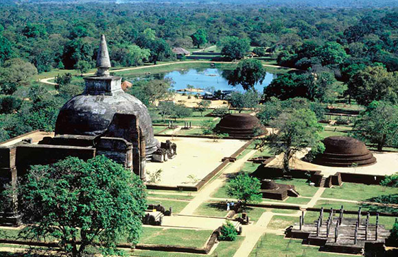
Polonnaruwa District is one of only two districts that make up Sri Lanka’s North Central Province. The capital of this district is also the largest city in the province and it is divided up into a modern town, referred to as New Town, as well as a part of town that still represents the royal ancient city of the Kingdom of Polonnaruwa.
The “Awakening of Polonnaruwa” is a major development project that is currently underway in the capital city. It’s a project initiated by former President Maithripala Sirisena. The objective of the project is to develop the roads, electricity, agriculture, education, health, and environment sectors in the region.
22. Puttalam
- 2021 Population Estimate: 849,000
- Total Land Area: 2,882 km2 (1,113 mi2)
- Province: North Western
Along with Kurunegala District, the district of Puttalam forms the North Western Province of Sri Lanka. It is located along a long stretch of Sri Lanka’s western coast and features several beautiful lagoons and the Kalpitiya Peninsula.
Prawn farming is a popular activity in this district, and it’s also well known for its shallow sea fishing. In the district’s capital city, Islam is the most widely practiced religion.
23. Ratnapura
- 2021 Population Estimate: 1,190,000
- Total Land Area: 3,236 km2 (1,249 mi2)
- Province: Sabaragamuwa
The Ratnapura District in Sri Lanka is in the southern region of the country, borders nine other districts, and has no coastline. This district is popular with nature lovers as it offers trekking and bird-watching opportunities as well as excursions into Sinharaja Forest Reserve and Udawalawe National Park.
The capital of this district is a center for the Sri Lankan gem trade. In fact, the name “Ratnapura” is a Sanskrit name meaning “city of gems.”
24. Trincomalee
- 2021 Population Estimate: 441,000
- Total Land Area: 2,529 km2 (976 mi2)
- Province: Eastern
The district of Trincomalee is located along the coast of northeastern Sri Lanka, in its Eastern Province. It borders five other districts and its capital city has the same name. The capital is on a peninsula of the same name and is a resort and port city overlooking Trincomalee Harbor.
The capital of this district is significant to Sri Lankan culture because it has been the center of Sri Lankan Tamil language speaking for more than two thousand years. Other interesting features of the city are the Bhadrakali Amman Temple, the Trincomalee Hindu Cultural Hall, and the Trincomalee Hindu College, which was opened in 1897.
25. Vavuniya
- 2021 Population Estimate: 194,000
- Total Land Area: 1,861 km2 (719 mi2)
- Province: Northern
Vavuniya is a landlocked district in the central northern part of Sri Lanka that borders four other districts and is part of the country’s Northern Province. Parts of this district were under the control of the Tamil Tigers during the Sri Lankan Civil War and were recaptured by the Sri Lankan military in 2008.
The capital of Vavuniya is a transport hub for the region and is considered the gateway to the Northern Province. There is a train station as well as an airport here. All northern Sri Lankan cities are easily accessible from the capital.