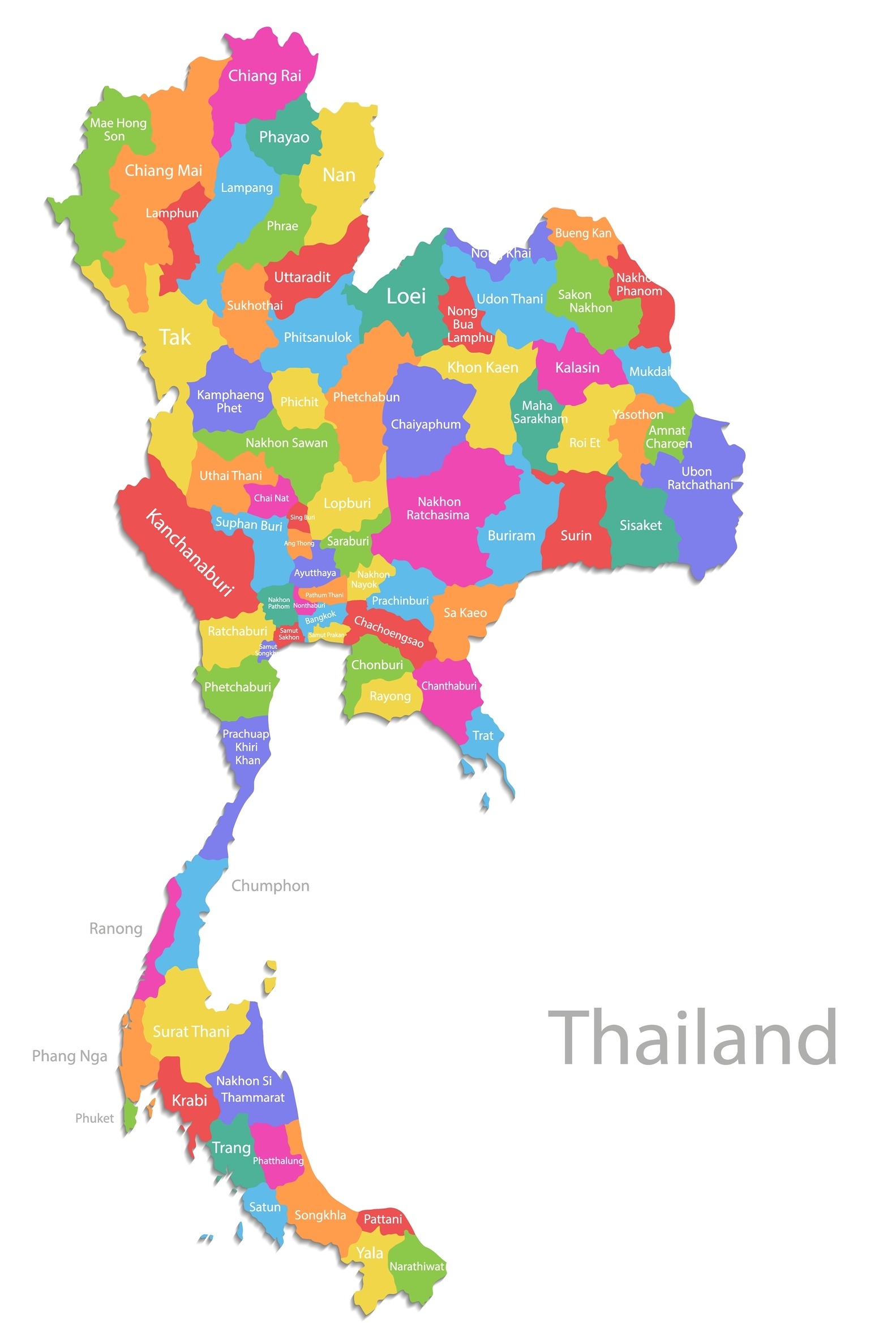
Each of the 76 provinces of Thailand has something unique to offer. The country’s capital city of Bangkok is also special, but it’s technically designated as a separate special administrative area. A province is called a Changwat in Thai and is further divided into districts (amphoe), sub-districts (tambon), and villages (muban).
Each of the provinces of Thailand is named for its main city, which in several cases is no longer the most populous city in the province. Provinces are part of the provincial government of Thailand and are administered by governors appointed by the Minister of the Interior. The Governor of Bangkok, however, is elected directly by the city’s citizens.
In this post, we’ll look at a map of the provinces of Thailand as well as a map of the country’s five different regions. We’ll then go into depth about each region and explore some of their most important provinces.
Below is a color-coded map of the provinces in Thailand along with an interactive map that allows you to select any province in the country.
Below is an interactive map of Thailand detailing each province:
The table below lists all 76 provinces of Thailand along with the Bangkok special administrative area in alphabetical order. The spelling of province names in this table is based on the Royal Thai General System of Transcription (RTGS).
| Thai Provinces | |
| 1 | Amnat Charoen |
| 2 | Ang Thong |
| 3 | Bangkok Metropolis |
| 4 | Bueng Kan |
| 5 | Buri Ram |
| 6 | Chachoengsao |
| 7 | Chai Nat |
| 8 | Chaiyaphum |
| 9 | Chanthaburi |
| 10 | Chiang Mai |
| 11 | Chiang Rai |
| 12 | Chon Buri |
| 13 | Chumphon |
| 14 | Kalasin |
| 15 | Kamphaeng Phet |
| 16 | Kanchanaburi |
| 17 | Khon Kaen |
| 18 | Krabi |
| 19 | Lampang |
| 20 | Lamphun |
| 21 | Loei |
| 22 | Lop Buri |
| 23 | Mae Hong Son |
| 24 | Maha Sarakham |
| 25 | Mukdahan |
| 26 | Nakhon Nayok |
| 27 | Nakhon Pathom |
| 28 | Nakhon Phanom |
| 29 | Nakhon Ratchasima |
| 30 | Nakhon Sawan |
| 31 | Nakhon Si Thammarat |
| 32 | Nan |
| 33 | Narathiwat |
| 34 | Nong Bua Lam Phu |
| 35 | Nong Khai |
| 36 | Nonthaburi |
| 37 | Pathum Thani |
| 38 | Pattani |
| 39 | Phangnga |
| 40 | Phatthalung |
| 41 | Phayao |
| 42 | Phetchabun |
| 43 | Phetchaburi |
| 44 | Phichit |
| 45 | Phitsanulok |
| 46 | Phra Nakhon Si Ayutthaya |
| 47 | Phrae |
| 48 | Phuket |
| 49 | Prachin Buri |
| 50 | Prachuap Khiri Khan |
| 51 | Ranong |
| 52 | Ratchaburi |
| 53 | Rayong |
| 54 | Roi Et |
| 55 | Sa Kaeo |
| 56 | Sakon Nakhon |
| 57 | Samut Prakan |
| 58 | Samut Sakhon |
| 59 | Samut Songkhram |
| 60 | Saraburi |
| 61 | Satun |
| 62 | Si Sa Ket |
| 63 | Sing Buri |
| 64 | Songkhla |
| 65 | Sukhothai |
| 66 | Suphan Buri |
| 67 | Surat Thani |
| 68 | Surin |
| 69 | Tak |
| 70 | Trang |
| 71 | Trat |
| 72 | Ubon Ratchathani |
| 73 | Udon Thani |
| 74 | Uthai Thani |
| 75 | Uttaradit |
| 76 | Yala |
| 77 | Yasothon |
Regions of Thailand Map
For administrative, statistical, geographic, and scientific purposes, the provinces of Thailand are often grouped into larger regions. Often the country is divided into six regions for geographic and scientific applications, and sometimes four regions are used for administrative or statistical uses.
Other times, as in this post, the provinces of Thailand are divided into five larger groups. In this division, the Western Region described in the six-region categorization is combined with the Southern Region. The map below defines these five regions:
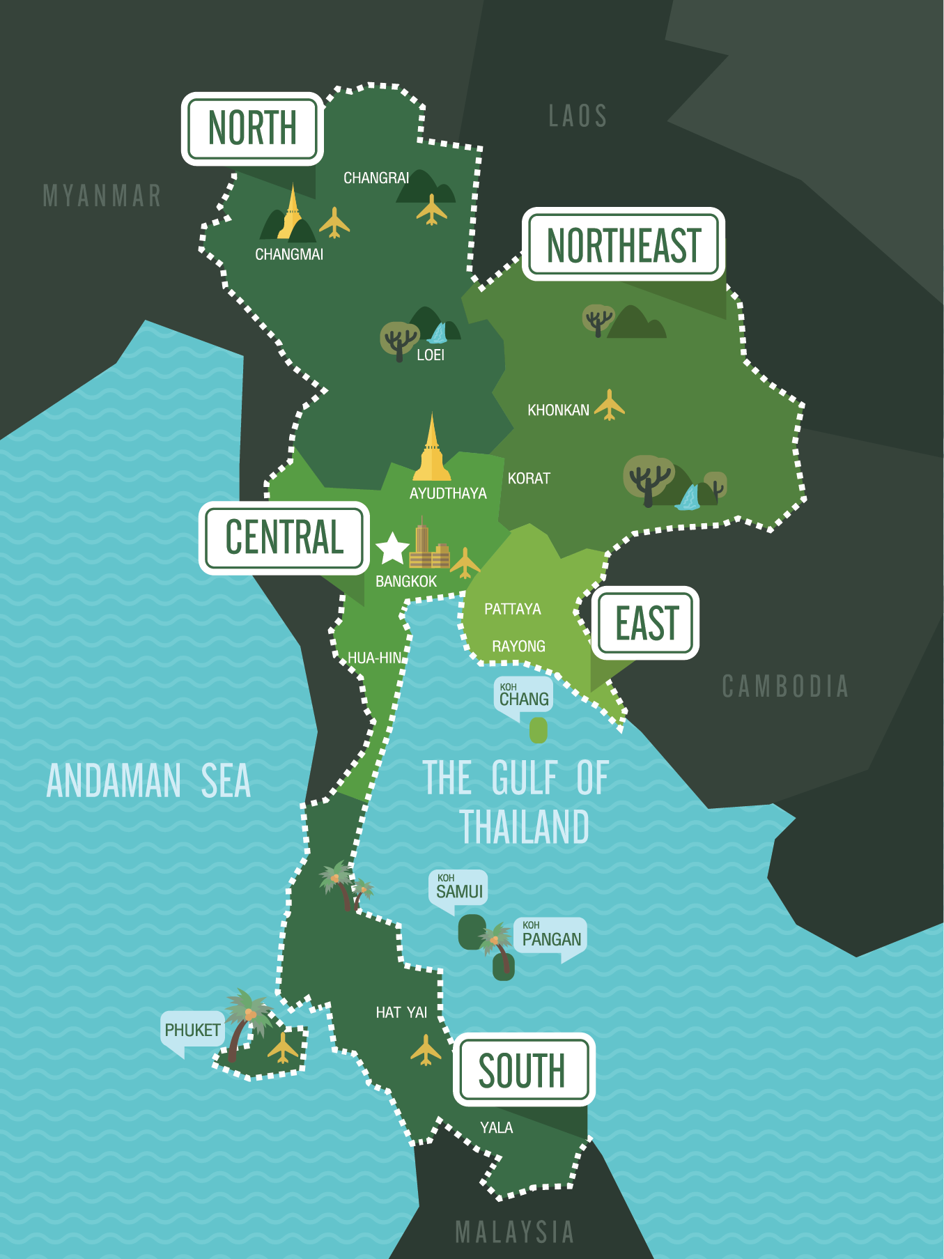
We’ll look at each of the regions in Thailand and will learn about the most important provinces in each. We’ll also learn about tourism in Thailand by exploring the most popular tourist attractions these provinces have to offer.
Northern Thailand

The Northern Region of Thailand, also referred to as Lanna, is characterized by mountain ranges, rivers, and an overall elevation that is higher than the rest of Thailand. The higher elevation lends itself to more dramatic seasonal changes in weather, particularly cooler winters than are found elsewhere in the country.
The most populous province in Northern Thailand is Chiang Mai, which is also where the country’s tallest mountain, Doi Inthanon, is located.
The predominant native language in Northern Thailand is Northern Thai, which is a Thai dialect that is not mutually intelligible with Central Thai, the standard dialect in education, media, and government.
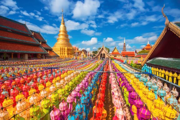
Chiang Mai
With a population of more than 1.8 million by the end of 2022, Chiang Mai is among the most populous provinces in Thailand. It is located in the Northern Region of the country and is considered the region’s cultural capital. Some of the things it’s known for are its cultural heritage, many temples, and natural beauty.
The growing tourist industry in Chiang Mai is supported by the natural and cultural attractions in the area. Many people visit the province to experience the surrounding green hills, and others come to see ancient temples or for the Yi Peng festival.
Chiang Rai
 in Chiang Rai, Thailand")
As well as being the second-most populous province in Northern Thailand, Chiang Rai is notable for being the northernmost province in the whole country. It shares borders with Laos and Myanmar along with three other Thai provinces.
Ecotourism and outdoor activities are both popular attractions in Chiang Rai, as the province is known for its beautiful landscape and rivers. The largest of the rivers in Northern Thailand is the Mae Kok River, which flows through the city of Chiang Rai, which is the capital and largest city of the province.
Chiang Rai occupies part of the Golden Triangle, a region where the borders of Thailand, Myanmar, and Laos meet. It was once a dangerous center of opium production and trade in the region, but the economy in the area has transitioned to agriculture.
Lampang
Lampang is another important province in Northern Thailand. It became a Thai province in 1892 and currently has a population of around 738,000, making it the sixth-most populous province in the region.
Around 900,000 tourists visit Lampang province every year, which isn’t enough to place it among the top tourist destinations in Thailand, but the provincial government has put a plan in motion to increase this number. Scenic landscapes, local traditions, and interesting architecture are some of what Lampang has to offer.
Sometimes called the “town of horse-drawn carriages,” Lampang stands out from the rest of Thailand with horse-drawn carriages still functioning as a popular mode of transportation in the city.
Lamphun
Lamphun is another of the most important provinces in Northern Thailand. As is characteristic of the region, the province is known for its natural beauty and cultural history. One of the oldest temples in the region, Wat Hariphunchai, is located here and is a popular tourist attraction.
Although Lamphun is the smallest province in Northern Thailand, it also has the highest GDP per capita in the region. This is thanks to its strong, diverse economy, its location near Myanmar, and the development of its infrastructure.
There are three national parks in the province of Lamphun and two wildlife sanctuaries.
Northeastern Thailand

Northeastern Thailand, also called Isan, is the largest region in the country, and it consists of 20 provinces. It borders Laos and Cambodia as well as Thailand’s North, Central, and East Regions.
Ethnically, the majority of people in Isan refer to themselves as khon Isan or Thai Isan. The primary native language in this region of Thailand is Isan, which is a dialect of Lao, but many people also speak Thai.
The majority of Northeastern Thailand lies on the Khorat Plateau, and the landscape consists mostly of gently rolling hills. The region also contains some of Thailand’s best-known national parks — 26 in total.
One-third of Thailand’s population lives in this region, but it only accounts for about 10% of the country’s GDP. This makes it the poorest region in Thailand by GDP per capita.
Nakhon Ratchasima
Also called Khorat, Nakhon Ratchasima is the second-largest province by area in Thailand. It’s also the most populous in the Northeastern Region by a large margin. With its large population, Nakhon Ratchasima has been the most significant political and economic center in the region for many years.
As well as its importance in political and economic spheres, Nakhon Ratchasima boasts two beautiful national parks, one of which, Khao Yai National Park, is part of the Dong-Phayayen-Khao Yai Forest Complex and a UNESCO World Heritage Site. The park is a popular attraction and includes hiking trails and an impressive array of wildlife.
Another interesting feature in this province is Phimai Historical Park, which includes one of the largest Khmer temples in Thailand and is the most popular tourist destination in the province.
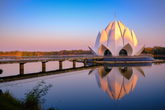
Ubon Ratchathani
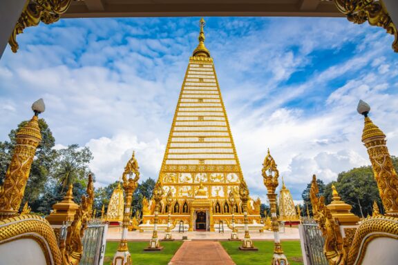
The second-most populous province in Northeastern Thailand is Ubon Ratchathani, often just called Ubon, which has a population of nearly 1.9 million. The city of Ubon was founded in the late 18th century, and the province was created in 1792.
The name Ubon Ratchathani translates to “royal city of the lotus flower,” and a lotus flower is depicted in the seal of the province. Rice is also common in the province, making it the leading rice producer in the country.
Among the tourist attractions in Ubon are famous Buddhist temples such as Wat Phra That Nong Bua and Wat Nong Pah Pong as well as several national parks and the Ubon Candle Festival.
Khon Kaen
In the central part of Northeastern Thailand lies the province of Khon Kaen. It is the third-most populous province in Northeastern Thailand, and the first city in the area was established in 1783. The main city was moved
The main city of Khon Kaen was incorporated in 1797 and moved a total of six times before settling in its current location. Today, the city and province are known for their cuisine, national parks, and famous temples.
One of the most famous temples in the Khon Kaen province is Phra That Kham Kaen, which is said to house an ancient relic of the Buddha.
Udon Thani
Located in the upper part of Northeastern Thailand, Udon Thani is a province that is known for ancient sites, its manufacturing industry, natural beauty, and its role as a regional hub. The name of the province and capital city likely translates to “northern city.”
Perhaps the most noteworthy ancient site in Udon Thani is Ban Chiang, which has been a UNESCO World Heritage Site since 1992 and is considered one of the most important prehistoric settlements in Southeast Asia.
One reason Udon Thani became a regional hub is because of the Udorn Royal Thai Air Force Base that was constructed in the 1960s as a joint-force military base with the United States during the Vietnam War.
Central Thailand

The region of Central Thailand, historically known as Siam, is of great historical significance for the country and is its political and economic center. Bangkok, not technically a province but a special administrative area, is the capital of Thailand and is located in this region.
Bangkok is the primate city of Thailand, meaning it is significantly larger and more powerful than any other in the country. It has a population of more than 5.7 million, accounts for nearly half of the country’s GDP, and is home to one of the largest airports in the world.
Dynamic economic activity and important cultural heritage are two things this region of Thailand is known for, along with natural beauty and its role as a transportation hub for Thailand and Southeast Asia.
Nonthaburi
After Bangkok, Nonthaburi is the most populous city in Central Thailand. It’s located just northeast of the capital and is the country’s most densely populated province. The city is often considered a suburb of Bangkok due to its proximity.
Nonthaburi is a highly urbanized province and includes no forested area. The area is famous for its durians, which are considered the best in the country and the most expensive in the world.
Floating markets and historic temples are some of the tourist attractions in Nonthaburi. The Chao Phraya River flows through the city, along which tourists can partake in boat tours.
Phra Nakhon Si Ayutthaya

Often shortened to Ayutthaya, this Central Thai province is located due north of Bangkok and the province of Pathum Thani. The name Ayutthaya is derived from the Sanskrit word for “invincible,” meaning “invincible city” in this context.
Located on the flat plain of the Chao Phraya River Valley, Ayutthaya is a major rice farming location, irrigated by the Lopburi and Pa Sak rivers. Another major contributor to the province’s economy is the Honda factory located in the main city.
Buddhist architecture, ancient temples, and palaces are some of the main tourist attractions in Ayutthaya. The city is accessible from Bangkok via boat, bus, and train.
Saraburi
Situated on the east bank of the Chao Phraya River valley, Thailand’s Saraburi province is in the country’s Central Region and is a gateway to Northeastern Thailand. The landscape transitions from mostly low, flat plains in the west to high plains and plateaus in the east.
This province contains the eastern edge of Khao Yai National park, one of the most biodiverse areas in Thailand and the country’s first national park. This area along with the Phra Phutthabat Hot Springs are popular outdoor tourist attractions.
There are also some famous religious sites in Saraburi such as Wat Phra Phutthabat Temple, which is believed to have a footprint left by Buddha.
Eastern Thailand

Thailand’s Eastern Region is separated from the Khorat Plateau in Northeastern Thailand by the San Kamphaeng Range and extends to the coast of the Gulf of Thailand. It also includes several islands and is known for having some of the country’s most popular beaches.
As is the case throughout most of the country, there are a number of ancient Buddhist temples in Eastern Thailand. These, along with beautiful beaches and islands, attract many tourists to the region.
The main economic activities in the Eastern Region are agriculture and industries such as the manufacturing of textiles, automobiles, and electronics. The region had the highest GDP per capita in Thailand in 2018.
Chonburi

Chonburi province in Eastern Thailand is the most populous province in the region with almost double the population of Rayong, the next largest province. It’s also the most popular province in the region with tourists, welcoming millions of visitors each year.
One of the most popular tourist destinations in Chonburi is Pattaya, a former fishing town on the Gulf of Thailand. The city’s popularity comes mostly from its beaches, notorious nightlife scene, and many festivals.
Chonburi is also known for hosting the Chonburi Buffalo Race each year, which attracts tourists from all over the world, and the Nong Nooch Tropical Garden.
Rayong
Rayong, another province of Eastern Thailand, is only about half the size of Chonburi, but it’s the highest GDP earner in the region and often has the highest GDP of any province in Thailand.
The economy of this province is so strong thanks to its electronics manufacturing sector and the presence of large industrial estates like the Map Ta Phut Industrial Estate, one of the largest petrochemical complexes in Southeast Asia. Agriculture is also a thriving industry here — most of Thailand’s fruit is produced in Rayong, sometimes called the “Fruit Basket of Thailand.
Rayong’s location along the Gulf of Thailand makes it an attractive destination for tourists. The province is known for its seafood cuisine, and there are several beaches that are popular among visitors.
Chachoengsao

Officially becoming a province in 1916, Chachoengsao is located in Eastern Thailand and has a short coastline on the Gulf of Thailand. Its name comes from the Chong language and means “deep canal,” referring to the Bang Pakong River that flows through the province and its canals.
The history of Chachoengsao dates back to the Ayutthaya Kingdom during the reign of King Borommatrailokkanat. Ancient temples can still be found here, and its rich cultural heritage is one thing the province is known for.
Agriculture is one of the most important economic activities in Chachoengsao, and the main crops grown in the province are rice and tapioca. The region is also known for producing quality seafood and durian fruit.
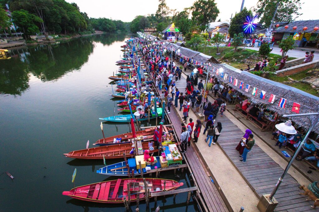
Southern Thailand

The Southern Region of Thailand is located on the Malay Peninsula and borders Myanmar, Malaysia, the Gulf of Thailand, and the Andaman Sea. This region is one of the most popular among tourists visiting Thailand because of its many beaches and islands.
Some of the most popular tourist destinations in Southern Thailand are Phuket, Krabi, and islands like Ko Samui and Ko Pha-Ngan. Adventure activities like diving, snorkeling, and rock climbing are popular in the area, though there are also cultural attractions like ancient temples.
The main native language spoken in this region is Southern Thai, and the main religion is Buddhism. Islam is also widely practiced by Malay people in Southern Thailand.
Nakhon Si Thammarat
Often shortened to Nakhon, this province is the most populous in the Southern Region of Thailand and is located along the western shore of the Gulf of Thailand. The name of the province comes from a Pali-Sanskrit name that translates to “City of the Sacred Dharma King” in English.
Geographically, Nakhon has a mostly hilly landscape which includes the region’s highest peak, Khao Luang. It also has strikingly pristine beaches that are off the well-beaten tourist track and can offer adventurous visitors solitude in nature.
Other noteworthy attractions in Nakhon are its five national parks and its historical role as an important center of Buddhism. The province receives many domestic tourists visiting religious sites.
Songkhla
Songkhla has a population of about 1.4 million and is the second-largest province in Southern Thailand. The capital city of the same name is not the largest city in the province; instead, the city of Hat Yai has almost twice the population of Songkhla city.
Hat Yai is located near the Malaysian border and is an attraction in Songkhla for anyone interested in shopping, entertainment, and nightlife. There are many bars, clubs, and karaoke venues in the city.
The economy of Songkhla is largely based on the energy industry. Offshore oil rigs, a gas separation plant, and power generation are the main contributors to the economy, but the construction of a new gas-fired power plant in the province could dramatically increase output.
Phuket

Phuket is the smallest province in Southern Thailand and the second-smallest in size in the entire country. What makes the province significant in this region, however, is its historical importance and its role as one of the country’s top tourist destinations.
The province of Phuket consists of the island of the same name — the largest in Thailand — and 32 smaller islands. It was a major stop on the trade route between India and China for many years. It also traded in tin and rubber internationally.
Today, the economy of the province is supported mostly by tourism. Millions of tourists visit the islands each year, drawn to the beautiful beaches and clear waters in the area.


