Kazakhstan is divided into fourteen regions. These regions are divided into sub-districts. The number of districts in Kazakhstan is 170. The four cities, Baikonur, Shymkent, the largest city of Almaty and the capital, Astana, are not part of the region. So, in this case, it can be said that there are 14 regions and 4 cities in Kazakhstan. The regions are governed by the Region’s governments, which are connected to the national government.
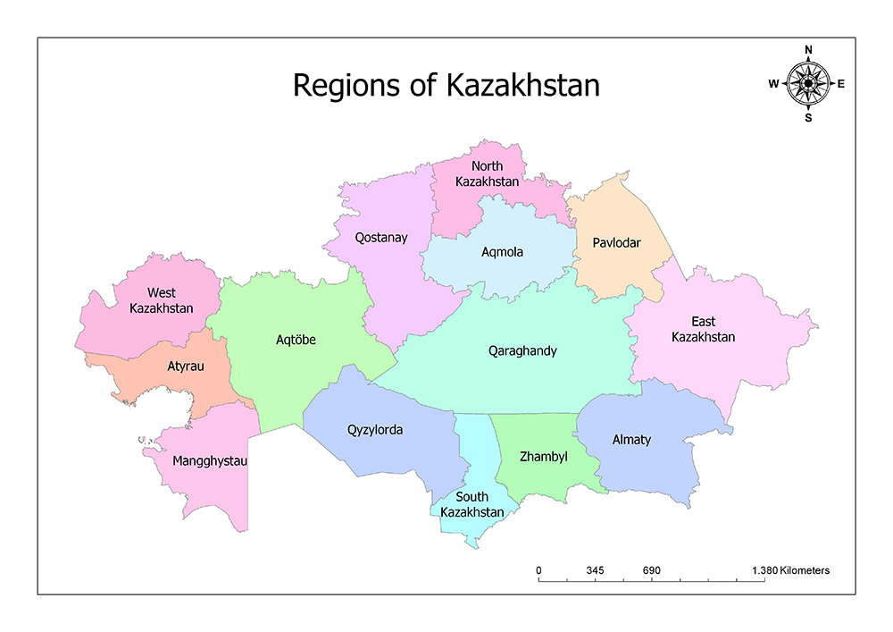
Fourteen Regions of Kazakhstan
There are fourteen regions in Kazakhstan. These regions are Aqmola Region, Aqtobe Region, Almaty Region, Atyrau Region, East Kazakhstan Region, Zhambyl Region, Qaraghandy Region, Qostanay Region, Qyzylorda Region, Mangghystau Region, North Kazakhstan Region, Pavlodar Region, South Kazakhstan Region, and West Kazakhstan Region.
The largest province of Kazakhstan is Qaraghandy Region and the smallest province is North Kazakhstan Region. The region with the highest population is South Kazakhstan Region / Turkistan Region and the least one is the region of Atyrau Region. The region with the highest population density is South Kazakhstan Region / Turkistan Region and the region with the least population density is Aqtobe Region.
Aqmola Region
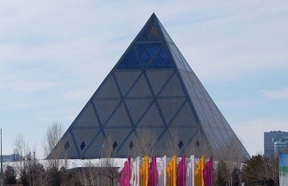
Aqmola Region is located in the northern part of Kazakhstan. The region has a surface area of 146,219 square kilometers. In 2017, the population is 715,000 and the population density is 4.9 / sq. Km. Aqmola Region takes its name from the center of the region, Aqmola. After the city of Aqmola became the capital of Kazakhstan in 1994, its name was changed to Astana and the capital of the region was Kokshetau. Most of the region is covered with steppes. To the north are forests with several mountains and Lake Borovoe.
Aqtobe Region
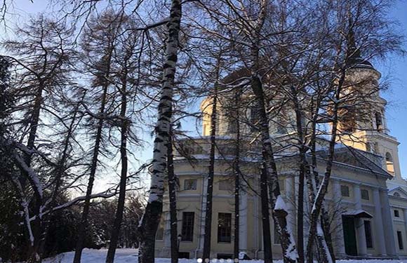
Aqtobe Region is located in the western part of Kazakhstan. The area has a surface area of 300,629 square kilometers. According to the census in 2017, the population is 797,036 and the population density is 2.7 / sq. Km. The center of Aqtobe is the city of Aqtobe. Region is the second largest region after Qaraghandy in Kazakhstan. The Aqtobe region borders Russia in the north and Uzbekistan in the south and is also neighboring six states.
Almaty Region
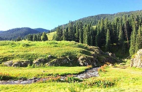
Almaty Region is located in the southeastern region of Kazakhstan. The area has an area of 223,911 square kilometers. According to the census made in 2017, the population is 1,949,837 and the population density is 8.7 / sq. Km. It is the second most populated region in Kazakhstan. It lies to the southeast of the country, on the outskirts of the Tian Shan mountains, on the Kyrgyzstan border. Almaty is the old capital and the largest city of Kazakhstan. The administrative center is located in Taldykorgan. Nursultan Nazarbayev carried the capital to Astana against the people’s proposal and the Chinese threat.
Atyrau Region
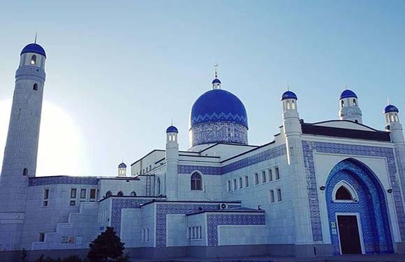
Atyrau Region is located in the northeast of the Caspian Sea and in the west of the country. The region has an area of 118,631 square kilometers and is the second smallest state in the country. According to the census made in 2017, the population is 556,388 and the population density is 4.7 / sq. Km. The neighboring state of Russia is also neighboring with the province of Aqtobe, Mangghystau and West Kazakhstan. Most of the province has rich Caspian oil fields. This is very important because the pipeline from Atyrau to Grozny passes through here. This pipeline goes to Europe via Russia.
East Kazakhstan Region
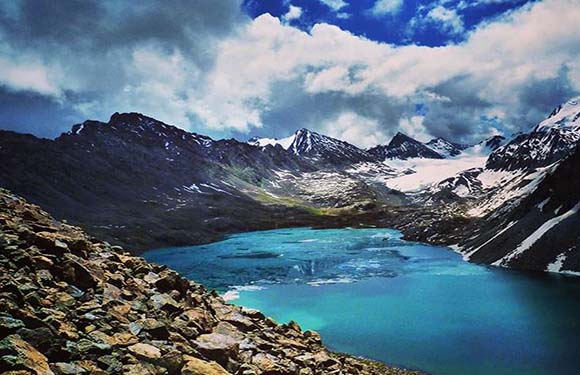
East Kazakhstan Region is located in the western part of Kazakhstan. The region has a surface area of 283,226 square kilometers. The population is 1,393,932 and the population density is 4.9 / sq. Km. Oskemen is the capital of the Region. China’s Xinjiang Uyghur Autonomous Region in the east, Altai Republic of Russia in the north, Almaty Province in the south, Pavlodar and Qaraghandy in the west are neighboring provinces.
Zhambyl Region
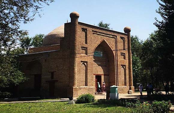
Zhambyl Region is located in the southeastern region of Kazakhstan. The region has a surface area of 144,264 square kilometers. In 2017, the population is 1,071,645 and the population density is 7.4 / sq. Km. Taraz is the capital of the Region. The state has borders with Kyrgyzstan and Uzbekistan. Qaraghandy province is adjacent to the province of South Kazakhstan and the province of Almaty.
Qaraghandy Region
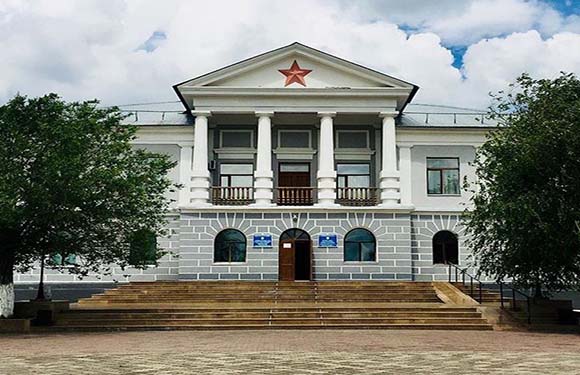
Qaraghandy Region is located in the central region of Kazakhstan. The region’s area is 427,982 square kilometers and is the largest province in Kazakhstan. According to the census in 2017, the population is 1,363,638 and the population density is 3.2 / sq. Km. Qaraghandy is the capital of the Region. The state has no borders to any country, but it has a limit to almost all other states. The city was one of the strongest states in the Soviet Union due to the presence of coal mines.
Qostanay Region
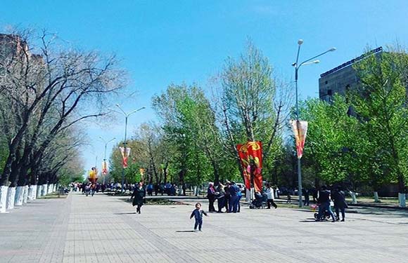
Qostanay Region is located in the central and northern part of Kazakhstan. The region has a surface area of 196,001 square kilometers. According to the census made in 2017, the population is 882,961 and the population density is 4.5 / square km. Qostanay is the capital of the Region. North Kazakhstan and Aqmola provinces in the east, Russia in the north, Qaraghandy in the south, Aqtobe Province in the west are neighbors of the region.
Qyzylorda Region

Qyzylorda Region is located in the southern region of Kazakhstan. The region has a surface area of 226,019 square kilometers. In 2017, the population is 727,990 and the population density is 3.2 / sq. Km. The capital of the Region is Qyzylorda. It is adjacent to South Kazakhstan Province in the east, Uzbekistan to the south, Qaraghandy Province to the north and Aqtobe Province to the west.
Mangghystau Region
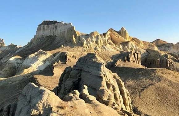
Mangghystau Region is located in the southwestern region of Kazakhstan. The area has a surface area of 165,642 square kilometers. According to the census made in 2017, the population is 674,963 and the population density is 3.6 / sq. Km. The province has long shores on the Caspian coast and has borders to Turkmenistan and Uzbekistan. Mangghystau is also neighbor to the province of Atyrau and the province of Aqtobe.
North Kazakhstan Region
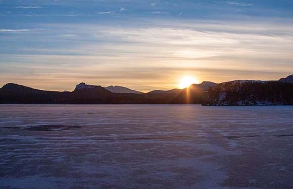
North Kazakhstan is the northernmost region of Kazakhstan. The area of the Region is 97,993 square kilometers and is the smallest province among all the states of Kazakhstan. According to the census made in 2017, the population is 558,700 and the population density is 5.9 / square kilometers. Petropavl is the capital of the Region. To the north have borders with Russia. It is neighbor to three Kazakh states within the country: in the east to Pavlodar, to Qostanay in the west and to Aqmola in the south.
Pavlodar Region
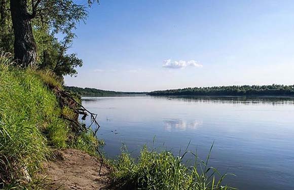
Pavlodar Region is located in the northeastern region of Kazakhstan. The area has a surface area of 124,800 square kilometers. According to the census in 2017, the population is 749,516 and the population density is 6.0 / square km. The capital of the Region is Pavlodar. Pavlodar Province is neighbor with Russia to the North, Aqmola and North Kazakhstan in the West, East Kazakhstan Province in the East and Qaraghandy Province in the South. With Nikita Khrushchev’s Virgin Lands Campaign many folks, especially Ukrainians, migrated to Pavlodar.
South Kazakhstan Region/Turkistan Region
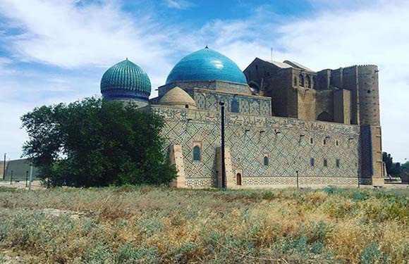
South Kazakhstan Region is located in the southern region of Kazakhstan. The region has a surface area of 117,249 square kilometers. According to the census made in 2017, the population is 2,685,009 and the population density is 23.0 / km2. Also, Turkistan Region is the most populated region of Kazakhstan. The capital of the Region is Turkistan. The South Kazakhstan Region has its border with Uzbekistan and is very close to Tashkent, the capital of Uzbekistan. It is also neighbor with the three states of Kazakhstan: Qaraghandy State, Qyzylorda Province and Zhambyl Province.
West Kazakhstan Region
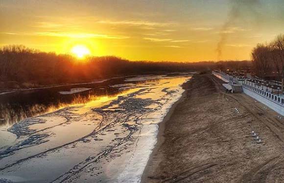
West Kazakhstan Region is located in the southern region of Kazakhstan. The region has a surface area of 151,339 square kilometers. According to the census in 2017, the population is 618,261 and the population density is 4.1 / sq. Km. The capital of the Region is Oral. The West Kazakhstan Region has a border with Russia and is close to the Ural Mountains. The Ural River emerges from Russia and flows through the province into the Caspian Sea. West Kazakhstan Region is partly located in Asia, partly in Europe.
Four Cities of Kazakhstan
There are four independent cities in Kazakhstan. These cities; Almaty, Astana, Baikonur, Shymkent.
Almaty
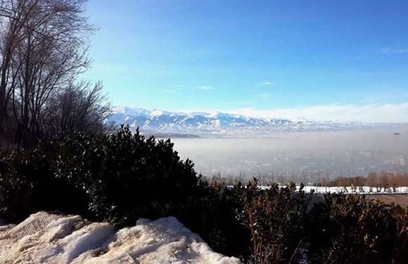
The city of Almaty is located in Almaty Region in the southeast of Kazakhstan. The city has a surface area of 682 square kilometers. The population of the city of Almaty in 2018 is 1,801,713 and the population density is 2,600 / square kilometers. The city of Almaty was founded in 1854 as the border fortress of the Russians and is the most developed cosmopolitan city in Central Asia. Almaty is the largest city in Kazakhstan.
Astana
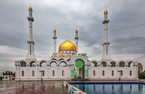
The city of Astana is located in the Aqmola Region, north of Kazakhstan. The area of the city is 810.2 square kilometers. The population of Astana is 1,200,000 in 2018 and the population density is 1,300 / sq. Km. It was declared as the capital of Kazakhstan in 1998 and moved from Almaty to prevent people from cluttering in the southern part of the country. After Astana became the capital of Kazakhstan, it showed a great change. The modern Astana is a planned capital and its main plan was designed by Japanese architect Kisho Kurokawa.
Baikonur
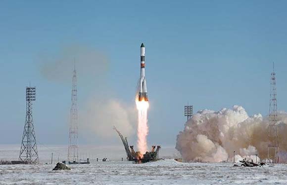
The city of Baikonur is located in the Qyzylorda Region in the south of Kazakhstan. The city has an area of 57 square kilometers. The population of Baikonur is 36,175 in 2018 and the population density is 630 / square km. The city is hired and managed by Russia. The city was established to serve Baikonur Cosmodrome during the Soviet era. Cosmodrome is the world’s first and largest operational space launch facility.
Shymkent
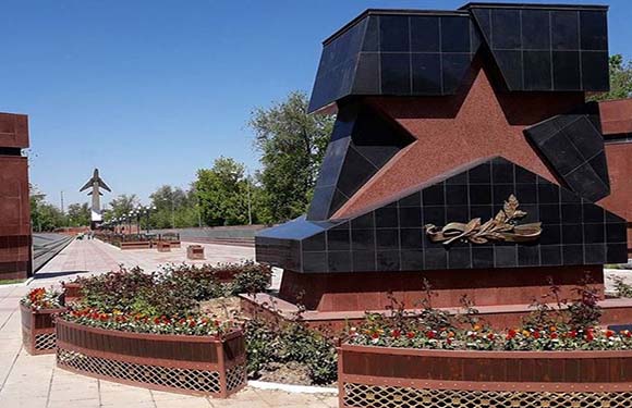
Shymkent is located in South Kazakhstan Region / Turkistan Region, south of Kazakhstan. The city has an area of 1,170 square kilometers. The population of Shymkent is 1,002,291 in 2018 and the population density is 860 / square km. It is the third largest city in Kazakhstan after Almaty and Astana and is one of the major metropolises of the country. Located at the junction of the Turkestan-Siberian Railway, the city also has Shymkent International Airport. Shymkent is 690 km west of Almaty and 120 km north of Tashkent.