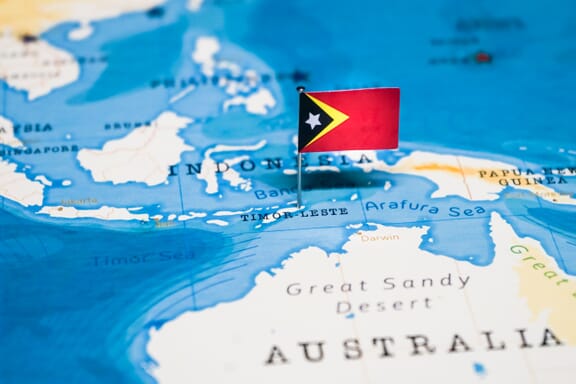
Timor-Leste is located in the Southeastern Asia region at latitude -8.874217 and longitude 125.727539 and is part of the Asian continent continent.
The DMS coordinates for the center of the country are:
8° 52' 27.18'' S
125° 43' 39.14'' E
You can see the location of Timor-Leste on the world map below:
Timor-Leste on the World Map
Timor-Leste Neighboring Countries
The neighboring countries of Timor-Leste (TL) are:
- Indonesia (ID)
Maritime Borders
East Timor borders with the Pacific Ocean.
Timor-Leste Key Facts
| Country | Timor-Leste |
|---|---|
| Coordinates |
Latitude: -8.874217 Longitude: 125.727539 |
| Country Codes |
Alpha 2: TL Alpha 3: TLS |
| Country Flag Emoji | 🇹🇱 |
| Int. Phone Prefix | +670 |
| Capital city | Dili |
| Continent / Subcontinent |
Asia Southeastern Asia |
| Country Area | 14,874 sq km |
| Population 2024 |
1,400,638 World Rank: 154 |
| Median Age | 20.3 |
| Life expectancy | 67.7 |
| Major languages | Tetum, Portuguese |
| UTC/GMT Time |
Number of time zones: 1
|
| Internet TLD | .tl |
| Biggest Airport | Presidente Nicolau Lobato International Airport (DIL) |
| Average temperature |
25.25 °C 77.45 °F |
| Administrative Divisions | 12 municipalities 1 special administrative region |
| Political system | Parliamentary democracy |
Timor-Leste Economy Facts
| World Bank Income Group | Lower middle income |
|---|---|
| World Bank Region | East Asia & Pacific |
| Currency | US Dollar (USD) |
| GDP in 2020 |
$1.9 (billions of USD) World Rank: 190 |
| GDP per capita in 2020 |
$1,332 World Rank: 185 |
| Major Industries / Economic Sectors | Manufacturing, services, agriculture, energy |
| Top 5 Import Countries | Singapore, Australia, China, Indonesia, Japan |
| Top 5 Export Countries | Singapore, Australia, China, Japan, United States |
Biggest Cities in Timor-Leste
Here are the largest cities in Timor-Leste based on 2024 data:
| City | Population |
|---|---|
| Dili | 150,000 |
| Maliana | 22,000 |
| Suai | 21,539 |
| Liquica | 19,000 |
| Aileu | 17,356 |
| Lospalos | 17,186 |
| Maubara | 16,300 |
| Baucau | 16,000 |
| Venilale | 16,000 |