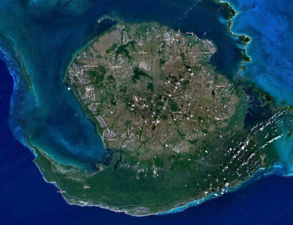
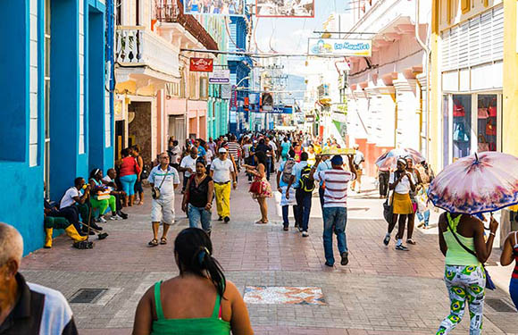
There are a variety of ways in which countries divide their territory: states, districts, provinces, cantons, departments… the list goes on. There are no districts or states in Cuba, but it does have provinces. It also has a special municipality.
There are 15 Cuba provinces and an island, Isla de Juventud, with special municipality status. This gives Cuba 16 distinct territories.
Provinces of Cuba Map
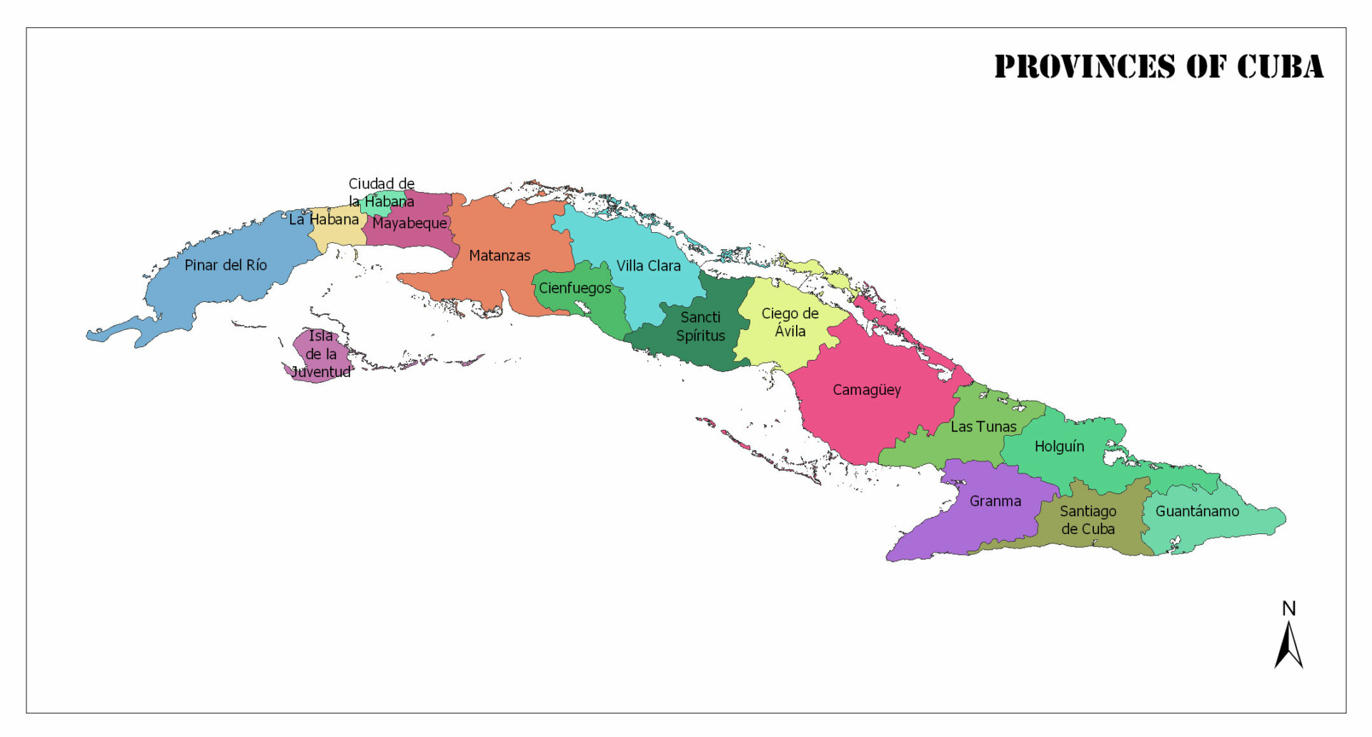
Provinces of Cuba
In this post, we’ll explore these territories and list some general information about each, such as population, total area, and capital city. Population data comes from statistics published in 2020 by the Cuban government.
Camagüey
- Population: 763,389
- Total Land Area: 15,386 square kilometers (5,941 square miles)
- Capital: Camagüey
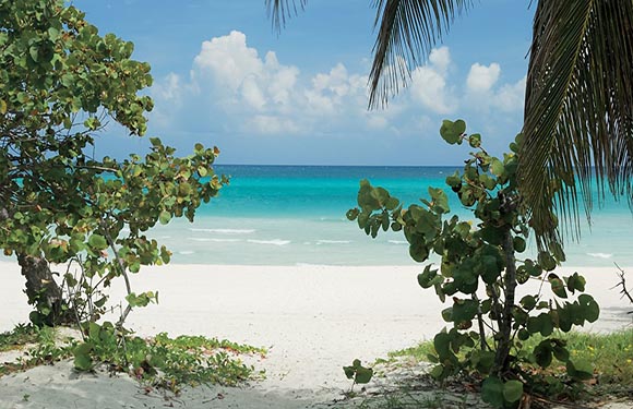
This is the largest of the Cuban provinces, though it does not have the highest population. The capital of Camagüey goes by the same name as the province, and other notable cities here are Florida and Nuevitas. The province has two coastlines, one on each side of the country, both of which are known for sandy beaches. The northern coast features two archipelagos, and the southern coast is home to several cays.
There are no mountains or large hills that pass through this province; it is of mostly low elevation. The economy of the province is mostly supported by sugar and cattle production. Tourism has not made significant contributions to the economy in this province, although it is considered to have potential as a good tourist destination with its sandy beaches.
Ciego de Ávila
- Population: 435,326
- Total Land Area: 6,972 square kilometers (2,692 square miles)
- Capital: Ciego de Ávila
Ciego de Ávila was historically a part of the Camagüey province, but the Cuban government separated the two in 1975. The province is home to Laguna de Leche, Cuba’s largest natural lake, and there are many mangroves on the province’s southern coast. The main economic activities here are cattle ranching and the production of sugar, pineapple, and citrus fruits. Tourist resorts are also being developed in the archipelagoes off of the northern coast.
The capital of this province is Ciego de Ávila, which was founded in 1840. It lies on the Carretera Central highway of Cuba as well as a major railroad, and there are several colonial Spanish buildings in the city’s center.
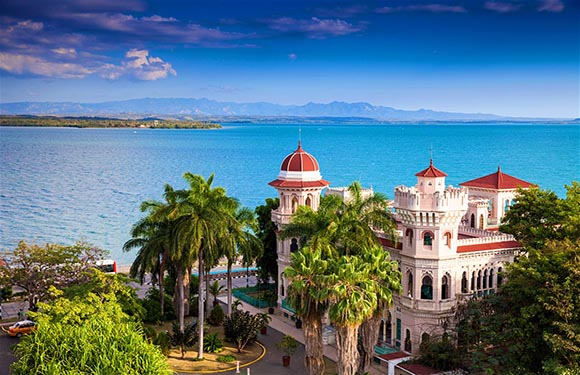
Cienfuegos
- Population: 406,244
- Total Land Area: 4,189 square kilometers (1,617 square miles)
- Capital: Cienfuegos
The province of Cienfuegos and its capital of the same name are located in central western Cuba along the country’s southern coast. This Cuban province has played an important role in the country’s sugar industry for many decades. Sugar mills are located throughout the region, and growing and processing sugar are still major economic activities, though tourism has grown in the province. Diving in particular is a popular attraction off the coast of Cienfuegos.
The capital city of Cienfuegos acquired its current name in 1829 after the Captain General of Cuba from 1816-1819, José Cienfuegos. The historic center of Cienfuegos is on the UNESCO World Heritage List because it is an example of Spanish Enlightenment in urban planning.
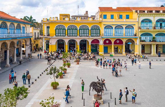
La Habana
- Population: 2,132,183
- Total Land Area: 728 square kilometers (281 square miles)
- Capital: La Habana (Havana)
La Habana is Cuba’s most populous province and also the location of the nation’s capital of the same name, which is known in English as Havana. La Habana was one of the original six provinces into which the island was divided in 1878, but this referred to a larger province that was split into two in 2010.
The focal point of the province is the city of Havana, the capital of Cuba. It is the main port and commercial hub of the country as well as the home of the Cuban government. The city is known for its interesting history, culture, and colorful buildings, making it a popular tourist destination — more than one million tourists typically visit in a year.
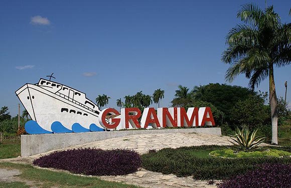
Granma
- Population: 817,763
- Total Land Area: 8,374 square kilometers (3,233 square miles)
- Capital: Bayamo
This province of Cuba gets its name from a yacht that was used by Che Guevara and Fidel Castro. The mountainous regions of the Granma are used for coffee production, which is a major contributor to the region’s economy.
The capital of Granma is Bayamo, one of the largest cities in the eastern region of Cuba. It was established by Spanish conquistador Diego Velázquez de Cuéllar in 1513.
Guantánamo
- Population: 505,606
- Total Land Area: 6,168 square kilometers (2,381 square miles)
- Capital: Guantánamo
Guantánamo is Cuba’s easternmost province and lies just 80 km (50 mi) west of Haiti. The culture and architecture of Guantánamo are unlike what is found in the rest of the country — there are many Jamaican immigrants here, and the buildings show more influence from French refugees from Haiti that aided in the colonization of the region.
The capital is also named Guantánamo, and it was founded in 1797. In the extinct Taíno language, the name means “land between the rivers.”
Holguín
- Population: 1,021,591
- Total Land Area: 9,216 square kilometers (3,558 square miles)
- Capital: Holguín
This province is in the southeast of Cuba, along the island’s northern coast. It is Cuba’s third most populous province and its capital city is also named Holguín. It’s believed that Cristopher Columbus landed in what is now the Holguín province in 1492, declaring it “the most beautiful land human eyes have ever seen.”
Isla de la Juventud
- Population: 83,625
- Total Land Area: 2,419 square kilometers (934 square miles)
- Capital: Nueva Gerona
Isla de la Juventud is the second-largest island in Cuba and has a special municipality status. The capital city of the island is Nueva Gerona. Much of the island is covered in pine forests, and these support its lumber industry.
Fishing and the production of citrus fruit and vegetables are also important industries on the island. Tourism is also popular on the island due to its attractive beaches and resorts.
Artemisa
- Population: 514,332
- Total Land Area: 4,003 square kilometers (1,456 square miles)
- Capital: Artemisa
The province of Artemisa is one of the two new provinces that were created by dividing the old La Habana Province. It is among the smallest provinces in Cuba, but it has coastlines on the northern and southern sides of the island.
The economy of Artemisa is supported mostly by agriculture, though it also contains an important port on the northern coastline. It also contains bases of the Cuban Air Force and Cuban Navy.
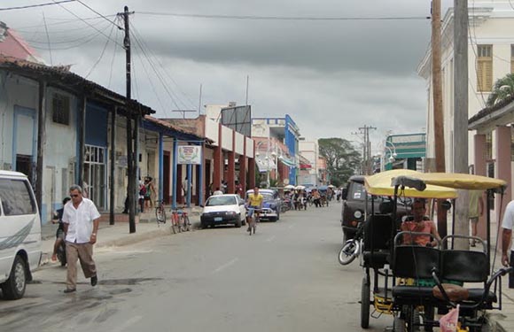
Las Tunas
- Population: 533,224
- Total Land Area: 6,593 square kilometers (2,546 square miles)
- Capital: Las Tunas
Las Tunas is a province in eastern Cuba with a capital city of the same name. It is the least visited province in the country, although efforts are being made to change this. There are a variety of artistic installations in the center of the province’s capital, and this has given it the nickname of the “City of Sculptures” within Cuba.
Matanzas
- Population: 716,320
- Total Land Area: 11,792 square kilometers (4,553 square miles)
- Capital: Matanzas
Matanzas is the second-largest province in Cuba and is one of the most industrialized. In addition to sugar production, petroleum products play a large role in the region’s economy. The capital is also named Matanzas, and it’s known for being a cultural center. There are seventeen bridges crossing three rivers in the city of Matanzas, which give it the nickname, City of Bridges.
Mayabeque
- Population: 384,389
- Total Land Area: 3,744 square kilometers (1,446 square miles)
- Capital: San José de las Lajas
Along with Artemisa, Mayabeque is the other province that was created in 2011 due to the division of the form La Habana Province. The capital of Mayabeque is San José de las Lajas, and the province is the least populated in the country. Mayabeque’s economy is mostly linked to agricultural activities and livestock farming, although there are also rum factories, power plants, and sugar mills.
Pinar del Río

- Population: 583,037
- Total Land Area: 8,884 square kilometers (3,430 square miles)
- Capital: Pinar del Río
This is the westernmost province in Cuba, and it features a mountain range, fertile valleys, coastline, and an archipelago. The Viñales Valley in the province was listed as a UNESCO World Heritage Site in 1999 because of the traditional tobacco-growing techniques used there.
The capital of this province goes by the same name and was one of the last major cities to be founded by the Spanish in Cuba in 1867. It is the tenth-largest city in Cuba.
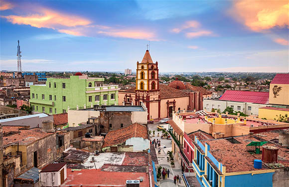
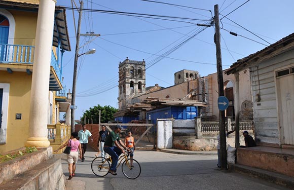
Sancti Spíritus
- Population: 463,844
- Total Land Area: 6,777 square kilometers (2,617 square miles)
- Capital: Sancti Spíritus
The Cuban province of Sancti Spíritus has a capital of the same name and also includes the city of Trinidad. This is also where Cuba’s largest man made reservoir, the Embalse Zaza, is located.
Sugar cane and cattle are two important contributors to the region’s economy, but the city of Trinidad is also a major tourist attractor. It’s listed as a UNESCO World Heritage Site and is full of colonial buildings that date back to the 16th century.
Santiago de Cuba
- Population: 1,045,631
- Total Land Area: 6,228 square kilometers (2,405 square miles)
- Capital: Santiago de Cuba
Santiago de Cuba, in the southwest of the county, is the second-most populated of the provinces of Cuba, and it has a storied history of battles fought during Cuba’s war for independence as well as the Cuban Revolution in 1959.
As is true with most of Cuba’s provinces, Santiago de Cuba relies heavily on agriculture to support its economy, though there are also high quantities of material resources like nickel and iron in the region.
Villa Clara
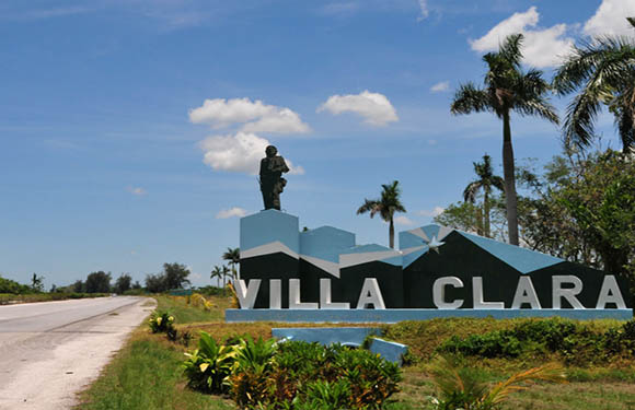
- Population: 775,091
- Total Land Area: 8,442 square kilometers (3,259 square miles)
- Capital: Santa Clara
Villa Clara is a province in central Cuba with the capital city of Santa Clara. Sugar and tobacco are two important commodities in Villa Clara, but the construction of beach resorts on its northern coastline is intended to help the region earn money from tourism.
Santa Clara was founded in 1689 and is presently Cuba’s fifth-most populous city. It is the location of a mausoleum with the remains of Che Guevara as well as Parque Vidal, an iconic Cuban park.