The provinces of Vietnam fall into the country’s highest administrative division along with the country’s municipalities. There are 58 provinces and five municipalities, all controlled by Vietnam’s central government.
Each province is further divided into provincial cities, towns, and rural districts. These make up the second-highest administrative division. The third and smallest level of division divides provincial cities and towns into wards and communes, and rural districts into townships and communes.
The government of Vietnam also often categorizes its 58 provinces into eight geographic regions, which are further grouped into three macro-regions: Northern, Central, and Southern. In this post, we’ll learn about each region in Vietnam, looking at the most important provinces in each.
To see where any province is located, check out the interactive Vietnam Provinces Map below, which will show the name of each province when selected.
Below is a table that lists each of the 58 provinces of Vietnam along with its five municipalities and the regions in which each is located. The provinces and municipalities are listed in alphabetical order, and the municipalities appear with an asterisk.
| Province/Municipality * | Region |
| An Giang | Mekong Delta |
| Bà Rịa–Vũng Tàu | Southeast |
| Bắc Giang | Northeast |
| Bắc Kạn | Northeast |
| Bạc Liêu | Mekong Delta |
| Bắc Ninh | Red River Delta |
| Bến Tre | Mekong Delta |
| Bình Định | South Central Coast |
| Bình Dương | Southeast |
| Bình Phước | Southeast |
| Bình Thuận | South Central Coast |
| Cà Mau | Mekong Delta |
| Cần Thơ * | Mekong Delta |
| Cao Bằng | Northeast |
| Đà Nẵng* | South Central Coast |
| Đắk Lắk | Central Highlands |
| Đắk Nông | Central Highlands |
| Điện Biên | Northwest |
| Đồng Nai | Southeast |
| Đồng Tháp | Mekong Delta |
| Gia Lai | Central Highlands |
| Hà Giang | Northeast |
| Hà Nam | Red River Delta |
| Hà Nội * | Red River Delta |
| Hà Tĩnh | North Central Coast |
| Hải Dương | Red River Delta |
| Hải Phòng * | Red River Delta |
| Hậu Giang | Mekong Delta |
| Hồ Chí Minh City * | Southeast |
| Hòa Bình | Northwest |
| Hưng Yên | Red River Delta |
| Khánh Hòa | South Central Coast |
| Kiên Giang | Mekong Delta |
| Kon Tum | Central Highlands |
| Lai Châu | Northwest |
| Lâm Đồng | Central Highlands |
| Lạng Sơn | Northeast |
| Lào Cai | Northeast |
| Long An | Mekong Delta |
| Nam Định | Red River Delta |
| Nghệ An | North Central Coast |
| Ninh Bình | Red River Delta |
| Ninh Thuận | South Central Coast |
| Phú Thọ | Northeast |
| Phú Yên | South Central Coast |
| Quảng Bình | North Central Coast |
| Quảng Nam | South Central Coast |
| Quảng Ngãi | South Central Coast |
| Quảng Ninh | Northeast |
| Quảng Trị | North Central Coast |
| Sóc Trăng | Mekong Delta |
| Sơn La | Northwest |
| Tây Ninh | Southeast |
| Thái Bình | Red River Delta |
| Thái Nguyên | Northeast |
| Thanh Hóa | North Central Coast |
| Thừa Thiên-Huế | North Central Coast |
| Tiền Giang | Mekong Delta |
| Trà Vinh | Mekong Delta |
| Tuyên Quang | Northeast |
| Vĩnh Long | Mekong Delta |
| Vĩnh Phúc | Red River Delta |
| Yên Bái | Northwest |
Regions of Vietnam Map
The color-coded Vietnam Regions Map below details the eight regions of Vietnam as well as the provinces within each.
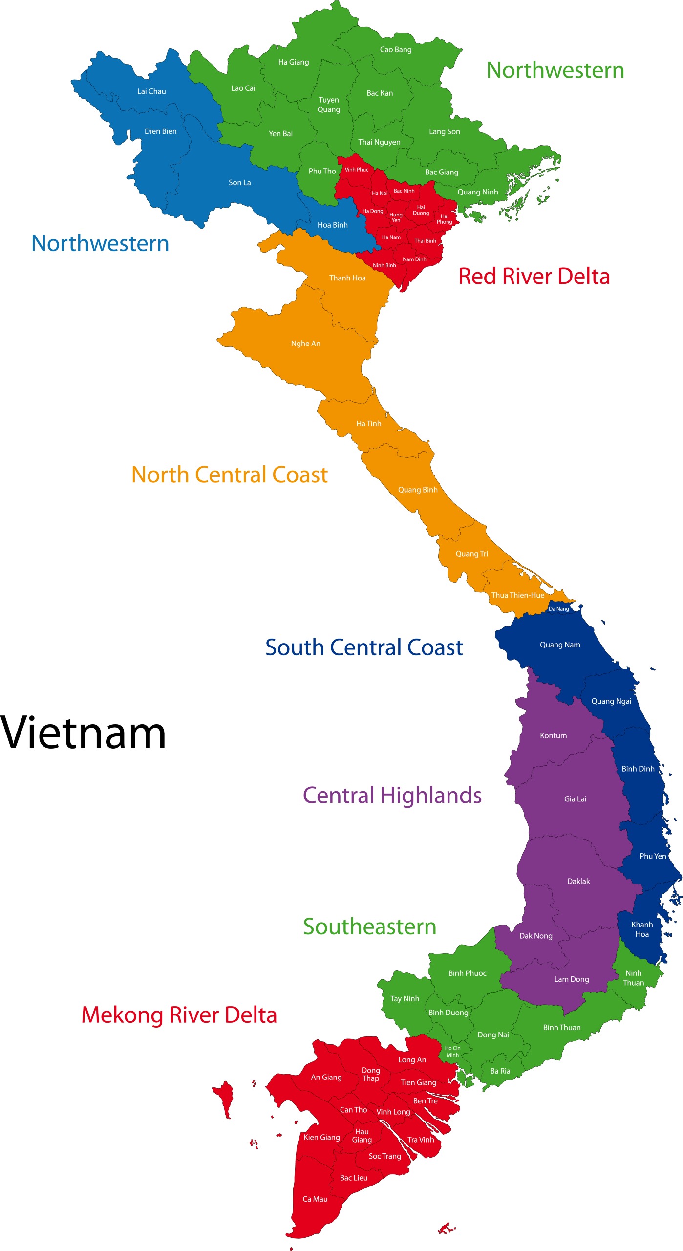
Northern Vietnam
Northern Vietnam is the northernmost geographical region in the country, bordering China, Laos, Central Vietnam, and the Gulf of Tonkin. There are three geographic regions and 23 provinces in Northern Vietnam as well as two municipalities.
This is also the oldest of the three macro-regions in Vietnam, as the Red River Delta is where Vietnamese culture began.
Northeast

This is the largest region in Northern Vietnam and the furthest north. It borders China and is just north of the Red River Delta. It is home to nine provinces and no municipalities. The most populous province in the region is Bắc Giang and the largest by size is Lạng Sơn.
In general, the Northeast Region of Vietnam is known for its topographically diverse landscape consisting of mountain ranges, valleys, and plateaus. It was under the rule of several Chinese dynasties throughout history, and it is not uncommon to hear Chinese languages spoken in the area today.
Bắc Giang
Bắc Giang is a Vietnamese province located just north of the Red River Delta Region in Northern Vietnam. Its population was just over 1.8 million people in 2019, making it the most populous province in the region.
Agriculture is the most important economic activity in this province, particularly the production of fruit. The main crops in Bắc Giang are Pineapple and Lychee, with Lychee crops covering more than 50,100 acres (20,275 hectares) in the province.
The popular tourist attractions in Bắc Giang include museums, monuments, and natural beauty. The Khe Rỗ Primitive Forest is a protected virgin primitive forest that’s home to many species of plants and animals. Guided tours through the forest are available.
Hà Giang
The Hà Giang province of Vietnam is one of the poorest in the country. This is because the terrain is mostly mountainous, which makes it difficult to develop agriculture.
There are 43 different ethnic groups living in this province, and each has its own language, culture, and traditions. The largest ethnic groups are the Hmong, Tày, Dao, and Vietnamese.
Due to its rugged landscape, most of the attractions in Hà Giang are natural. Mã Pí Lèng Pass, for example, is a stunning mountain pass. There are also several famous markets that take place just once a year in the region, such as the Khau Vai “Love Market.”
Northwest

There are six provinces that make up the mountainous Northwestern Region of Vietnam, of which Sơn La is the most populous and largest in size. With a population of just over 4.4 million in 2015, this is the least populous region in Vietnam.
One of the most prominent features in this area of Vietnam is Fansipan, which is the highest peak in Indochina and is located in the Hoàng Liên Sơn Mountain Range. Other mountain ranges in the region are the Tà Trùng and Phìn Hồ ranges.
Several ethnic groups live in this part of Vietnam, such as the Hmong, Muong, and Thai.
Sơn La
This is the largest and most populous province in Northwestern Vietnam. It’s home to the Black Tai (Tai Đen), White Tai (Tai Trắng), Hmong, and Muong ethnic groups as well as Sơn La Dam, which is one of the largest hydroelectric power stations in Southeast Asia.
Each ethnic group has its own cultures and traditions, and some of the traditional food in the Sơn La Province includes smoked buffalo meat and special local rice wine.
Mountain ranges and steep valleys give this region one of the most extreme landscapes in Vietnam.
Hòa Bình
Hòa Bình is the second-most populous province in Northwestern Vietnam and also the smallest in size. It was first created in 1886 under the name “Mường Province,” but this name was changed to the current name in 1891. The capital of this province is Hòa Bình City.
Known as a center of ancient culture in Vietnam, this province has many cultural tourist attractions such as historic relics and museums. There are also natural attractions such as Mai Châu Valley and Hòa Bình Lake, one of the largest man-made lakes in Vietnam.
Red River Delta

Along with eight provinces, the region of Vietnam’s Red River Delta is home to two major municipalities: Hanoi and Hai Phong. Hanoi is the capital of Vietnam and the country’s second-largest city. While this region is the smallest in size, it has the highest population and population density of any in the country.
In addition to densely packed major cities, the Red River Delta is agriculturally rich, and much of the land is dedicated to rice cultivation. In 2004, the region was designated as the Red River Biosphere Reserve by UNESCO for its wetlands with high levels of biodiversity.
Hải Dương
Although it’s got a much smaller population than Hanoi, this is the most populous province in the Red River Delta Region. Hải Dương is a landlocked province with a strong manufacturing industry. The region is also known for its lychee production and mung bean paste.
Manufacturing may be the main industry supporting the economy of Hải Dương, but the diversity of the economy is also important to the province. Due to its location in the middle of the Red River Delta, it is well positioned for agriculture and transportation.
Tourists visiting this province may be interested in seeing the famous Kiếp Bạ Temple or taking a boat tour of the river delta.
Ninh Bình
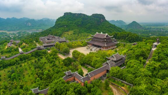
Ninh Bình is a province in Northern Vietnam that’s famous for its natural beauty. There are 23 ethnic groups that live in the province, though 98% of the population is ethnically Vietnamese, and it has a very short coastline on the Gulf of Tonkin.
One of the things the province is most famous for is the many cultural and natural attractions it has to offer. Some of these include Cúc Phương National Park, the first and largest natural reserve in Vietnam, and the Tràng An scenic area with its boat cave tours.
This province is also home to Bái Đính Temple, the largest Buddhist worshiping complex in Vietnam.
Central Vietnam
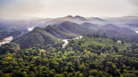
Central Vietnam is geographically diverse and located in the center of the country. It is further divided into the North Central, South Central Coast, and Central Highlands regions. Throughout this macro-region, there are highlands, jungles, amazing beaches, and more.
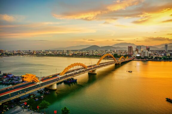
In addition to tourists interested in visiting the many sandy beaches in Central Vietnam, visitors come to admire the many historical sites in this part of the country. Đà Nẵng is the one major municipality in this region, an important port city with the fifth-largest municipal population.
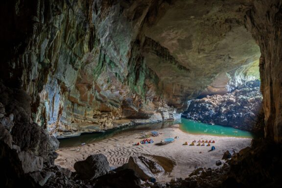
Important sites in Central Vietnam include the imperial city of Huế, the ancient town of Hội An, and Hang Son Doong, the largest cave in the world.
North Central Coast
This region of Vietnam consists of the upper-central, narrowest stretch of the country, reaching east to the South China Sea and west to Laos. There are six provinces in this region, the most populous of which is Thanh Hóa. The largest province in the region by size is Nghệ An.
There are three UNESCO World Heritage Sites in this region of Vietnam, one of which is a natural site and two of which are cultural. The region also has the second-lowest GDP per capita in the country after Northwestern Vietnam.
The North Central Coast Region of Vietnam borders the country’s Northwestern and Red River Delta regions to the north and the South Central Coast region to the south.
Thanh Hóa
This is the most populous province in North Central Vietnam and the third-most populous in the country. The province’s capital city of the same name is one of the most populous in the region and has been the center of politics, economy, and culture in the province for many years.
The province was one of the earliest centers of ancient Vietnamese culture and was inhabited by humans at least 6,000 years ago. Today there are many different ethnic groups living in the province.
Some of the most interesting sites in this province include the Citadel of the Hồ Dynasty in the city of Thanh Hóa and Sầm Sơn Beach in the seaside resort city of the same name.
Thừa Thiên–Huế
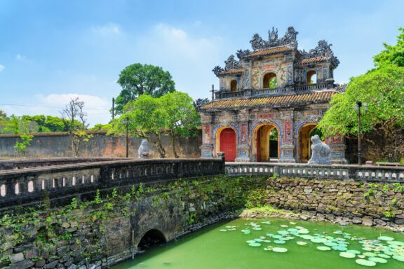
The Vietnamese province of Thừa Thiên–Huế is located at the far southern end of the North Central Region of Vietnam, bordering the South Central Coast Region. The area of this province has been inhabited for tens of thousands of years, but it is well known in recent history for the heavy fighting that occurred during the Vietnam War.
Huế is the capital and largest city in the province and is separated from the city of Đà Nẵng by Hải Vân Pass, one of several scenic tourist attractions in the area. Huế is famous for having functioned as the old Imperial city and capital for the Nguyễn dynasty.
South Central Coast
The South Central Coast is the least populous region in Central Vietnam and contains seven provinces and one municipality. The municipality is the city of Đà Nẵng, which is located at the border of this region and North Central Vietnam, on the coast of the South China Sea.
The Quảng Nam Province of the South Central Coast is the only one in the region to border the neighboring country Laos, the others bordering provinces in the Central Highlands Region.
The geography of this region of Vietnam is known for being diverse, including mountains, beaches, bays, peninsulas, islands, and more.
Bình Định
This province is the most populous in the South Central Coast Region, and it’s likely the first place the Cham people settled in Vietnam. The favorable location led to the establishment of Cham Port of Thị Nại, which is now Quy Nhơn, the capital city of the province.
Economically, the Bình Định Province benefits from its strategic location as a gateway to the Central Highlands Region and its major port at Quy Nhơn. The economy of the province is largely based on agriculture, though furniture manufacturing, forestry, livestock, and fishing also support the economy.
Khánh Hòa

Khánh Hòa is the second easternmost province on the Vietnamese mainland, located at the bottom of the South Central Coast area along the South China Sea. The capital city of Khánh Hòa is Nha Trang, which is a very popular tourist destination in Vietnam.
In addition to its picturesque beaches and bays, Nha Trang is known for being a good location for activities like SCUBA diving and kiteboarding. There are also a number of cultural attractions like pagodas and Champa ruins.
The attractive coastline and Cham heritage of this province attracts many tourists, which has helped the province become the most economically developed in the region after the municipality of Đà Nẵng.
Central Highlands

The Central Highlands Region in Vietnam consists of a plateau located in the central part of the country, bordering Cambodia, Laos, the South Central Coast, and Southeastern Vietnam. It has no coastline.
Diversity in landscapes and ethnic groups makes the region unique and gives each of its five provinces different qualities. The region lies on a series of connected plateaus, the highest of which is Lâm Viên Plateau, also called Đà Lạt Plateau.
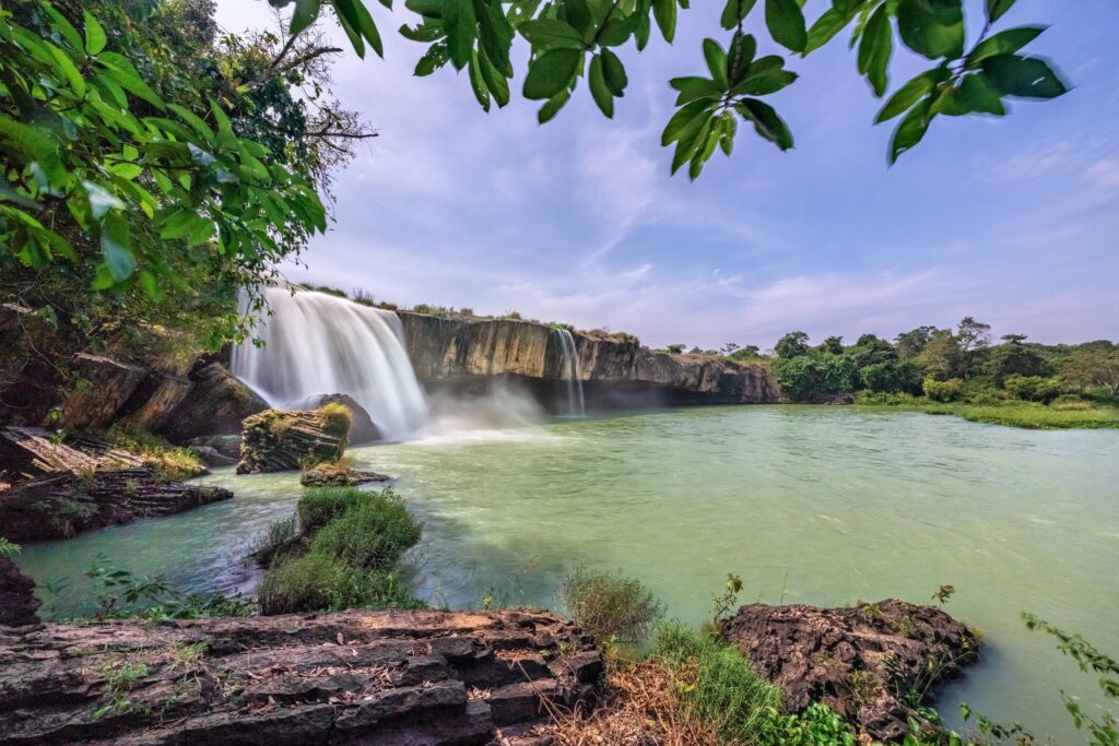
Due to the high quantity of fertile soil in the Central Highlands, coffee production is the region’s most important industry. Numerous waterfalls in the region allow it to take advantage of hydroelectric power.
Gia Lai
Gia Lai is the second-largest province in Vietnam and the most populous in the Central Highlands. The capital city of the province is Pleiku, which was an important center for US and South Vietnamese forces during the Vietnam War.
Attractions in Pleiku include the Pleiku Air Base and nearby natural sites like Phù Cường Waterfall and T’Nung lake. Pleiku is also a hub for the Central Highlands coffee industry, and it’s possible to visit local plantations and sample a variety of coffees.
The name of this province comes from the Jarai people who are indigenous to the area.
Đắk Lắk
This province is the second-largest in size and population in the Central Highlands. Its capital city is Buôn Ma Thuột, which is famous for producing some of the country’s best coffee. Tours of plantations are a common activity for tourists visiting Buôn Ma Thuột.
Outside of the capital city, the natural landscape in Đắk Lắk also attracts many visitors. Yok Đôn National Park is located here, and it’s home to endangered species like the Indochinese tiger and the Asian elephant. There are also many waterfalls in the province.
There are a variety of ethnic groups living in Đắk Lắk, such as the Ede, M’nong, and Jarai people, many of whom still practice traditional ways of life.
Southern Vietnam
The southernmost macro-region of Vietnam includes the Southeast and Mekong River Delta regions, which are made up of 17 provinces and two municipalities, Ho Chi Minh City and Cần Thơ.
This area of Vietnam was the most recently acquired territory by the country and was the first area to be colonized by the French as French Cochinchina. The term “Southern Vietnam” can sometimes also include Central Vietnam in some contexts, especially when speaking about the Vietnam War.
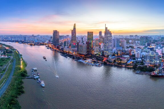
Ho Chi Minh City, formerly Saigon, is located in Southern Vietnam, and it is the most populous city in the country with an estimated population of over 9.1 million in 2021.
Southeast
Vietnam’s Southeast Region includes five provinces and the municipality of Ho Chi Minh City. It is the second-smallest geographic region in Vietnam by total area, but it is also the most urbanized and the most economically developed. More than half of the population in this region lives in urban areas.
This region of Vietnam borders Cambodia, the South China Sea, and the regions of the Central Highlands, South Central Coast, and the Mekong River Delta. The geography in the region is mostly flat, which contrasts with the highlands in the middle of the country and the mountainous north.
Bình Dương
Bình Dương is one of the most important provinces in this region for its economic prosperity and rapid growth. It is located adjacent to Ho Chi Minh City and is connected to important roadways in the region. It’s also located less than 15 km (9.3 mi) from Tân Sơn Nhất International Airport, the largest airport in the country.
The land in Bình Dương is favorable for growing crops, and agriculture plays an important role in the province’s economy. The other major industry in Bình Dương is manufacturing.
The capital city of the province is Thủ Dầu Một, which has been recognized as a first-class city for its outstanding economic achievements.
Đồng Nai
Another important province in Southeastern Vietnam, and the most populous, is Đồng Nai. It is located adjacent to both Ho Chi Minh City and Bình Dương, and it has a small coastline. The province is known for its historic and cultural sites, strong economy, and the production of fruits and vegetables.
One of the most noteworthy sites in Đồng Nai is Cát Tiên National Park, a natural reserve that spans three provinces and is home to a wide range of endemic species. Many domestic and foreign tourists visit the park on tours that are available from nearby cities.
Mekong River Delta

The final and southernmost region on this list is the Mekong River Delta, which gets its name for being the place where the Mekong River empties into the South China Sea via numerous distributaries. There are 12 provinces and one major municipality that make up this region.
Cần Thơ is the municipality of this region, and it’s considered the hub of the Mekong River Delta. It’s got a higher population density than any province in the region, a large freshwater port, floating markets, and a number of tourist attractions.
An Giang
An Giang is the most populous province in the Mekong River Delta and is located in the western part of the region. It borders Cambodia, and the Hậu Giang and Tiền Giang branches of the Mekong River are the main geographic features in the province.
The province is mostly flat, with the exception of the Cấm Mountains in the western part of the province. The mostly flat terrain of An Giang is crossed by many canals and waterways, which are ideal for agriculture. Rice production is an important part of the province’s economy.
Kiên Giang

This province is located in the western part of the Mekong River Delta; it borders Cambodia and has a coastline facing the Gulf of Thailand. The province is the third-most populous in the region and the largest by total area.
Agriculturally, Kiên Giang is known for rice farming and its seafood industry. Coconuts and fruit such as durian and mango are also produced here in large quantities.
Of several tourist attractions in this province, the most popular is Phú Quốc Island, the largest island in Vietnam. It’s known by tourists for its luxury resorts, coral reefs, and beautiful beaches. It’s also famous for its fish sauce and black pepper.


