The African country of Sierra Leone is divided into five major areas. Four of the Sierra Leone regions are provinces, and the capital city is located on a peninsula called the Western Area.
These provinces are then divided into 16 districts, which are further divided into 190 chiefdoms. Until 2017, there were only three Sierra Leone provinces, and there were previously fewer districts and chiefdoms as well.
In addition to information about the provinces of Sierra Leone, we’ll also look at how many districts are in Sierra Leone and data relating to each. Population data comes from the most recent census conducted in the country in 2015.
Below you can find a map of Sierra Leone provinces:
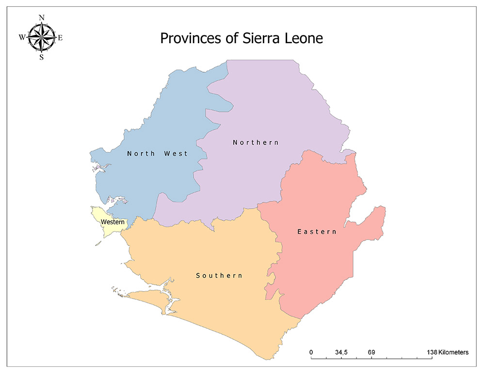
Five Provinces of Sierra Leone
Sierra Leone is divided into five units as the highest level administrative division. These At the highest level of administration, Sierra Leone is divided into five units. Four of these are provinces, and one is simply called the Western Area.
The names of the four provinces are straightforward and related to their geographical position:
- Eastern Province
- Northern Province
- Southern Province
- North West Province
The Western Area contains the capital of Sierra Leone, Freetown.
Eastern Province
- Population: 1,641,012
- Total Land Area: 15,553 square kilometers (6,005 square miles)
- Capital: Kenema
The Eastern Province is located on the eastern side of Sierra Leone and borders Guinea and Liberia as well as two other Sierra Leone provinces. There are two mountain ranges in this province, and it is one of two provinces without any coastline. Diamond mining has been an important part of Sierra Leone’s history since diamond’s were discovered here in the 1930s. The Eastern Province is the center of the country’s diamond mining industry.
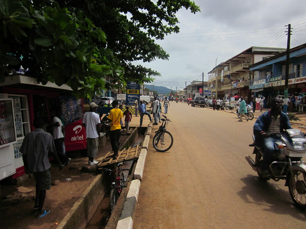
The capital of this province is Kenema, which is the economic center of the region and one of the most ethnically diverse cities in the country. Football is the most popular sport in this city, and it’s home to the Kamboi Eagles professional football club.
The Eastern Province is divided into three districts:
- Kailahun
- Kenema
- Koidu Town
Northern Province
- Population: 2,502,865
- Total Land Area: Approximately 22,000 square kilometers (8,494 square miles)
- Capital: Makeni
Located in the northern region of Sierra Leone is the country’s Northern Province. It borders the country of Guinea as well as three other provinces in Sierra Leone. The topography of the province is mostly hilly woodlands, and the land supports a range of endangered species. With the Eastern Province, this is one of two provinces in the country without a coastline.
Before 2017, this province included the area that is now the North West Province of Sierra Leone. Combined, the two provinces had a total land area of 35,936 square kilometers (13,874 square miles), but there is no official measure of the areas of the new individual provinces.
One of the most popular tourist destinations in Sierra Leone is located in this province: Outamba-Kilimi National Park. The park is home to elephants, hippos, buffaloes, and many chimpanzees — it’s also listed as a protected area by the UN Environment Programme (UNEP).
Makeni is the administrative and economic center of the region. It is the fifth-largest city in Sierra Leone, and the Tenme people make up the largest ethnic group in the city. The most widely spoken language among different ethnic groups in the city is Krio.
There are four districts in the Northern Province:
- Bombali
- Falaba
- Koinadugu
- Tonkolili
Southern Province
- Population: 2,502,865
- Total Land Area: 19,694 square kilometers (7,604 square miles)
- Capital: Bo
The Southern Province of Sierra Leone has the most coastline on the Atlantic Ocean. It also borders Liberia and each of Sierra Leone’s five administrative regions. The capital of this province is the city of Bo, and the largest ethnic group is the Mende ethnic group.
The city of Bo, also called Bo Town, is the economic hub of the Southern Province and Sierra Leone’s second-largest city. Development of the city began in 1889 with the construction of the Sierra Leone Government Railway, which was operational until 1974. Bo was then the capital of the British Protectorate of Sierra Leone until the country gained independence in 1961. It is the second-most important city in terms of transportation, economy, and education after Freetown.
The Southern Province is divided into four districts:
- Bo
- Bonthe
- Moyamba
- Pujehun
North West Province
- Population: 1,162,065 (2017 estimate)
- Total Land Area: Approximately 14,000 square kilometers (5,405 square miles)
- Capital: Port Loko
The North West Province of Sierra Leone borders the Atlantic Ocean, Guinea, and three domestic regions. Its capital and economic hub is Port Loko, and it is divided into three districts. In the southern region of the North West Province is Sierra Leone’s only international airport, which lies just across the Sierra Leone River from Freetown, the nation’s capital.
Prior to 2017, the area of the North West Province was included in the Northern Province, and its cumulative area measured 35,936 square kilometers (13,874 square miles). Now that the provinces have been divided, an exact measurement of the new provincial areas is unknown.
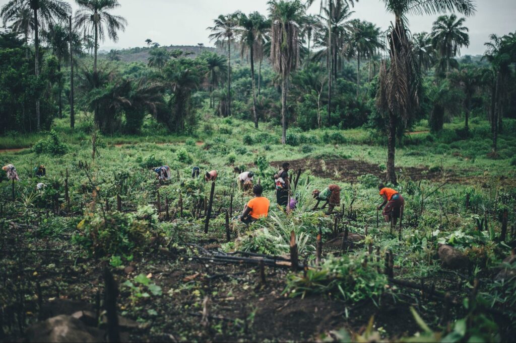
Agricultural activities are the major contributors to the economy in this province; farming, fishing, and raising livestock are some of the most common ways people earn money here. There is also a supply of natural resources such as gold, aluminum, and bauxite, which also contribute to the local economy.
Port Loko, the capital city of this province, was named for the Loko people and was established by Portuguese merchants. It’s now home to a diverse group of inhabitants and is also where the Bai Bureh Warriors hail from, one of Sierra Leone’s oldest and most famous football clubs.
The three districts of the North West Province are:
- Kambia
- Karine
- Port Loko
Western Area
- Population: 1,447,271
- Total Land Area: 557 square kilometers (215 square miles)
- Capital: Freetown
Sierra Leone’s Western Area is the only region in the country to not have an international border. Instead, it borders two domestic provinces and the Atlantic Ocean. The area is a peninsula and contains Freetown, the capital city of the country. It is the wealthiest region in Sierra Leone and also acts as the country’s cultural and financial center. It’s also the seat of the Sierra Leone government.
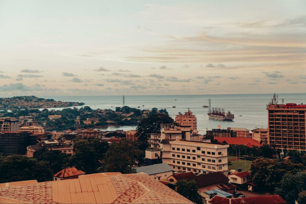
In addition to being Sierra Leone’s capital and largest city, Freetown is a major port city and utilizes one of the world’s largest natural deep water harbors. It was founded in 1792 by abolitionist John Clarkson and was settled by freed slaves from various parts of the world whose descendants are known as the Sierra Leone Creole people. The land was also home to the Temee and Loko peoples, whose presence predates the arrival of Europeans.
There are a number of cultural attractions in Freetown, such as the Sierra Leone National Museum and various historical landmarks related to the founding of the city. Cultural events and festivals are also organized in the city on a regular basis.
The two districts of the Western Area are:
- Western Area Rural
- Western Area Urban
Also Read: Sierra Leone Flag and Meaning
Districts of Sierra Leone
As of 2017, there are 16 Sierra Leone districts. A traditional leader from each district has a seat in the country’s parliament, and each district is governed by an elected council. The districts are further divided into 190 chiefdoms, which perform some local government functions.
In the map below, you’ll be able to see the borders of all 16 districts in Sierra Leone.
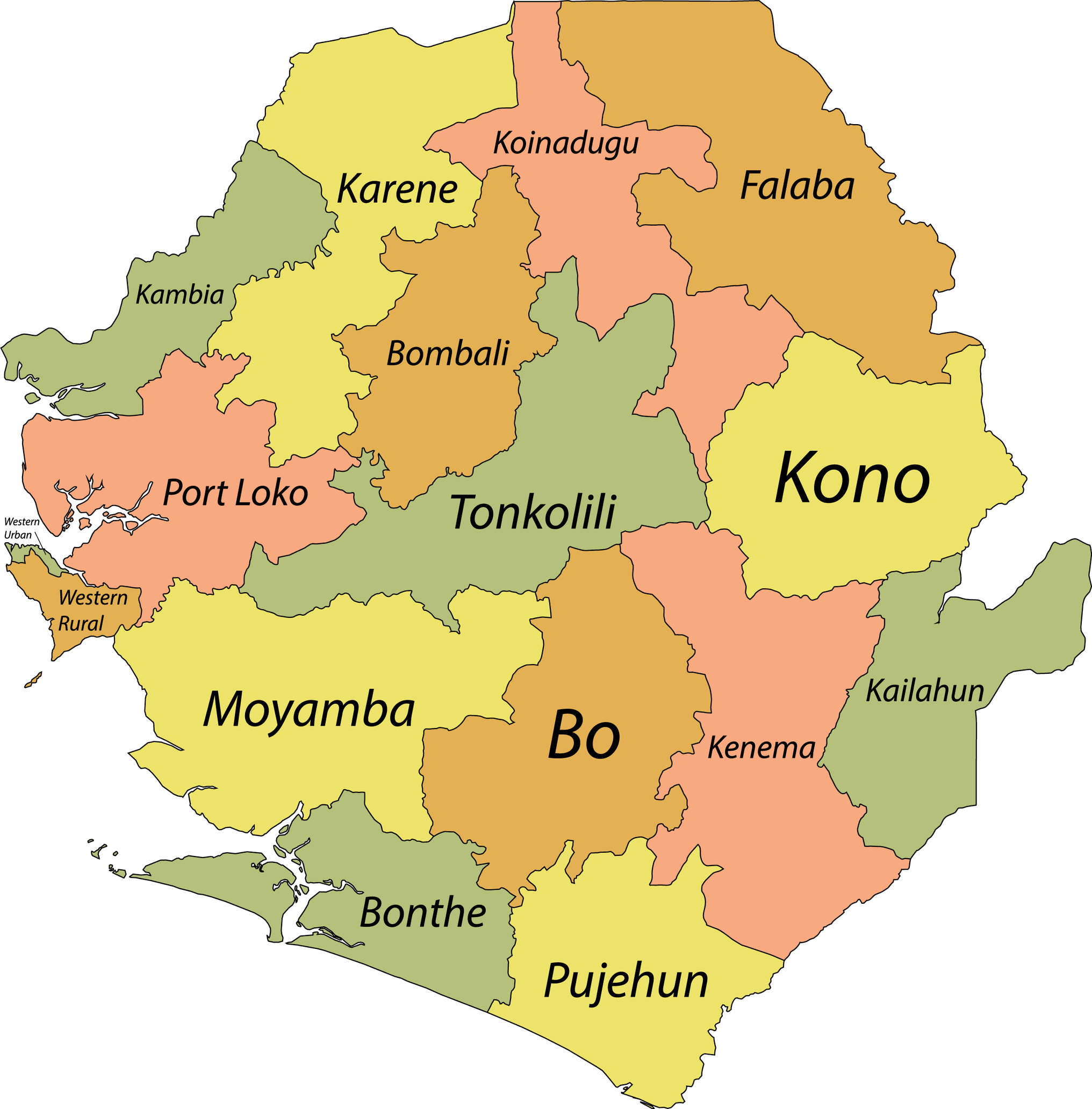
The 16 districts of Sierra Leone are:
- Kailahun
- Kenema
- Kono
- Bombali
- Falaba
- Koinadugu
- Tonkolili
- Kambia
- Karene
- Port Loko
- Bo
- Bonthe
- Moyamba
- Pujehun
- Western Rural
- Western Urban
The most populous district, by far, is the Western Urban District. This is where Freetown is located, and it’s also the smallest district in size by a large margin. Many people moved to Freetown during the country’s civil war to avoid violence in more rural areas, and economic opportunities also draw people to the city.
By geographical area, Koinadugu District is the largest by several thousand square kilometers. It also has one of the lowest population densities in the country with just over 400,000 people recorded in the 2015 census.
Also Read: Poorest Countries in Africa