Azerbaijan is divided into 14 economic regions. These are distinct from the country’s 69 districts, which function as the largest administrative divisions of Azerbaijan.
Prior to 2021, there were 10 economic regions in Azerbaijan. This changed when President Ilham Aliyev signed a Decree on July 7, 2021. The map below shows the new economic regions of Azerbaijan:
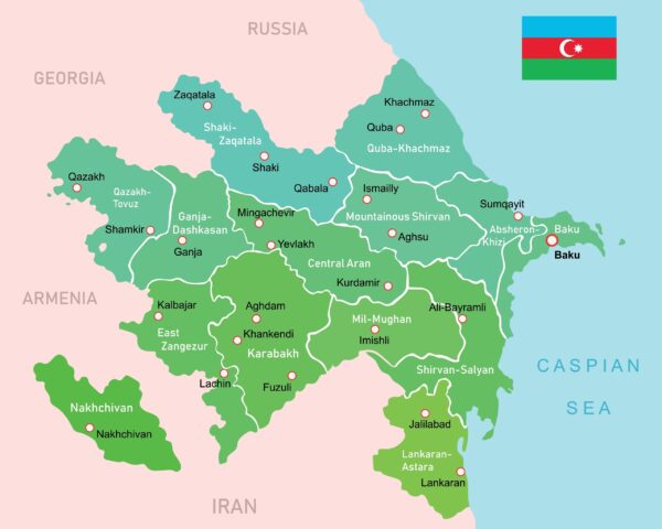
The 14 economic regions of Azerbaijan in alphabetical order are listed below:
- Absheron-Khizi
- Baku
- Central Aran
- East Zangezur
- Ganja-Dashkasan
- Gazakh-Tovuz
- Guba-Khachmaz
- Karabakh
- Lankaran-Astara
- Mil-Mughan
- Mountainous Shirvan
- Nakhchivan
- Shaki-Zagatala
- Shirvan-Salyan
The 14 Economic Regions of Azerbaijan
Azerbaijan is divided into 14 economic regions, which include Nakhchivan. The most populated region of Azerbaijan is Baku, while the least populated region is Mountainous Shirvan.
Baku also has the highest population density of any economic region in Azerbaijan. The region with the lowest population density is East Zanzegur.
Absheron-Khizi
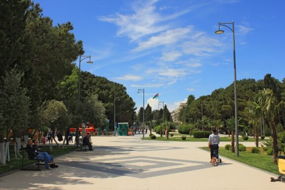
Previously part of the larger Absheron Economic Region, the Absheron-Khizi region was established in 2021 and covers an area of 3,730 square kilometers (1,440 sq mi), making it the second-smallest economic region in Azerbaijan. The region comprises the districts of Absheron and Khizi as well as the city of Sumgait.
The main industries in the Absheron-Khizi Economic Region include petrochemical, construction, transport infrastructure, and heavy industry.
Baku
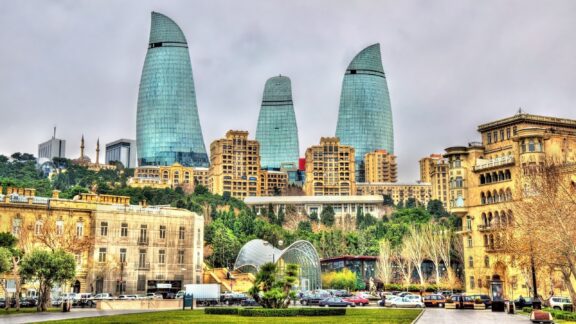
The Baku Economic Region, encompassing Azerbaijan’s capital city, Baku, and its surrounding areas, was established as a distinct economic region in 2021. This region, covering approximately 2,140 square kilometers (826 sq mi), is not only the smallest in terms of area but also the most significant in Azerbaijan’s economy. The region includes the city of Baku along with the Absheron Peninsula.
The Baku Economic Region is the country’s commercial and industrial heart, with key sectors including oil and gas extraction, refining, information technology, and tourism. The region also serves as Azerbaijan’s primary cultural and educational center, boasting numerous universities that attract international students.
Central Aran
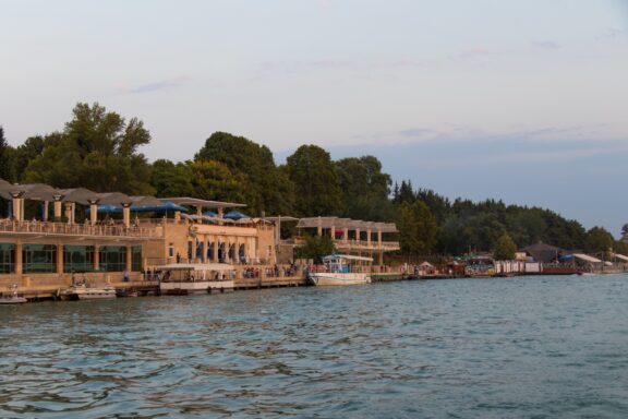
Established in 2021, the Central Aran Economic Region is one of Azerbaijan’s pivotal economic areas, stretching over an expanse of approximately 6,690 square kilometers (2,583 sq mi).
This region, characterized by its fertile plains and agricultural sector, includes the districts of Ujar, Goychay, Agdash, Kurdamir, Yevlakh, and Zardab, along with Mingachevir, a city famed for its hydroelectric power station on the Kura River.
Central Aran is renowned for its diverse agricultural output, primarily focusing on the cultivation of fruits, vegetables, and cotton.
East Zangezur
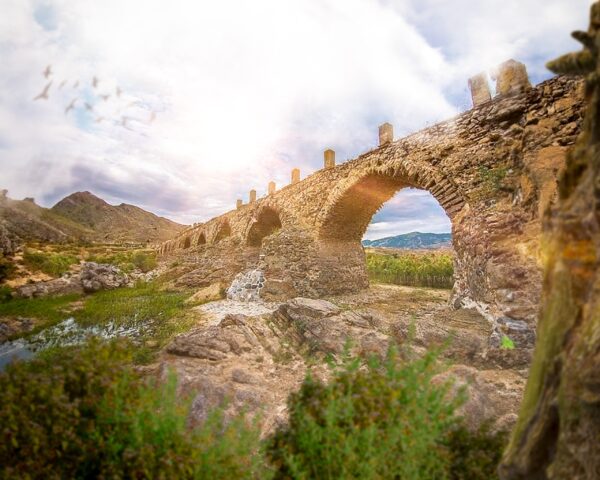
The East Zangezur Economic Region, formed in 2021, is among the largest in the country, covering an area of approximately 7,470 square kilometers (2,884 sq mi) in the southeastern part of Azerbaijan.
This region includes the districts of Kalbajar, Lachin, Qubadli, Zangilan, and Jabrayil, each boasting a rich cultural and historical heritage. East Zangezur’s landscape is marked by its rugged terrain, encompassing the Lesser Caucasus mountains and verdant valleys.
East Zangezur’s economy is primarily agricultural, but the region also possesses significant potential for the development of tourism, given its historical landmarks and picturesque natural scenery. This region is also one of the most heavily affected by land mines in the country.
Ganja-Dashkasan
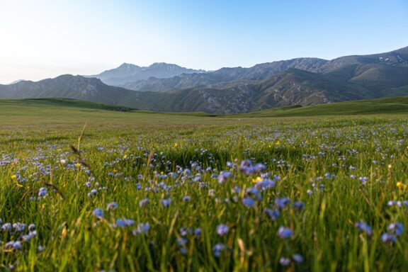
Azerbaijan’s Ganja-Dashkasan Economic Region, established on July 7, 2021, plays a significant role in the country’s economic structure as one of Azerbaijan’s 14 economic regions. It encompasses an area of 5,270 square kilometers (2,030 sq mi) and had a population of approximately 611,300 people as of January 2021.
This region is strategically located, bordering Georgia to the north and Armenia to the south, also sharing boundaries with the Shaki-Zagatala, Central Aran, Karabakh, East Zangezur, and Gazakh-Tovuz economic regions.
The region is composed of the Dashkasan, Goranboy, Goygol, and Samukh districts, along with the cities of Ganja and Naftalan.
Gazakh-Tovuz
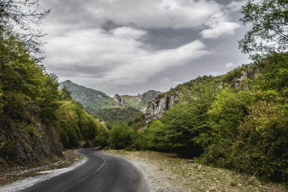
The Gazakh-Tovuz Economic Region in Azerbaijan spans an area of 7,030 square kilometers (2,710 sq mi), and its population was estimated at approximately 687,600 people as of January 2021.
Geographically, the Gazakh-Tovuz Economic Region is strategically located, bordering Georgia to the north and Armenia to the south and west. It also shares a boundary with the Ganja-Dashkasan Economic Region to the east. This region is composed of the districts of Aghstafa, Gadabay, Gazakh, Shamkir, and Tovuz.
Prior to the 2021 reformation, this territory was part of the larger Ganja-Qazakh Economic Region.
Guba-Khachmaz
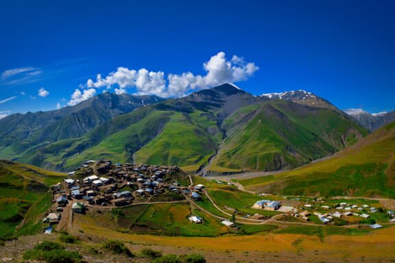
The Guba-Khachmaz Economic Region of Azerbaijan, encompassing an area of 6,960 square kilometers, is known for its scenic beauty and agricultural prowess. With a population of approximately 558,700, it lies in the country’s northern part, bordering Russia.
This region is distinguished by its rich natural resources, including oil and gas, and its forests cover about 10-11% of the area. While agriculture is the main economic driver in the region, there are developing industries in tourism and folk art.
This economic region is composed of the Shabran, Khachmaz, Guba, Qusar, and Siyazan administrative districts.
Karabakh
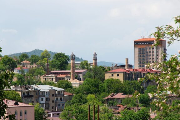
The Karabakh Economic Region, established in 2021, spans 8,990 square kilometers and has a rich historical and cultural background. It is the largest economic region in Azerbaijan by area.
Situated in south-central Azerbaijan, it borders Iran and is near several other important economic regions. It encompasses the Agjabadi, Aghdam, Barda, Fuzuli, Khojaly, Khojavend, Shusha, and Tartar districts. The city of Khankendi is also part of this economic region.
Much of the region’s ethnic Armenian population fled the area due to a 2023 military conflict.
Lankaran-Astara
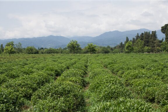
The Lankaran-Astara Economic Region in Azerbaijan, established in July 2021, is a notable area covering 6,070 square kilometers. It borders Iran and the Caspian Sea and is adjacent to the Shirvan-Salyan Economic Region.
The region is home to about 953,600 people and is known for its diverse geography, including the Lankaran lowland and the Talysh Mountains. This diversity contributes to its unique climate, with hot, mostly dry summers and very mild winters.
Economically, Lankaran-Astara is predominantly agricultural, and renowned for tea-growing, accounting for the vast majority of Azerbaijan’s tea production. The Lankaran-Astara region includes the districts of Jalilabad, Astara, Lerik, Lankaran, Masally, and Yardimli, each contributing to the region’s economic and cultural diversity.
Mil-Mughan
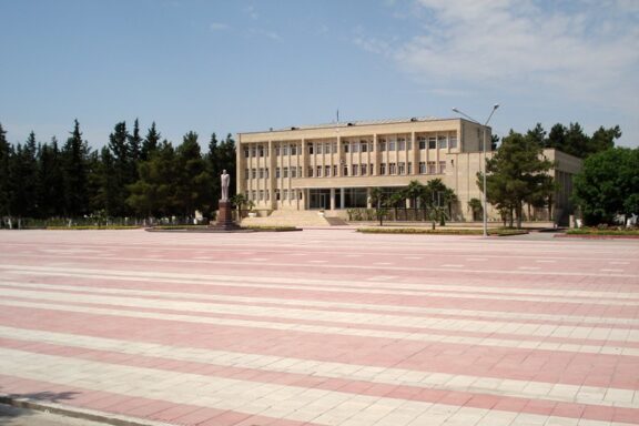
The Mil-Mughan Economic Region in Azerbaijan is characterized by its border with Iran to the south and connections with the Shirvan-Salyan, Central Aran, and Karabakh economic regions. It comprises the districts of Beylagan, Imishli, Saatly, and Sabirabad and is home to a population of approximately 522,600 as of January 2021.
Mil-Mughan’s establishment reflects Azerbaijan’s strategic effort to reorganize its economic regions for enhanced management and development. Previously, this area was part of the larger Aran Economic Region. The new configuration aims to optimize regional planning and economic efficiency across Azerbaijan, including Mil-Mughan.
Mountainous Shirvan
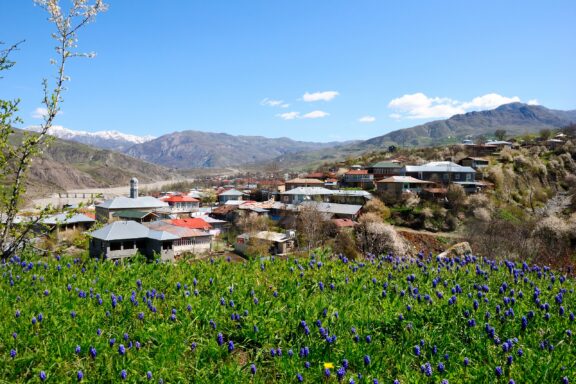
The Mountainous Shirvan Economic Region of Azerbaijan, covering an area of 6,130 square kilometers, is known for its diverse climate and geography. It is bordered by several other economic regions including Shaki-Zagatala, Guba-Khachmaz, Absheron-Khizi, Shirvan-Salyan, and Central Aran.
Mountainous Shirvan’s economy is diverse. The region supports a small manufacturing industry, including carpet weaving, container production, timber and building materials processing, and agricultural machinery repair.
Transportation and communication infrastructure in the region includes important highways and a regional organization to regulate the auto-transport system, particularly in the Shamakhi district. Educational facilities include secondary schools and branches of higher education institutions.
Nakhchivan
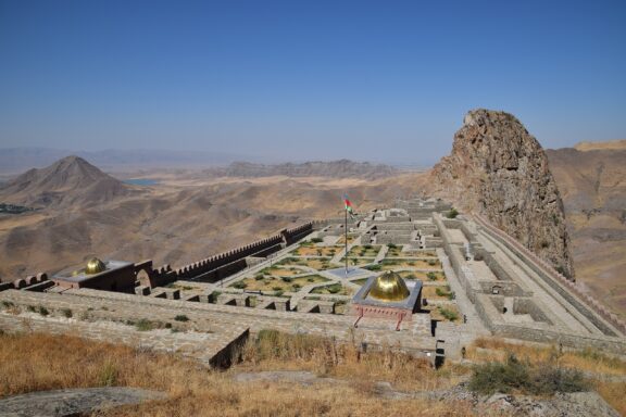
The Nakhchivan Economic Region in Azerbaijan is unique due to its geographical location and political status. Covering an area of 5,500 square kilometers, Nakhchivan is an Azerbaijani exclave, bordering Iran to the south, Turkey to the west, and Armenia to the north and east.
This region encompasses the Nakhchivan Autonomous Republic and includes districts Babek, Julfa, Kangarli, Ordubad, Sadarak, Shahbuz, and Sharur, as well as the city of Nakhchivan. As of January 2021, the region’s population was estimated to be around 461,500.
Nakhchivan’s distinct geographical position and borders with three countries make it a strategically important region for Azerbaijan.
Shaki-Zagatala
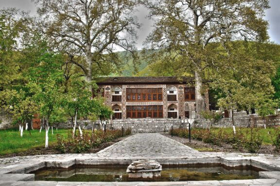
The Shaki-Zagatala Economic Region in Azerbaijan, with an area of 8,840 square kilometers, is known for its diverse landscape including the southern slopes of the Greater Caucasus and the Central Kur Highland.
The region is rich in natural resources, particularly minerals, and is heavily forested, contributing to its biodiversity. With a population of about 630,400 as of 2021, its economy is primarily based on agriculture, focusing on tobacco, sericulture, and fruit cultivation, among others.
The region also has a significant tourism industry, thanks to its natural beauty. The transport network here includes railways, highways, and airways, facilitating both cargo and passenger transportation.
Shirvan-Salyan
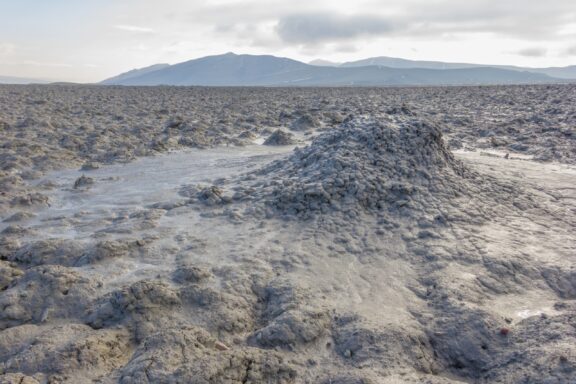
The Shirvan-Salyan Economic Region in Azerbaijan, established in July 2021, covers an area of 6,080 square kilometers. It’s bordered by Iran to the west and is adjacent to several other economic regions, including Mil-Mughan, Central Aran, Mountainous Shirvan, Absheron-Khizi, Baku, and Lankaran-Astara.
This region was a part of the larger Aran Economic Region before its establishment as a separate entity in 2021 and now includes the districts of Bilasuvar, Hajigabul, Neftchala, Salyan, and the city of Shirvan. The Shirvan-Salyan Economic Region is integral to Azerbaijan’s economic structure, contributing through its distinct districts and strategic location.
Image Sources and Copyright Information
- Vector Illustration of Azerbaijan’s Economic Regions Map with Major Cities and National Flag: © Radzas2008/Shutterstock
- Sunny Day at a Lush Green Park Boulevard with People Enjoying the Outdoors: © MasyuraN/Shutterstock
- Panoramic View of Baku City Center with Flame Towers, Azerbaijan: © Leonid Andronov/Shutterstock
- Riverside Promenade at Dusk in Mingachevir, Azerbaijan: © Nurlan Mammadzada/Shutterstock
- Scenic View of the Ancient Khudafarin Bridge in the Lush Landscape of East Zangezur, Azerbaijan: © Orkhanss/Shutterstock
- Serene Mountain Meadow with Wildflowers at Dusk: © Rzaev/Shutterstock
- Winding Road Through the Lush Green Mountains of Tovuz, Azerbaijan: © zef art/Shutterstock
- Scenic View of Khinalug Village Nestled in the Lush Green Caucasus Mountains: © Lyokin/Shutterstock
- Restoration Progress in Shusha City After the Karabakh War: © Nurlan Mammadzada/Shutterstock
- Verdant Tea Plantation with Rolling Hills in the Background: © Retan/Shutterstock
- City Hall Building with Spacious Pink Paved Square in Saatly, Azerbaijan: © Mirəfqan Sultanov/Wikimedia Commons | GFDL GNU Free Documentation License 1.2
- Idyllic Village Nestled in the Greater Caucasus with Lush Greenery and Blooming Flowers: © Nina Alizada/Shutterstock
- Panoramic View of Alinja Castle with Surrounding Landscape in Nakhchivan: © Owen Morton/Shutterstock
- Shaki Khan Palace Surrounded by Verdant Trees in Azerbaijan: © Polad Gasimov/Shutterstock
- Mud Volcano Landscape in Hajigabul, Azerbaijan: © Bikomins/Shutterstock