Five years after the generals seized power, the question of who actually rules Myanmar no longer has a simple answer. The military council that staged the February 2021 coup expected to consolidate control within months.
Instead, it has spent half a decade losing ground. First to a sprawling patchwork of newly formed People’s Defence Forces, then to battle-hardened ethnic armies that smelled weakness and went on the offensive.
By mid-2026 the country is carved into a mosaic of overlapping control: a shrinking junta core in the central lowlands and big cities, vast contested borderlands, and front lines that shift town by town. This is the map of that fragmentation.
Key Takeaways
- The junta now controls a minority of Myanmar. Five years after the February 2021 coup, independent estimates put the military's firm control at roughly 21–33% of the country. One survey credited resistance forces with about 42% of the territory by mid-2026, up from 38% a year earlier, with the rest actively contested.
- The west has effectively seceded. The Arakan Army holds around 14 of Rakhine State's 17 townships, leaving the junta clinging to the capital Sittwe and the Chinese-backed Kyaukphyu port. In Chin State, resistance forces overran the last junta base in 2025.
- Operation 1027 won ground, then fractured. The Three Brotherhood Alliance's 2024 northern offensive seized dozens of towns, but Chinese pressure forced Lashio back to the junta and, in March 2026, the MNDAA turned its guns on its ally the TNLA, capturing Kutkai.
- The dry-zone heartland is a grinding stalemate. Sagaing remains the resistance heartland under relentless airstrikes, while Karenni fighters besiege Loikaw and Kachin's KIA presses junta battalions around Bhamo and the rare-earth belt.
- A humanitarian catastrophe underneath the map. Roughly 4.5 million people are internally displaced and the UN projects up to 16 million will need aid in 2026, as air campaigns hit hospitals and the December 2025 elections were cancelled across much of the country.
Who Controls Myanmar in 2026
There is no single authoritative ledger of control in Myanmar, and credible sources disagree. A 2026 UN Security Council briefing put the junta’s footprint at about 21% of the country. Independent mapping projects put it closer to a third.
A field survey credited the resistance with roughly 38% of the territory at the end of 2025, and a further analysis raised that to around 42% by mid-2026. Every assessment agrees on the direction of travel: the military administers less of Myanmar each year.

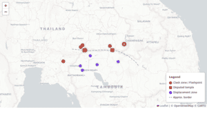
The interactive map below shows which side holds the upper hand in each state and region. Control is fluid and decided township by township, so treat it as a snapshot, not a fixed border.
The West Has Slipped Away: Rakhine and Chin
Nowhere has the junta’s position collapsed more completely than along the western coast. The Arakan Army (AA), the most powerful of the ethnic armies, now controls all but three of Rakhine State’s 17 townships, administering a near-contiguous stretch of interior and coastline.
The military is pinned into a few urban islands: the state capital Sittwe, the strategically vital Kyaukphyu deep-sea port that anchors a Chinese pipeline corridor, and Manaung island. As ground control slipped, the junta leaned on air power, and a December 2025 airstrike hit Mrauk-U General Hospital.
Chin State tells a similar story. Chin resistance forces, a mix of the Chin National Army and the Chin Brotherhood, captured Falam and overran the last junta base in the state in 2025, then deepened cooperation with the AA next door.
Together, Rakhine and Chin form a resistance-dominated belt across Myanmar’s western flank. By July 2026, analysts were describing the Arakan Army as the most effective insurgent force in the country.
The North: Operation 1027’s Promise and Collapse
The most dramatic chapter unfolded in northern Shan State. On 10 October 2024, the Three Brotherhood Alliance (the MNDAA, TNLA and AA) launched a renewed Operation 1027, capturing a string of towns and junta outposts along the Chinese border in a matter of weeks. For a moment it looked as if the whole north might fall.
Then Beijing intervened. Anxious to protect its border trade and pipelines, China leaned hard on the alliance. The captured city of Lashio was handed back to the regime in 2025, and the coalition began to fray.
The breakdown turned violent in March 2026, when the MNDAA captured Kutkai, not from the junta but from its own former ally the TNLA. Analysts read the move as a realignment toward Beijing. The alliance that had humbled the military a year earlier had effectively shattered.
Further north, the Kachin Independence Army (KIA) seized dozens of junta positions around Bhamo. By 2026 the junta was fighting to claw back the rare-earth mining belt near the Chinese border, a reminder that in Myanmar’s borderlands, resources and control are inseparable.
The Heartland Front: Sagaing, the Dry Zone and the Karenni Hills
The war’s bloodiest stalemate sits in the central dry zone. Sagaing Region is the heartland of the People’s Defence Forces, who administer much of the countryside even as the military answers with near-daily airstrikes and scorched-earth raids.
To the east, Karenni fighters have spent two years besieging the state capital Loikaw. In Kayin (Karen) State, the Karen National Liberation Army struck the Taungoo air base and overran roadside outposts. Resistance fighters even captured Thabeikkyin in Mandalay Region, edging the war toward the junta’s symbolic core.
The fighting pressed on through mid-2026. In July, the KIA and allied forces overran further junta bases in Sagaing and the north. The map below pins the towns that changed hands or saw major fighting in 2025 and 2026.
A Country in Pieces: The Human Cost
Behind every shaded zone on the map is a displacement crisis. Humanitarian monitors counted roughly 4.5 million internally displaced people by May 2026, and the UN’s 2026 response plan projects that up to 16 million citizens will need assistance.
Airstrikes on hospitals, schools and markets surged through 2025 as the military traded territory for firepower. The junta’s long-promised elections, staged in phases over December 2025 and January 2026, could not be held across wide stretches of the country because the government did not control the ground. It was the clearest possible verdict on the map above.
The Bottom Line
Myanmar in 2026 is neither a junta state nor a liberated one. It is a fractured patchwork. The military retains the cities, the centre and a decisive edge in air power, while resistance forces and ethnic armies hold most of the map by area.
Yet the resistance remains too divided, and too pressured by outside powers like China, to deliver a knockout blow. The result is a stalemate measured not in front lines but in townships, and paid for in the largest displacement crisis in the country’s history. The borders on this map will keep moving, and the fragmentation they describe is likely to outlast the fighting.
Territorial estimates in Myanmar vary by source and definition; this map synthesises the assessments below and should be read as a provisional snapshot.