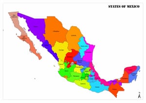
Cantons of the Federation of Bosnia and Herzegovina. The administrative divisions of Bosnia and Herzegovina consist of two entities, the Bosnia-Herzegovina Federation formed by Bosniaks and Croats, and the Republika Srpska formed by Serbs, and an autonomous administrative region, Brčko.
Each entity has its own president, parliament, police and customs organization and postal system. The Republika Srpska additionally has its own flag and armor. Until the establishment of the Bosnian-Herzegovina Armed Forces in 2005, both entities had their own armies.
The Brchko Region, located in the north-east of the country, is an autonomous administration and under international supervision.
The Federation of Bosnia and Herzegovina is divided into 10 cantons and municipalities, while the Republika Srpska is directly divided into municipalities. Republika Srpska is divided into seven geographical regions.
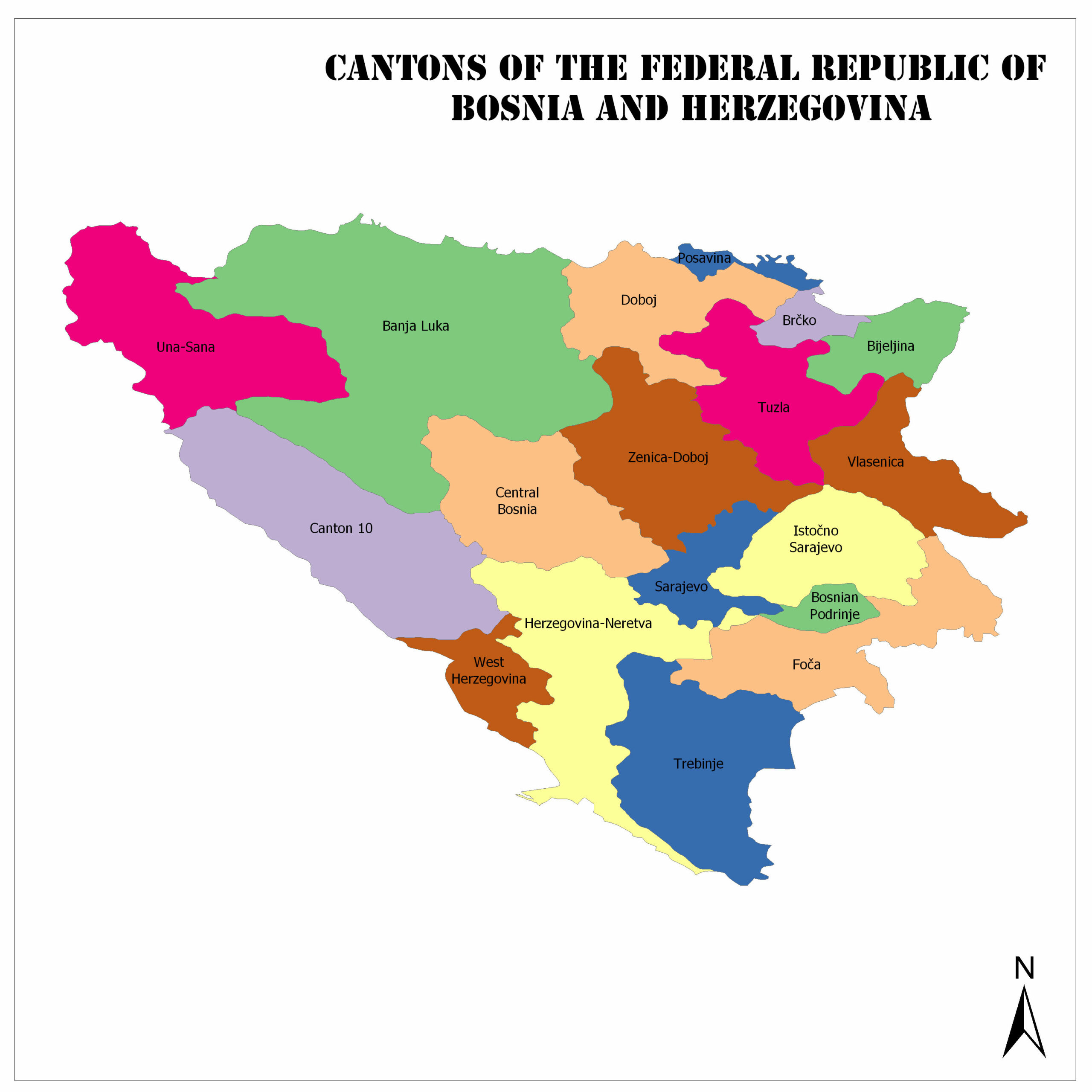
Cantons of the Federation of Bosnia and Herzegovina
Una-Sana
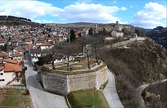
It is one of the 10 cantons that make up the Federation of Bosnia and Herzegovina. The capital is Bihac. According to the population census made in 2013, the population is 299,343. The surface area is 4,125 square kilometers.
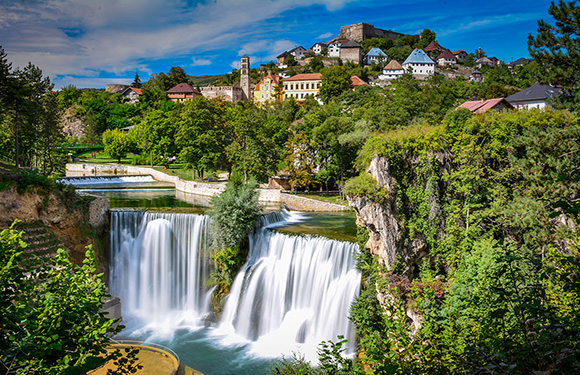
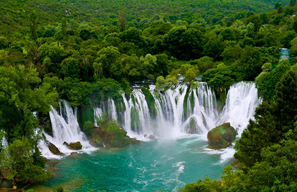
Must-see places, Una National Park, Fethiye Mosque, Bliha Falls, Ostrožac Castle, Kapetanova kula, Hamzibegova Moschee an der Sanski Most, Ostrovica Castle, Crkva sv. Ante Padovanskog, Muzej Prvog zasjedanja AVNOJ-a, Stari Grad, Great Una Waterfalls, Zeleni otoci, Bužim Fort, Muzej Usk.
Highlights of Una-Sana
Rmanj Monastery
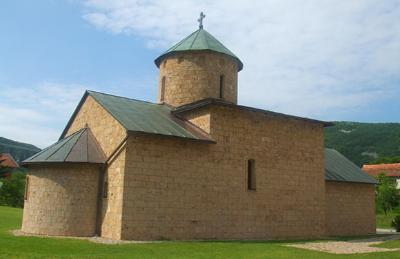
It is a Serbian Orthodox monastery dedicated to Saint Nicholas and located in Martin Brod in north-western Bosnia and Herzegovina, at the left bank of the Unac River near its confluence with the Una.
Dabarska Cave
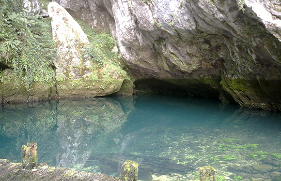
Dabarska cave is one of the two protected caves in the municipality of Sanski Most, which is located in the village of Donji Dabar. Evidences as objects inside the cave indicate that it was inhabited during the prehistory.
Posavina
The capital is Oras. According to the population census made in 2013, the population is 48,089. The surface area is 325 square kilometers. Places you should see are, War Childhood Museum, Gallery 11/07/95, Svrzo House, Sarajevo War Tunnel, The Yellow Fortress, Sarajevo Olympic Bobsleigh and Luge Track, Jewish Museum of Bosnia and Herzegovina.
Tuzla
Başkenti Tuzla’dır. 2013 yılında yapılan nüfusu sayımına göre nüfusu 477,278’tür. Yüzölçümü 2,649 kilometrekare’dir. Places you should see are, Pannonica, Slana Banja, Bosnian Cultural Center of Tuzla Canton, Bingo zoo vrt Tuzla, Kapija Behram-begove.
Zenica-Doboj
The cities that give the name of cantona are the capital Zenica and Doboj. There are 12 cantonal cities connected to the Bosnia-Herzegovina federation. These are; Breza, Doboj Jug, Kakanj, Maglaj, Olovo, Tešanj, Vareš, Visoko, Zavidovići, Zenica, Žepče, Usora. According to the population census made in 2013, the population is 385,067. The surface area is 3,415.3 square kilometers. Moreover, places you should see are, Jezero Jelen, Tešanjska tvrđava, Gradski Muzej, Old town of Visoki, Eminagića konak, Native Museum, Site archéologique de Mile, Tvrđava Maglaj, Tvrđava Vranduk, Spomen park zrtvaama zloćina Ahmići.
Highlights of Zenica-Doboj
Kraljeva Sutjeska Franciscan Monastery
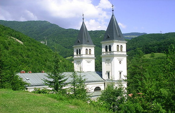
It is located near Kakanj, in the village of Kraljevska Sutjeska. It includes a museum in which it houses historical treasures, a library which keeps rare and valuable historical records. There are around 11,000 works in the library, including 31 incunabula and works in Bosnian Cyrillic.
Bosnia-Podrinje
The capital is Gorazde. According to the population census made in 2013, the population is 25,336. The surface area is 504.6 square kilometers.. Furthermore, places you should see are, Most ispod mosta, Semiz Ali-pašino turbe sa haremom Semiz Ali-pašine džamije.
Central Bosnia
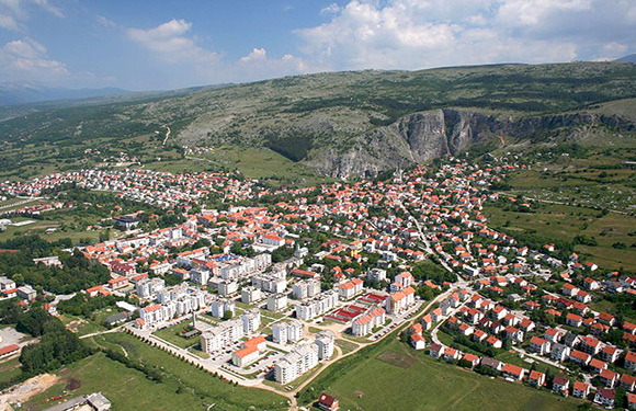
A mixed Bosnian-Croatian. In other words, it belongs to both ethnicity. The capital is Travnik. According to the population census made in 2013, the population is 273,149. The surface area is 3,189 square kilometers. Moreover, places you should see are, Pliva Waterfall, Alaca Mosque, Mlinčići, Rodna kuća Ive Andrića, Vodeni park Ribica, Temple of Mithras, Mlinovi, Kupaliste Brana Jajce, Esma Sultana Mosque.
Hersek-Neretva
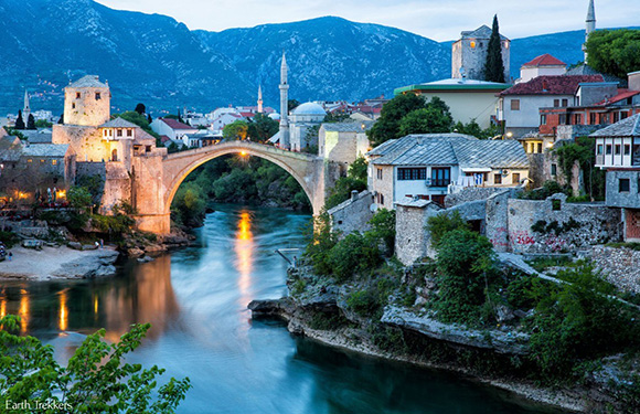
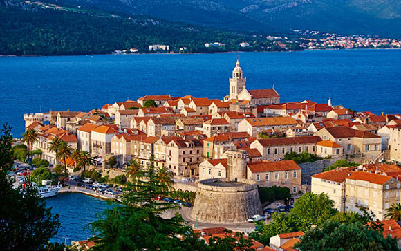
The capital is Mostar. According to the population census made in 2013, the population is 236,278. The surface area is 4,401 square kilometers. Furthermore, places you should see are, Mostar Bridge, Kravitse, Vjetrenica, Blidinje.
West Hersek
The capital is Široki Brijeg. According to the population census made in 2013, the population is 97,893. The surface area is 1,362 square kilometers. Places you should see are, Mogorjelo, Kocusa Waterfall, Chiesa di San Giacomo, Međugorje’s Risen Christ Statue, Sahat Kula Počitelj, Stara župna crkva sv. Jakova, Kupalište Čeveljuša, Počitelj historijsko – gradsko područje, Castillo Patrick Y Nancy, Fortress of Herzog Stjepan Vukčić Kosača, Monte Podbrdo, Peć Mlini, Crkva svetog Ilije.
Sarajevo
The capital is Sarajevo. According to the population census made in 2013, the population is 413,593. The surface area is 1,276.9 square kilometers. Places you should see are, Vrelo Bosne, National Museum of Bosnia and Herzegovina, Skakavac, Museum of Sarajevo 1878–1918, Bezistan de Brusa, Historical Museum of Bosnia and Herzegovina, Ferhadija Mosque in Sarajevo, Museum of Crimes Against, Humanity and Genocide 1992-1995, Ars Aevi, Art kuća sevdaha,Museum of Literature & Performing Arts, Museum of the Jews of Bosnia and Herzegovina, Latin Bridge, Sebil, Olimpijski muzej, Vijecnica Library, Sacred Heart Cathedral, Hünkâr Mosque, Church of the Holy, Archangels Michael and Gabriel, Eternal flame, Morića Han, National Gallery of Bosnia and Herzegovina.
Highlihgts of Sarajevo
Gazi Hüsrev Bey Mosque
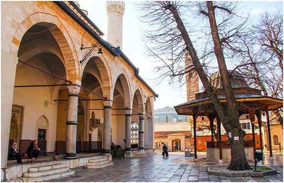
Gazi Husrev Bey Mosque is located in Başçarşı, the heart of Bosnia-Herzegovina’s capital, Sarajevo. Also known as Bey Mosque. It was one of the most striking works of Ottoman architecture and was built in 1531 by Mimar Sinan.
Livno
The capital is in Livno. According to the population census made in 2013, the population is 84,127. The surface area is 4,934.1 square kilometers.
Bosnia and Herzegovina: Geography and Facts
- Population: 3,502,583
- Population Density: 69 per Km2
- Land Area: 51,000 Km ²
Bosnia and Herzegovina, coast of the Adriatic Sea, is a Balkan country. It was established by separating from the territory of the former Yugoslavia. The capital city of Sarajevo has a green nature.
Bosnia and Herzegovina is a country in the Balkan territory. The country is a neighbor to Croatia in the north, west and south, and Serbia in the east and Montenegro in the south.
A 20-kilometer coast on the southern tip of the country faces the Adriatic Sea but does not have a natural harbor.
Geography
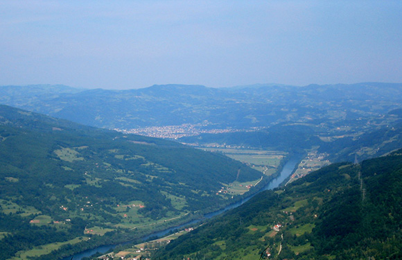
Bosnia and Herzegovina has a mountainous terrain structure that resembles a triangle. The Sava and Neretva rivers divide the mountainous terrain. Moreover, there is arable land in small dips in between.
The Bosnian River, giving its name to the country, merges with the Sava River after 271 kilometers. To the north of the country’s soil, there are arable fertile soils.
Governance
It is a republic-ruled country. The president and councilors are elected every five years. Assembly consists of 240 seats.
Climate
In the country, winters are cold and cool, and summers are hot. Bosnia and Herzegovina, blessed with a region close to the Mediterranean, is not under the influence of the Mediterranean climate because the Mediterranean climate does not reach the region with the mountains in the country.
Religion
In Bosnia-Herzegovina, 44% are Muslims, the majority being Bosniaks. 36% are Orthodox, generally Serbian. And 16% are Catholic Christians, predominantly Croats. In a country with a secular system of religion and belief, it manifests itself as a traditional cultural element.
Industry and Tourism
The economy is based on agriculture. The main agricultural products are cereals and fats. Vegetables, sugar beets, linen, and tobacco are also important products. Forestry and sheep breeding is important in the economy.
Fruit growing has developed in the central and northern parts of Bosnia. In Herzegovina, viticulture has developed. Among the industrial products are timber, iron-steel, tobacco, leather, and sugar.
Bosnia and Herzegovina is a country with four seasons, the winters are cold and rainy and the summers are hot and dry. For this reason, the best time for your visit to Bosnia and Herzegovina will be spring and autumn.
If you want to choose Bosnia-Herzegovina for winter tourism, especially Bjelasnica, Igman and Jahorina mountains are waiting for you to ski. For visitors who love entertainment, festivals, art, and warmth, Bosnia and Herzegovina can be a very pleasant sightseeing destination in August.
Art
The music of the country, which is called Europe’s most exotic and homogeneous music, is influenced by the reflections of its hosting of different nations. The world famous Goran Begovic is an important artist trained in Bosnia Herzegovina.