
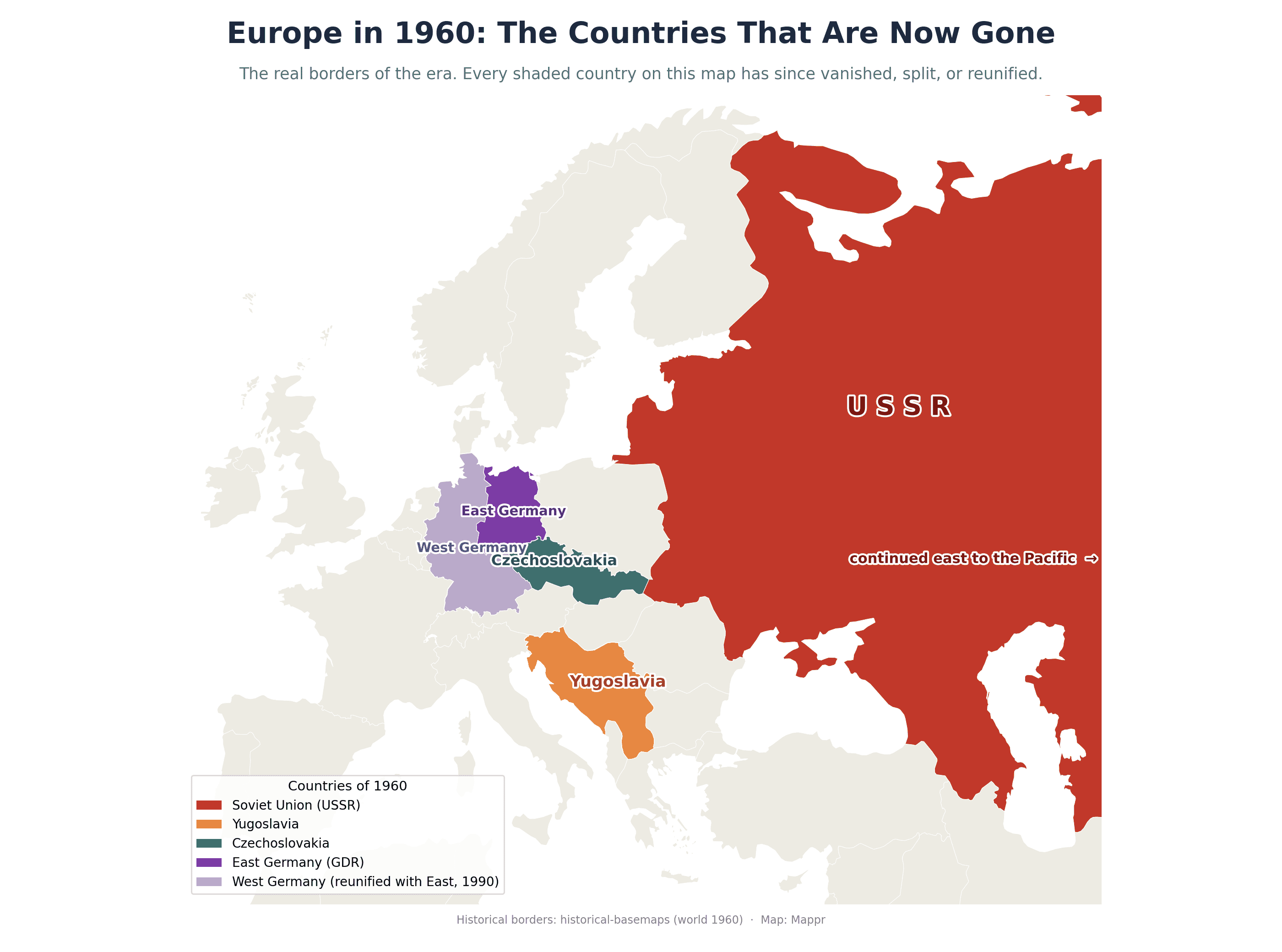
Borders feel permanent, but they are not. Look at a map from a few decades ago and whole countries stare back that no longer exist. Some shattered in war, some dissolved by agreement, some simply merged into a neighbour. This page maps the most significant nations that have vanished from the world map, starting with the four great disappearances at the end of the Cold War and expanding out to the empires, kingdoms and unions that came before.
Key Takeaways
- The USSR split into 15 countries. When the Soviet Union dissolved on 26 December 1991, it broke into 15 independent states, from Russia and Ukraine to Kazakhstan and the three Baltic nations. It was the largest country that has ever existed.
- Yugoslavia became seven nations. Yugoslavia unravelled through the 1990s into Slovenia, Croatia, Bosnia and Herzegovina, Serbia, Montenegro, North Macedonia and, later, Kosovo, much of it through war.
- Czechoslovakia split peacefully. On 1 January 1993, Czechoslovakia divided into the Czech Republic (Czechia) and Slovakia in the amicable 'Velvet Divorce', one of the few breakups without bloodshed.
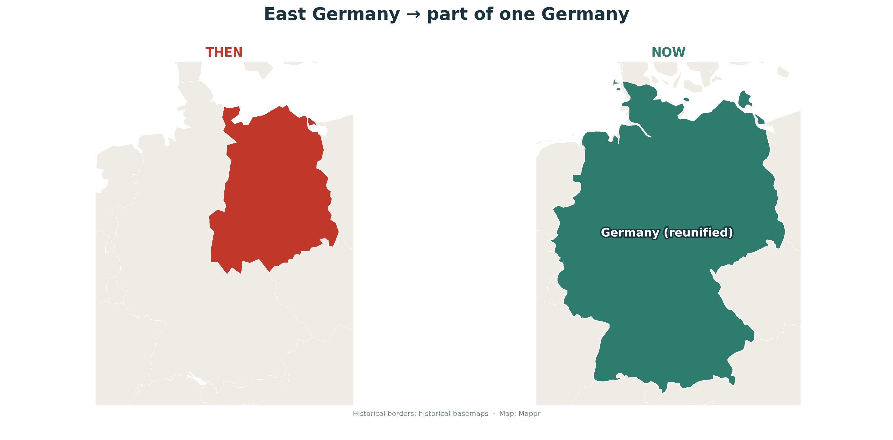
- East Germany merged into one Germany. The German Democratic Republic (East Germany) did not fragment; it reunified with West Germany on 3 October 1990, disappearing by joining rather than splitting.
- The map is always being redrawn. These are only the most famous cases. Empires, kingdoms and unions vanish in every generation, from the Ottoman Empire to Serbia and Montenegro, which only dissolved in 2006.
Soviet Union (USSR), 1922 to 1991
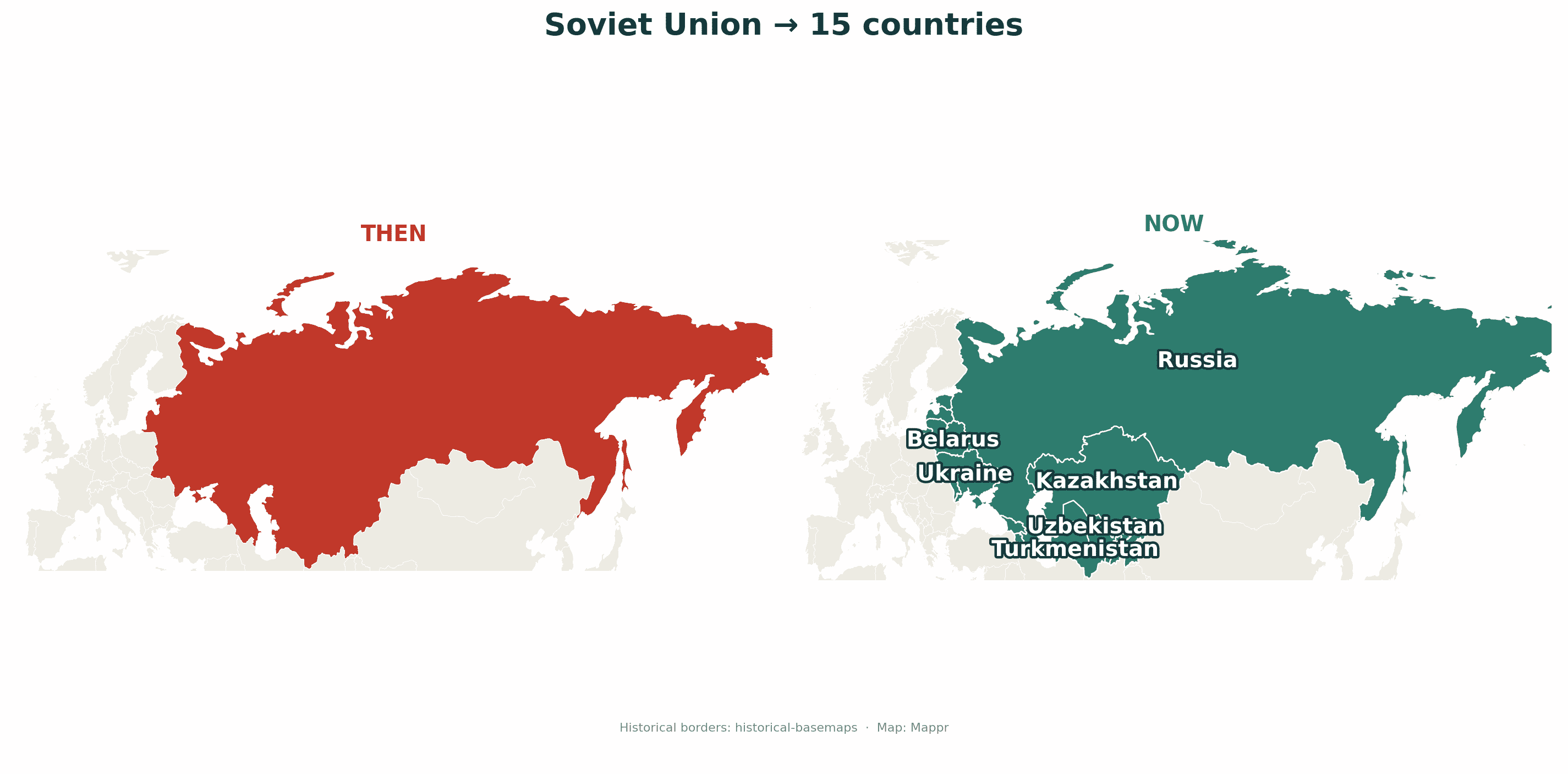
The Union of Soviet Socialist Republics was the largest country that has ever existed, spanning eleven time zones from the Baltic Sea to the Pacific. Founded in 1922 after the Russian Revolution, it dissolved on 26 December 1991 as its republics declared independence and the union formally ended. In its place came 15 independent countries: Russia, Ukraine, Belarus, Kazakhstan, Uzbekistan, Turkmenistan, Kyrgyzstan, Tajikistan, Georgia, Armenia, Azerbaijan, Moldova, and the three Baltic states of Estonia, Latvia and Lithuania. Russia inherited the USSR’s UN Security Council seat and most of its nuclear arsenal, but the country itself was gone.
Yugoslavia, 1918 to 1992 (and 2006)
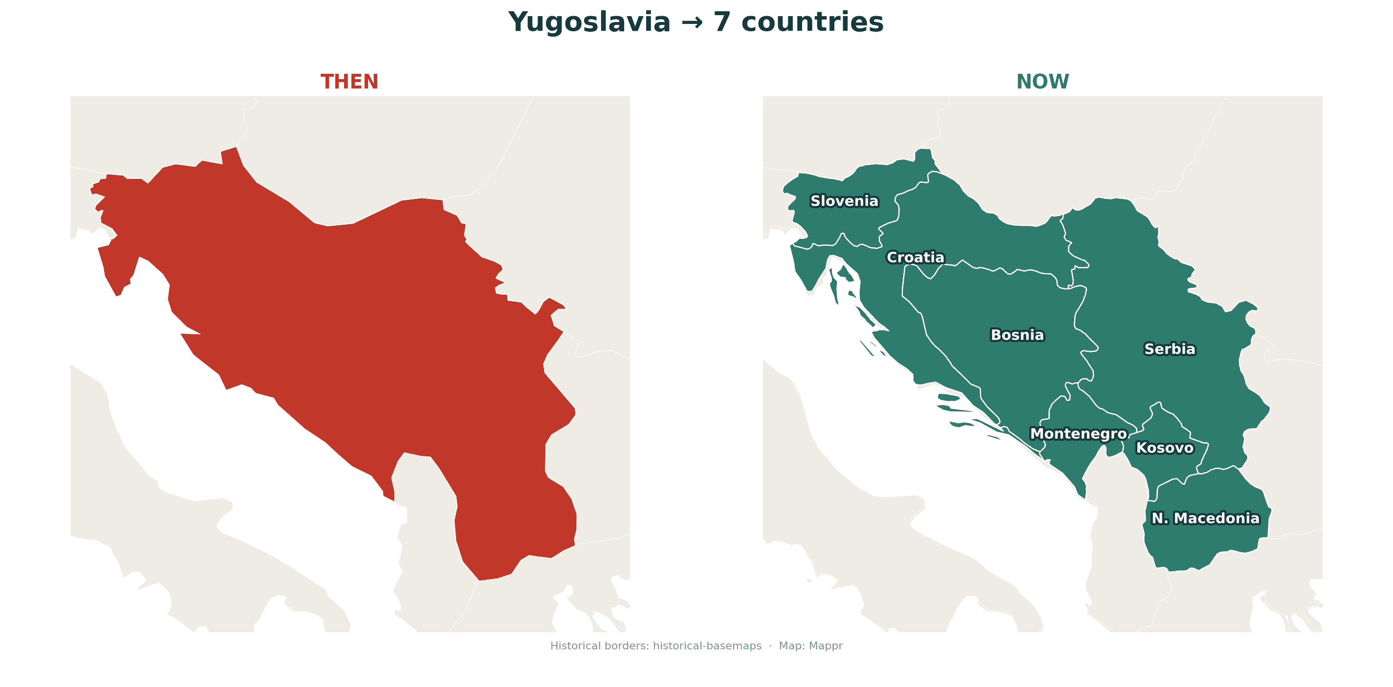
Yugoslavia (“land of the South Slavs”) united a patchwork of Balkan peoples, first as a kingdom in 1918 and then as a socialist federation after 1945. It came apart in the early 1990s in a series of brutal wars as its republics broke away. Slovenia, Croatia, Bosnia and Herzegovina and North Macedonia declared independence in 1991 and 1992; the rump state of Serbia and Montenegro lingered on before splitting in 2006, and Kosovo declared independence in 2008. In all, Yugoslavia became seven countries. It is the clearest modern example of a nation dismantled by ethnic conflict rather than negotiation.
Czechoslovakia, 1918 to 1992
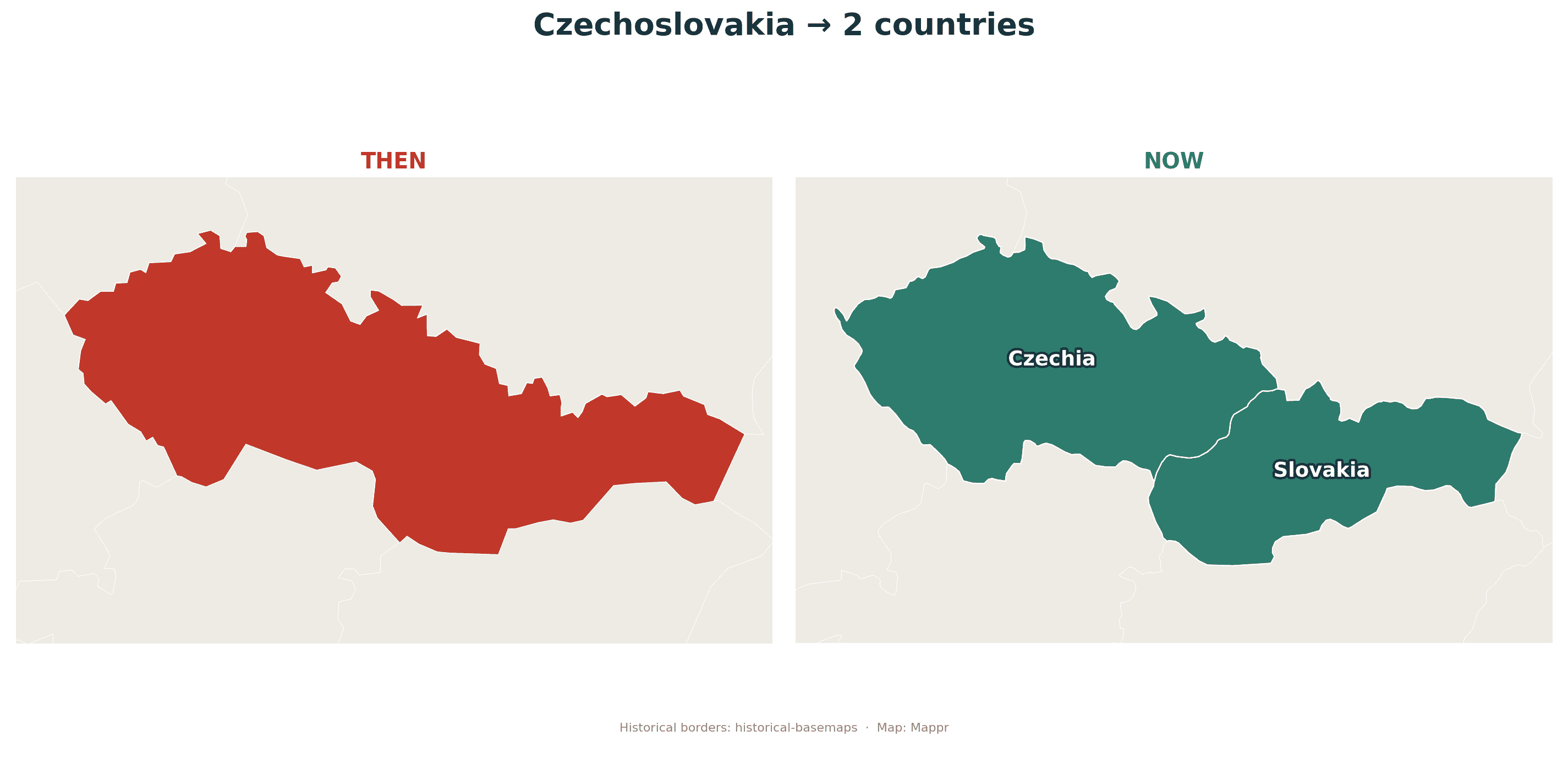
Not every breakup is violent. Czechoslovakia, created in 1918 from the wreckage of Austria-Hungary, split into the Czech Republic (Czechia) and Slovakia at the stroke of midnight on 1 January 1993. The separation was so calm and negotiated that it became known as the “Velvet Divorce”, echoing the peaceful 1989 “Velvet Revolution” that had ended communist rule. Two capable, stable countries emerged, both now in the EU and NATO, with no war and barely a raised voice.
East Germany (GDR), 1949 to 1990
The German Democratic Republic, or East Germany, is the odd one out: it vanished not by splitting but by joining. Created in 1949 as the Soviet-aligned half of a divided Germany and sealed off by the Berlin Wall from 1961, it collapsed politically after the Wall fell in November 1989. On 3 October 1990, its territory acceded to the Federal Republic of Germany, and East Germany simply ceased to exist. Its five states are now part of a single, reunified Germany.
More countries that have vanished
The four above are the most famous recent cases, but the graveyard of nations is crowded. A few more that once filled the map:
🇷🇸 Serbia and Montenegro (2003–2006)
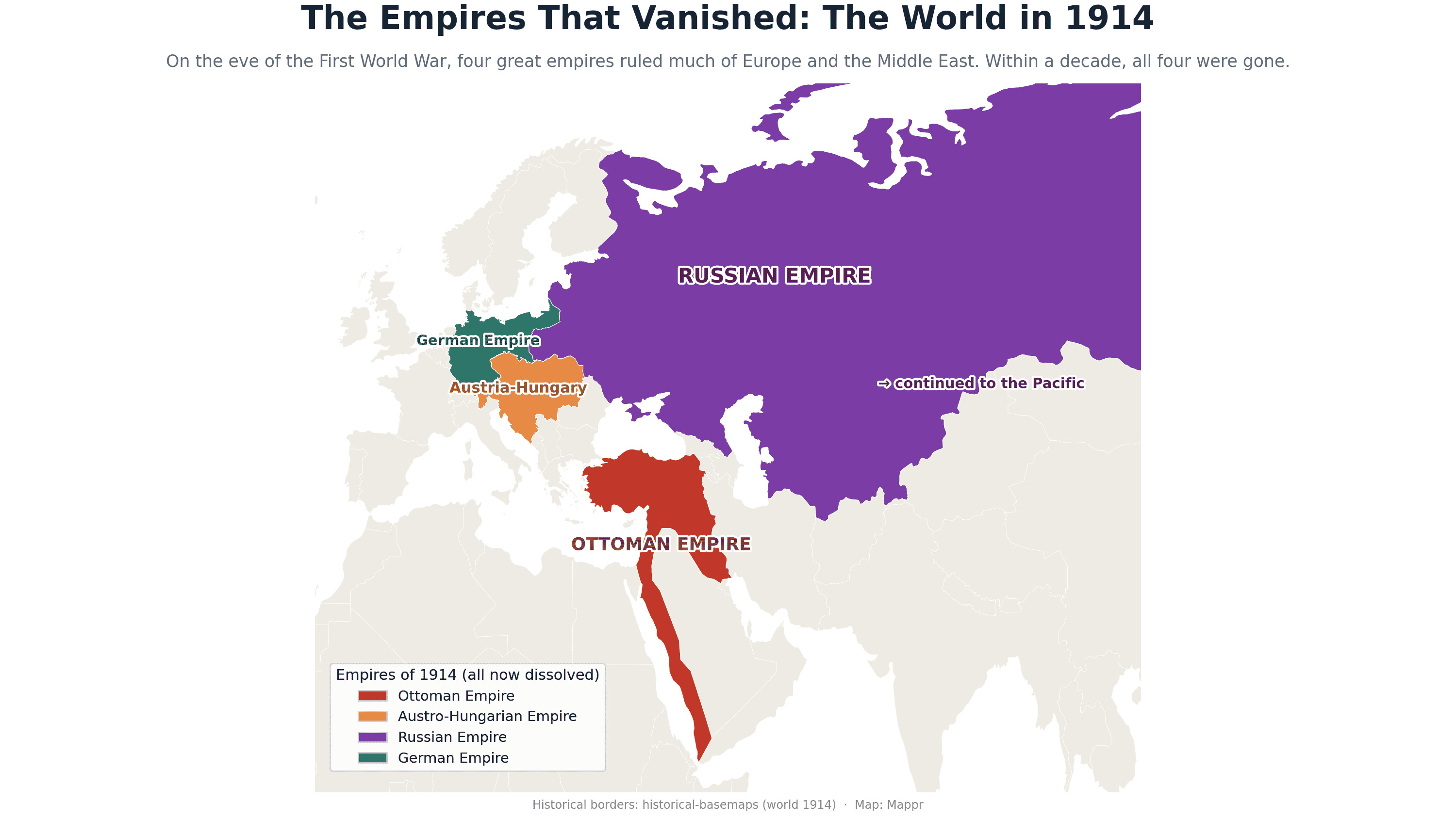
The last remnant of Yugoslavia. This loose union of the two republics lasted just three years before Montenegro voted for independence in 2006, splitting them into separate countries.
🇹🇷 The Ottoman Empire (1299–1922)
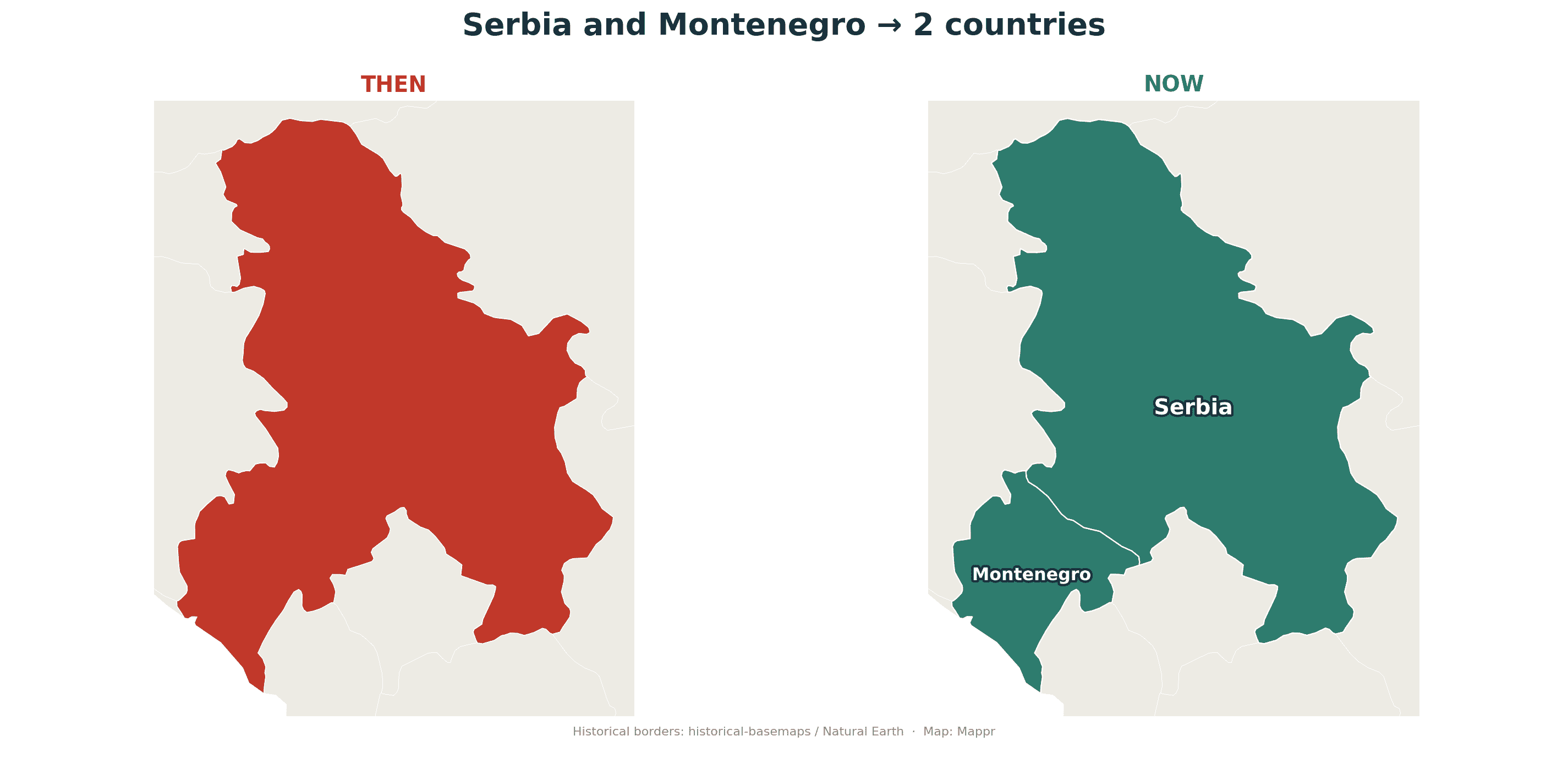
One of history’s great empires, it ruled the Middle East, North Africa and southeastern Europe for six centuries before its defeat in the First World War. Its collapse birthed modern Turkey and much of today’s Middle Eastern map.
🇦🇹 Austria-Hungary (1867–1918)
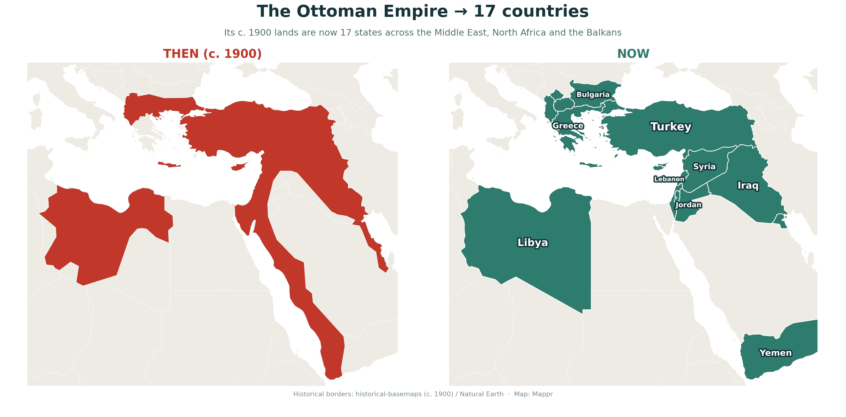
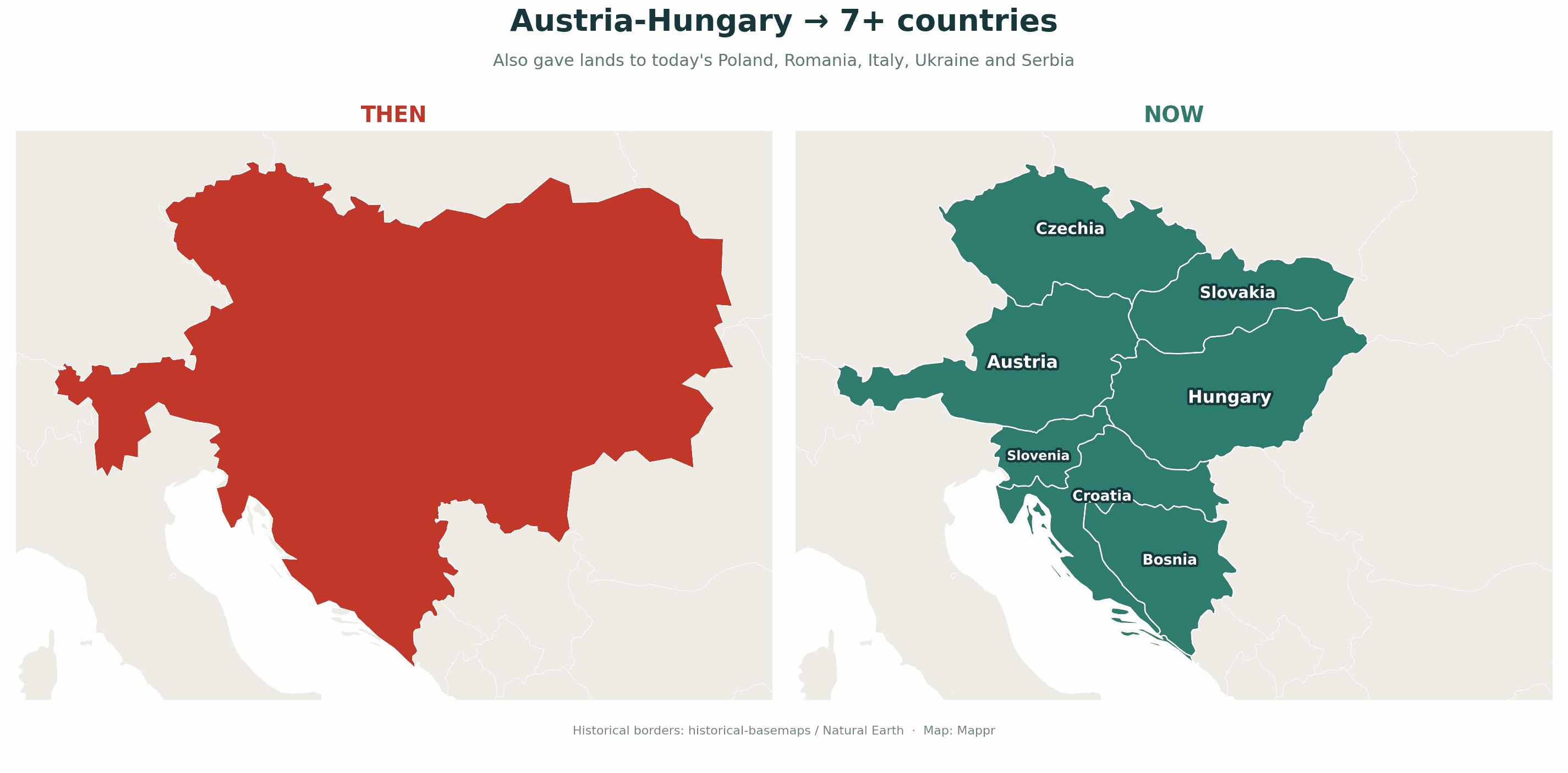
A sprawling central-European empire that dissolved at the end of the First World War, giving rise to Austria, Hungary, Czechoslovakia and parts of Yugoslavia, Poland, Romania and Italy.
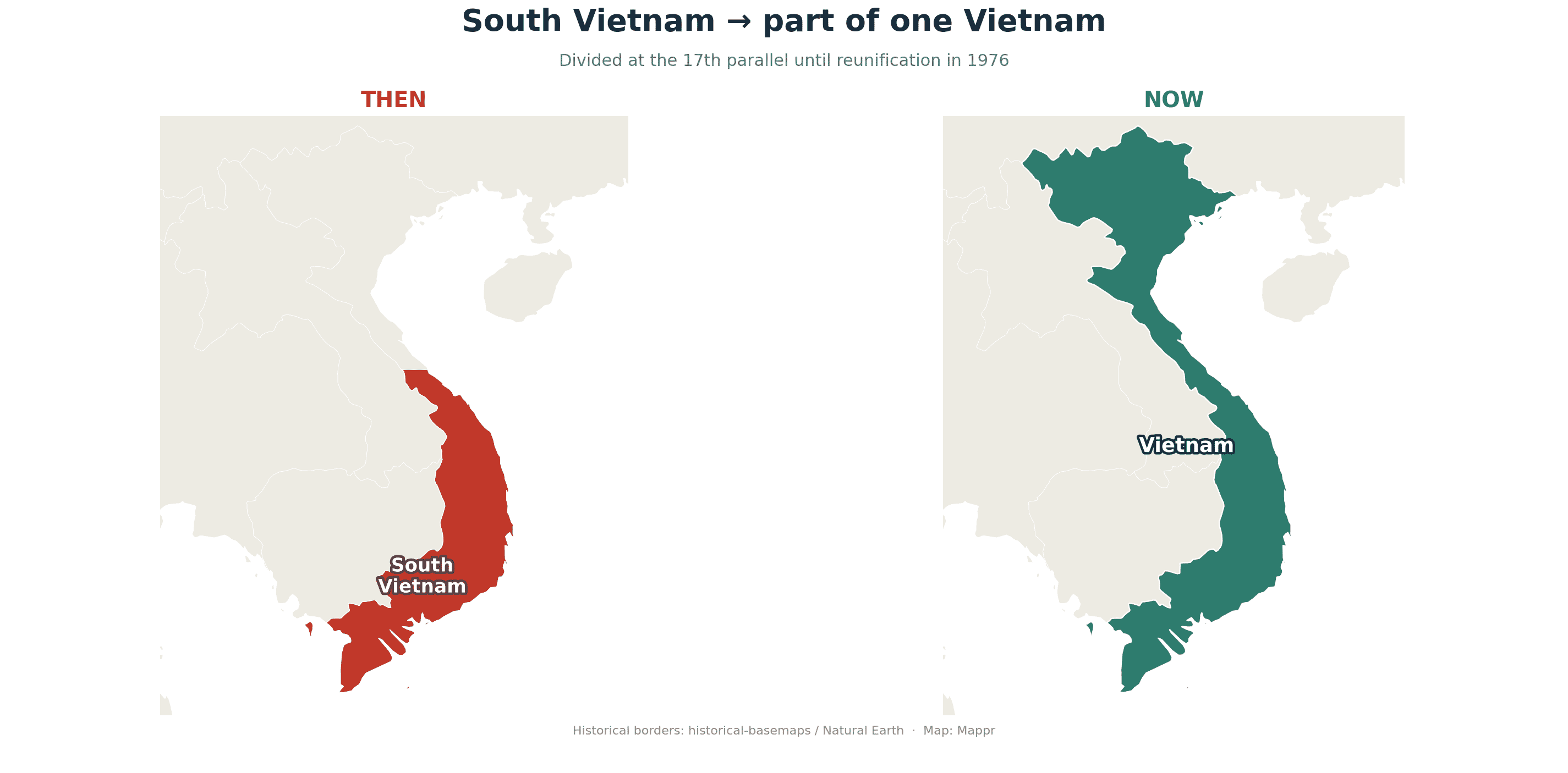
🇻🇳 South Vietnam (1955–1975)
The US-backed Republic of Vietnam ceased to exist when the war ended and the country was reunified under the north as the Socialist Republic of Vietnam in 1976.
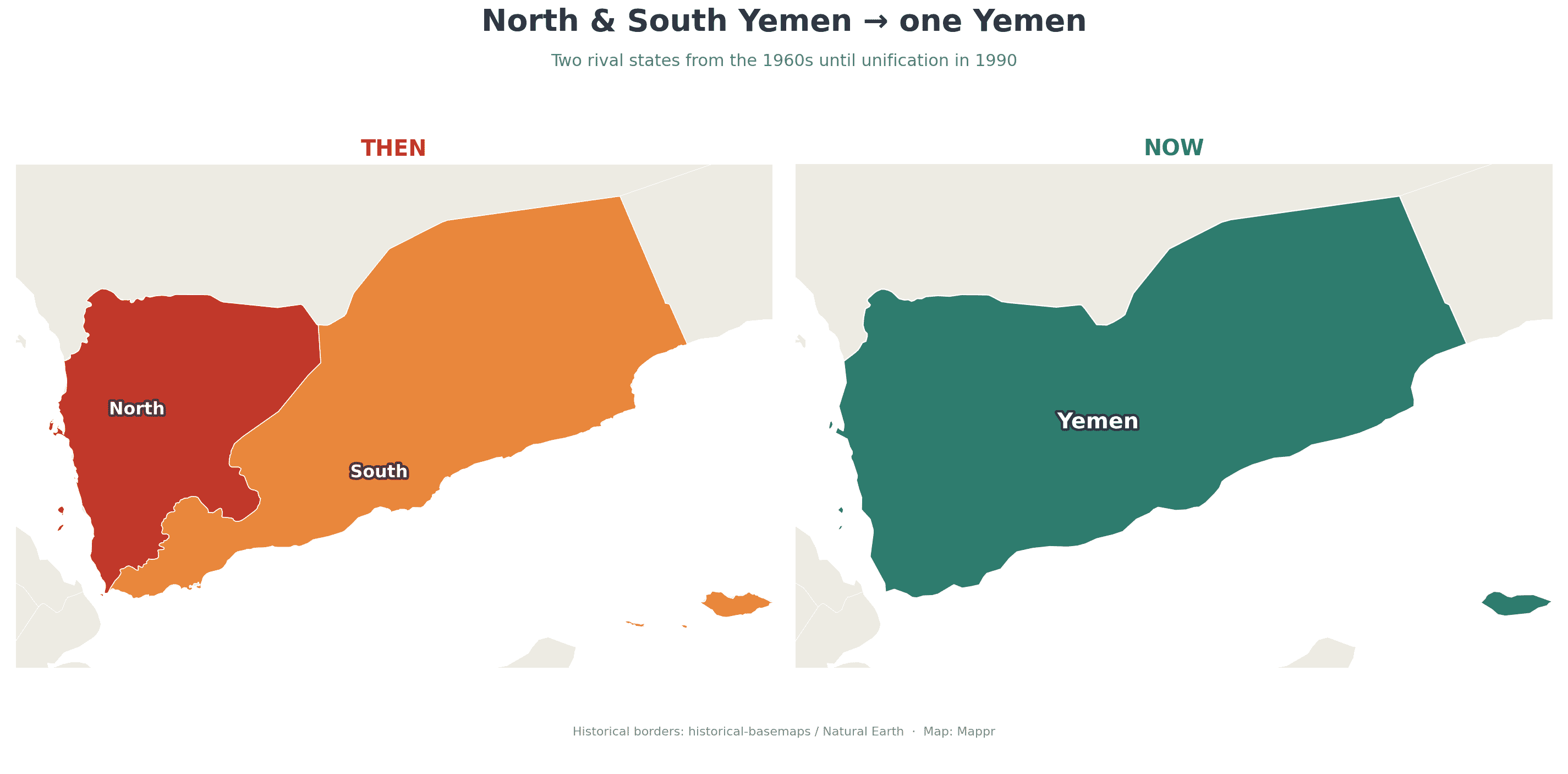
🇾🇪 North and South Yemen (to 1990)
For decades Yemen was two countries, a northern republic and a southern Marxist state. They unified into a single Yemen in 1990.
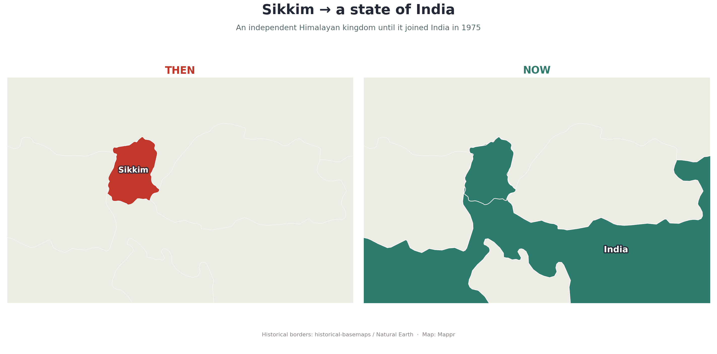
🇮🇳 Sikkim (to 1975)
A small Himalayan kingdom between India and China, Sikkim held a referendum in 1975 and became a state of India, ending centuries of monarchy.
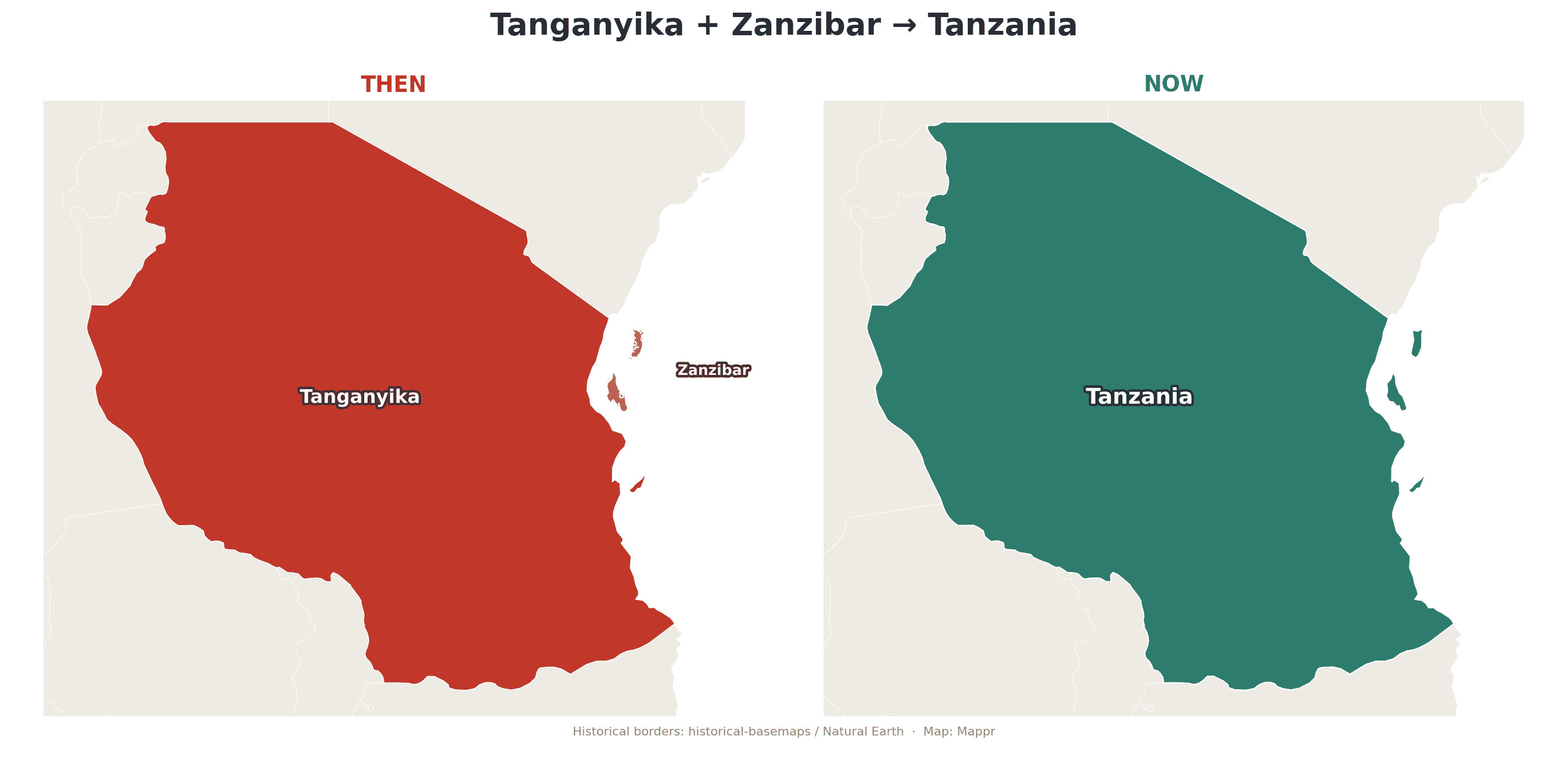
🇹🇿 Tanganyika and Zanzibar (to 1964)
These two East African states merged in 1964 to form a new country, whose name is a portmanteau of both: Tanzania.
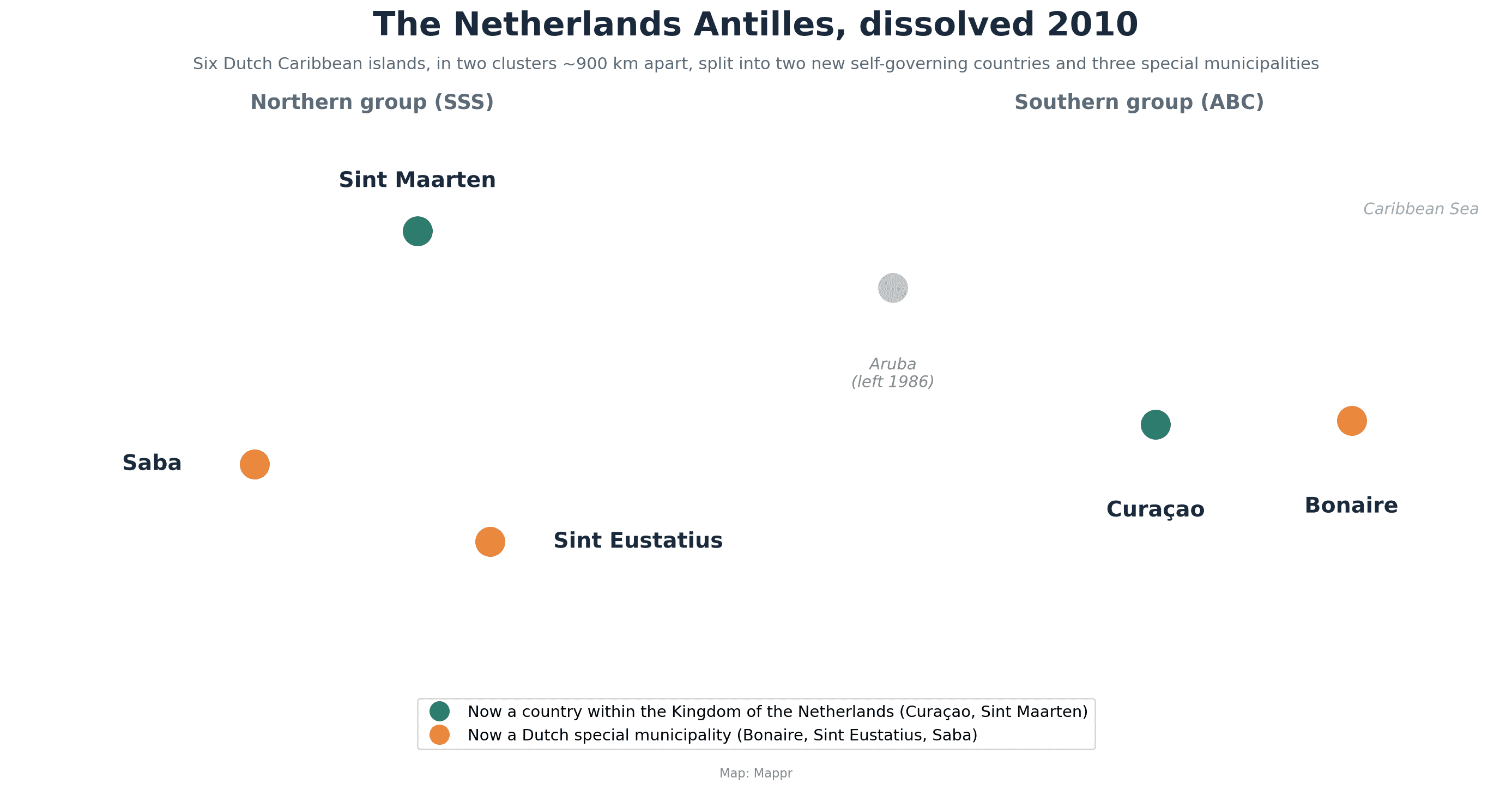
🇳🇱 The Netherlands Antilles (1954–2010)
This Caribbean group of Dutch islands dissolved in 2010; Curaçao and Sint Maarten became self-governing countries within the Kingdom of the Netherlands, while the smaller islands became Dutch municipalities.
Why countries disappear
Strip away the specifics and nations vanish in a handful of ways. Some break apart, as ethnic, linguistic or political fault lines pull a state into pieces (Yugoslavia, the USSR). Some merge, joining a neighbour or uniting with a twin (East Germany, Tanzania, Yemen). Some are absorbed by a larger power (Sikkim). And empires simply collapse under the weight of war and time (the Ottomans, Austria-Hungary). Today’s map looks permanent, but it is only the latest frame in a very long film. We will keep adding to this page as we map more of the countries that time erased.


