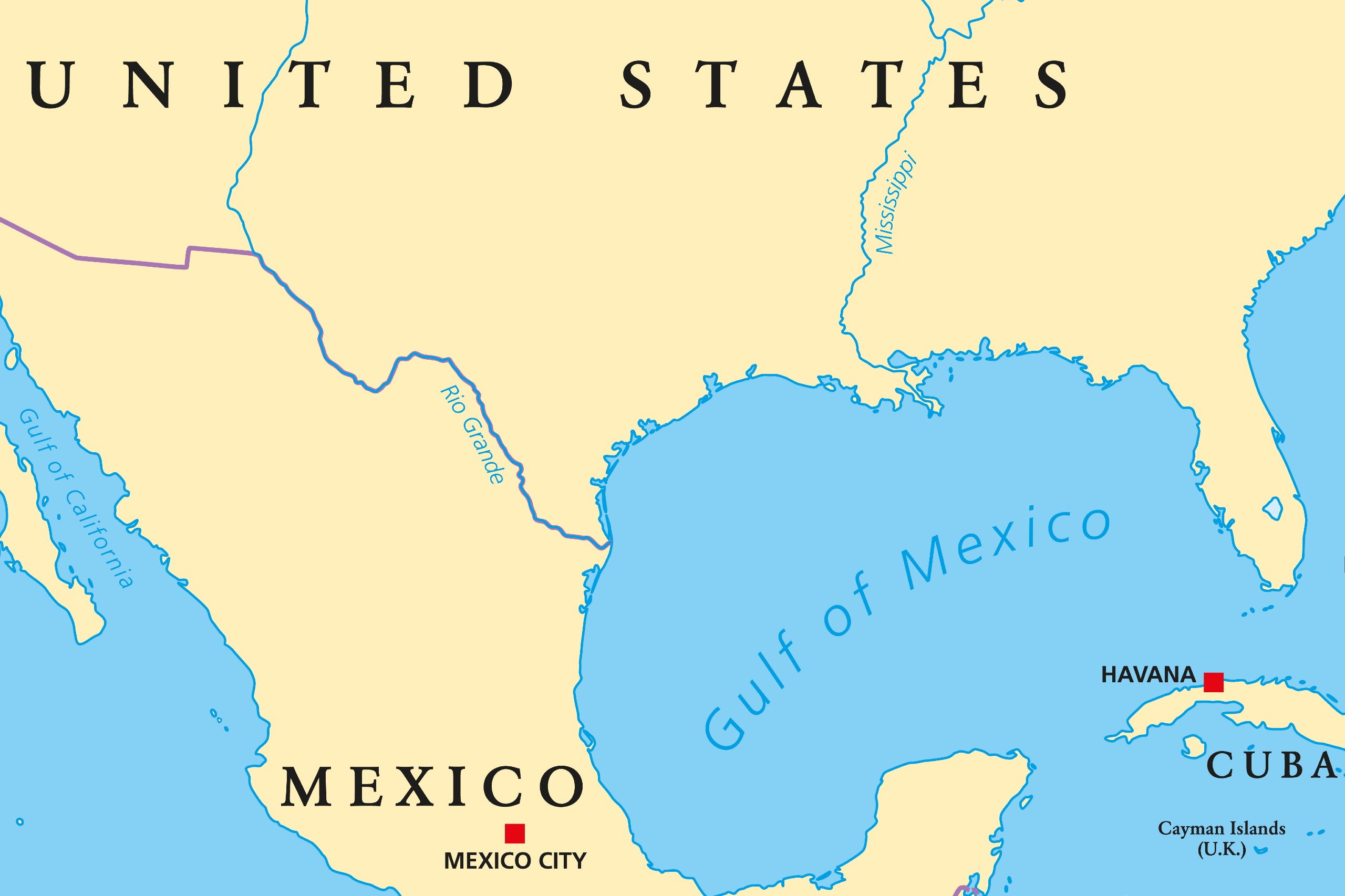
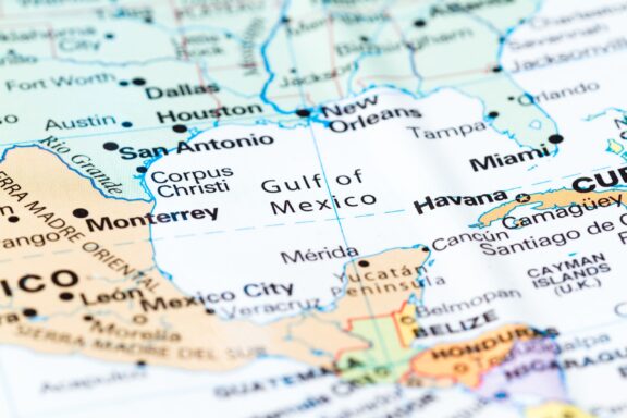
The Gulf Coast states of the United States – Texas, Louisiana, Mississippi, Alabama, and Florida – each boast a unique identity, but they are also closely linked by their shared connection to the Gulf of Mexico.
From the oil-rich waters off the Texas coast to the tourist-laden beaches of Florida, the Gulf’s influence is profound and pervasive. In this post, we’ll look at the role the region has played in the histories and current identities of states and cities on the Gulf Coast of the United States.

The Five US Gulf Coast States
Texas
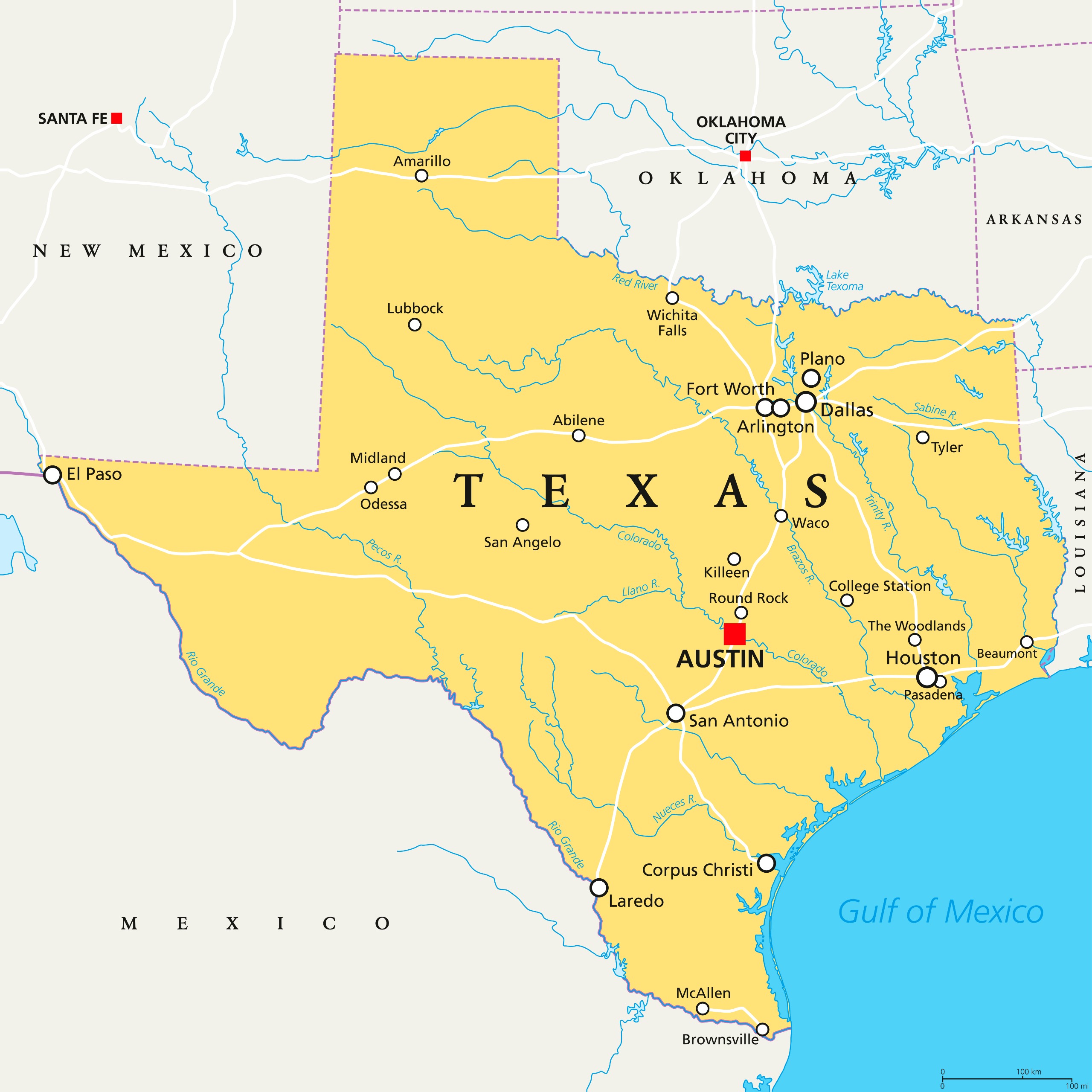
Texas, the largest of the US Gulf Coast States, boasts a rich and diverse history deeply intertwined with the Gulf of Mexico. This extensive coastline has played a pivotal role in shaping Texas’s economic, cultural, and historical landscape.
One of the most significant events in Texas’s history is the Battle of San Jacinto, fought on April 21, 1836, near present-day Houston. This battle was crucial in Texas’s fight for independence from Mexico, leading to the establishment of the Republic of Texas. Today, visitors can see the San Jacinto Battleground State Historic Site in La Porte, Texas.
The discovery of oil at Spindletop near Beaumont in 1901 transformed the Gulf Coast, ushering in an era of economic prosperity and industrial growth. This event marked the beginning of the Texas Oil Boom, significantly impacting the state’s economy and contributing to its pivotal role in the global oil industry.
Today, the Gulf Coast region is a hub for the energy sector, with cities like Houston and Corpus Christi playing key roles in oil and gas production. The Port of Houston, one of the largest in the country, serves as a testament to the Gulf’s enduring economic impact on Texas.
Some of the best beaches on the Gulf Coast of Texas are located around Galveston Island State Park and the Padre Island National Seashore.
Louisiana
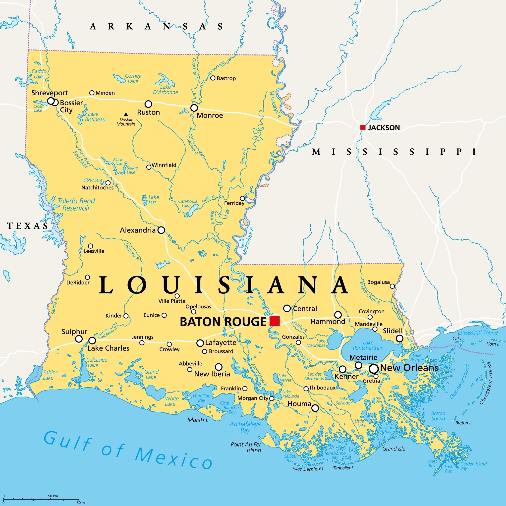
Bordering Texas to the east is Louisiana, another state with a deep connection to the Gulf of Mexico. The state’s unique geographical position has influenced its development from the early days of European colonization to its current status as a vital player in the American maritime industry.
New Orleans, Louisiana’s most famous city, was founded in 1718 by the French Mississippi Company. Its location near the mouth of the Mississippi River made it a strategic port, fostering a rich blend of cultures, including French, African, Spanish, and Caribbean influences. This cultural melting pot is evident in the city’s unique architecture, music, and cuisine.
The state is also known for its significant role in the oil and gas industry. The discovery of the Jennings Oil Field in 1901 marked the beginning of Louisiana’s oil boom, placing it at the forefront of America’s energy sector. Today, Louisiana’s offshore oil rigs in the Gulf of Mexico and the Louisiana Offshore Oil Port (LOOP) play a crucial role in national energy supply.
Louisiana’s coast is also famed for its natural beauty and environmental significance. The state’s wetlands, such as those in the Jean Lafitte National Historical Park and Preserve, are critical for wildlife habitats and act as natural barriers against hurricanes.
The region’s vulnerability to hurricanes was starkly highlighted by Hurricane Katrina in 2005, underscoring the need for ongoing environmental and coastal protection efforts.
Mississippi
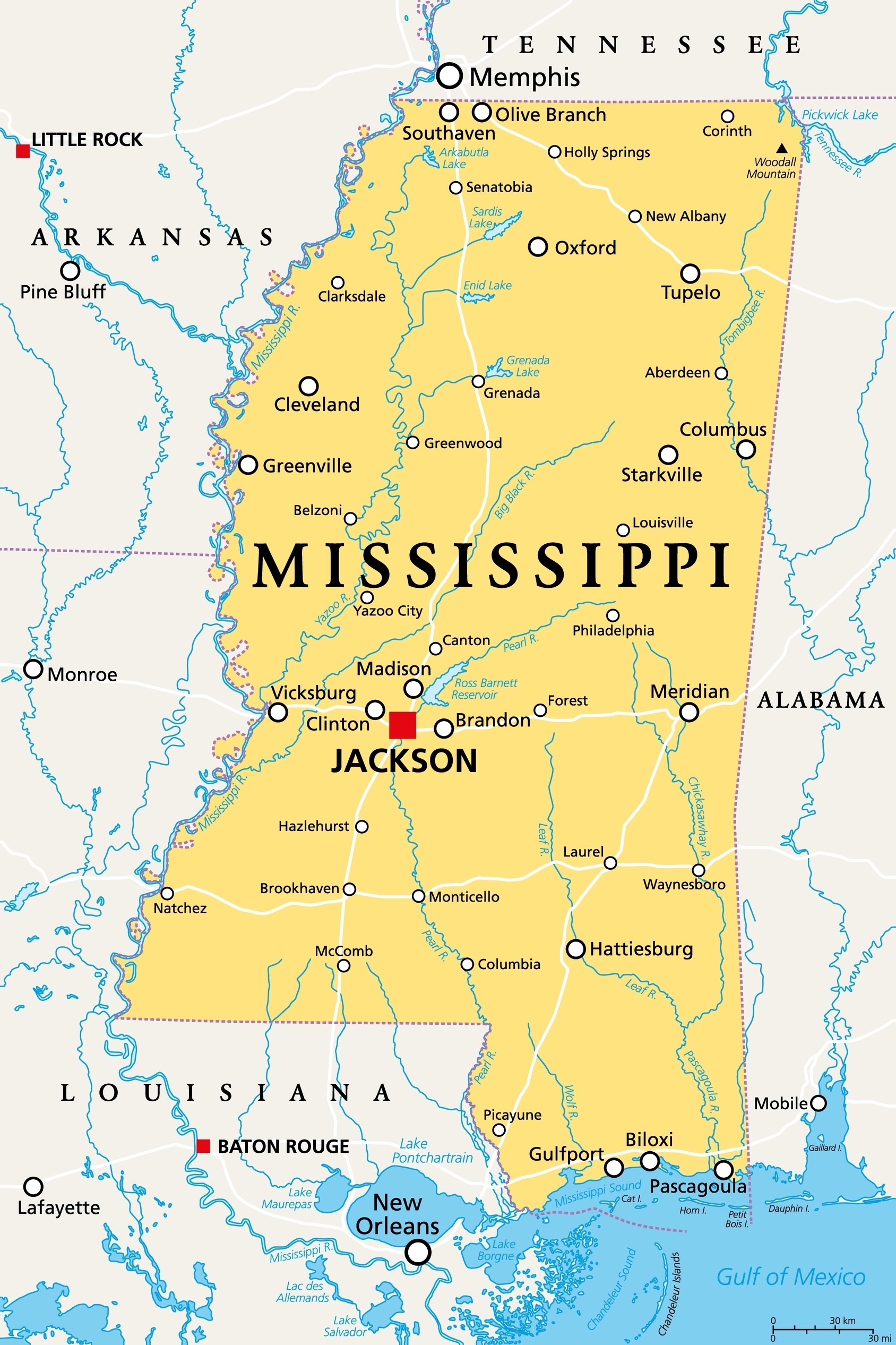
Mississippi, nestled between Louisiana and Alabama along the Gulf of Mexico, has a history that has been significantly shaped by its coastal geography. This position has been crucial to Mississippi’s identity, from the era of precolonial inhabitants to the complexities of the modern age.
The city of Biloxi, founded in 1699, is one of the oldest European settlements in the contiguous United States. Its establishment as the capital of French Louisiana illustrates the Gulf Coast’s long-standing strategic and economic significance. Over time, Biloxi has evolved, becoming known as “The Seafood Capital of the World” in the early 20th century due to its bustling seafood processing industry.
Mississippi’s Gulf Coast also played a notable role during the Civil War, with the crucial Confederate stronghold of Fort Massachusetts on Ship Island being captured by Union forces in 1862. This event was a turning point in the Union’s Gulf Campaign.
In the realm of cultural contributions, Mississippi has given rise to the vibrant Mississippi Blues, a genre that has deeply influenced modern music. The Gulf Coast’s blend of cultures contributes to this rich musical heritage.
The state’s economy and environment have been significantly influenced by the Gulf of Mexico, particularly through the shipping industry at the Port of Gulfport, the state’s largest port.
Alabama
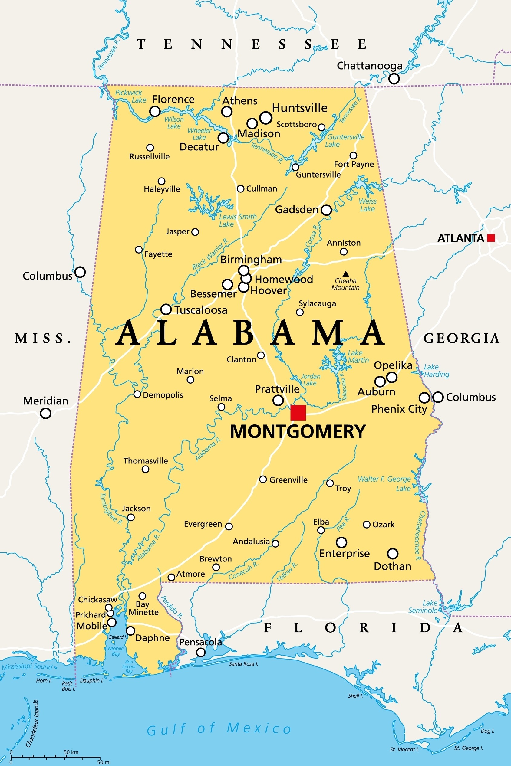
Alabama’s Gulf Coast, while modest in length, is deeply influenced by its proximity to the Gulf of Mexico. The state’s coastline may be less extensive than that of its neighbors, but it has been equally significant in shaping Alabama’s identity.
Mobile, founded by the French in 1702, is Alabama’s key coastal city and one of the oldest in the Gulf Coast region. As the original capital of French Louisiana, Mobile’s port has long been a vital conduit for trade and cultural exchange, which continues to this day with the Alabama State Port Authority playing a critical role in the state’s economy.
Alabama’s Gulf Coast has also been the site of pivotal historical events, including the Battle of Mobile Bay during the Civil War on August 5, 1864. This battle was marked by Admiral David Farragut’s famous command, “Damn the torpedoes, full speed ahead!” which led to a decisive Union victory.
In terms of cultural influence, the Gulf Coast has contributed significantly to Alabama’s maritime traditions. The Annual National Shrimp Festival in Gulf Shores celebrates the region’s seafood industry and attracts visitors from across the nation.
The Gulf of Mexico’s impact on Alabama extends to the environmental sector as well. The state’s coastal ecosystems, such as those within the Bon Secour National Wildlife Refuge, are recognized for their biodiversity and serve as crucial habitats for migratory birds and endangered species.
Florida
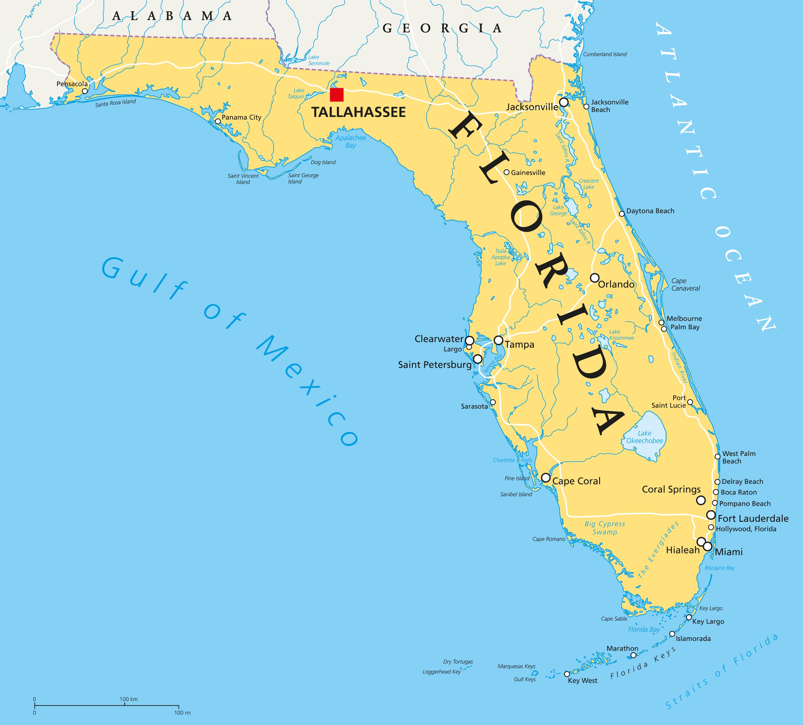
Florida’s Gulf Coast, a sprawling stretch of white sandy beaches and clear waters, stands as a testament to the state’s intricate bond with the Gulf of Mexico. From Pensacola in the western Panhandle to the Ten Thousand Islands near Naples, the Gulf Coast is an integral part of Florida’s geography and allure.
This region is not just a vacation destination but also a place of historical significance. The city of St. Augustine, while not directly on the Gulf Coast, was founded in 1565 by Spanish explorers and is the oldest continuously inhabited European-established settlement in the continental United States.
St. Augustine’s history set the stage for the development of Gulf Coast cities like Tampa and St. Petersburg, which would later flourish from the late 19th century as trade and tourism hubs.
Florida’s economy is heavily bolstered by the Gulf Coast’s contributions to fishing, shipping, and especially tourism, with cities like Clearwater and Sarasota being focal points for visitors seeking sun, sea, and sand.
The Gulf Coast’s environment is a rich tapestry of biodiversity, with areas such as the Everglades National Park serving as crucial wildlife habitats. The Gulf’s warm waters are also breeding grounds for many species of fish and the endangered manatee.
Challenges such as the impact of hurricanes and coastal erosion are ever-present, but Florida continues to demonstrate resilience, balancing development with the preservation of its Gulf Coast treasures.
About the Gulf of Mexico
Geography and Size
The Gulf of Mexico is an ocean basin largely surrounded by the North American continent and the island of Cuba. It is bounded on the northeast, north, and northwest by the Gulf Coast of the United States, on the southwest and south by Mexico, and on the southeast by Cuba.
Covering approximately 600,000 square miles, the Gulf is the ninth-largest body of water in the world. Its basin is a complex and diverse ecological region that extends into the Caribbean Sea via the Yucatan Channel between Mexico and Cuba.
Ecology and Biodiversity
The Gulf of Mexico is renowned for its ecological diversity, hosting thousands of species of marine life, including over 1,400 fish species. Its waters serve as a crucial habitat for various marine mammals, seabirds, and the endangered Kemp’s Ridley sea turtle.
The Gulf’s coastline features a range of ecosystems from mangroves to marshes, which are vital for the environmental health of the region.
Economy and Industry
Economically, the Gulf of Mexico is a powerhouse. It is a major navigation zone and supports activities such as commercial fishing, which is crucial for both the United States and Mexico.
The Gulf is also a bedrock for the petroleum industry, with numerous offshore oil rigs extracting significant portions of the United States’ oil supply.
The region’s warm waters and beautiful beaches drive a thriving tourism industry, attracting millions of visitors annually.
Environmental Challenges
The Gulf of Mexico has faced several environmental challenges. The Deepwater Horizon oil spill in 2010 was one of the worst environmental disasters in U.S. history, releasing millions of barrels of oil into the Gulf. This event highlighted the environmental risks associated with deep-sea drilling.
The Gulf’s marine habitats are also threatened by overfishing, habitat loss, and the impacts of climate change, which include more frequent and severe hurricanes.


- Map of US Gulf Coast States — © Peter Hermes Furian/Shutterstock