Australia, a land of dazzling contrasts and natural wonders, beckons travelers to its sun-soaked shores, especially during summer.
Beyond the well-trodden paths to iconic landmarks lies a tapestry of hidden gems waiting to be discovered by those eager to explore the road less traveled.
Embark on a journey to unearth these treasures, each offering a unique slice of paradise and a chance to create unforgettable memories under the Southern Hemisphere sun.
1. Ningaloo Reef
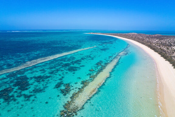
Ningaloo Reef is a beacon of natural beauty, unrivaled in its biodiversity and aquatic wonders. It offers an intimate encounter with marine life, where vibrant coral gardens and many sea creatures are snorkels from shore.
This underwater paradise is a sanctuary for those seeking serenity and a profound connection with nature during Australia’s summer months.
The reef’s proximity to the coast makes it uniquely accessible, inviting adventurers to immerse themselves in its underwater marvels without requiring long boat rides.
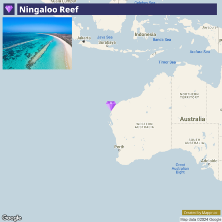
- ✈️ How to Get There: You can reach Ningaloo Reef by flying into Learmonth Airport, which has regular flights from Perth. It’s a short drive from the airport to the coastal towns of Exmouth or Coral Bay, gateways to the reef.
- 🏨 Where to Stay: Mantarays Ningaloo Beach Resort in Exmouth stands as a pinnacle of luxury amidst the stunning backdrop of Australia’s Coral Coast. This exquisite resort allows guests to immerse themselves in unparalleled beachfront elegance.
2. Jervis Bay, NSW
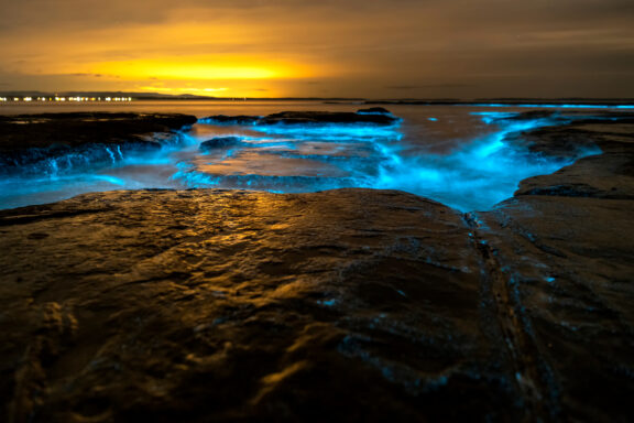
Jervis Bay is a coastal haven famed for its powdery white sands and crystal-clear turquoise waters, making it an idyllic summer retreat. This lesser-known destination is a mosaic of stunning beaches, lush national parks, and rich marine and terrestrial wildlife.
The bay’s most famous beach, Hyams Beach, is celebrated for having some of the whitest sand in the world, providing a stark, beautiful contrast to the verdant national parks surrounding the area.
Jervis Bay is a beachgoer’s paradise and a sanctuary for nature lovers. It offers whale watching, dolphin cruises, and bushwalking opportunities.
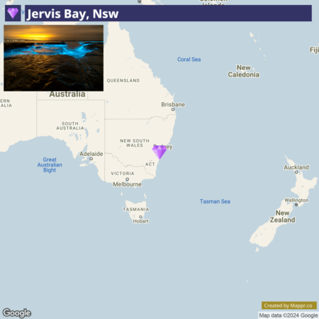
- ✈️ How to Get There: Jervis Bay is approximately a 3-hour drive from Sydney, making it an accessible road trip destination. Regular train services also run to nearby Bomaderry.
- 🏨 Where to Stay: The Paperbark Camp offers a unique eco-friendly glamping experience, blending luxury with nature, or the Huskisson Beach Bed and Breakfast for those seeking cozy, beachfront charm.
3. Whitehaven Beach, Whitsunday Islands
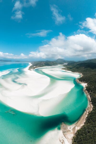
Whitehaven Beach is an emblem of pristine natural beauty accessible only by boat, helicopter, or seaplane, and it offers a peaceful retreat from the outside world with its breathtaking landscapes and postcard-perfect vistas.
The beach’s swirling sands, a blend of pure white silica and crystal-clear azure waters, create mesmerizing patterns that are both a photographer’s dream and a haven for relaxation and introspection.
Whitehaven Beach is a testament to the untouched beauty of Australia’s coastlines, providing a serene backdrop for swimming, sunbathing, and soul-searching.
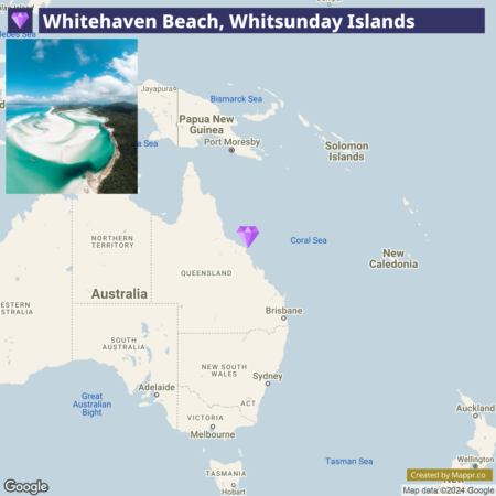
- ✈️ How to Get There: The gateway to Whitehaven Beach is the town of Airlie Beach. From here, you can embark on a scenic boat, seaplane, or helicopter ride to this isolated paradise.
- 🏨 Where to Stay: Opt for the Airlie Beach Hotel‘s central location and stunning sea views or the Palm Bungalows on Hamilton Island for a tranquil, tropical island experience close to Whitehaven Beach.
4. Daintree Rainforest, Queensland
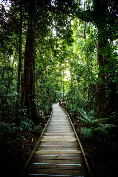
Daintree Rainforest in Queensland offers an immersive journey into one of the planet’s oldest surviving rainforests. This lush, ancient ecosystem is a living museum where every leaf, vine, and stream tells a story of ecological resilience and diversity.
Venture into this dense, emerald world to uncover hidden waterfalls, exotic wildlife, and towering canopies that form a natural cathedral.
The rainforest is a haven for biologists and nature enthusiasts and a place where visitors can connect with an untouched Earth’s tranquil, timeless energy.
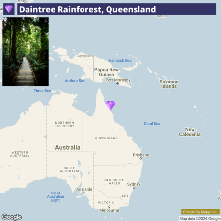
- ✈️ How to Get There: The gateway to Daintree is Cairns, with the rainforest approximately a 2-hour drive north. Cairns is well-connected by air with major Australian cities and some international destinations.
- 🏨 Where to Stay: Daintree Cascades offers luxury eco-lodges along the Mossman River, providing a serene rainforest experience, or the Daintree Eco Lodge for a sustainable stay amidst the lush canopy.
5. Bruny Island
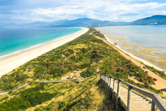
Bruny Island, a secluded isle off the southeastern coast of Tasmania, is a mosaic of rugged coastline, dense bushland, and gourmet local produce.
This island is a sanctuary for those seeking solitude and natural beauty and who want to taste Tasmania’s renowned fresh foods. Bruny Island is a feast for the senses, with artisan cheeses, chocolates, fresh oysters, and berries.
The island’s diverse landscapes offer many activities, from hiking through the South Bruny National Park to witnessing the majestic ‘Neck,’ a narrow isthmus connecting the north and south parts of the island.
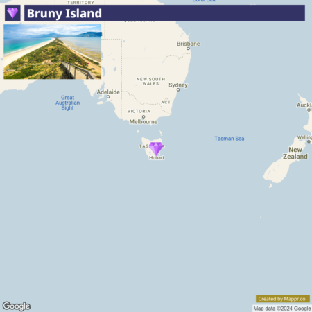
- ✈️ How to Get There: Access Bruny Island by a short ferry ride from Kettering, about a 30-minute south of Hobart. Hobart is the nearest major city with an airport servicing flights from mainland Australia.
- 🏨 Where to Stay: Adventure Bay Retreat offers luxury accommodations with stunning wilderness views or the 43 Degrees Bruny Island for those seeking a serene seaside escape.
6. The Kimberley
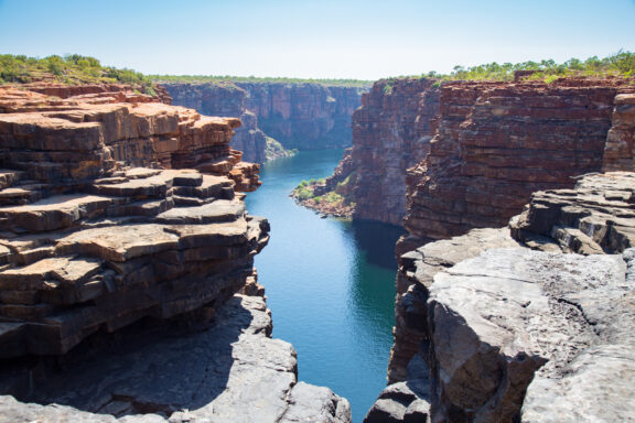
The Kimberley transforms into an oasis of life and color during summer. This vast wilderness, known for its majestic gorges, thundering waterfalls, and ancient Indigenous rock art, comes alive with the arrival of the summer rains.
Travelers to The Kimberley can embark on a journey through time, navigating the ancient, eroded landscapes that teem with wildlife and are dotted with crystal-clear swimming holes.
It’s a place where the vastness of nature can be genuinely felt, from the Bungle Bungles’ beehive-striped domes to the cascading waters of Mitchell Falls.
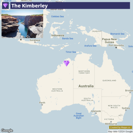
- ✈️ How to Get There: The Kimberley is accessible via Broome or Kununurra, with both towns having airports that connect to Perth and other major Australian cities. Road travel in the region often requires a 4WD vehicle.
- 🏨 Where to Stay: The Cable Beach Club Resort & Spa in Broome offers luxurious accommodations with stunning views of the iconic Cable Beach or the Berkeley River Lodge for an authentic outback experience in the heart of Kimberley.
7. Lord Howe Island, NSW
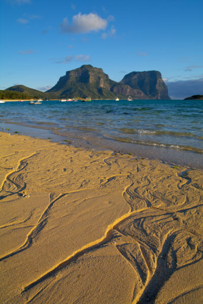
Lord Howe Island, nestled in the Tasman Sea, is an idyllic paradise characterized by its striking volcanic peaks, lush forests, and pristine beaches.
With limited visitor numbers, this UNESCO World Heritage-listed island ensures an exclusive and serene getaway. The island’s unique ecosystem is home to many bird species, making it a birdwatcher’s paradise.
At the same time, its crystal-clear waters are perfect for snorkeling and diving, offering a glimpse into the vibrant marine life of the world’s southernmost coral reef.
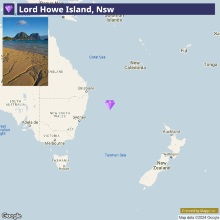
- ✈️ How to Get There: Access to Lord Howe Island is via a short flight from Sydney or Brisbane. Due to the island’s commitment to conservation and maintaining its untouched beauty, visitor numbers are limited, making advance booking essential.
- 🏨 Where to Stay: Beachcomber Lodge is the epitome of luxury, offering stunning views of the ocean and mountains, while Arajilla Retreat provides a serene hideaway under a canopy of Kentia palms and Banyan trees.
8. Kakadu National Park
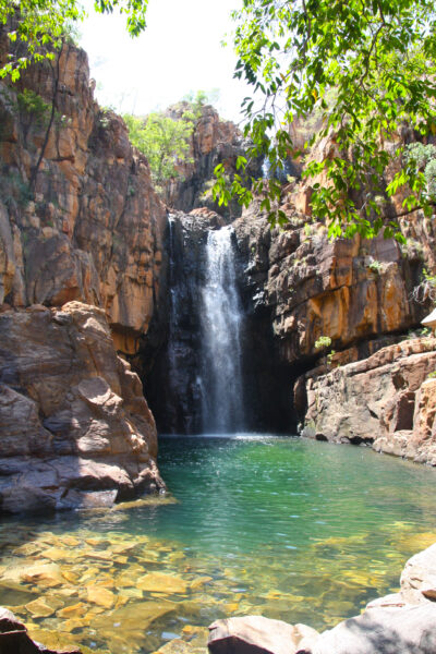
Kakadu National Park, one of Australia’s largest national park, is a tapestry of biodiverse habitats, from wetlands and rivers to sandstone escarpments.
This vast park is a natural wonder and a cultural treasure, with its ancient Aboriginal rock art sites offering a window into the region’s rich Indigenous heritage.
Kakadu’s landscapes transform with the seasons, each revealing new sights and experiences, from the dramatic waterfalls of the wet season to the teeming wildlife of the dry season.
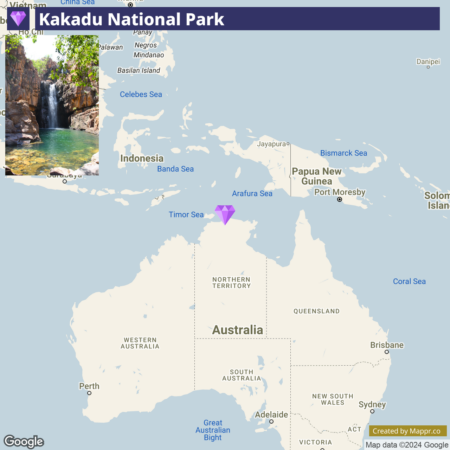
- ✈️ How to Get There: Kakadu is approximately a 3-hour drive from Darwin, the capital of the Northern Territory, which is well-connected by air to other major Australian cities.
- 🏨 Where to Stay: The Oasis Tourist Park offers a unique and comfortable stay in an urban setting, while the Cooinda Lodge Kakadu near the Yellow Water Billabong provides easy access to nature tours and activities.
9. Mataranka, Elsey National Park
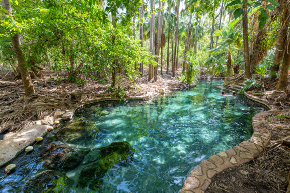
Mataranka is renowned for its thermal pools, set amidst a landscape of tropical woodlands. These natural springs, with their crystal-clear warm waters, offer a tranquil respite and are said to have healing properties.
The park itself is steeped in history, immortalized in the novel “We of the Never Never” by Jeannie Gunn, and offers visitors a glimpse into the pioneering spirit of the Australian outback.
Beyond the soothing waters of the thermal pools, Elsey National Park invites exploration of its serene waterways by canoe, walking trails that meander through lush vegetation, and the historic Elsey Cemetery.
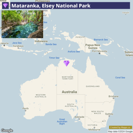
- ✈️ How to Get There: Mataranka is about a one-hour drive from Katherine, which is serviced by buses and trains from Darwin and Alice Springs. The closest major city with an airport is Darwin, approximately four hours away.
- 🏨 Where to Stay: Nestled within the natural beauty of the Northern Territory, Cicada Lodge offers a luxurious and immersive stay. This refined retreat is renowned for blending modern elegance with the rich cultural heritage of the Jawoyn people.
10. Blue Lake, Mount Gambier
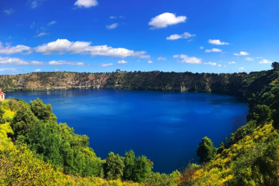
Blue Lake in Mount Gambier is a remarkable natural phenomenon. During the summer months, it transforms into a vibrant cobalt blue, a spectacle that captivates visitors with its stunning hues.
This crater lake, set within a dormant volcanic maar, offers a visual feast and a glimpse into the region’s geological history.
The summer transformation results from a unique seasonal shift in the lake’s limnology, making it an intriguing subject for scientists and a must-see for nature enthusiasts.
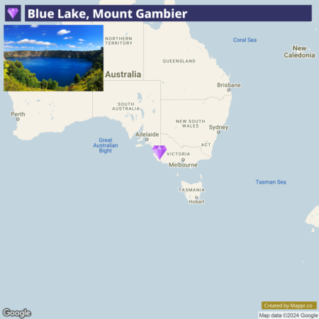
- ✈️ How to Get There: Mount Gambier is accessible by car from Adelaide or Melbourne, and the journey offers picturesque views of the Australian countryside. The nearest airport is in Mount Gambier, and flights connect to major cities.
- 🏨 Where to Stay: The Commodore on the Park offers comfortable and convenient accommodations near the city center. For a more boutique experience, the Blue Lake Motel provides cozy lodging with easy access to the lake’s viewing platforms.
11. Litchfield National Park
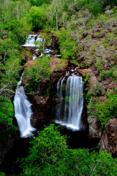
Litchfield National Park, a jewel in the Northern Territory, is renowned for its stunning waterfalls, crystal-clear swimming holes, and fascinating termite mounds.
This park is a sanctuary for those looking to escape into the wild, offering a range of activities from hiking and swimming to wildlife spotting.
The park’s waterfalls, including Wangi, Florence, and Tolmer Falls, cascade into idyllic plunge pools, creating natural oases in the rugged Australian bushland.
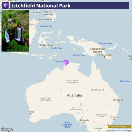
- ✈️ How to Get There: Litchfield National Park is approximately a 1.5-hour drive from Darwin, making it an ideal day trip or weekend getaway. The park’s proximity to the city ensures it is well-traveled yet remains unspoiled.
- 🏨 Where to Stay: For comfortable and convenient access to the park, stay at the Hideaway Litchfield, or for a more immersive experience, the Litchfield Tourist Park offers cabins and camping sites amidst the natural beauty of the Northern Territory.
12. Roebuck Bay, Broome
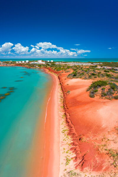
Roebuck Bay in Broome is a coastal paradise known for its extraordinary natural phenomena, including the famed ‘Staircase to the Moon,’ an optical illusion created by the rising full moon reflecting on the bay’s tidal flats.
This captivating spectacle draws visitors from around the globe, offering a unique blend of natural beauty and cultural experience. The bay’s rich marine life, including migratory birds and dolphins, makes it a hotspot for wildlife enthusiasts.
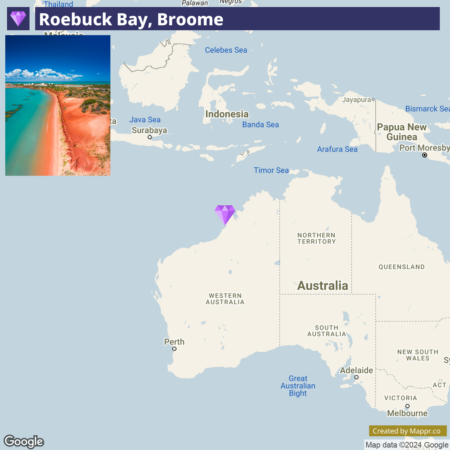
- ✈️ How to Get There: Broome is well connected by air, with direct flights from Perth and other major Australian cities. Roebuck Bay is easily accessible from the town, making it a convenient location for visitors.
- 🏨 Where to Stay: The Mangrove Hotel offers stunning views of Roebuck Bay and is perfectly positioned for observing the Staircase to the Moon phenomenon. Alternatively, the Moonlight Bay Suites offer spacious accommodations, with the bay just a short walk away.
13. Mungo National Park, NSW
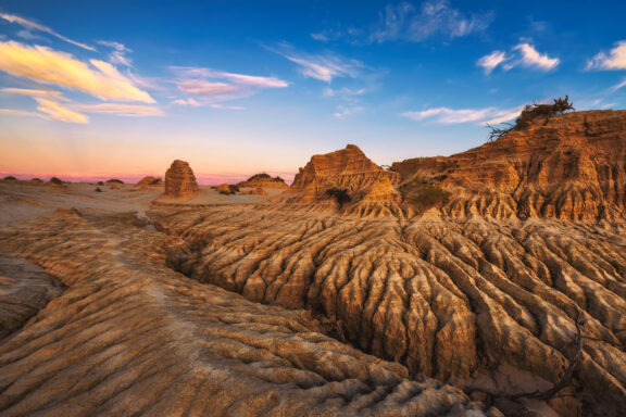
Mungo National Park in New South Wales is an ethereal landscape where ancient dry lake beds and shifting sand dunes tell tales of Australia’s long-gone megafauna and human history dating back over 40,000 years.
The park’s most iconic feature, the Walls of China, is a series of striking lunette dunes that have been sculpted by wind and erosion into delicate formations.
This World Heritage site is not only a geological wonder but also a significant cultural and archaeological site, offering insights into the oldest known human occupation on the continent.
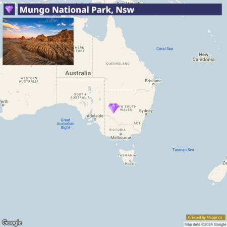
- ✈️ How to Get There: Mungo National Park is approximately a 2-hour from Mildura, accessible by air from major Australian cities. The journey to the park is an adventure, traversing through the scenic outback.
- 🏨 Where to Stay: While no hotels are within the park, nearby accommodations include the Mungo Lodge, offering comfortable rooms and guided tours, or the more rustic option of camping under the stars at one of the park’s designated campsites.
14. Noosa National Park, Queensland
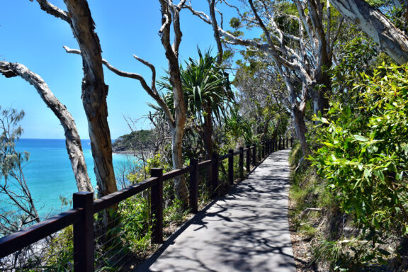
Noosa National Park in Queensland is a coastal gem renowned for its stunning beaches, clear waters, and lush rainforest.
The park’s headland section offers scenic walking trails that provide breathtaking views of the Noosa coastline and the chance to spot local wildlife, including koalas in their natural habitat.
The park’s diverse ecosystems range from coastal rainforests to rugged sea cliffs, encompassing the serene Tea Tree Bay, a popular spot for swimming and relaxing on the beach.
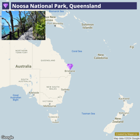
- ✈️ How to Get There: Noosa National Park is a short drive from Noosa Heads, easily accessible by car from Brisbane, about a 2-hour drive south. Brisbane International Airport serves as the main gateway for travelers coming from afar.
- 🏨 Where to Stay: The Ocean Breeze Resort provides luxurious accommodations close to the park, offering easy access to its natural attractions. For a more intimate experience, the Noosa Hill Resort offers self-contained apartments with panoramic views of the surrounding area.
15. Carnarvon Gorge
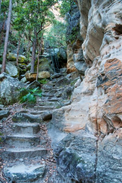
Carnarvon Gorge in Queensland’s Central Highlands is a sanctuary of lush rainforest, towering sandstone cliffs, and ancient Aboriginal rock art.
This natural oasis is carved out by Carnarvon Creek, which winds its way through the gorge and creates a vibrant, biodiverse environment.
The gorge is famed for its numerous walking tracks that lead to stunning natural features, such as the Art Gallery, which houses one of Australia’s most significant collections of Indigenous rock art.
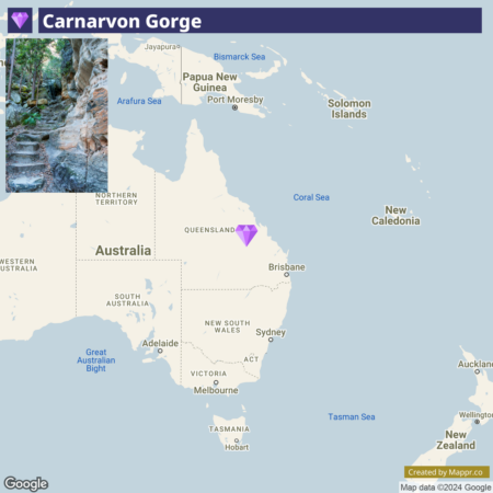
- ✈️ How to Get There: The nearest major town is Emerald, approximately a 3-hour from Carnarvon Gorge. Emerald is accessible by air from Brisbane, making it a feasible journey.
- 🏨 Where to Stay: The Moura Meridian Motel provides a comfortable and contemporary stay, ideal for those journeying to Carnarvon Gorge. Similarly, the Injune Motel offers cozy accommodations, ensuring a restful retreat amidst the region’s natural splendor.
16. Binalong Bay
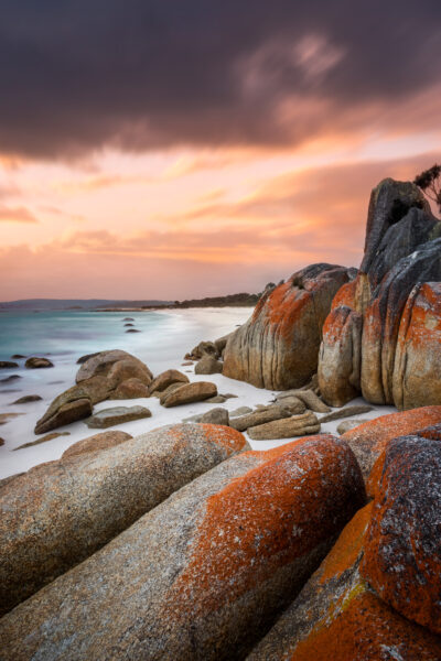
Binalong Bay is the gateway to the Bay of Fires, known for its crystal-clear waters, white sandy beaches, and iconic orange-lichen-covered granite boulders.
This picturesque coastal haven comes alive in summer, drawing visitors with its warm, temperate climate and tranquil, azure waters ideal for swimming, snorkeling, and kayaking.
The contrast of the vivid blue ocean, white sands, and fiery boulders creates a stunning natural palette that is a photographer’s dream.
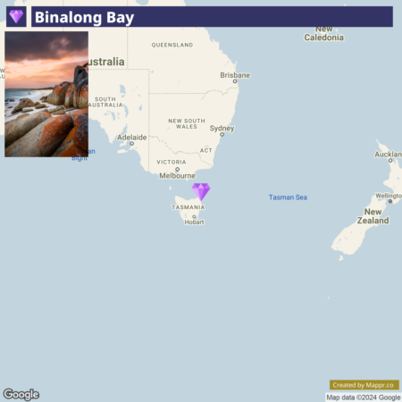
- ✈️ How to Get There: Binalong Bay is approximately a 2.5-hour drive from Launceston, which has an airport servicing flights from major Australian cities. The drive itself is scenic, showcasing Tasmania’s diverse landscapes.
- 🏨 Where to Stay: The Bay of Fires Bush Retreat offers stylish bell tents and king rooms, blending comfort with the rustic charm of the Tasmanian bushland. Alternatively, the Bay Of Fires Apartments provides a cozy, private getaway with stunning sea views.
17. Maria Island
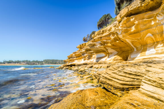
Maria Island, off Tasmania’s east coast, is a natural wildlife sanctuary and a haven for history enthusiasts.
This car-free island is known for its rich biodiversity, including wombats, Tasmanian devils, and various bird species. Its historic ruins, dating back to its days as a convict settlement, offer a glimpse into Tasmania’s past.
The island’s diverse landscapes feature sweeping bays, dramatic cliffs, and ancient fossils, making it a unique destination for nature lovers and history buffs.
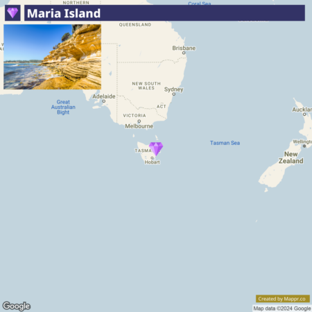
- ✈️ How to Get There: Maria Island is accessible by ferry from the small town of Triabunna, about a 1.5-hour drive from Hobart. The ferry journey itself offers beautiful views of Tasmania’s coastline.
- 🏨 Where to Stay: Accommodations on Maria Island are limited to camping and basic bunkhouses, encouraging a genuinely immersive natural experience. Stay in Orford Blue Waters Hotel before or after your island visit for comfortable lodging.
18. Rottnest Island
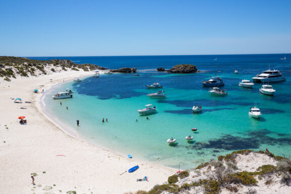
Rottnest Island, located off the coast of Western Australia, is a popular destination known for its stunning beaches, clear waters, and friendly quokkas.
This idyllic island offers a range of activities, from snorkeling and diving in its protected marine areas to exploring its historical sites and scenic lighthouses.
Visitors can enjoy the unique experience of taking selfies with the quokkas, known as the “happiest animals on Earth,” against the backdrop of the island’s beautiful landscapes.
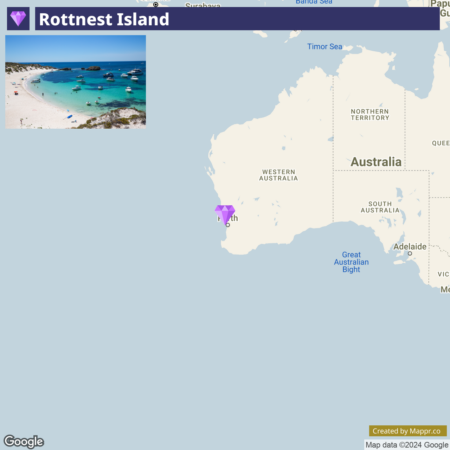
- ✈️ How to Get There: Rottnest Island is accessible by ferry from Perth or Fremantle, with the journey offering panoramic views of the Western Australian coast. The island’s proximity to Perth makes it an ideal day trip or weekend getaway.
- 🏨 Where to Stay: On Rottnest Island, Discovery Resorts presents an eco-friendly resort experience with tents that blend luxury with the beauty of the natural surroundings. Alternatively, Samphire Rottnest captures the essence of beachside elegance, providing guests with stylish accommodations and panoramic ocean views.
19. Purnululu National Park
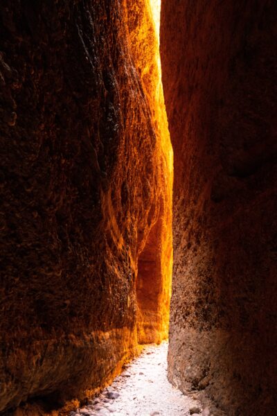
Purnululu National Park is renowned for its striking Bungle Bungle Range – towering sandstone formations striped with orange and black bands shaped by millions of years of erosion.
This UNESCO World Heritage site offers a landscape like no other, with its beehive-shaped domes, deep gorges, and ancient Indigenous rock art sites.
The park’s dramatic terrain provides a haven for adventure seekers, with opportunities for hiking, helicopter tours, and exploring the serene pools and waterfalls hidden within its gorges.
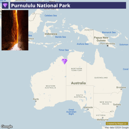
- ✈️ How to Get There: The park is accessible via a 4WD vehicle from Kununurra or Halls Creek, both of which have airports with flights from Perth. The remote location adds to the park’s allure, making it a secluded escape.
- 🏨 Where to Stay: For an immersive experience in Purnululu National Park, the Bungle Bungle Wilderness Lodge offers eco-tented cabins that harmonize with the rugged landscape, providing a unique outback experience.
20. Atherton Tablelands, Queensland
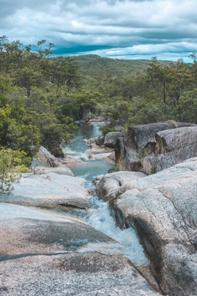
The Atherton Tablelands in Queensland, a fertile plateau west of Cairns, offers a picturesque landscape of rolling hills, charming villages, and diverse ecosystems.
This region is a patchwork of rainforest, savanna, and agricultural lands, making it a hotspot for nature lovers and food enthusiasts alike.
The Tablelands are known for their stunning waterfalls, such as Millaa Millaa Falls, and crater lakes, like Lake Barrine and Lake Eacham, which offer tranquil settings for picnics, swimming, and wildlife watching.
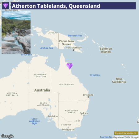
- ✈️ How to Get There: The Atherton Tablelands are easily accessible by car from Cairns. A scenic drive up the range offers panoramic views of the coast and hinterland. Cairns International Airport is the gateway for visitors coming from afar.
- 🏨 Where to Stay: The Canopy Rainforest Treehouses and Wildlife Sanctuary offer unique accommodations within the ancient rainforest, providing an immersive nature experience.
21. Spa Pool, Karijini National Park
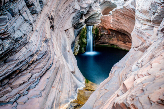
The Spa Pool in Karijini National Park is a natural wonder. It is a stunningly clear and inviting pool set within the rugged red landscape of the park’s gorges.
This secluded spot, hidden within Hancock Gorge, is famous for its serene beauty and the remarkable color contrast between the deep, turquoise waters and the iron-rich rocks surrounding it.
Karijini National Park, known for its spectacular gorges, waterfalls, and natural pools, offers a range of experiences for the intrepid traveler, from challenging hikes to leisurely walks and refreshing swims in natural pools.
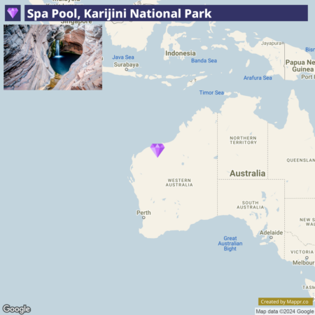
- ✈️ How to Get There: Karijini National Park is best accessed from the town of Tom Price, the nearest settlement with road access to the park. Tom Price is reachable by road from Perth or by flying into Paraburdoo Airport.
- 🏨 Where to Stay: Within the park, the Karijini Eco Retreat offers eco-friendly tents and cabins that blend seamlessly with the natural environment. Tom Price has several accommodation options for those looking for a base outside the park, including the Tom Price Tourist Park.
22. Wave Rock

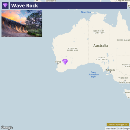
Wave Rock is an impressive natural rock formation that rises 15 meters high and stretches 110 meters long, resembling a giant wave about to break.
This granite cliff, shaped by weathering and water erosion over millions of years, showcases striking patterns of red, yellow, and grey stripes.
Visitors to Wave Rock can walk along its crest and explore the surrounding area, which includes ancient Indigenous rock art, wildlife, and the tranquil Mulka’s Cave.
- ✈️ How to Get There: Wave Rock is located near the town of Hyden, about a 4-hour drive from Perth. The journey through Western Australia’s Wheatbelt offers picturesque views and a glimpse into rural Australian life.
- 🏨 Where to Stay: The Wave Rock Bungalow Short Stay in Hyden provides comfortable accommodations with easy access to the Wave Rock.
23. Crystal Shower Falls
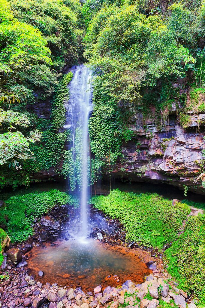
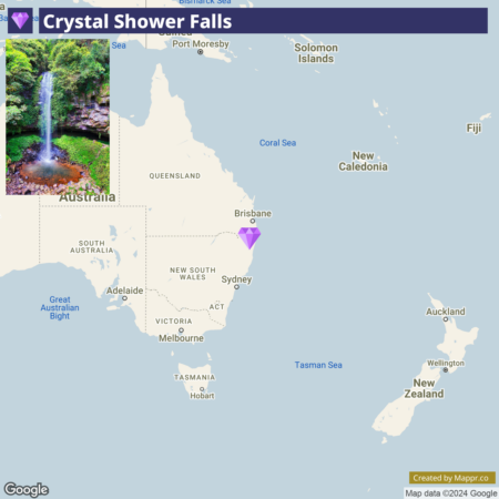
Crystal Shower Falls, nestled within the World Heritage-listed Dorrigo National Park in New South Wales, transforms into a magical oasis in summer. This enchanting waterfall cascades over a fern-fringed cliff into a clear, shallow pool below.
A unique feature of Crystal Shower Falls is the suspended walkway that allows visitors to walk behind the waterfall, offering a mesmerizing perspective of the water flowing over the rock face above.
The surrounding rainforest, part of the Gondwana Rainforests of Australia, is a haven for diverse plant and animal life, making the journey to the falls a rich sensory experience.
- ✈️ How to Get There: Dorrigo National Park is about an hour’s drive from Coffs Harbour, serviced by flights from major Australian cities. The scenic drive to the park through the Bellinger River Valley is an experience.
- 🏨 Where to Stay: The Tree House Bellingen offers rustic accommodations close to the national park, perfect for exploring the area’s natural wonders. Alternatively, the Lookout Mountain Retreat, situated on the edge of the Dorrigo Plateau, provides panoramic views of the surrounding landscape.
24. Mornington Peninsula, Victoria
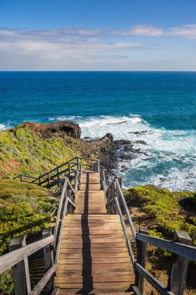
Mornington Peninsula is a coastal region known for its picturesque beaches, vineyards, and scenic countryside. This destination offers diverse activities, from soaking in natural hot springs and exploring coastal trails to tasting the region’s renowned Pinot Noir and Chardonnay.
For beach lovers, the Peninsula’s sheltered bays offer calm waters ideal for swimming, while the ocean beaches on the southern side present opportunities for surfing.
The historic Point Nepean National Park and the panoramic views from Arthurs Seat are highlights not to be missed. They provide insights into the region’s natural beauty and history.
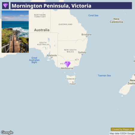
- ✈️ How to Get There: The Mornington Peninsula is approximately a 1-hour drive from Melbourne, making it an accessible getaway from the city. Public transport options are also available, including trains and buses that service the region.
- 🏨 Where to Stay: The Peppers Moonah Links Resort offers luxury accommodations with access to golf courses and spa facilities, while the Mornington Hotel blends art, design, and indulgence in the heart of the Peninsula’s wine country.
25. Port Arthur
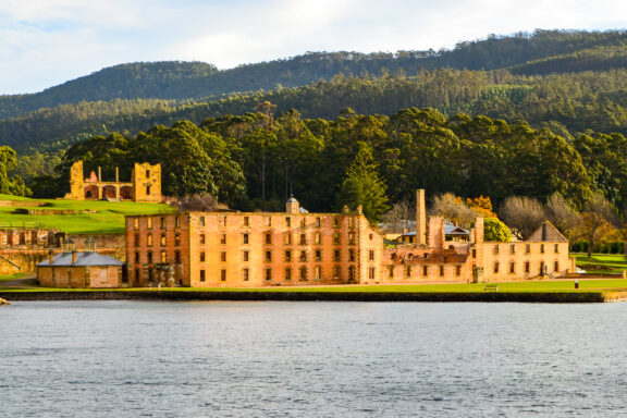
Port Arthur is a historic site that was once a convict settlement, and it is part of the Australian Convict Sites World Heritage Property.
Today, it stands as a poignant reminder of Australia’s colonial past, offering visitors a glimpse into the lives of those who were incarcerated there.
The well-preserved ruins, including the penitentiary, hospital, and asylum, set against the stunning backdrop of rugged coastline and serene waters, make Port Arthur a unique blend of beauty and history.
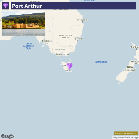
- ✈️ How to Get There: Port Arthur is approximately a 1.5-hour drive from Hobart, the capital city of Tasmania, which is accessible by air from major Australian cities. The scenic drive offers beautiful views of Tasmania’s coast and countryside.
- 🏨 Where to Stay: The Port Arthur Motor Inn offers comfortable accommodations with views of the historic site. Stewarts Bay Lodge provides a more secluded retreat in the surrounding bushland and waterfront.
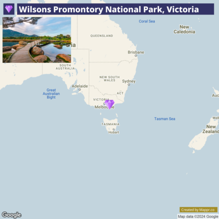
26. Wilsons Promontory National Park, Victoria
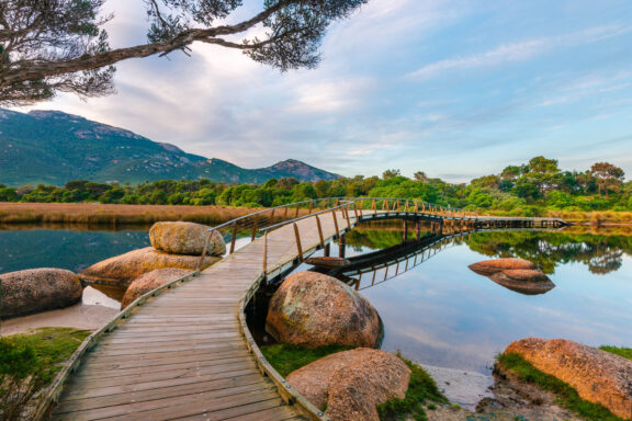
Wilsons Promontory National Park is a haven of pristine beaches, dense rainforests, and abundant wildlife. Known affectionately as “The Prom,” this national park boasts some of the most spectacular coastal scenery in the country.
The park’s diverse landscapes offer a variety of outdoor activities, from short walks and challenging hikes to snorkeling and kayaking in its crystal-clear waters.
The Prom is a sanctuary for native flora and fauna, including kangaroos, wombats, and an array of bird species, making it a fantastic destination for wildlife enthusiasts.
- ✈️ How to Get There: The park is about a 3-hour drive from Melbourne, taking visitors through Victoria’s picturesque countryside. The closest regional centers are Foster and Fish Creek.
- 🏨 Where to Stay: Driftwood Villas provides a serene retreat near Wilson Promontory, with elegant and modern accommodations. Alternatively, Black Cockatoo Cottages, set amidst the tranquil natural scenery, offer a cozy, intimate setting with stunning views.
27. Esperance, Western Australia
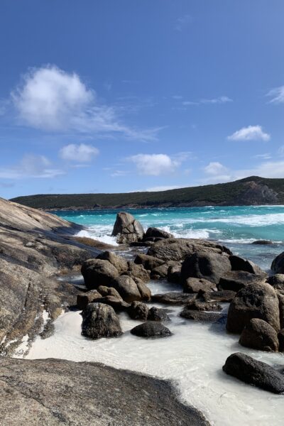
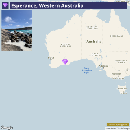
Esperance is renowned for its pristine white sandy beaches, crystal-clear turquoise waters, and the stunning archipelago of the Recherche Islands.
Esperance’s coastline, including the famed Twilight Beach, offers some of the most beautiful beaches in Australia, ideal for swimming, surfing, and sunbathing.
Esperance is a beach destination and a gateway to exploring the region’s natural wonders, including the Pink Lake (Lake Hillier) on Middle Island, known for its distinctive bubblegum-pink hue.
- ✈️ How to Get There: Esperance is accessible by air from Perth, with the local airport offering regular flights. A long scenic drive from Perth can also reach the town, taking visitors through Western Australia’s vast landscapes.
- 🏨 Where to Stay: The Clearwater Motel Apartments offer contemporary accommodations close to the beach, while the Esperance Beachfront Resort provides comfortable and convenient lodging near the town’s amenities and beaches.
28. Tranquility Bay
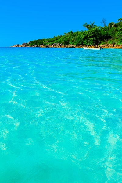
Tranquility Bay, a secluded spot known for its serene atmosphere and picturesque surroundings, offers a perfect retreat for those seeking peace and quiet amidst nature’s beauty.
During the summer months, this bay becomes a haven for relaxation, where the gentle lapping of the waves and the soft whisper of the breeze create a calming ambiance.
The bay’s clear waters are ideal for swimming and kayaking, while its sandy shores provide a perfect setting for sunbathing and picnics.
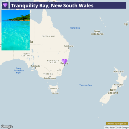
- ✈️ How to Get There: Canberra is the most convenient starting point for Tranquility Bay, and flights from various locations are available at the nearest airport.
- 🏨 Where to Stay: Pebbly Beach Escape offers an exclusive retreat near Tranquility Bay. It features luxurious beachfront cottages nestled among natural surroundings.
29. Fraser Island, Queensland
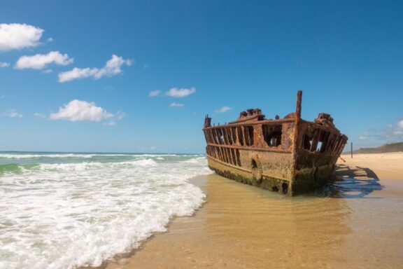
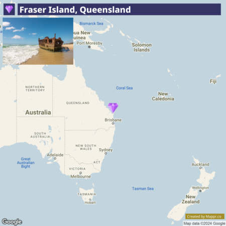
Fraser Island is the world’s largest sand island and a World Heritage site, celebrated for its diverse landscapes, from ancient rainforests growing on sand dunes to over 100 freshwater lakes.
The island’s iconic spots include the crystal-clear Lake McKenzie, the SS Maheno’s rusting wreck, and The Pinnacles’ colorful sand cliffs.
Fraser Island is also known for its unique wildlife, including dingoes and migrating humpback whales off its shores. Adventure seekers can explore the island’s sandy tracks by 4WD.
- ✈️ How to Get There: The island is accessible by ferry from Hervey Bay or Rainbow Beach, which are themselves reachable by car or bus from Brisbane. Hervey Bay also has a regional airport with flights from Brisbane and Sydney.
- 🏨 Where to Stay: On Fraser Island, K’gari Beach Resort offers a unique blend of adventure and relaxation amidst the island’s natural beauty, while Kingfisher Bay Resort caters to those seeking a harmonious balance with nature, featuring comfortable, eco-friendly lodgings.
30. Babinda Boulders
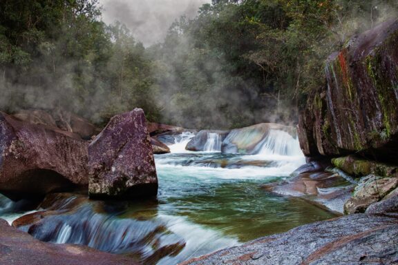
Babinda Boulders is a picturesque swimming hole surrounded by dense rainforest. The site is named for its massive granite boulders, which create natural pools and a fast-flowing creek that is steeped in Indigenous legend.
The surrounding Babinda Boulders Scenic Reserve provides walking tracks that lead to lookouts offering stunning views of the boulders, creek, and rainforest.
The area’s natural beauty and cultural significance make it a captivating destination for visitors looking to explore Queensland’s natural wonders.
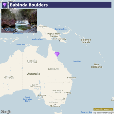
- ✈️ How to Get There: Babinda Boulders is about an hour’s drive south of Cairns. The site is easily accessible by road, making it a popular day trip or camping destination from Cairns and the surrounding areas.
- 🏨 Where to Stay: Babinda Quarters is a charming accommodation option in the heart of Babinda. This historic guesthouse has been thoughtfully restored to offer guests a comfortable and character-filled stay.
31. Agnes Water
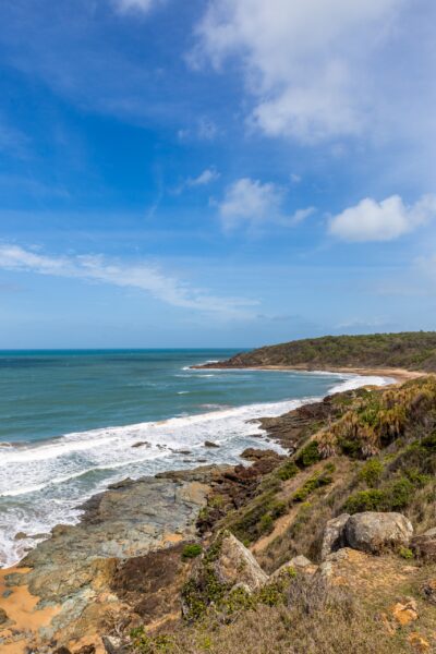
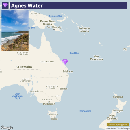
Agnes Water is the northernmost surfing beach on Australia’s east coast and a hidden gem known for its laid-back atmosphere and picturesque landscapes.
This coastal town and its neighboring 1770 offer a unique blend of history, natural beauty, and aquatic adventures. With their gentle waves, the pristine beaches are perfect for novice surfers and those looking to relax on the sand.
The area is also a gateway to the Southern Great Barrier Reef, offering opportunities for snorkeling and diving to explore the vibrant marine life.
- ✈️ How to Get There: Agnes Water can be reached by car from Bundaberg or Gladstone, which have regional airports with flights from Brisbane.
- 🏨 Where to Stay: In Agnes Water, the Agnes Water Beach Club offers guests stylish and spacious apartments just a short stroll from the beach. For a more resort-like experience, Sandcastles 1770 Motel & Resort provides a range of accommodation options, from motel rooms to luxury apartments.
32. Little Blowhole, Kiama
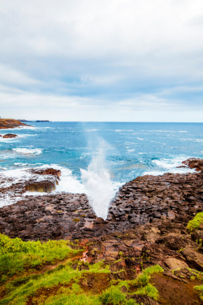
Little Blowhole is a lesser-known counterpart to the town’s more famous Blowhole. When conditions are right, this natural rock formation shoots sea spray high into the air through a narrow channel in the rocks, creating a dramatic and beautiful spectacle.
The surrounding area offers panoramic ocean views and a quiet, picturesque spot for picnicking and photography. Kiama’s coastal walks, charming lighthouse, and vibrant arts scene add to the appeal, making the Little Blowhole a must-visit for those exploring the Illawarra region.
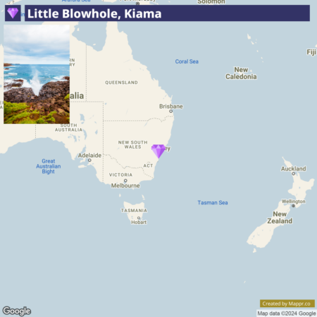
- ✈️ How to Get There: Kiama is about two hours south of Sydney and offers stunning coastal views. The town is also accessible by train from Sydney.
- 🏨 Where to Stay: In Kiama, Kendalls Beach Holiday Park provides a picturesque setting for a beachside escape. Meanwhile, BIG4 Easts Beach Holiday Park offers a family-friendly retreat with multiple accommodation options, from luxury cabins to spacious sites for caravans and tents.
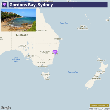
33. Gordons Bay, Sydney
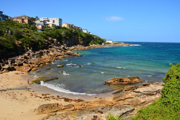
Gordons Bay is a secluded, picturesque cove known for its clear blue waters and tranquil ambiance. This hidden gem is part of the Coogee to Bondi coastal walk and is encircled by a rocky shoreline and Mediterranean-style fishing boats, adding to its charm.
The bay is a popular spot for snorkeling. An underwater nature trail guides divers and snorkelers through various marine life.
The calm waters and abundance of marine flora and fauna make Gordons Bay an aquatic sanctuary for those looking to escape the city’s bustle.
- ✈️ How to Get There: Gordons Bay is easily accessible from Sydney’s city center by public transport, car, or walking along the scenic coastal trail from Coogee or Clovelly.
- 🏨 Where to Stay: For those visiting Gordons Bay, Crowne Plaza Sydney Coogee Beach, an IHG Hotel, is a premier accommodation choice. Positioned with stunning views of Coogee Beach and a short distance from Gordons Bay, this hotel offers guests upscale comfort and convenience.
Final Thoughts
Each hidden gem, with its unique allure and story, contributes to the rich mosaic of Australia’s natural and cultural heritage.
hese secluded spots invite travelers to pause, reflect, and connect with the essence of the land, offering a more profound, more intimate travel experience.
Whether you’re drawn to the tranquil shores of a hidden bay or the mystical allure of an ancient rainforest, Australia’s summer secrets promise adventures that resonate with the soul, urging you to return to its vast and vibrant landscapes.
Image Sources and Copyright Information
- Ningaloo Reef Close To Coral Bay Aerial Image Of Reef: © MXW Stock/Shutterstock
- Bioluminescence At Night Jervis Bay Australia: © RugliG/Shutterstock
- Whitehaven Beach And Hill Inlet Aerial Drone Shot Whitsundays Queensland: © Mathias Berlin/Shutterstock
- The Famous Jindalba Boardwalk Thru Ancient Rainforest In The Daintree: © FiledIMAGE/Shutterstock
- Bruny Island Neck View Of The Isthmus Connecting The North: © SAKARET/Shutterstock
- King George River Gorge Kimberley Australia: © robert mcgillivray/Shutterstock
- Late Afternoon Light On The Lagoon Lord Howe Island Australia: © Ashley Whitworth/Shutterstock
- Jim Jim Falls In Kakadu National Park Landscape Northern Territory: © sabrinaphototraveladdict/Shutterstock
- Mataranka Northern Territory March 13 2020 : People Swimming: © Nick Brundle Photography/Shutterstock
- Panorama View Of Blue Lake A Volcanic Crater At Mount: © doublelee/Shutterstock
- The Beautiful Florence Falls In Litchfield National Park: © Stanislav Fosenbauer/Shutterstock
- High Tide In Roebuck Bay Broome From A Drone: © Matt Deakin/Shutterstock
- Sunset Over Walls Of China In Mungo National Park New: © Nick Fox/Shutterstock
- Forest Way Trail With An Amazing Ocean Scenery At Noosa: © Adam J/Shutterstock
- Bushwalking In Carnarvon Gorge National Park Queensland Australia: © AustralianCamera/Shutterstock
- Sunset At Binalong Bay Situated At The Southern End Of: © bmphotographer/Shutterstock
- Amazing Coast Line Called Painted Cliffs With Orange Yellow Colored: © Tom Jastram/Shutterstock
- Landscape On Rottnest Island In Western Australia: © Victor Maschek/Shutterstock
- Sunlight Pouring In At Echidna Chasm Bungle Bungles Purnululu Wa: © aeonWAVE/Shutterstock
- Emerald Creek Falls Mareeba Atherton Tablelands: © jimmy_muto_photography/Shutterstock
- Spa Pool Hamersley Gorge Karijini National Park Western Australia: © iacomino FRiMAGES/Shutterstock
- Sunset At Wave Rock Near The Town Of Hyden In: © bmphotographer/Shutterstock
- Crystal Shower Waterfall In Dorrigo National Park In Rocky Creek: © Taras Vyshnya/Shutterstock
- Mornington Peninsula In Sunny Weather Australia: © mehdi33300/Shutterstock
- Port Arthur In Tasmania Australia Is An Old Jail Or: © JEONA/Shutterstock
- Footbridge At Tidal River Wilsons Promontory With Surrounding Trees And: © Victory Snaps/Shutterstock
- Little Hellfire Bay Esperance Western Australia: © Ann Moss/Shutterstock
- Shore Tranquility Bay: © Vibrant Image Studio/Shutterstock
- Ss Maheno Ship Wreck Fraser Island K Gari Wide Bayburnett Region: © LouieLea/Shutterstock
- Devil S Pool Or Babinda Boulders Is A Mystical Natural Pool: © Navigator-tour/Shutterstock
- Agnes Water Beach With Rocks In Town 1770 Queensland Australia: © Maximiliane Wagner/Shutterstock
- Little Kiama Blowhole Water Can Be Seen Coming Out Of: © Paul Leong/Shutterstock
- Gordons Bay Sydney: © Alizada Studios/Shutterstock