The United States is one of the largest countries in the world, and it’s made up of several different regions. Each of these regions has its own cultural, political, and geographic identity. In this post, we’ll look at what makes the Eastern United States unique.
What is the Eastern United States?
There are several ways to define the Eastern United States. The US Census Bureau divides the country into five regions, with the Northeast, and South regions containing the nation’s easternmost states. 5 US Regions Map and Facts
There are also subregions used by the Census Bureau, such as New England, East North Central, East South Central, the Middle Atlantic, and South Atlantic, all of which contain states that are located east of the Mississippi River.
Two of the most common ways to describe the eastern part of the US are to talk about East Coast states, those with coastlines on the Atlantic Ocean, and to talk about states found east of the Mississippi River.
The states in this part of the country were the first to be contacted by European colonists and saw the earliest history of the United States. They are also typically smaller than their counterparts in the Western United States.
Typical Map of East Coast USA
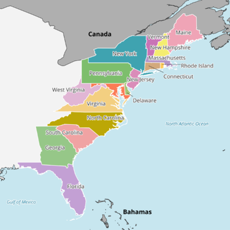
The states in the above East Coast Map are those that have a coastline on the Atlantic Ocean or are very close to the sea. Vermont, West Virginia, and Pennsylvania are the only states considered part of the East Coast that do not directly border the Atlantic.
The 17 states in this category are listed below:
- Maine
- New Hampshire
- Vermont
- Massachusetts
- Rhode Island
- Connecticut
- New York
- New Jersey
- Pennsylvania
- Delaware
- Maryland
- Virginia
- West Virginia
- North Carolina
- South Carolina
- Georgia
- Florida
Eastern United States Map
The most extensive version of an Eastern United States Map includes all of the states located east of the Mississippi River. The river serves as a natural boundary, running the entire distance between the country’s north and south borders.
With the signing of the Treaty of Paris in 1783, the Mississippi River became the westernmost border of the United States. It remained the country’s western border until the purchase of the Louisiana Territory in 1803.
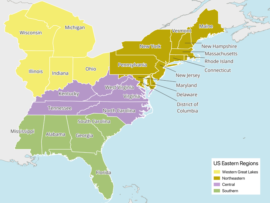
All of the states in this extended, most comprehensive version of the Eastern United States Map have been included below with interesting information about each one.
Alabama
Total Area: 52,419 sq mi (135,765 sq km)
2022 Population Estimate: 5,066,084
Alabama is located in the Southeastern part of the United States and has a short coastline bordering the Gulf of Mexico. Although it belongs to the East United States geographically, it is politically and culturally more closely associated with the Deep South. The state is known for being a focal point of the American civil rights movement in the 1950s and 1960s.
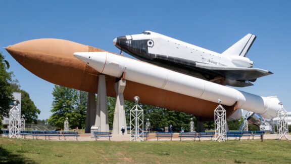
The capital city of Alabama is Montgomery, and its most populous city is Huntsville, where the US Space and Rocket Center is located.
Connecticut
Total Area: 5,543 sq mi (14,357 sq km)
2022 Population Estimate: 3,612,087
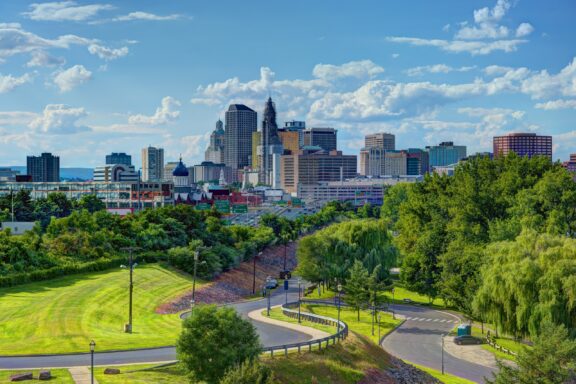
Connecticut is the third-smallest state in the US and the southernmost state to be included in the New England region. Evidence of human settlement in the area dates back to around 12,000 years ago, and indigenous Nipmuc peoples inhabited the area before Europeans arrived. The first European settlers to reach the area were Dutch, and it later became one of the 13 British colonies.
Some notable features of Connecticut are Yale University, its seafood cuisine, and striking fall foliage. The state had the country’s highest per capita personal income in 2019.
Delaware
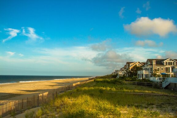
Total Area: 1,982 sq mi (5,130 sq km)
2022 Population Estimate: 1,018,836
A small state known for historic sites and beaches on the Atlantic, Delaware also has a reputation for its business-friendly tax laws. This is why more than 60% of Fortune 500 companies are registered in the state. The state’s name comes from Delaware Bay, which was named after an English merchant and politician.
The region of Delaware was inhabited by the Indigenous Lenape and Nanticoke groups before the arrival of Europeans who explored the coastline in the 16th century. The state’s location near major cities like Philadelphia, New York, and Washington, DC has allowed it to prosper economically.
District of Columbia

Total Area: 68 sq mi (177 sq km)
2022 Population Estimate: 644,655
The District of Columbia, or Washington DC, is the capital city of the United States. As a federal district, it’s the only region on this list that isn’t technically a state. The city was named for George Washington, the first president of the US. As the nation’s capital, it is the seat of the federal government and an important world political capital.
Among the important national landmarks located in Washington DC are the Smithsonian Museums, the National Mall, and the White House. Ford’s Theater, infamous for the assassination of Abraham Lincoln, is still an operating theater in the city.
Florida
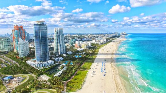
Total Area: 65,758 sq mi (170,312 sq km)
2022 Population Estimate: 22,040,323
Called the Sunshine State for the consistently warm weather and more than 230 days of sunshine it gets each year, Florida is located in the Southeasternmost corner of the contiguous United States. The state is the only one to border both the Atlantic Ocean and the Gulf of Mexico, and it’s the third-most populous state in the country.
Florida has a large, diverse economy that includes industries like international banking, healthcare research, and tourism. World-class beaches and the resorts of Miami are major draws of domestic and international tourism. Additional attractions include theme parks like Walt Disney World and SeaWorld.
Georgia
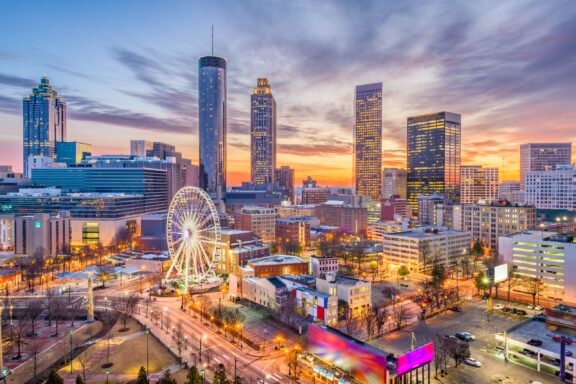
Total Area: 59,425 sq mi (153,909 sq km)
2022 Population Estimate: 10,920,521
Located next to Alabama and Florida, Georgia is another state in the Southeastern US that belongs to the Deep South. The capital of Georgia is Atlanta, which is also the state’s largest city. Prior to statehood, the Province of Georgia was the southernmost and last British colony to be established.
Human history in the area of present-day Georgia began around 13,000 years ago and involved a number of different cultures before the arrival of Europeans in the 16th century. After its time as a British colony, Georgia became the fourth state to ratify the Constitution of the United States in 1788.
Illinois
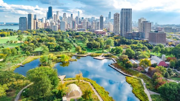
Total Area: 57,914 sq mi (149,995 sq km)
2022 Population Estimate: 12,518,144
Bordering the Mississippi River, Illinois belongs to both the Midwestern US as well as the country’s Eastern region. The capital of Illinois is Chicago, which is well-known for its deep-dish pizza, impressive skyline, and music scene.
Manufacturing and agriculture are two of the largest economic sectors in Illinois. The state is consistently one of the country’s leading producers of corn and soybeans each year. Chemical and machinery manufacturing are also leading industries.
Indiana
Total Area: 36,418 sq mi (94,326 sq km)
2022 Population Estimate: 6,831,167
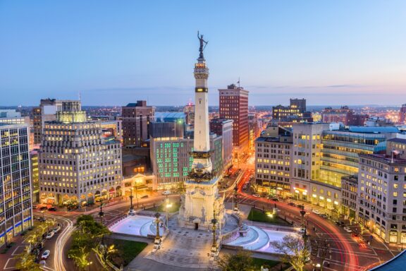
Along with Illinois, the state of Indiana belongs to the Midwestern US and is located just east of the Mississippi River. Its capital and largest city is Indianapolis, and it’s known as the “Crossroads of America” for its location and interstate transportation infrastructure.
The state has a notable history and culture of auto racing, with its most famous race being the Indianapolis 500. It’s one of the world’s largest one-day sporting events.
Kentucky
Total Area: 40,409 sq mi (104,656 sq km)
2022 Population Estimate: 4,519,315
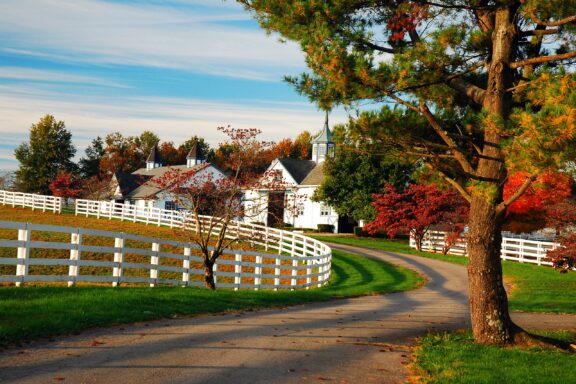
Horse racing, bourbon, and bluegrass music are some of the things this state in the Eastern US is most famous for. The Kentucky Derby is one the biggest horse races in the country, bourbon is most closely associated with the state, and it’s called the Bluegrass State.
Kentucky is located just east of the Mississippi River and doesn’t have any ocean coastline. A significant portion of the eastern part of the state is part of Appalachia.
Maine
Total Area: 35,385 sq mi (91,633 sq km)
2022 Population Estimate: 1,387,479
Maine is the northeasternmost state in the United States and is part of the New England region. It borders the Gulf of Maine in the Atlantic Ocean, the US state of New Hampshire, and the two Canadian provinces of New Brunswick and Montreal.
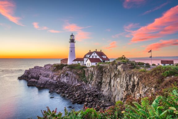
Home to a beautiful and rocky coastline, Maine is home to Acadia National Park, which is among the ten most-visited national parks in the country. The coastline also features Portland Head Light, a popular lighthouse among tourists and the oldest in the state.
Maryland
Total Area: 12,407 sq mi (32,131 sq km)
2022 Population Estimate: 6,158,964
Located in the Mid-Atlantic region of the US, Maryland borders five other states as well as the Atlantic Ocean. Baltimore, the largest city in Maryland, is known for its role as a historic trading port and for being the birthplace of the country’s national anthem.
One of the most famous foods and animals to come out of the state is the blue crab, which is constantly getting more expensive. The state is also known for hosting the US Naval Academy in its capital city of Annapolis.
Massachusetts
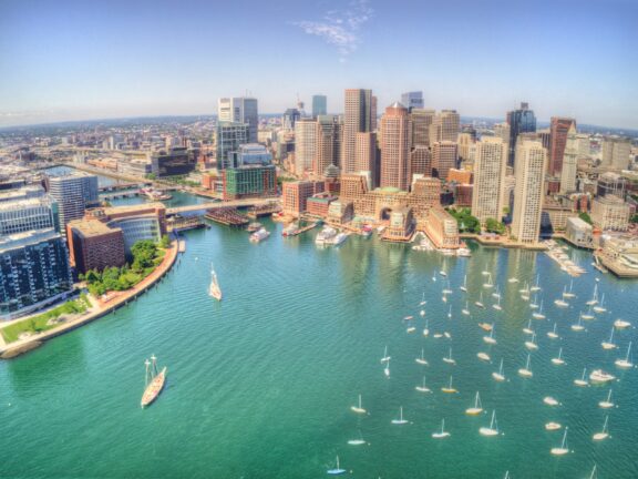
Total Area: 10,554 sq mi (27,336 sq km)
2022 Population Estimate: 6,962,372
Harvard University, Fenway Park, and Freedom Trail are some of the most famous landmarks in Massachusetts. The state is located in the New England of the Northeastern US and borders the Atlantic Ocean. Its capital and largest city is Boston.
Some of the largest sectors in the Massachusetts economy are biotechnology, information technology, finance, and health care. Tourism is a growing industry in Massachusetts, with most visitors choosing Boston or Cape Cod as a destination.
Michigan
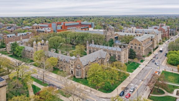
Total Area: 96,714 sq mi (250,487 sq km)
2022 Population Estimate: 10,032,720
Michigan is located in the Great Lakes region of the US and is bordered by Lake Huron, Lake Michigan, and Lake Eerie. The largest city in the state is Detroit, and the capital is Lansing. Detroit is well-known for its historical background in the automotive industry as well as for its contributions to music, art, and architecture.
The name of this state is a variant of the original Ojibwe word meaning “large lake.” The natural landscape around Michigan is uniquely beautiful and includes destinations like the Sleeping Bear Dunes National Lakeshore.
Mississippi
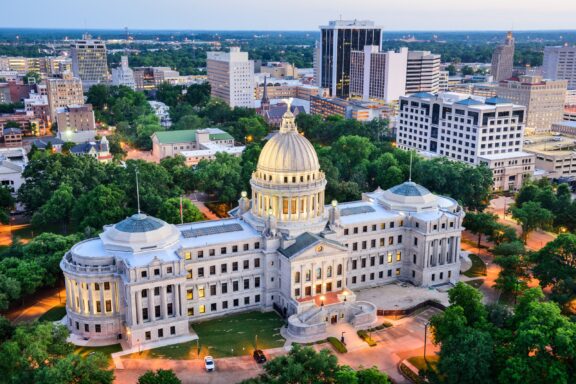
Total Area: 48,431 sq mi (125,438 sq km)
2022 Population Estimate: 2,940,820
The western border of the state of Mississippi is mostly defined by the Mississippi River, and the state is located in the Southeastern part of the United States with a short coastline along the Gulf of Mexico. The capital and largest city in Mississippi is Jackson.
Residents of the Mississippi Delta region made considerable contributions to the creation of blues music in the first half of the 20th century. Notable blues musicians from the area include Robert Johnson, Muddy Waters, and B.B. King.
New Hampshire
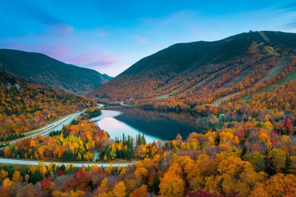
Total Area: 9,349 sq mi (24,214 sq km)
2022 Population Estimate: 1,419,133
New Hampshire is situated in the New England region of the Eastern United States and is bordered by Maine, Vermont, Massachusetts, Canada, and the Atlantic Ocean. The capital of New Hampshire is Concord, its largest city is Manchester, and it was the ninth state to be admitted to the Union.
The geography of New Hampshire is made up of mountains, valleys, rivers, and lakes. It also has the shortest coastline of any US coastal state. Most of the state experiences warm, humid summers and cold, snowy winters.
New Jersey
Total Area: 8,722 sq mi (22,591 sq km)
2022 Population Estimate: 9,242,109
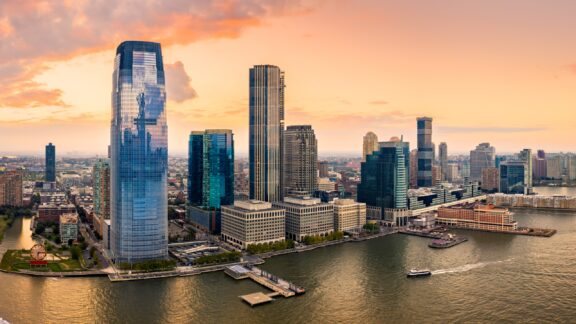
Located at the center of the Northeastern Megalopolis, New Jersey is the most densely populated state in the US. The capital city of the state is Trenton, but the largest is Newark, which is home to Newark Liberty International Airport.
The land in New Jersey was inhabited since at least 13,000 BCE by Paleo-Indians, and the Lenape were the dominant indigenous group when Europeans first arrived in the 17th century. The colony of New Jersey supported the American Revolution and was the site of several significant battles in the American Revolutionary War.
New York
Total Area: 54,555 sq mi (141,297 sq km)
2022 Population Estimate: 19,657,390
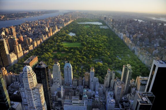
The state of New York is situated in the Northeastern United States and is made up of a diverse collection of landscapes and environments. The state’s New York City is a massive metropolis, but meadows, rivers, forests, mountains, and lakes populate much of the state.
New York City is probably the best-known aspect of the state. It is a major international hub of culture, finance, and entertainment that welcomes millions of tourists each year. Times Square, Central Park, and the Statue of Liberty are some of the city’s most famous landmarks.
North Carolina
Total Area: 53,819 sq mi (139,391 sq km)
2022 Population Estimate: 10,678,831
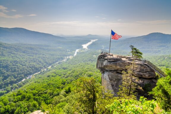
The state of North Carolina can be found in the eastern part of the US, but it is considered part of the Southern US. One of the things the state is known for is its scenery. Natural beauty is abundant in the state’s Blue Ridge Mountains and the Outer Banks, which attracts millions of tourists.
Notable cities in the state include Charlotte, Asheville, and Raleigh, which is the capital. Live performances attract tourists to Asheville, and Charlotte is the largest city in the state.
Ohio
Total Area: 44,825 sq mi (116,098 sq km)
2022 Population Estimate: 11,767,059
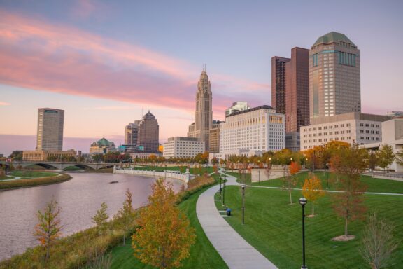
Ohio is a state included in the Midwestern region of the US that is often known for its major cities: Cleveland, Cincinnati, and Columbus, the last of which is the largest as well as the state’s capital. Some of the state’s landmarks include the Rock and Roll Hall of Fame and the National Museum of the US Air Force.
Ohio is a geographical link between the Northeast and the Midwest, and trade and business traffic between the two regions makes transportation a major industry in the state’s economy.
Pennsylvania

Total Area: 46,055 sq mi (119,283 sq km)
2022 Population Estimate: 12,916,089
Pennsylvania earned itself the nickname, “Keystone State” for its central role in the founding of the United States. The state borders six others in the US and has a short coastline on Lake Erie.
World-class museums, a thriving art scene, and culinary traditions like cheesesteaks and pretzels attract tourists to the state’s cities. The countryside in Pennsylvania is beautiful and includes the Pocono Mountains as well as Amish Country.
Rhode Island
Total Area: 1,545 sq mi (4,001 sq km)
2022 Population Estimate: 1,093,638
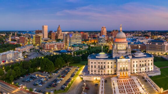
Located in the New England region of the US, Rhode Island is the smallest state in the country by area. Nearly all of the state’s land is part of the mainland, but the state’s name comes from the island just off the coast in Narragansett Bay.
The largest city and capital of Rhode Island is Providence, which is one of the oldest cities in New England. The coastline of the state, with its beaches, lighthouses, and small seaside towns, is one of the biggest attractions in Rhode Island.
South Carolina
Total Area: 32,020 sq mi (82,933 sq km)
2022 Population Estimate: 5,283,100
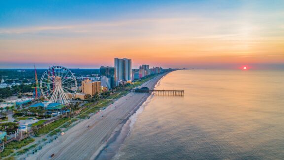
The 23rd-most populous state in the US is South Carolina, which is located in the Southeastern region of the country. Its capital is Columbus, and its largest city is Charleston, which is located along the state’s coast on the Atlantic Ocean.
South Carolina is known for its warm weather, sandy beaches, Southern hospitality, rich US history, and antebellum architecture. Hilton Head Island and Myrtle Beach are some of the state’s most popular vacation destinations.
Tennessee
Total Area: 42,144 sq mi (109,152 sq km)
2022 Population Estimate: 7,059,618
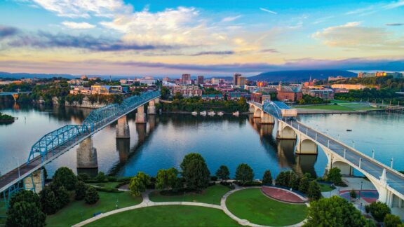
Tennessee is tied with Missouri for being the state that borders the most other states; they each border eight other states. Among Tennessee’s claims to fame are its music scene, whiskey, and the Great Smoky Mountains.
Elvis Presley and Dolly Parton are two of the most famous musicians to come out of the state, and Tennessee’s capital and largest city, Nashville, is known for its music scene. Great Smoky Mountains National Park in Tennessee is the most visited park in the country.
Vermont
Total Area: 9,616 sq mi
2022 Population Estimate: 647,378
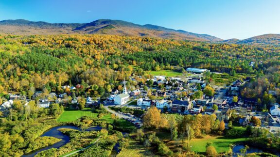
Vermont is in the Northeastern part of the US and is part of the New England region. It is the only landlocked state in the region and is known for its natural beauty and small towns. Vermont is also famous for its maple syrup production.
After only Wyoming, Vermont is the second-least populated state in the US. It also has the least-populous state capital in the country, Montpelier. Before French colonists began claiming the territory in the 17th century, the Abenaki and Mohawk tribes were active in the area.
Image Sources and Copyright Information
- Usa east coast typical map: © Mappr
- Us eastern states: © Mappr
- Space Shuttle Exhibit on Display Outdoors: © Philip Arno/Shutterstock
- Downtown Hartford, Connecticut Skyline: © Sean Pavone/Shutterstock
- Coastal Homes Along Bethany Beach, Delaware: © Al Jurina/Shutterstock
- US Capitol Building on a Clear Day: © Cvandyke/Shutterstock
- Aerial View of South Beach, Miami, Florida: © Mia2you/Shutterstock
- Downtown Atlanta Skyline at Sunset: © Sean Pavone/Shutterstock
- Aerial View of Chicago Skyline and Park: © JaySi/Shutterstock
- Indianapolis Skyline at Dusk: © Sean Pavone/Shutterstock
- Autumn Scenery in Lexington, Kentucky with White Fences and Country House: © James Kirkikis/Shutterstock
- Sunset at Portland Head Lighthouse, Maine: © Sean Pavone/Shutterstock
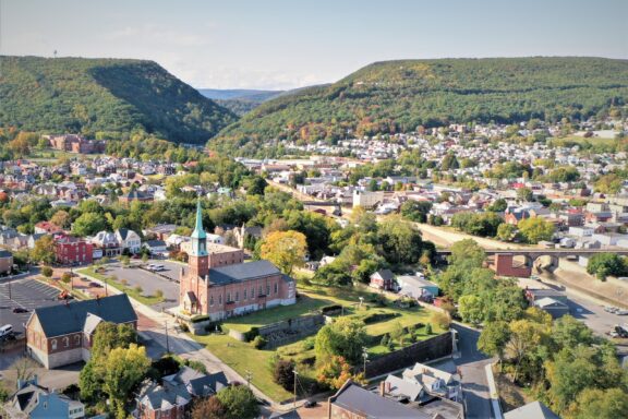
- Aerial View of Cumberland, Maryland with Church and Town: © Jairtello/Shutterstock
- Aerial View of Boston Skyline and Harbor: © Jacob Boomsma/Shutterstock
- Aerial View of University Campus with Gothic Architecture: © Agnieszka Gaul/Shutterstock
- Jackson, Mississippi Skyline with Capitol Building: © Sean Pavone/Shutterstock
- Autumn Foliage Overlooking a Mountain Lake: © Winston Tan/Shutterstock
- Jersey City Skyline at Sunset – Aerial Panorama: © Mihai Andritoiu/Shutterstock
- Aerial View of Central Park in Manhattan, New York: T photography/Shutterstock
- Flag Overlooking Mountainous Landscape from Chimney Rock: © Sean Pavone/Shutterstock
- Downtown Columbus, Ohio Skyline at Twilight: © f11photo/Shutterstock
- Downtown Pittsburgh Skyline with Incline: © Sean Pavone/Shutterstock
- Aerial View of Providence Skyline at Dusk, Rhode Island: © Mihai_Andritoiu/Shutterstock
- Sunrise Over Myrtle Beach Skyline and Coastline from Drone Perspective: © Kevin Ruck/Shutterstock
- Aerial View of Chattanooga, Tennessee Skyline at Dusk: © Kevin Ruck/Shutterstock
- Autumn Foliage Over Stowe Village in Vermont: © John Couture/Shutterstock