Not to be confused with its regions, Costa Rica can be divided into seven different provinces. These provinces are the largest administrative divisions used in the county, and each has its unique cultural, historical, and ecological characteristics.
Below is a Costa Rica Provinces Map detailing the borders and major cities of each province in the country.
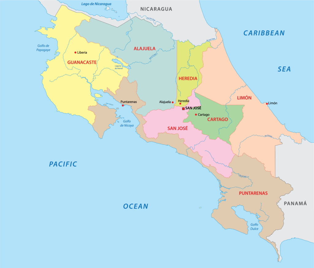
The provinces are used for administrative purposes, which assists the Costa Rican government in managing the different parts of the country. The President of the country appoints a governor to each province, and each province has a capital city.
The seven Costa Rican provinces are further divided into 82 cantons, which are further divided into 473 districts.
Costa Rica Provinces
Each of Costa Rica’s provinces has its own unique character and geography. In this section, we’ll explore what makes each of these provinces stand out.
San José
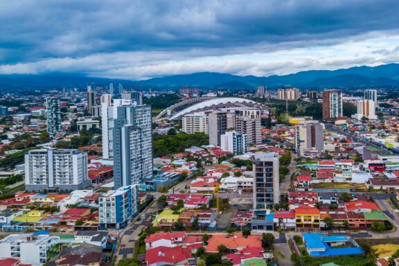
Costa Rica’s province of San José holds a unique position as the political, cultural, and economic center of the country. San José City is the capital of Costa Rica as well as the capital of its province. It is the largest city in the country.
San José Province is located near the center of the country and is surrounded by mountains and valleys, a characteristic feature of the Central Valley region where it lies. The province is home to urban centers, small towns, coffee plantations, and vast green spaces.
Access to both urban and rural experiences makes this province a gateway to Costa Rica as well as a destination in itself. Historical landmarks in San Jose include the National Theater and the Metropolitan Cathedral.
Alajuela
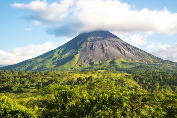
The province of Alajuela is located in north central Costa Rica, bordering four other Costa Rican provinces and neighboring Nicaragua. It’s the second-largest province in the country and is known for its diverse landscapes that include cloud forests, volcanoes, coffee plantations, and cattle ranches.
The city of Alajuela is the capital of the province and Costa Rica’s second-largest city. It’s home to the Santamaría International Airport, the primary gateway for international travelers to Costa Rica.
One of the most notable features of this province is the Arenal Volcano, a young stratovolcano with an elevation of 1670 m (5479 ft). Although it recently entered a resting phase and is mostly inactive, it was Costa Rica’s most active volcano for several decades.
Cartago
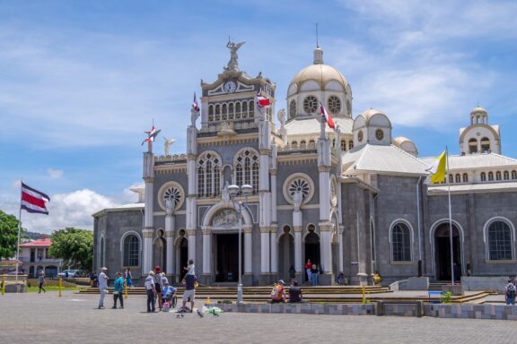
Cartago is located near the center of Costa Rica, just east of San José. It’s the country’s second-smallest province in terms of size, but it is rich in colonial history and once served as the nation’s capital.
An especially noteworthy structure in the city of Cartago is the Basilica of Our Lady of the Angels. It’s an ornate church with intricate carvings and impressive architecture that is also an important pilgrimage site for many devout Costa Ricans.
The province’s natural beauty is on full display in the Irazú Volcano National Park, which hosts Costa Rica’s tallest volcano.
Heredia
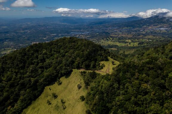
Heredia, affectionately referred to as “The City of Flowers,” is a province located in the central part of Costa Rica. It’s situated between the provinces of San José, Alajuela, and Limón, and is renowned for its verdant landscapes, coffee plantations, and charming colonial architecture.
The capital city, also named Heredia, is characterized by its well-preserved colonial streets, historic churches, and El Fortín, a fortress tower that represents the city’s colonial history.
Coffee tours are a popular activity among visiting tourists, who can visit some of the many coffee fincas in the area to learn about coffee production in the country. The province is also home to Barva Volcano, which is part of the Braulio Carrillo National Park.
Guanacaste
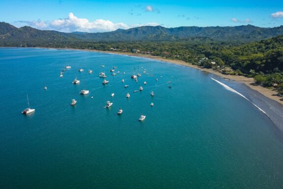
Guanacaste is located in the northwestern part of Costa Rica and is known for its sun-kissed beaches, vibrant culture, and sprawling savannas. With a coastline along the Pacific Ocean, it’s a haven for beach lovers and surfers. Some of the most famous beaches in the province are Tamarindo, Flamingo, and Nosara.
Offering much more than just its coastal beauty, Guanacaste is also home to both Rincon de la Vieja and Santa Rosa National Parks. These include geothermal springs, diverse wildlife, and some dry forest ecosystems.
The historical legacy of the province is evident in its culture which has been influenced by indigenous groups, Spanish colonists, and Nicaraguan migrants. These influences can be seen in the music, dance, and traditions of the region.
Puntarenas
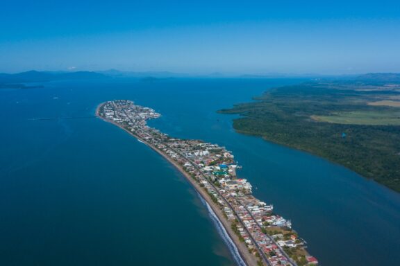
Puntarenas is the largest province in Costa Rica, stretching along most of the country’s Pacific coast to its southernmost point bordering Panama. This extensive coastline is composed of sandy beaches, mangrove forests, and vibrant coastal towns.
The provincial capital, also named Puntarenas, is a significant port city and has served as a crucial gateway for international trade and tourism.
Some of the natural wonders of the Puntarenas Province include the Monteverde Cloud Forest Reserve, situated in the northern part of the province, and the Osa Peninsula’s Corcovado National Park in the south. The latter is often hailed as one of the most biodiverse places on the planet.
Limón
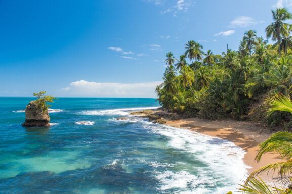
The province of Limón stretches along the Caribbean coast of Costa Rica and is characterized by lush rainforests, Afro-Caribbean culture, and pristine beaches. The capital city, Puerto Limón, is the region’s main urban center and port.
One of Limón’s standout features is its biodiversity. Tortuguero National Park, often dubbed the “Amazon of Costa Rica,” is a maze of water canals and tropical rainforests, known for its annual sea turtle nesting phenomenon.
Limón’s culture is deeply influenced by its Afro-Caribbean heritage, which is evident in its music, cuisine, and festivals like the annual Carnaval de Limón.
Regions of Costa Rica
The regions of Costa Rica are based on distinct geographical and ecological zones. These are not used for the same administrative purposes as provinces and are instead useful in the areas of ecology, tourism, and conservation.
Each region represents a different aspect of Costa Rica’s rich biodiversity and has its own unique ecology and climate. They also sometimes represent distinct local cultures and economies. See our Costa Rica Regions Map below.
NOTE: We will make a map like this, explaining the regions:

Costa Rica’s regions often overlap multiple provinces and are more commonly used in the tourism industry to denote areas with shared attractions and ecological zones. For example, the Central Valley region encompasses parts of San José, Alajuela, Heredia, and Cartago provinces.
Costa Rica Regions
In this section, we’ll provide a brief overview of each of the regions in Costa Rica. Some sources divide Costa Rica into just four geographical regions, and others don’t differentiate between regions and the country’s seven provinces.
For this post, we’ve used six regions of Costa Rica based on the unique geographical features they exhibit.
Central Valley
Costa Rica’s Central Valley is home to the country’s largest cities and is its main economic and political hub. The valley is defined by the mountains that surround it, and its gently rolling hills are home to coffee plantations and farms. It also provides easy access to several natural parks, including the La Paz Waterfall Gardens and the cloud forests of Monteverde.
North Pacific
The North Pacific Region is home to the Guanacaste Province and features mountainous terrain as well as a coastline along the Pacific. The Nicoya Peninsula is a dominant feature of the geography in this region and the Central Pacific Region. It extends into the Pacific and creates the Gulf of Nicoya.
Tourism is one of the most important industries in this region, which is one of the most sparsely populated regions in the country.
Central Pacific
This region is characterized by its transitional forests – the blend between the tropical dry forest of the northwest and the tropical rainforest of the southern Pacific. It’s an excellent location for adventurers who enjoy fishing, surfing, and hiking.
The Central Pacific Region is also home to Puntarenas, the capital of the Costa Rican province of the same name and an important port city.
South Pacific
The South Pacific region is known for its sustainable tourism efforts, with many eco-lodges and responsible tour operators. Visitors can enjoy dolphin and whale watching in the Marino Ballena National Park, named for the humpback whales that migrate here annually.
Northern Plains
The Northern Plains feature stunning wetlands, including the Caño Negro Wildlife Refuge, a Ramsar Wetland of International Importance. Birdwatchers are particularly attracted to this region due to its abundant avifauna. The region also includes the Venado Caves, a favorite of brave spelunkers.
Caribbean Coast
This region of Costa Rica includes the Limón Province in the eastern part of the country along the Caribbean Sea. Some of the most notable landmarks in this region are the Port of Limón and Tortuguero National Park. The park is a nesting ground for sea turtles and is one of the rainiest areas in the country.
Related Content:
Image Sources and Copyright Information
- Aerial View of San Jose Cityscape with Mountains in the Background: © Gianfranco Vivi/Shutterstock
- Majestic Arenal Volcano Rising Above the Lush Costa Rican Landscape: © Esdelval/Shutterstock
- Visitors in Front of the Ornate Basilica in Cartago, Costa Rica on a Sunny Day: © Salvador Aznar/Shutterstock
- Aerial View of Lush Green Landscape with Barva Volcano in Heredia, Costa Rica: © Gianfranco Vivi/Shutterstock
- Aerial View of Playa Potrero, Guanacaste, Costa Rica with Moored Boats: © Stefan Neumann/Shutterstock
- Aerial View of a Coastal Town Peninsula with Lush Greenery and Blue Waters: © Gianfranco Vivi/Shutterstock
- Serene Tropical Beach with Palm Trees and Clear Blue Waters: © Simon Dannhauer/Shutterstock